
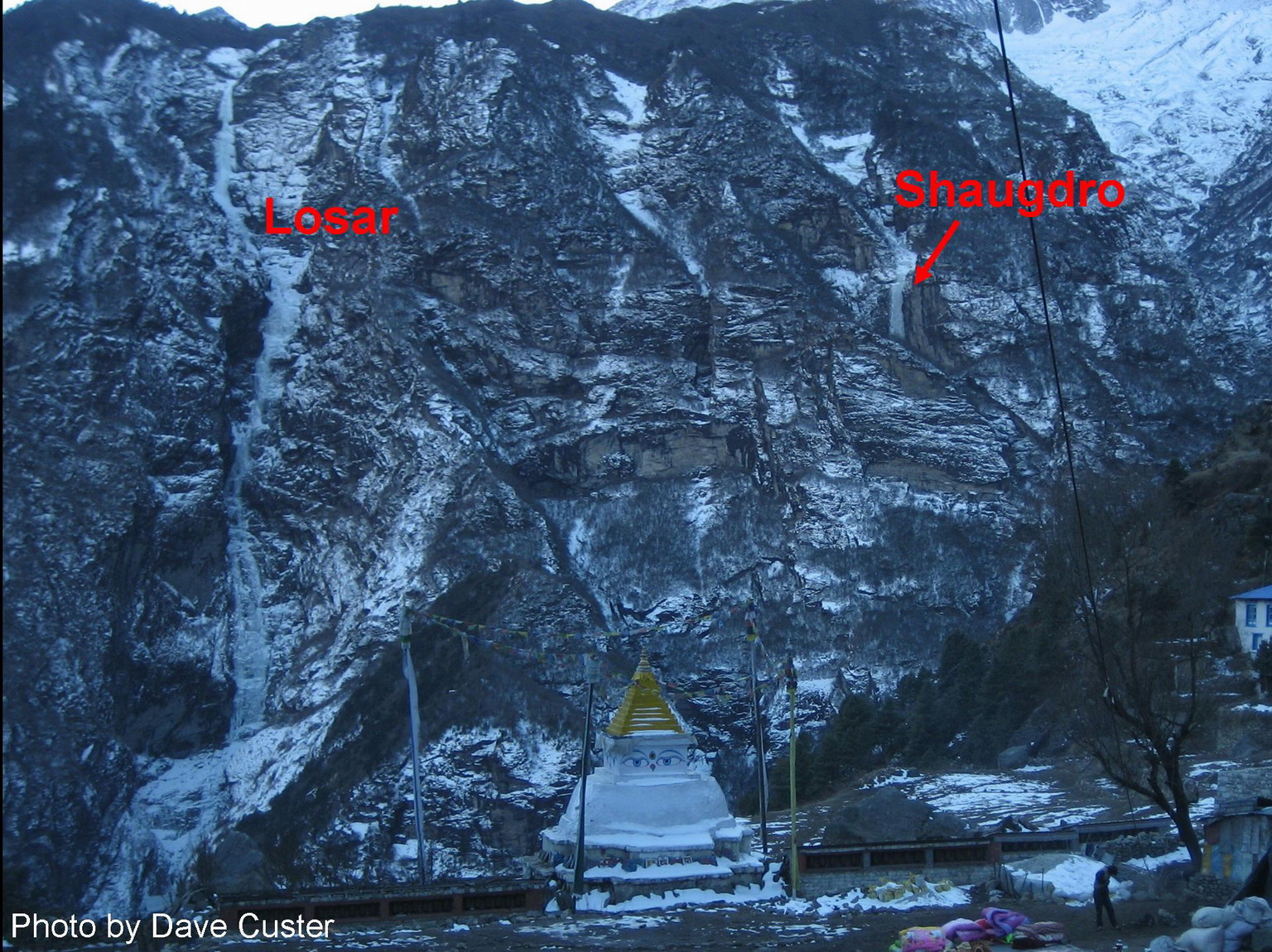
Many ice flows are found on the northern slopes of Kongde Ri, among them the famous Losar, the super-long ice line directly opposite Namche Bazar.
|
|
|
Losar, WI5, 800m.
Approach: from Namche Bazar, descent past the Tibetan market towards the main entrance gate. After crossing the stream, leave the main trail and follow the stream downwards. Soon you come upon a stream crossing and a path leading right. Follow the path all the way to the bottom of the gorge, where it crosses Bhote Koshi (a fairly good makeshift bridge, ~30 min. from Namche). After the bridge, take a path leading left; follow the river for a little while, then turn right and acsend the obvious drainage (no trail here) to the base of the ice flow (2 hrs from Namche).
Climbing: we climbed the route in 20 pitches with 50m ropes; with 70m ropes it goes in 14 pitches. Most of the climbing is at WI3-4 level, but steeper sections are encountered, notably the final 100m - high column. When we climbed it (at the end of January), the route was very wet and the last pitch was a horrible waterfall. We bivuaced on the comfortable grassy ledges on the right just past the midpoint of the climb (11 out of 20 pitches). There are more bivuac spots higher on (also on the right).
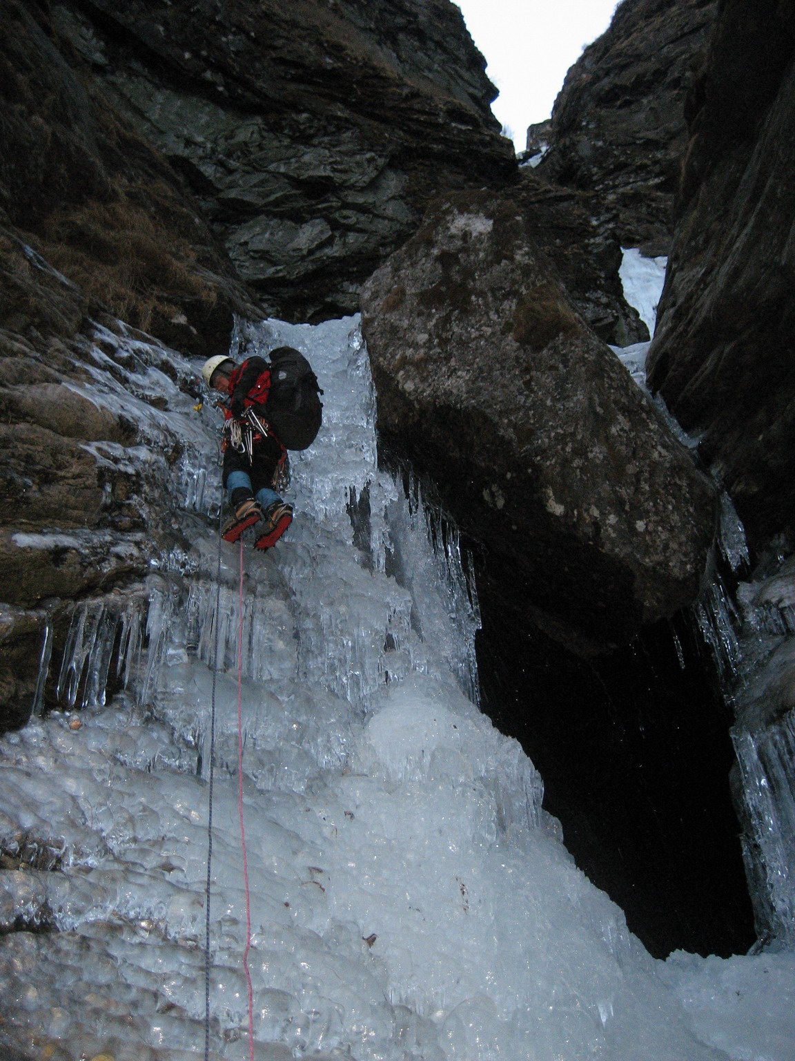 The start of Losar in very wet condition. Photo by Dave Custer.
|
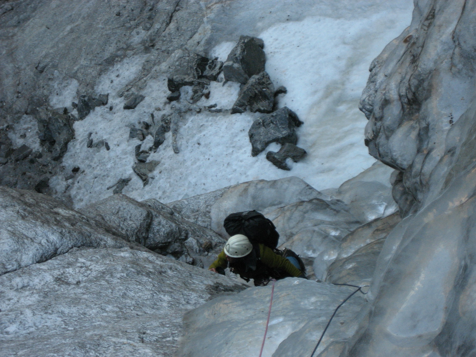 Pitch 4. Photo by Dave Custer.
|
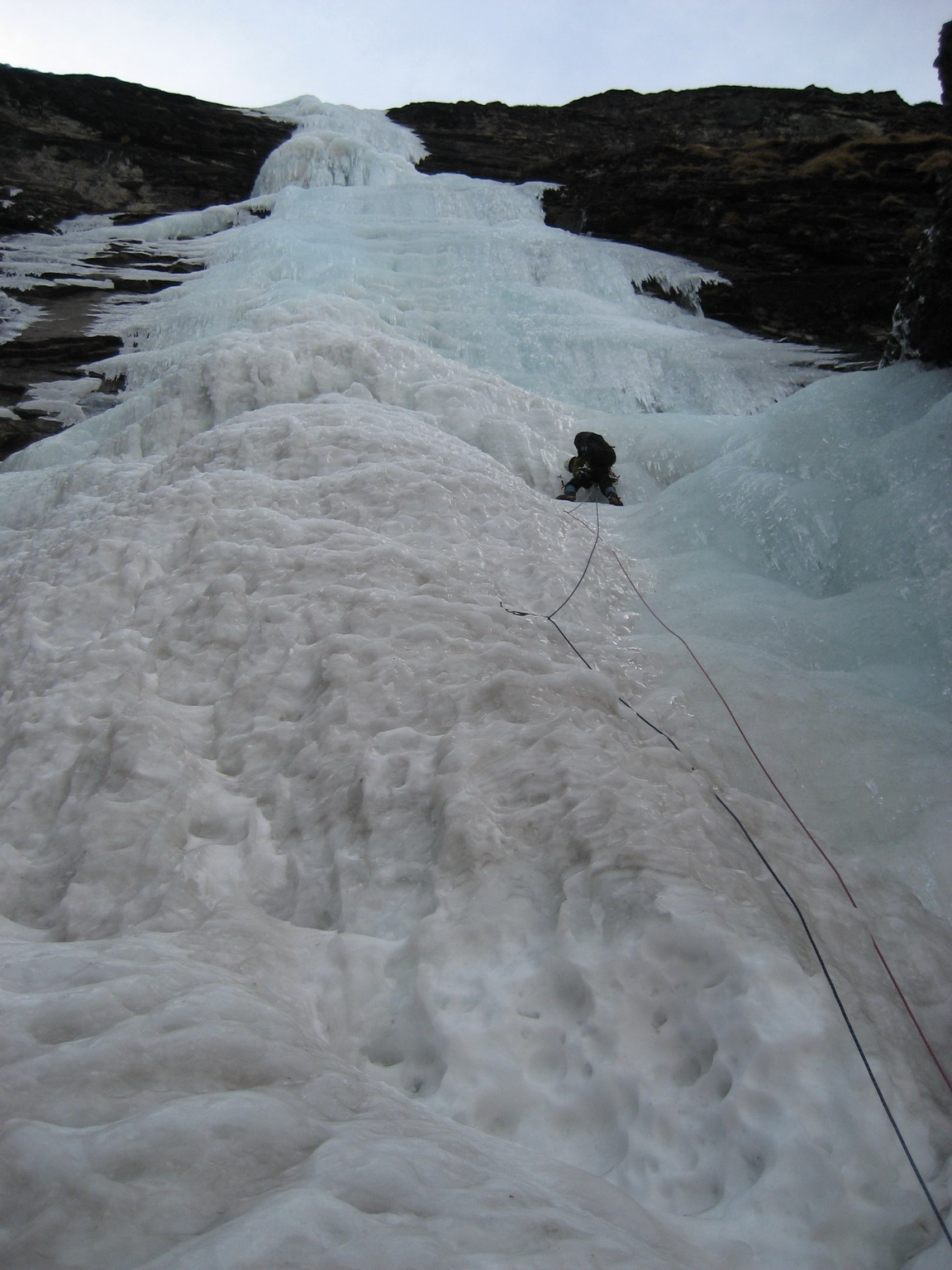 The final column. Photo by Dave Custer.
|
Descent: either by rappel, or top out on the Kongde plateau, either by following the frozen streambed or by climbing grassy slopes on the right, and continue to walk south-west (in the direction of the Kongde Ri ridge) until you come upon a good trail. If you turn right here, the trail will lead you to Thame, Samde or Thamo in perhaps ~4 hrs. from the top of the climb. If you turn left, you'll come to a luxury 'Yeti Mountain Home Chain Hotel' (~1 hr. from the top of the climb). A stone hut near the hotel can be used as a shelter for the night (water can be found a few hundred meters to the south). From here a good trail leads to Toktok in about 4 hrs (1500m vertical drop).
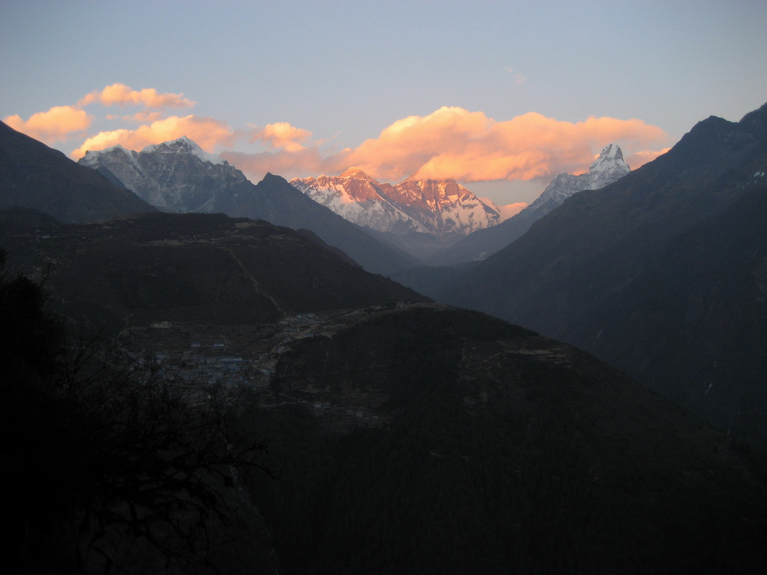 View from the bivuac: Namche Bazar, behind it Everest, Lhotse, Ama Dablam.
|
Shaugdro, WI5, 500m.
Another big waterfall to the right of Losar, info from Ian Osteyee.
Climbing: On the first acsent, the first two pitches were detached in places and not thick enough for screws until 60, or so feet up. The ice thickened, but only enough for small and eventually mid sized screws and continued to have large detached sections almost all the way to the first anchor. After two pitches of thin WI5 ice (with 70m ropes) the angle eases off, the rest of the climb being not harder than WI3+.
Descent: same options as for Losar.
Power House bowl
A few shorter climbs are found in the hydro powerplant drainage (see map). These can be easily reached from either Thamo, Samde, or Thame (~1.5 hr approach from Thamo) and offer climbing at a relatively low altitude (3600-3700m). The climbs are described from left to right.
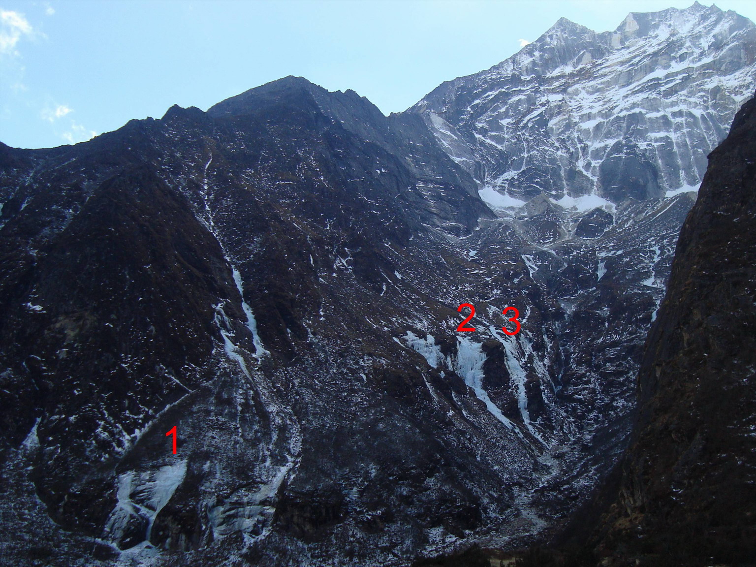
1. WI4+ 60m. A steep, narrow flow (WI4+) gains a bench below a broad headwall with a low-angle gulley at its right end. From the base to the top of the gulley is 60m; to the top of the headwall might be farther. You can descend by traversing up and climbers' right, crossing another ice flow, and traversing down and farther climbers' right to the top of the next gully. A "trail" descends that gulley.
2. WI4+ 160m (or more, depending on where you start climbing). A mostly low-angle ice flow leads to a steep headwall (~30 m high); easier climbing above the headwall leads to the top. Descend on foot (around left) or make 3 rappels with 60m ropes.
3. WI3+ 200m. A right-angling pitch (WI3, 60m), followed by an amble (60m), capped by a jaunt to a short broad headwall (WI3+, 60m). Either rap or amble up and left for a half pitch to walk off (climbers' left).
There are many more ice flows on the northern side of Kongde Ri; some of them may have been climbed but many have surely been not, and there are many opportunities for further exploration. To the right of Shaugdro (as viewed from Namche) there is a big bowl called on some maps "Sastema Khola". There are many ice flows in that bowl, and the newly built good trail from Thame to the Kongde plateau offers a convenient approach.
Ice flows to the left of Losar may be quite hard to reach from below, but some of them can be easily reached from the plateau above. Perhaps you can even stay in the Yeti Mountain Home while doing those climbs... we heard various rumours as to how expensive that hotel is, up to $180 per night, please do tell us if you end up staying there!
Some impressive ice flows are found low down across the river from Phurte. Those were out of condition when we saw them, but one day they must be in.
 back to the main page