Creating GIS Data
from Non-GIS Sources
Common sources
Raw Imagery
CAD Files
Digitizing
Addresses
Different sources, different methods
Raw Imagery
- Georeference (if necessary)
- Classify (by Color/Spectral Characteristics) or
- Digitize (aka Trace)
GeoReferencing Imagery
Note: JPG and TIF images can be directly read into ArcGIS. But by default, they won't have an appropriate coordinate system and won't overlay anything else. (JPEG 2000 and GeoTiff are standard formats that are not always supported but can save coordinate system metadata information along with the image.)
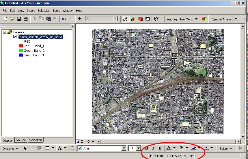
So we need some data with a coordinate system we trust. (Warning: Google Earth, etc. can be *very* imprecise internationally - see error in this image below).
- If you identify one corresponding location in each data layer, the software computes a simple shift.
- If you identify more than one location, the software does a more complex transform (linear, or fancier).
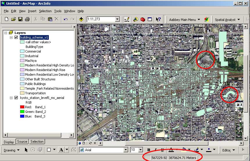
So, now we have a valid coordinate system, but our image is clearly pretty far from being correctly registered.
The solution? The "Georeferencing Toolbar" (View->Toolbars->Georeferencing). This tool allows you to identify relationships (by clicking on the screen):
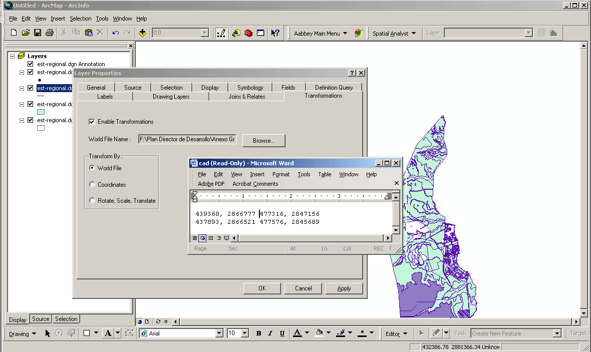
CAD Files
Can simply "open" most common CAD files directly in GIS (DXF, DWG, DGN)
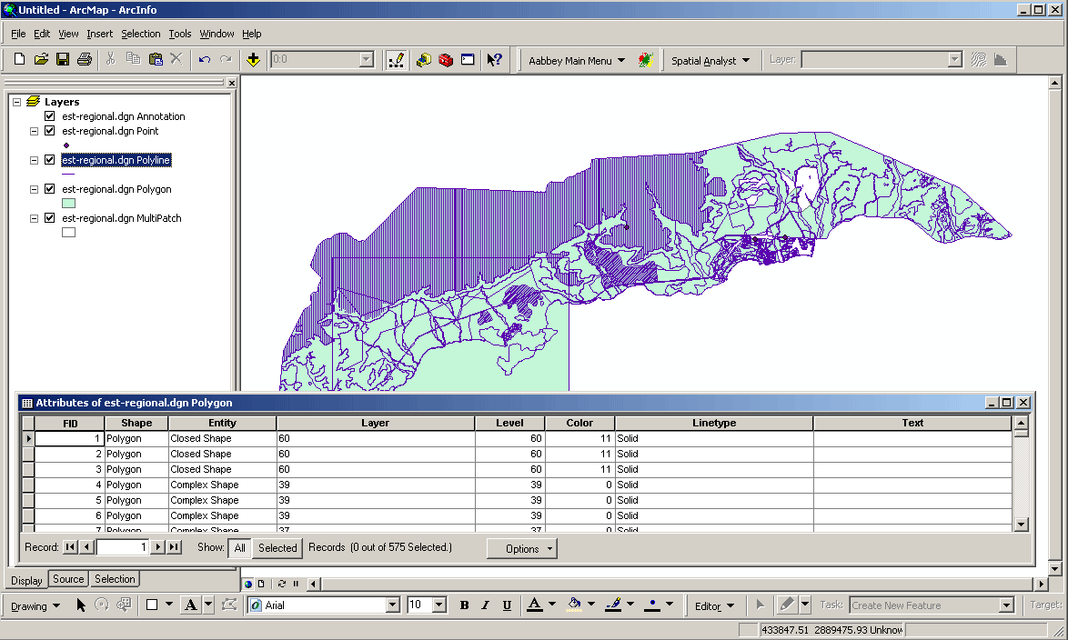
For example, from a real world project, here are CAD data for a regional plan as created by Fonatur, the Mexican national tourism/development agency.
Important limits:
"attributes" don't come along, only layer names *therefore you are well-advised to know the layer naming/numbering convention* (and if none - a big messy problem).
objects must be "exploded" in CAD before export
solids must be converted into boundary representations
Common problems / solutions
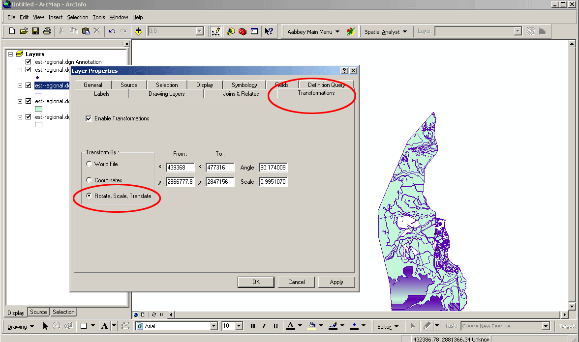
Drawn "to scale", but often without explicit projection information and not North aligned
Solution 1: layer properties dialog allows specification of transformations
Solution 2: "world files" (*.wld) are simple text files documenting transforms
Why bother with "world files"?!!! Scalability: one world file can be replicated and applied to many CAD documents drawn against the same base.
Digitizing - Creating new (georeferenced) Geometry
Vector Data Model - Requires boundaries with X,Y coordinates
- Old method - large digitizing table with 'puck' on top of paper map
- New method - 'heads up' digitizing on-screen on top of image
- Illustrate with QGIS
- Chapter 5 of QGIS documentation:
https://docs.qgis.org/3.16/en/docs/training_manual/create_vector_data/create_new_vector.html- First, create empty layer with desired coordinate reference system and extents
- Then, add points, lines, or polygons together with attribute table
- We demonstrate use of QGIS to create a new shapefile of polygons via 'heads up' digitizing on top of one of the orthophotos that we accessed last week from the MassGIS WMS server. (You could just as easily digitize new polygons on top of any other shapefiles that we have used.)
Deeper integration of geoprocessing services within web
pages:
Deeper integration of geoprocessing services within web pages:
- Example of back end support for large, dynamic databases
- Postgres + PostGIS for SQL compliant, multi-user, relational database management with spatial extensions
- Illustrate use of postgres from QGIS - by redoing example from census lecture
- Thematic map of median personal earnings from 2000 census
- Geography: us_ma_e25blkgrpsct_2000 block group boundaries
- Census 2000 data:
- MAGEO table of geographic identifiers and summary levels
- MA0007 table including LOGRECNO and P85 personal earnings data
- Examine tables on PostGIS server (on VM at Medai lab)
- Note X/Y boundary geometry (of polygons) is included in 'geom' column
- Spatial Reference System (SRS) information for EPSG codes is in a separate table
- Relationship between SRS and census block group boundaries is stored in a view
- Join boundaries, mageo, and ma0007 with SQL query in PostGIS for summary level 150
create table c2000inc as
(select g."LOGRECNO",
        e."P085001", e."P085002", e."P085003",
        g."STATE"||g."COUNTY"||g."TRACT"||g."BLKGRP" AS blkkey
   from census2k.mageo g,
        census2k.ma00007 e
  where g."LOGRECNO" = e."LOGRECNO"
    and g."SUMLEV" = '150');
- Pull result into QGIS, join to boundary layer and thematically map
-
These tools are useful for 'publishing' project work
-
Enable interactive manipulation of maps within browser, PDF document, etc. without 'running' GIS software
- See DUSPviz tutorial:
- Web Mapping workshop tutorials: http://duspviz.mit.edu/tutorials/
- Leaflet tutorial: http://duspviz.mit.edu/web-map-workshop/leaflet-js/
- Carto: additional libraries plus backend PostgreSQL (PostGIS) database access
- See DUSPviz Carto tutorial: http://duspviz.mit.edu/web-map-workshop/databases-leaflet-cartodb/
- ESRI ArcOnline web services (available from MIT via Rotch Library)
Network
Modeling and Analysis
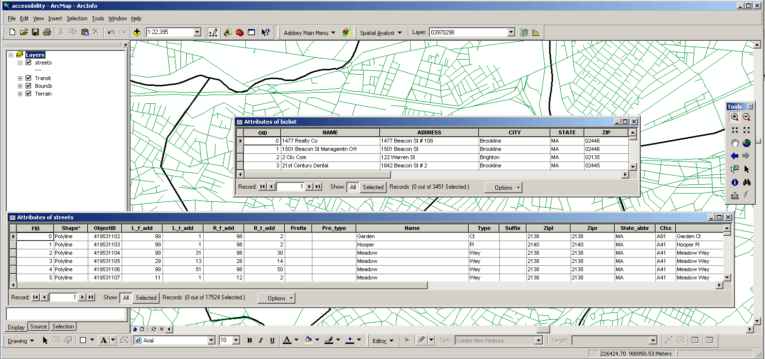
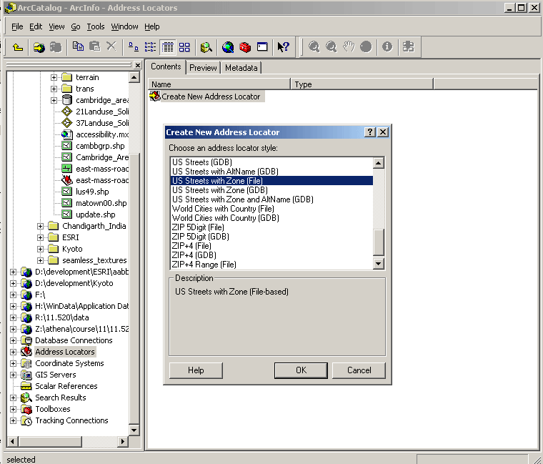
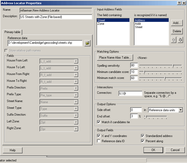
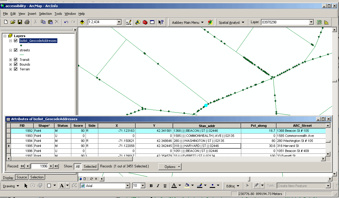
To generate points from Addresses - 'Geocoding's
What is Geocoding
-
- Geocoding typically uses Interpolation as a
method to find the location information about an
address.
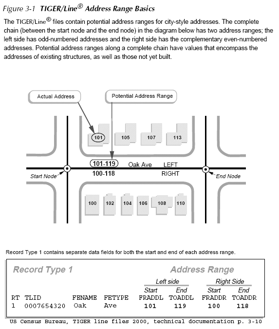
- (If the address along one side of a block range from 1 to 199, then Street Number = 66 is about one-third of the way along that side of the block.)
-
- Reasonably clean, consistent list of legal addresses (i.e. not too many typos, addresses really exist, etc.)
- Address range attributes on a linear street network
- Most commonly from Census
- More current/cleaner data available from private vendors
- Geocoding is one of many geoprocessing services
Geocoding Process
- Converting textual addresses and names to X,Y locations
- via address matching - develop point map from mailing list
- Lookup place names in a 'gazeteer' to find lat/lon, zip, place boundary, voting district, etc.
- General 'service' to translate among geographic identifiers
Example: using US Census Bureau, TIGER Line Files (as source info for geocoding)
- Geocoding Strategy using TIGER
- Encode road network as street centerlines
- Attach address information to each street segment
- Use 'in reverse' to match street address to street segment to get approximate X,Y location
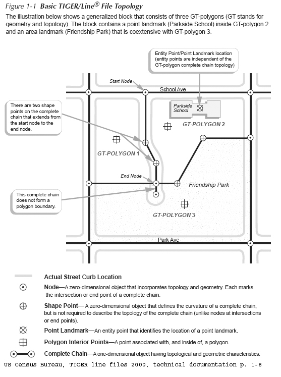
- TIGER: Topologically Integrated
Geographic Encoding and Referencing
system
- http://www.census.gov/geo/www/tiger/
- US Census Bureau TIGER line file 2000, technical
documentation
- at Census: http://www.census.gov/geo/www/tiger/rd_2ktiger/tgrrd2k.pdf
- in class locker: http://mit.edu/www/data/census2k/tiger_tgrrd2k.pdf
- Illustrative Example
|
Street centerline road segments
|
Attaching address ranges to road
segments
|
 |
 |