Massachusetts Institute of
Technology
Department of Urban Studies and Planning
|
11.520: A Workshop on Geographic Information Systems |
|
11.188: Urban Planning and Social Science Laboratory |
Comments on Lab1 and Lab2
Pay attention to the following:
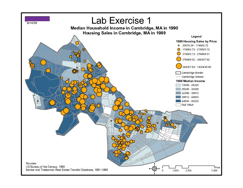
1).whether all the maps are complete (title, north arrow, scale bar, legend, data sources and date)
-layer orders: usually lines are above polygons and points are above lines
-identify symbology in the legend to indicate excluded features
2).whether all the maps are readable
-Change the confusing names of layers and headings(Med_HH_Inc, camborder)
-Identify the units of measurement ($?, million $?)
-Clarify choice of data classification method (quantile? natural break? equal interval?)
-Exclude unnecessary information
3).Lab1: the map that you overlapped with Google earth should be set to transparent (Projection: Lat/Lon WGS84 )
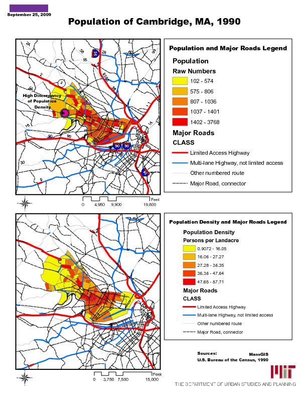
4).Lab2: to perform the comparison of coordination systems, both maps should be adjusted to the same scale.
The major disparity between the two coordination systems: the lat/lon map is more distorted (flatter, stretched) than Mass state Plane coordinate. In other words, the projection into Mass state plane coordinate tends to be more accurate in drawing Cambridge on a 2D plane so that areas are preserved, whereas the lat/lon map plots the 3D spherical coordinates (the lat/lon values) on a Euclidean 2D map. Since Cambridge is about half way from the equator to the north pole, a degree of longitude is much smaller than one degree of latitude so the Mass map looks flatter and stretched compared with the more realistic Mass state plane map.
Check Plus Examples: (drawn from class submissions with the student names removed)
Prepared by Lulu Xue
Back to the 11.520 Home Page.