
| Home
Mission 2007 Team Research Sources Progress Journal |
|
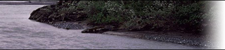
Research Hydrology Water Availability The
Arctic Coastal Plain may seem to be abundant in water resources, but in
actuality, the low precipitation limits the amount of readily available water.
Much of the available water resources come from snow melt, runoff, and rivers
and lakes within the area. In arctic
and subarctic areas, rivers typically carry 55 to 65 percent of precipitation
falling onto their watersheds. The reason is that permafrost prevents the
downward percolation of water and forces it to run off at and very near the
ground surface. One of the consequences of the high runoff is that northern
streams are much more prone to flooding. Another is that they have higher eroding and silt-carrying capabilities
(A). Critical
to the control of water runoff in the north is the cover of moss and other
vegetation of the tundra, bogs and forests. A thick layer of moss acts much
like a sponge laid over the permafrost to slow down the movement of water
across the ground surface. Frozen Water Formations One
main source of water is in thermokarsts or thaw lakes. These lakes
are actually thaw basins, low areas in the tundra where water from melting snow
and ice collect. Thousands of square miles in the Arctic are covered by ground
which has been segmented into what are called tundra polygons or ice
wedge polygons. This pattern is caused by intersecting honeycomb
networks of shallow troughs underlain by more or less vertical ice
wedges. The ice wedges are formed when the ground contracts and splits
in a manner analogous to the formation of cracks on the dry lake bed. This
allows water to enter, and successive seasons of repeated partial thawing,
injection of water, and refreezing cause the wedges to grow. As they do, the
strata to either side are turned up to enclose the polygon, and a lake may form
in the center with the raised troughs at the margins. Above the frozen region, unfrozen water saturation increases due
to low hydraulic conductivity, which prevents the melting ice from draining,
thus causing accumulation of water above it (E). During this process, pingos
are sometimes formed, when the pressure from the contraction of the unfrozen
water pushes it up until it collects and freezes under the root mat. All of the thaw lakes studied were very shallow; even though the lakes could be
several thousand feet long, most were no deeper than 10 feet (A). Drainage
patterns typically follow the troughs, and where they meet, small pools may
form. These are often joined by a stream which causes the pools to resemble
beads on a string -- in fact, this type of stream form is called beaded
drainage. Thaw lakes tend to be elongated perpendicular to prevailing
winds caused by subsurface currents. The waves caused by crosswinds may be
eating away at the peat more aggressively along the edges creating a pattern of
elongation that all arctic lakes share (A). The
amount of available water in the 1002 area has been estimated to be around 9
billion gallons (TAPS). Water Usage in the 1002 Area Water
resources are limited in the 1002 Area.
In winter, only about nine million gallons of liquid water may be
available in the entire 1002 Area, which is enough to freeze into and maintain
only 10 miles of ice roads. Although
such exploration is conducted only in winter, snow cover on the 1002 Area is
often shallow and uneven, providing little protection for sensitive tundra
vegetation and soils. The impact from seismic vehicles and lines depends on the
type of vegetation, texture and ice content of the soil, the surface shape,
snow depth, and type of vehicle. Oil
companies are withdrawing surface water faster than it can be replenished, says
Steve Lyons, hydrologist with the U.S. Fish and Wildlife Service (USFWS). When
an ice road melts, the water runs over the surface into streams, usually
outside the original watershed from which it was withdrawn, he explains.
Because the 1000-ft-thick permafrost does not allow groundwater movement
between water bodies, lakes are filled only by snowmelt and may take more than
two years to refill after the permitted 15% of their liquid volume is withdrawn
for ice road construction (G). Surface
water will also be used for potable purposes at manned facilities, equipment
washing, tank cleaning, dust abatement on roads and workpads, and hydrostatic
testing. Permafrost Examining
the soil and water cycles of the 1002 region, one cannot ignore the presence of
permafrost, or permanently frozen soil, which underlies 80% of Alaska and
remains a central issue in the debate about oil drilling. Permafrost has been
defined as frozen ground in which a naturally occurring temperature below 0° C
(32° F) has existed for two or more years (A). On the North Slope, permafrost
ranges in thickness from Permafrost
can be either thaw-stable or non thaw-stable, depending on the type and
percentage water of the soil it is made of. Permafrosts in more fine-grained
soils like loess (silty) tend to thaw, sink, and create thermokarsts more
often. Permafrost thaws from heat input, such as global warming or human
activity, as well as the clearing of vegetation which insulates the ground. Permafrost is affected by road dust
generated by traffic on unpaved roads; snow melt due to dust deposition can
lead to flooding, ponding, and hydrological changes in oil. Continuing oil and
gas exploration, development, and production, construction of a natural gas
pipeline, the operation and maintenance of facilities, and other activities
requiring road travel would add cumulatively to the volume of road dust
generated on unpaved roads (A). Regions
of ice which have been wind-dusted are likely to undergo localized melting
earlier than the neighboring non-dusted ice (A). There
are three approaches to dealing with the permafrost problem in the construction
practice. The first and most obvious is to avoid it entirely. The second is to
destroy it by stripping the insulating vegetative cover and allowing it to melt
over a period of years. This has the obvious drawback of requiring a
considerable period of time to elapse before construction can begin, and even
then, it is a good idea to excavate the thawed ground and replace it with
coarse material. The
third approach, and one which is becoming more widespread, is to preserve it.
This can be accomplished by building on piles to allow cold air to circulate
beneath heated structures, by building up the construction site with gravel
fill which insulates and protects the permafrost below, or by refrigeration to maintain
low ground temperatures. This is done by utilizing thermal piles or freeze
tubes, such as those used by the trans-Alaska pipeline. These devices are
filled with a non-freezing liquid and act like coffee percolators. They are
cooled during the winter months and draw heat from the ground to retard thawing
during warm weather (A). In
nearshore areas, ice-bonded permafrost is probably present and must be
considered in the design of an offshore pipeline. But nearshore ice-wedge
permafrost under shallow water, particularly along a rapidly receding
coastline, is even more critical for design. Oil pipelines placed in areas of
ice-bonded or ice-wedge permafrost must be heavily insulated to limit thawing
of permafrost. The best location for an offshore platform is at water depths of
6.5-65 feet, to minimize ice gouging. Beyond the 6.5 foot water depth the top
of the ice-bonded permafrost generally is below the surface of the seabed.
Inshore of the 18-foot bottom-depth contour, ice gouging is typically less than
1.6 feet (Y).
|


| Last updated: Nov 16, 2003 | Team 5 - m2007-5@mit.edu |