Proposal of Phases
for
Seismic Exploration:
- Calculating the position and the
amount of the equipment for taking the seismic measures. Questions to
be asked:
- How much explosives do we need for
the given territory?
- Where should we position the
explosives?
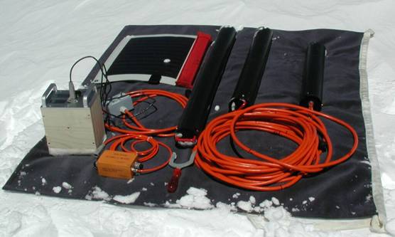
- How many geophones do we need?
- What are the optimal positions of
those geophones?
- After the calculations phase is done,
we position the geophones on the ground and drill the holes for
positioning the explosives. The explosives holes and the geophones will
be positioned using DGPS technology which provides the most accurate
GPS measurements (2 meters to 30cm precision).
- It is possible to drill the needed
holes (12 meters deep) with mobile drilling devices such as lightweight
Ice Core Drills. They may be brought in to the needed territory using
light helicopters or even one man snow-mobiles.
Complete drill with
transportation
protection ( http://www.icedrill.ch/
)
- The geophones and the detonators will
be connected to the data recording unit. The recording unit may consist
of as little as medium sized van which contains the recording equipment.
- The explosives will be positioned in
the ground using the proper safe guidelines. They are also “capped” in
order to direct the explosion downwards.
- The area will be evacuated.
- Synced detonation of explosives will
be followed by seismic data being recorder on the data recording
devices.
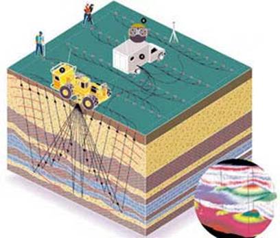
The left truck represents explosives position and
the right
truck the recording unit.
- The recording data will be processed
for 3-D imagining and analysis of the region.
- Later seismic exploration can give us
a fluid flow VS. time diagram, thus enabling another dimension (4-D
Seismic).
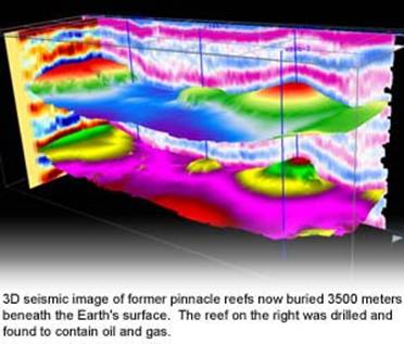
- The last stage of the seismic
exploration is the analysis of the data recorded by the recording unit.
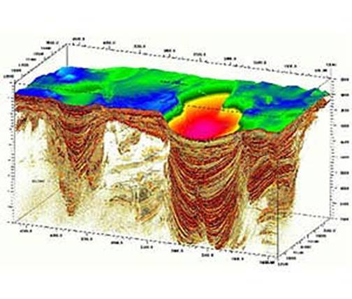
Pictures are property of VERITAS DGC Inc.
( http://www.veritasdgc.com )