Puerto Baquerizo Moreno
El Progreso
El Junco
Kicker Rock
Punta Pitt
Playa Ochoa
La Galapagera
Highlands
San Joaquin Hill
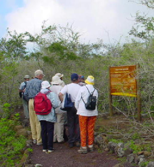
Puerto Baquerizo Moreno is the capital city of all of the islands and is located in the southwestern part of the island. The majority of the population on the island, about 5, 400 people live here. Among the attractions are: a natural history museum, a cathedral on Avenida Northia, and the Interpretation Center/Galapagos National Park Visitor Center. This center was built in 1998 and exhibits the history of the islands (human and natural) and conservation. It is meant to be educational for visitors to the islands. About thirty five minutes past this center is a place called Cerro Tijeretas where visitors can view the Frigate nests. Nearby Puerto Baquerizo Moreno is a place called Playa Punta Carola, the beach best known for surfing. The best times of the year to go surfing are December to March. There is a surfing competition during the second week of February. For swimming, visitors should go to Playa Mann- a beach that is north of Playa Punta Carola. Playa de Oro is a small town close to Playa Punta Carola. The capital has an airport (built in 1985) which visitors may pass on their way to La Loberia from Puerto Baquerizo Moreno. The airport has brought many tour boat bases to the island. An Ecuadorian Navy base is also located on the island. At La Loberia, visitors will see sea lions, marine iguanas, bird life, rays, and tortoises in the bay area of La Loberia. The chief sources of income for people who live in the capital include: fisheries, tourism, cattle ranching, agriculture and government work. Visitors can camp at some nearby beaches. These beaches are among the few where visitors are allowed to camp in the Islands.
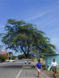
Puerto Baquerizo Moreno (The Capital)
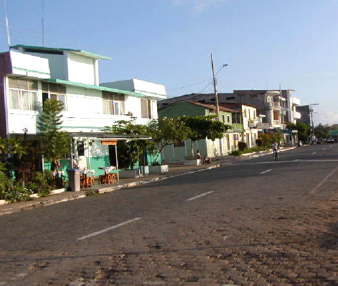
Puerto Baquerizo Moreno
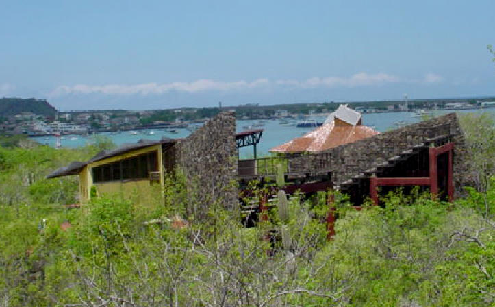
The Interpretation Center
El Progreso
El Progreso was founded by Manuel Cobos in 1869 after General Villamil failed at establishing a colony. Cobos had prisoners whom he treated like slaves and he developed a sugar cane and coffee plantation. The town retained its name after Cobos left. Today, it is a small agricultural town and the site of the Carlos Darwin School. Visitors can take a bus from Puerto Baquerizo Moreno to El Progreso. It is about a twenty minute ride and covers a distance of about seven kilometers. Close to El Progreso is a place called Puerto Chino which has wild beaches and another place called La Soledad. At La Soledad, visitors can view the vegetation.
El Junco
El Junco is the only freshwater lake on all of the Galapagos Islands. It is situated in the center of San Cristobal at a height of 700 meters. It was formed from a collapsed volcano cone, a caldera, and is about three hundred meters wide. The depth of the lake depends on the amount of rainfall so it is deepest from October to May- the rainy season in the Galapagos. Visitors can hike here from El Progreso. However, it is a rather long hike of about three hours. One can also take a collection truck to reach El Junco. Miconia (also called cacaotillo) bushes comprise the vegetation around the lake along with sedge. (from which the lake derives its name- El Junco means "sedge" in Spanish) However, this vegetation is diminishing and is currently endangered due to grazing, burning, and competition with plants that have been introduced to the area. Bracken Fern is a specific type of plant, located in the Miconia and Pampa zones, that is suffering from introduced species and cattle grazing. Some of the wildlife in the area includes white-cheeked pintail ducks and common gallinules.
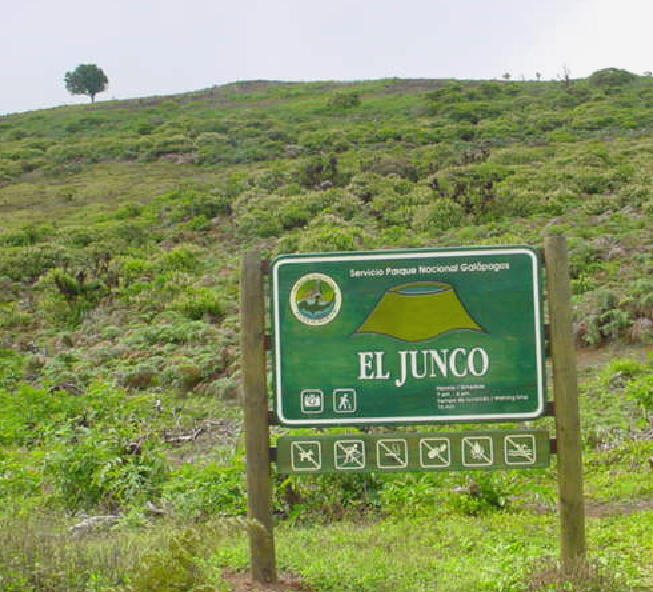
El Junco
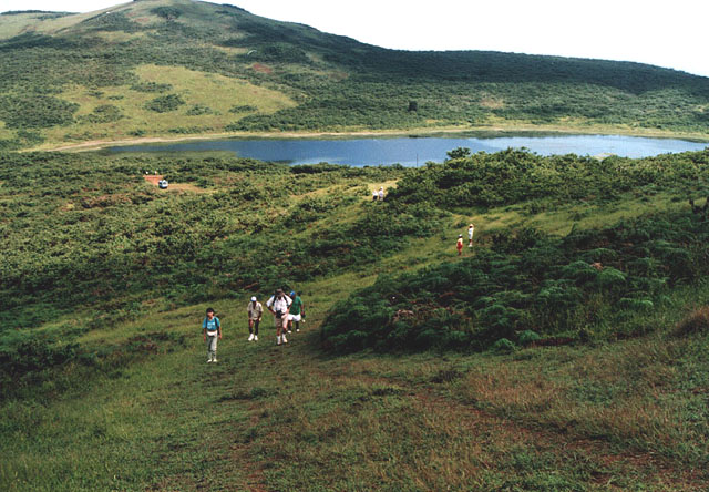
El Junco (freshwater lake)
El Junco
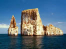
Kicker Rock (Leon Dormido)
Kicker Rock is a vertical rock, about five hundred feet tall, that has been divided into two sections as a result of erosion. It is on the western shore and is said to resemble a shoe. It is one of the most visited diving sites along with Punta Pitt and Roca Ballena. Blue-footed boobies and masked boobies can be seen here. Visitors travel through the two sections of the rock on panga trips.
El Progreso
El Progreso was founded by Manuel Cobos in 1869 after General Villamil failed at establishing a colony. Cobos had prisoners whom he treated like slaves and he developed a sugar cane and coffee plantation. The town retained its name after Cobos left. Today, it is a small agricultural town and the site of the Carlos Darwin School. Visitors can take a bus from Puerto Baquerizo Moreno to El Progreso. It is about a twenty minute ride and covers a distance of about seven kilometers. Close to El Progreso is a place called Puerto Chino which has wild beaches and another place called La Soledad. At La Soledad, visitors can view the vegetation.
El Junco
El Junco is the only freshwater lake on all of the Galapagos Islands. It is situated in the center of San Cristobal at a height of 700 meters. It was formed from a collapsed volcano cone, a caldera, and is about three hundred meters wide. The depth of the lake depends on the amount of rainfall so it is deepest from October to May- the rainy season in the Galapagos. Visitors can hike here from El Progreso. However, it is a rather long hike of about three hours. One can also take a collection truck to reach El Junco. Miconia (also called cacaotillo) bushes comprise the vegetation around the lake along with sedge. (from which the lake derives its name- El Junco means "sedge" in Spanish) However, this vegetation is diminishing and is currently endangered due to grazing, burning, and competition with plants that have been introduced to the area. Bracken Fern is a specific type of plant, located in the Miconia and Pampa zones, that is suffering from introduced species and cattle grazing. Some of the wildlife in the area includes white-cheeked pintail ducks and common gallinules.
El Junco
El Junco (freshwater lake)
El Junco
Kicker Rock (Leon Dormido)
Kicker Rock is a vertical rock, about five hundred feet tall, that has been divided into two sections as a result of erosion. It is on the western shore and is said to resemble a shoe. It is one of the most visited diving sites along with Punta Pitt and Roca Ballena. Blue-footed boobies and masked boobies can be seen here. Visitors travel through the two sections of the rock on panga trips.
Kicker Rock
Back To Top
Back To Top
Punta Pitt
Punta Pitt is located on the northeastern part of the island. There is a steep trail located at this wet landing. Red-footed, blue-footed, and masked boobies can be seen here. Frigatebirds, swallow-tailed gulls, and storm petrels can also be seen.
Playa Ochoa
This is an island about an hour from San Cristobal with a trail to a beach where visitors can swim. Pelicans and various other birds can be seen from this island.
La Galapagera
This is a relatively new visitor site with trails that give visitors the opportunity to see giant tortoises and vegetation that is typical of the lowland and moist upland areas.
La Galapagera
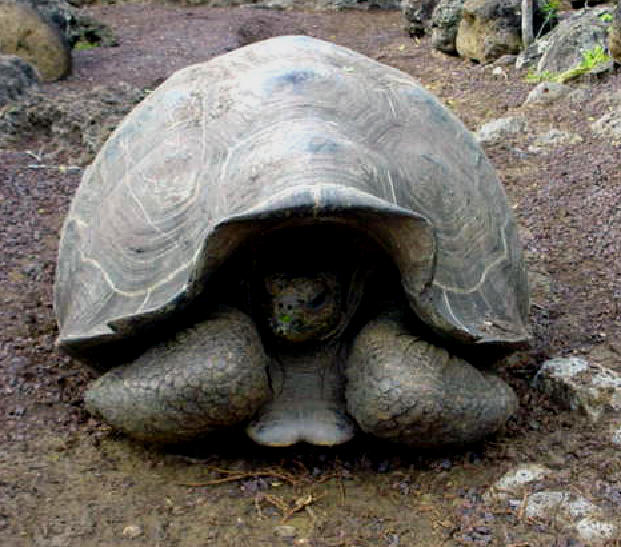
A Giant Tortoise
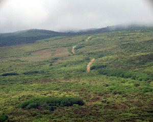
Highlands
This is one of the few places where visitors are not required to visit with a guide. Many locals come to this area and few visitors who chose to stay longer in Puerto Baquerizo Moreno to explore the area on foot or by truck.
Punta Pitt is located on the northeastern part of the island. There is a steep trail located at this wet landing. Red-footed, blue-footed, and masked boobies can be seen here. Frigatebirds, swallow-tailed gulls, and storm petrels can also be seen.
Playa Ochoa
This is an island about an hour from San Cristobal with a trail to a beach where visitors can swim. Pelicans and various other birds can be seen from this island.
La Galapagera
This is a relatively new visitor site with trails that give visitors the opportunity to see giant tortoises and vegetation that is typical of the lowland and moist upland areas.
La Galapagera
A Giant Tortoise
Highlands
This is one of the few places where visitors are not required to visit with a guide. Many locals come to this area and few visitors who chose to stay longer in Puerto Baquerizo Moreno to explore the area on foot or by truck.
San Joaquin Hill
This is the Island's highest point and can be reached by bus or truck. It rises 24,000 feet, bringing visitors above the tree line to view the various zones and ecosystems on the Island.
Home