History
The Federated States of Micronesia (FSM) was first settled several thousand years ago by people from Asia and Polynesia. Portuguese sailors came across Yap in 1525, the first European contact with the natives, followed by Spain, which ruled FSM until 1899. Spain then sold its Pacific sovereignties to Germany, which ended its administration after it's loss in the Spanish-American War. After World War I, when Japan was allied with the U.S. and its European Allies, the League of Nations awarded Micronesia to Japan. Soon after, Japan fortified Micronesia, and it was used as an important stop in the Allied march towards Japan.
In 1947, after World War II, the United Nations took over Micronesia and formed the Trust Territory of the Pacific Islands (TTPI), composed of Pohnpei, Kosrae, Chuuk (also called Truk), Yap, Palau, the Marshall Islands, and the Northern Mariana Islands. The United States took on the responsibility of the Trusteeship, and agreed to "promote the economic advancement and self-sufficiency of the inhabitants".
After a Constitution Convention, on July 12, 1978, Chuuk, Yap, Pohnpei, and Kosrae voted to form the Federated States of Micronesia and finally regained their sovereignty. Tosiwo Nakayama, former President of the Congress of Micronesia, became the first President of the new FSM. The US currently recognizes the national and state governments of FSM, and continues in a "backstage role" in the new federation's economy, part of which involved creating a Compact of Free Association with FSM, as well as the Republic of the Marshall Islands, and the Republic of Palau after their constitutions were established.
visit-fsm.org/index.html
Geography
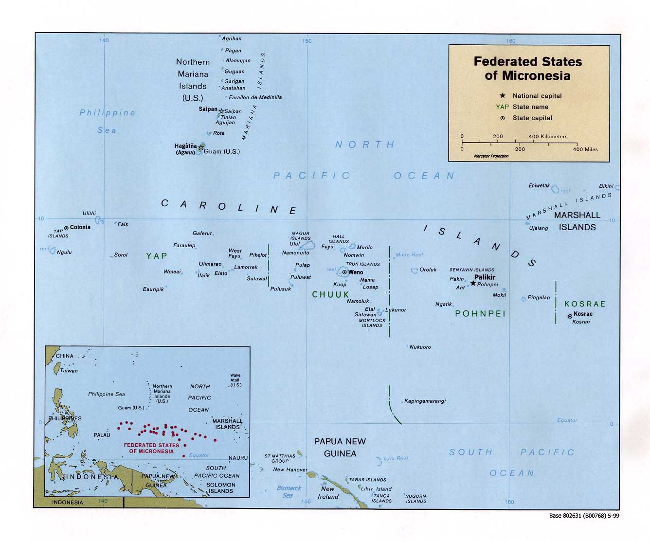
The FSM is a group of islands in the western Pacific Ocean east of the Philippines. Its 607 islands have a total area of 4840 square kilometers, with the smallest islands barely a kilometer across. FSM is organized into four island groups - Pohnpei, Chuuk, Kosrae, and Yap. Its population is concentrated on the larger, higher islands for the most part, with 49% of the 118,000 total population concentrated on the large islands in Chuuk. Pohnpei is of volcanic origin, and has high rainfall (300 rainy days a year). The westernmost island group, Yap, has a very high elevation. Chuuk, the Central Caroline islands, consists of 15 islands groups and is surrounded by huge barrier reefs. 14 of the main mountainous islands are of volcanic origin. The outer islands are all low islands (atoll). People live on the shores, meaning they are significantly at risk in the event of a tsunami. Chuuk is also characterized by high humidity and rainfall. The final island group is Kosrae, one large island; it is 109.6 square kilometers with fertile soil, mountainous, and has 4 harbors.
state.gov/r/pa/ei/bgn/1839.htm
Risk Assessment
The country of Micronesia consists of over 600 islands located in the southwestern Pacific Ocean. These islands are divided into four main groups called Chuuk, Kosrae, Pohnpei, and Yap. Nearly all of these 600 islands are very close to sea level which creates a difficult problem in evacuating people in the situation of a tsunami. However, since these islands were originally created by volcanic eruptions, there are a few peaks which reach over 2,500 feet. When evaluating risk assessment, or which areas are most likely to suffer from a tsunami, it is easy to see that all of the islands have an equally great chance of suffering a lot of damage from a tsunami. Therefore, the most important areas to evacuate people in Micronesia are the most populated islands, even though all of the islands need to be evacuated.
worldatlas.com/webimage/countrys/oceania/fm.htm