Pictures
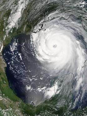 This is a satellite image of
Hurricane Katrina as it approached Louisiana. You can clearly see the structure of the
hurricane. The circular shape and the
eye in the center are very clearly defined.
This is a satellite image of
Hurricane Katrina as it approached Louisiana. You can clearly see the structure of the
hurricane. The circular shape and the
eye in the center are very clearly defined.

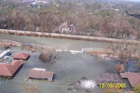
This is
the London Avenue Canal. The levees there failed rather
catastrophically causing all of the flooding that you can see in the
picture. Because these levees broke, the
pumps at the end of the canal were flooded and rendered ineffectual. The water in the canal comes from Lake Pontchartrain, which experienced strong storm surges
in the hurricane probably contributing to the levee failure.

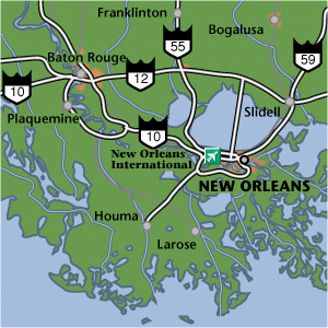 This is a map of the major
routes and highways into and out of New
Orleans. We
would primarily consider these roads in the evacuation plans. By opening both directions to outbound
traffic during an evacuation, it would help to make things run smoothly. (Picture
from www.worldexecutive.com/.../new_orleans/maps.html
)
This is a map of the major
routes and highways into and out of New
Orleans. We
would primarily consider these roads in the evacuation plans. By opening both directions to outbound
traffic during an evacuation, it would help to make things run smoothly. (Picture
from www.worldexecutive.com/.../new_orleans/maps.html
)
Home