HOW TO MAKE A SLOPEMAP FROM A DEM
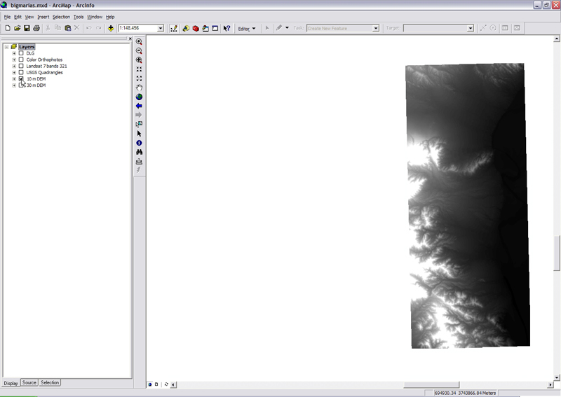
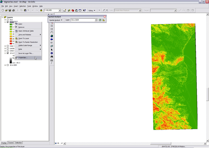
1) In ArcMap, display the DEM you are interested in analyzing.
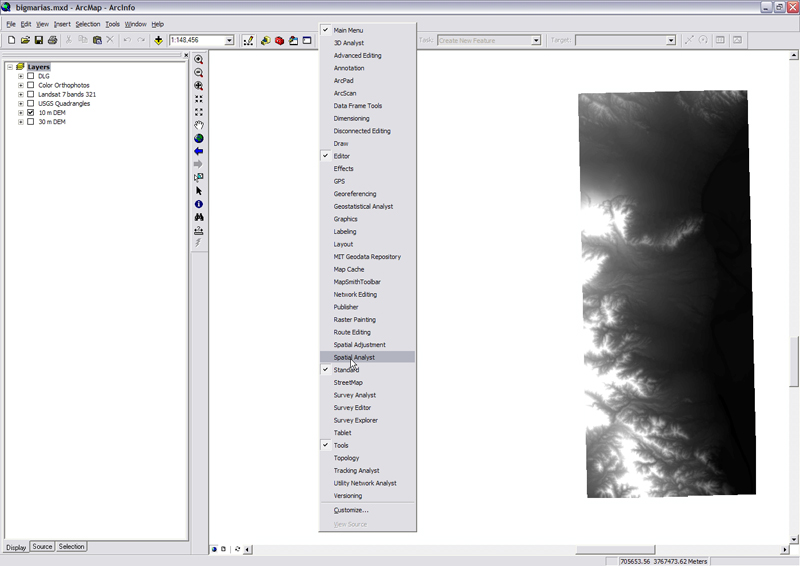
2) Make the Spatial Analyst tools available. Right-click on the taskbar at the top of the window and make sure Spatial Analyst is checked. The Spatial Analyst toolbar will appear.
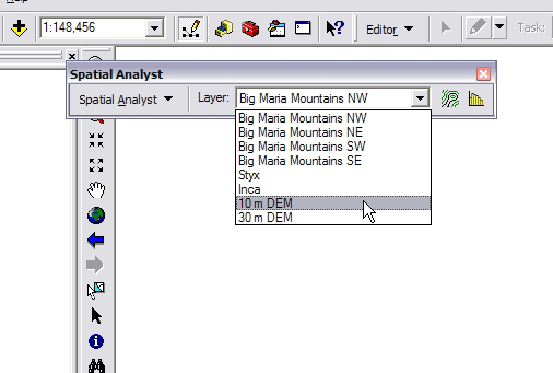
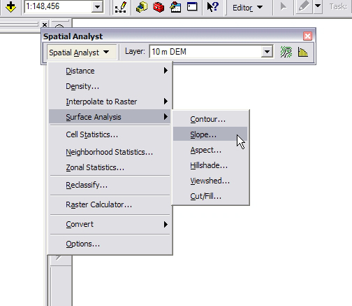
3) From the Layer pulldown in the Spatial Analyst toolbar, select the DEM you want to analyze
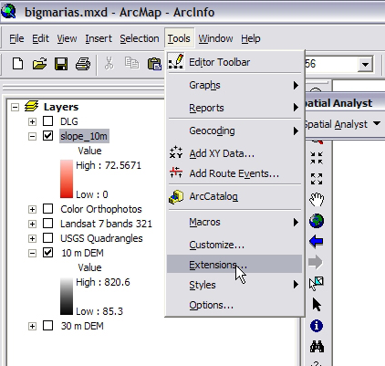
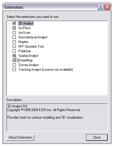
Note! If all the options in the Spatial Analyst toolbar are greyed out, and there are no available layers, it is likely that the Spatial Analyst extension is turned off. To turn it on, in the ArcMap window click Tools and select extensions. Make sure that the box next to Spatial Analyst is checked.
4) From the Spatial Analyst pulldown, select Surface Analysis, and Slope.
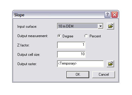
5) A window appears. Specify the output path and press OK.
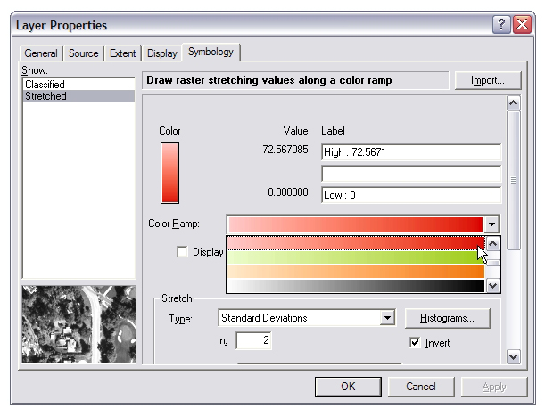
6) Let's give the slopemap a beautiful color scheme! In the Tabloe of Contents, right-click on the layer corresponding to the slope map you just created, and select Properties.
7) Click the symbology tab.
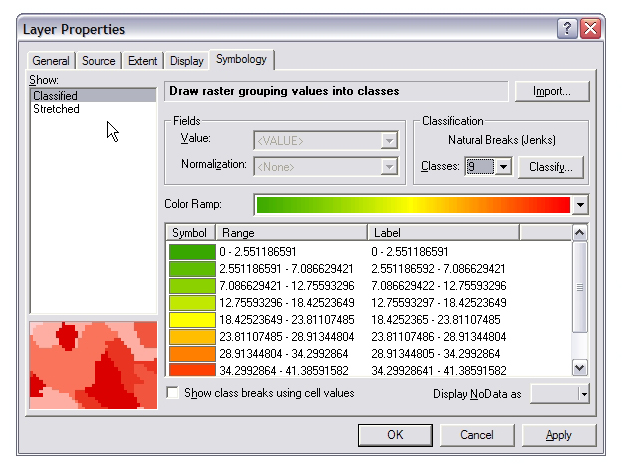
8) Select Stretched from the menu on the left, then select the black-to-white colormap (it should be the default). We want black to be the steepest slopes so click the Invert box in the lower right corner of the window to flip the colors so that black is at the top. When you're finished, click OK.