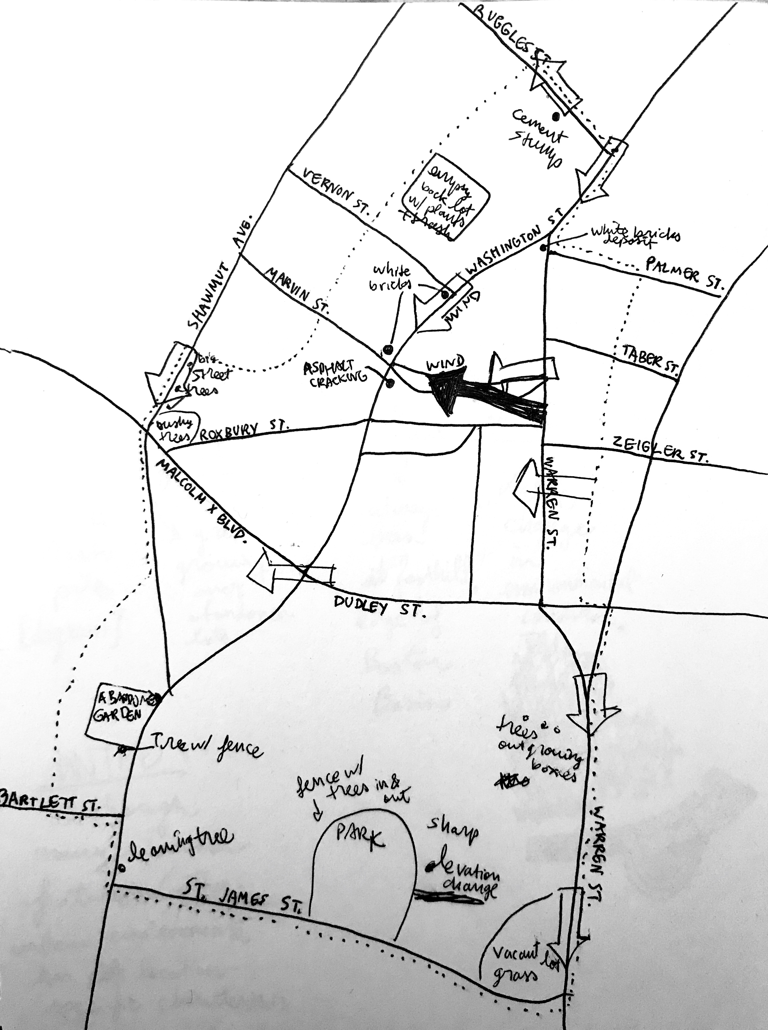
 Figure 1: Site Map with Field Notes on Natural Processes
Although Dudley Square is an urban environment, and thus seemingly on shaped by human factors, a closer look into the site reveals that it has been shaped at multiple scales by a variety of natural processes over time. These range from geological formations spanning history to contemporary human activity only decades in the making. The superposition and interaction of these processes with human development has defined the site as it stands today, leaving behind numerous physical clues. The site does share many common features with other urban environments including the channeling of wind flow by tall buildings, trees leaning out from façades in search of sunlight, and fences mangled by tree branches. However, Dudley Square has been shaped by a combination of more site-specific natural processes, namely the presence of a hill as well as subsidence and shoving on the pavement. While the effects of the hill represent the action of multi-millennial geological processes, smaller scale, contemporary effects on the pavement reflect Dudley Square’s high vehicular traffic. Ultimately, the lack of regard for these natural processes by developers, planners, and designers leaves Dudley Square appearing rather neglected with potential risks for the future.
The Role of the Hill
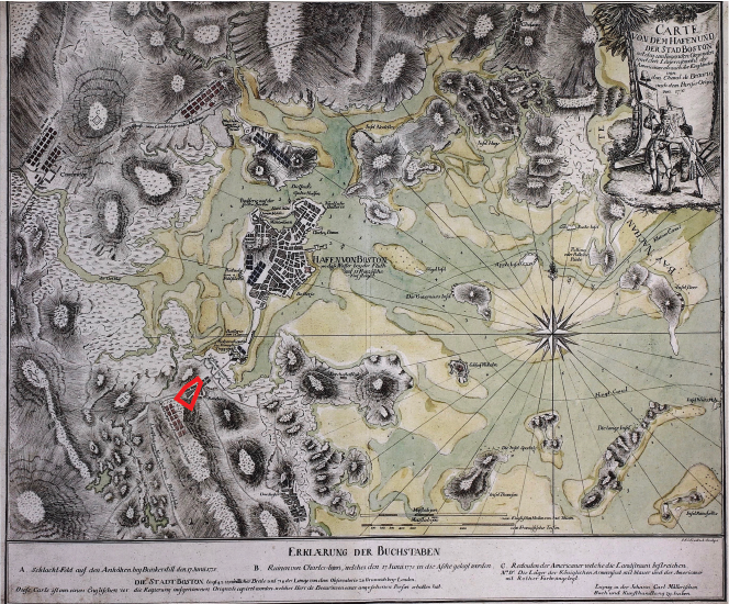 . Figure 2: Frentzel Map
Frentzel, George Friedrich Jonas Carte von dem Hafen und der Stad Boston In: Krieger, Alex, David Cobb, and Amy Turner, eds. Mapping Boston. Cambridge, MA: MIT Press, 1999: 181.
. Figure 2: Frentzel Map
Frentzel, George Friedrich Jonas Carte von dem Hafen und der Stad Boston In: Krieger, Alex, David Cobb, and Amy Turner, eds. Mapping Boston. Cambridge, MA: MIT Press, 1999: 181.
The hill located at the southern part of the site has played and continues to play an essential role in the site’s physical environment; indeed, it has existed since before the founding of Boston and Roxbury. As a drumlin formed by the sliding of glaciers, it follows the oblique pattern of most of the hills in Greater Boston as well as the islands of Boston Harbor, as described by Anne Whiston Spirn in her book, The Granite Garden . A look at Frentzel’s 1776 map of Boston (Figure 2) reveals small rivers and streams meandering around the hill and pouring out into the water adjacent to the neck leading to Boston.
 Figure 3: Geologic Map
Brankman, C. M., comp. "Surface Geology of Boston South Quadrangle." Map. Boston Geology. 2004. Accessed March 11, 2018. http://bostongeology.com/geology/index.htm.
Figure 3: Geologic Map
Brankman, C. M., comp. "Surface Geology of Boston South Quadrangle." Map. Boston Geology. 2004. Accessed March 11, 2018. http://bostongeology.com/geology/index.htm.
Although these water features have been progressively filled in, their historic presence has likely resulted in erosion and ultimately uneven sediment on the site. Thus, there exists a contrast between the denser, more homogeneous drumlin soil and the looser, more heterogeneous former stream-bed soil. This kind of soil can be identified on a geologic map (Figure 3) and can help explain the subsidence seen on the flat areas of the site near the bus station. In The Granite Garden, Spirn discusses the importance of earth, water, and gravity in determining the composition of urban terrain . The combination of these forces can shape the physical environment of an area for hundreds of years.
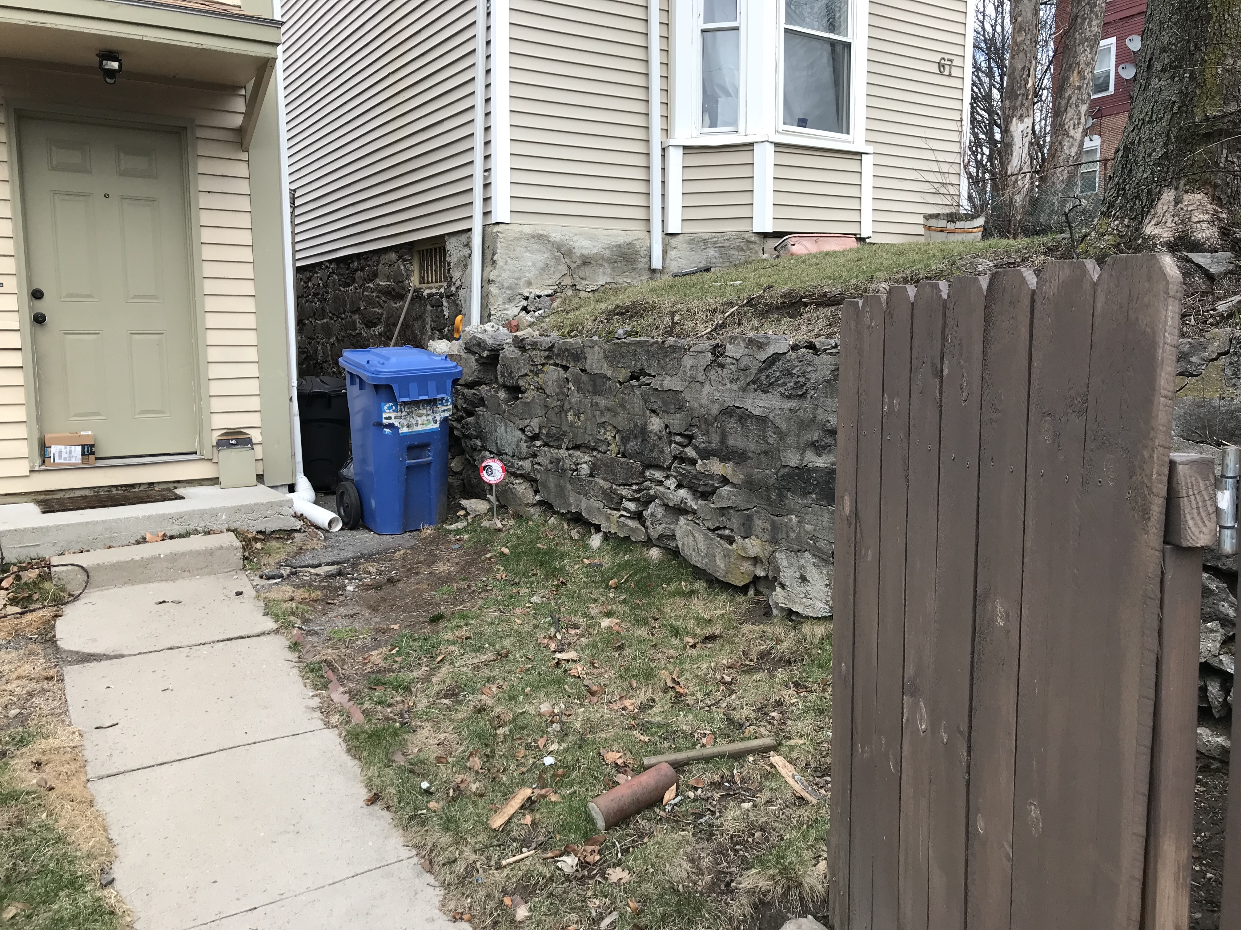 Figure 4: Cracking Retaining Wall
Some of the most visible features showing the force of the hill itself are the cracking retaining walls bounding the lots on St. James Street. Though the side of the hill is curved, it has been cut into rectangles to provide flat lots for the houses built on it. This terracing method relies on strong retaining walls between lots to keep soil from spilling into lower lots and onto the street. While these walls may have once been uniform, they are now cracking and seem to be at risk of collapse. The cracking seems to be caused by a combination of water leaking as seen in Figure 5 and the sheer weight of soil being retained.
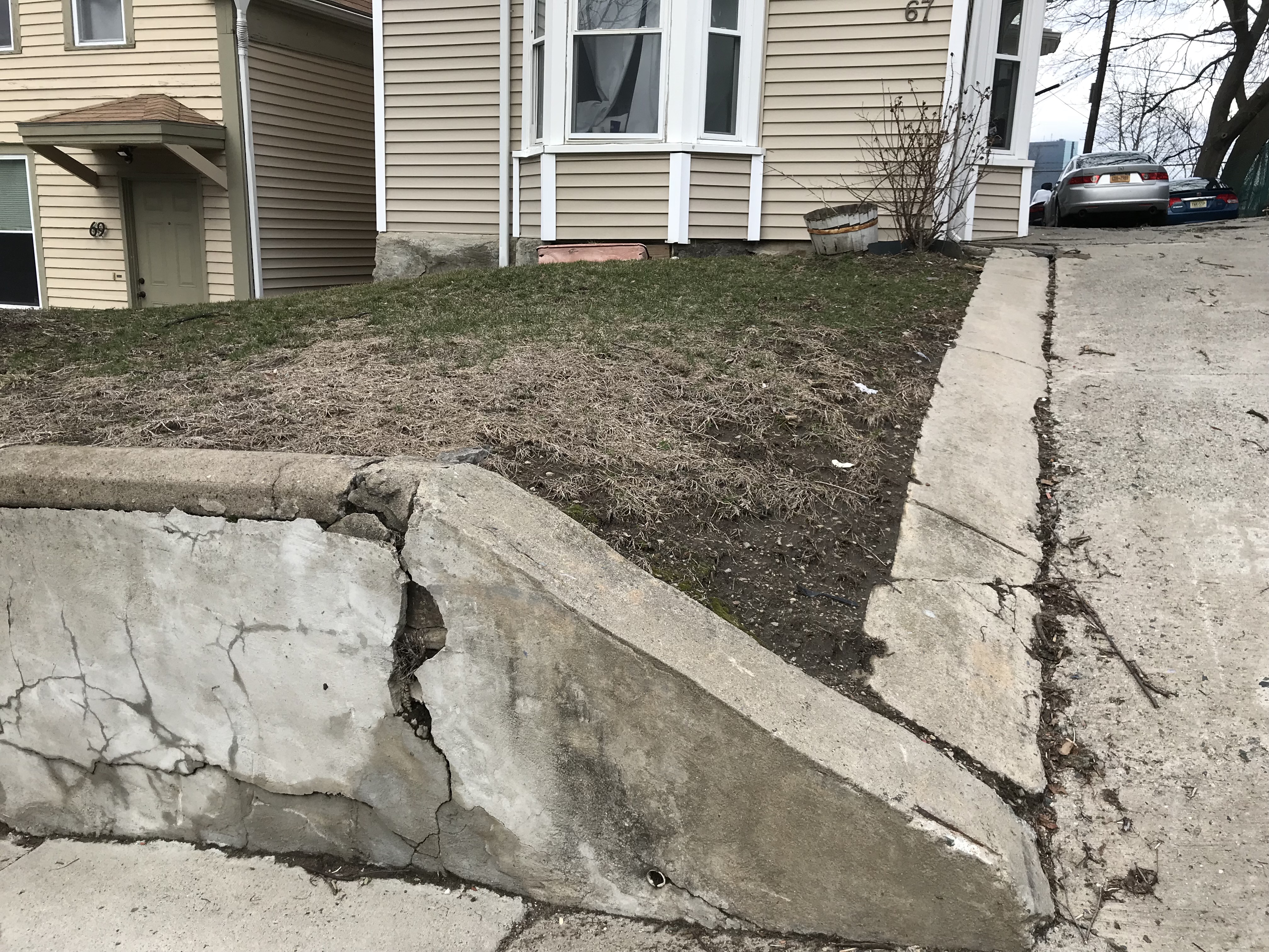 Figure 5: Water Leak Retaining Wall
The damage of these retaining walls points to the inevitability and strength of natural forces, such as gravity, in urban environments. Despite attempts to control and sculpt nature to specific human desires, physical forces cannot be entirely contained. A building design more incorporated with the slope of the hill rather than in opposition to it would likely result in more durable development and lower maintenance costs.
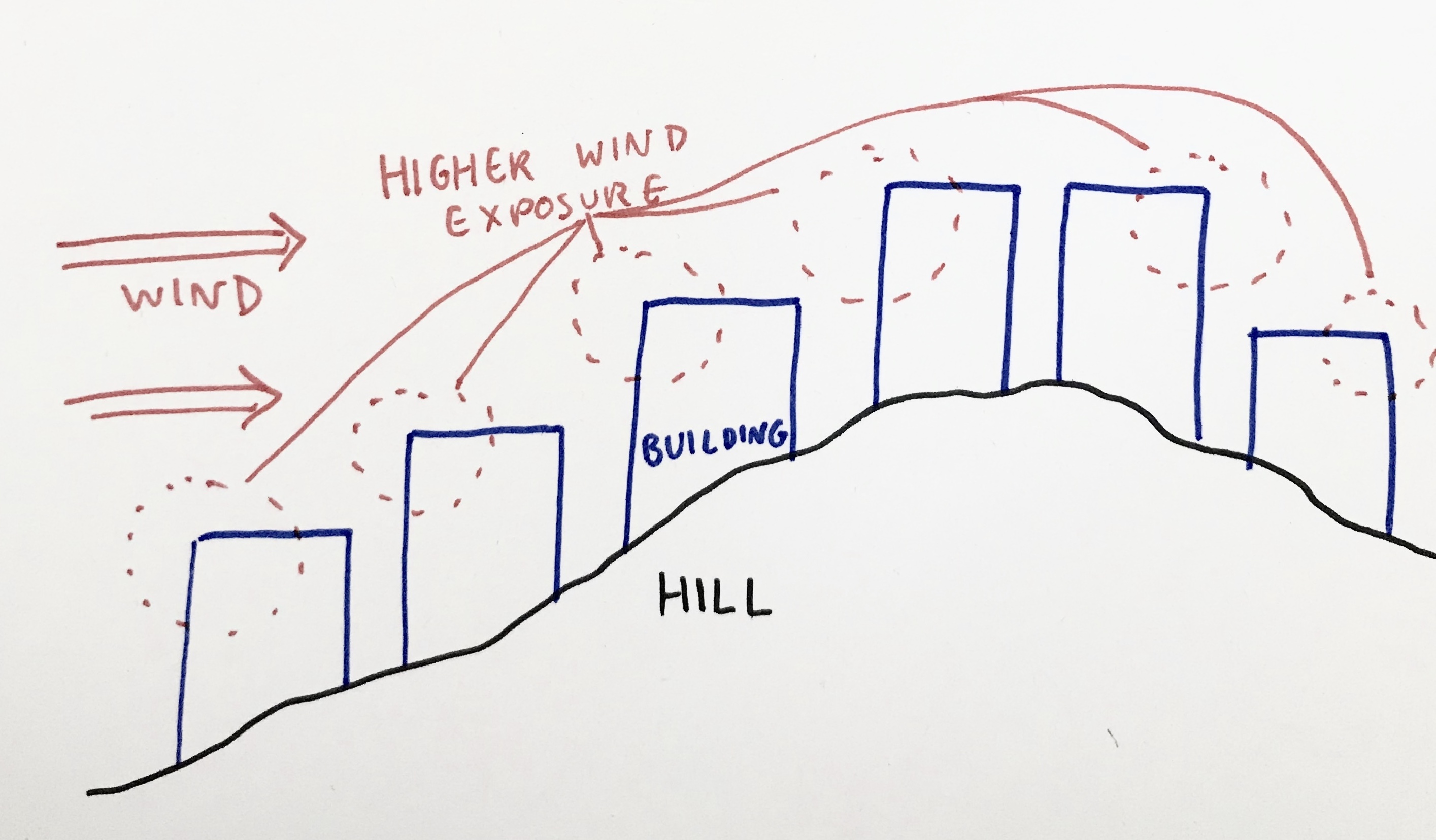 Figure 6: Diagram of Wind Exposure on Hill
The presence of the hill also influences the wind patterns on the site. As Spirn discusses in The Granite Garden, urban environments see a great deal of variation in wind direction and speed due to changes in airflow by buildings and topography . By revealing some buildings and shielding others, the hill provides differential wind exposure leading to both increased wear on buildings as well as opportunities for automatic maintenance by natural processes. St. James Street is sloped and is composed of detached houses, leading to certain sides of houses being more exposed to the wind than the other sides. For example, the left side of the house shown in Figure 7 seems to have suffered significant paint chipping due to high wind exposure; it is higher in elevation than the house to the left and thus receives direct wind. The right side, while still showing paint chipping, is in much better shape; it is much closer to the adjacent house, which is at the same elevation, and is thus protected.
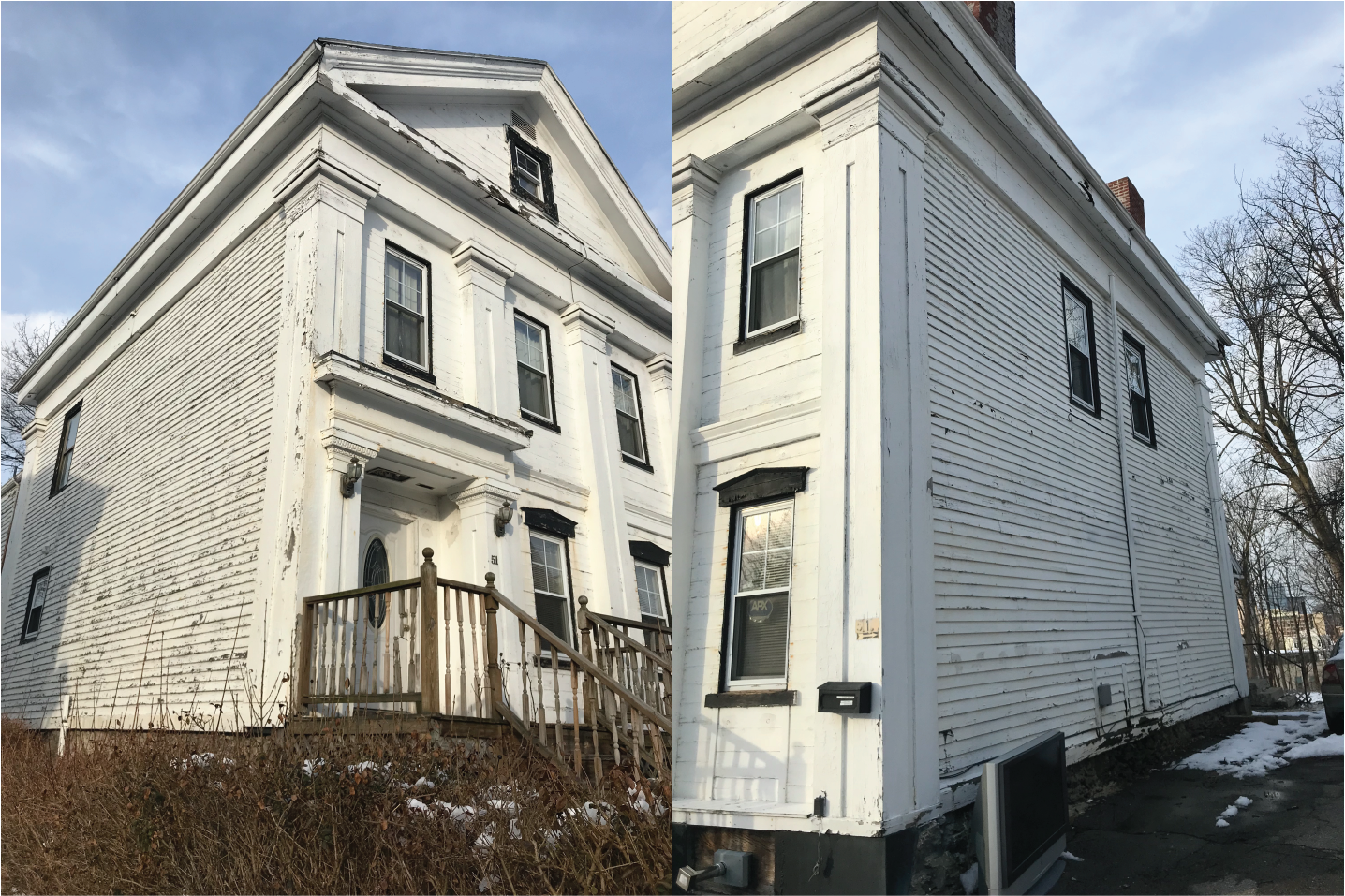 Figure 7: Chipping on Left Side of House vs Right Side
This differential exposure to wind is also clear when observing the way in which the wind can remove snow from roofs. In one row of houses on a lot on St. James Street, the amount of snow on each roof decreases progressively towards the point where the hill drops at the north (the right side in Figure 8). The houses closest to the drop receive the most wind and thus have the least snow on their roofs.
 Figure 8: Wind Clearing Snow on Roof
This differential weathering reflects the importance of wind as a natural process and the hill’s potential to accentuate or diminish such natural processes. While exposing some structures to the wind, the hill itself also serves as a shield for others. The Boys and Girls Club and the Roxbury Municipal Court located right at the base of the hill, to the north, experience much less wind than most of the site. The hill drops abruptly on its northern side, leaving a relatively large area shielded from most winds emerging from the south and southwest.The hill is a crucial element on the site. It engenders its own natural processes while simultaneously influencing others.
An Area of High Traffic
Despite the significance of long-term natural processes, some of the site’s other physical features result from contemporary forces and reveal non-natural qualities of the site. Specifically, the many instances of subsidence and shoving in the pavement remind that Dudley Square sees a high quantity of vehicular traffic.
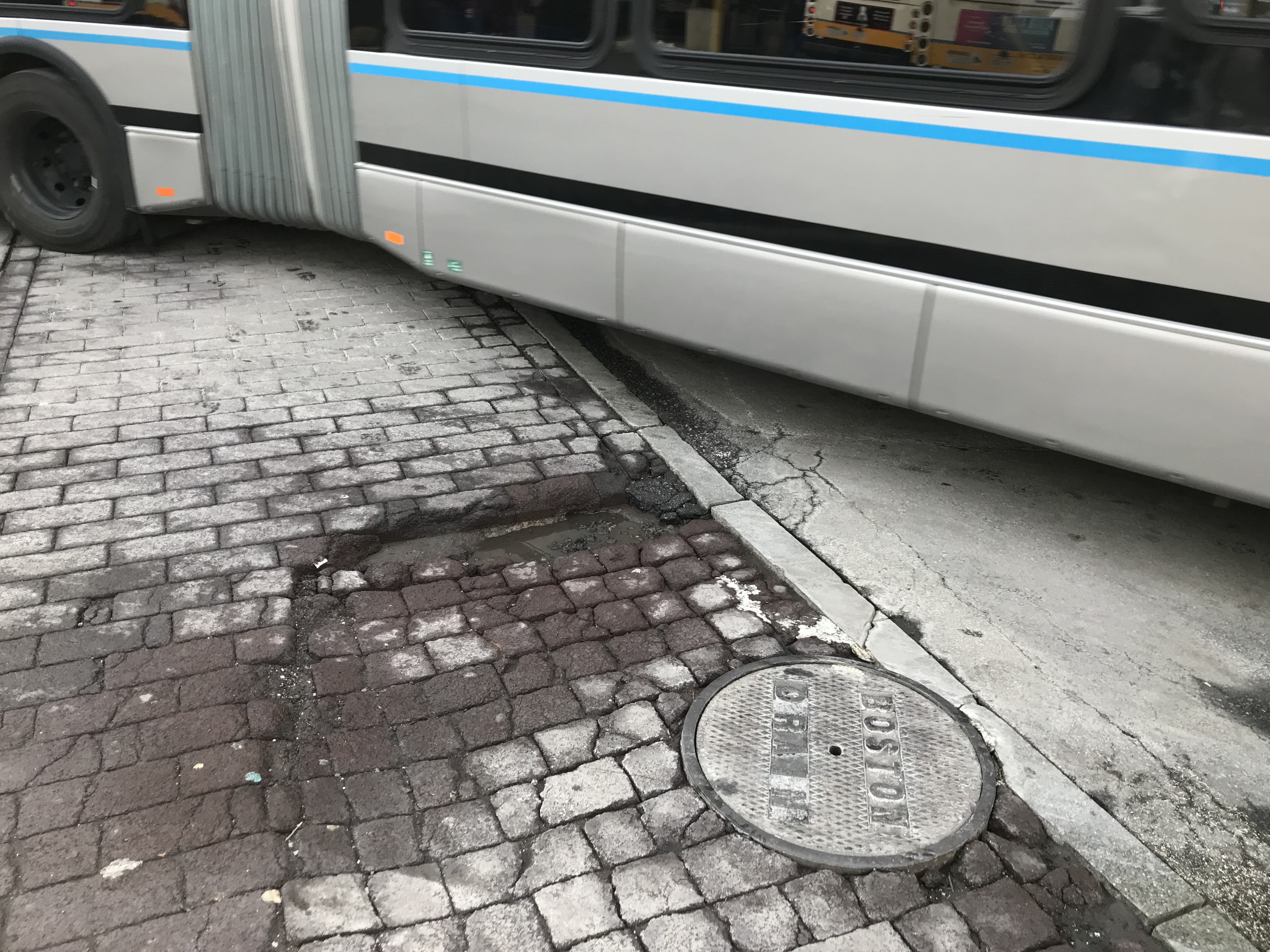 Figure 9: Pavement Subsidence and Bus
While many areas around the site show some subsidence in the pavement, the most pronounced instances are located in the bus station area. Cracks and holes are created as some bricks sink relative to the bricks around them (Figure 9). Although the subsidence can likely be explained by the heterogeneous soil resulting from the deposits of historic rivers and streams running down from the hills of Roxbury as described above, the instances in the bus station are accentuated by the near constant pressure of bus and car tires. These indentations are thus the deepest and the most dangerous. Each bus passing over an indentation dips a bit, both slowing down and exerting more force on an already damaged pavement. Who knows how soon these will become potholes.
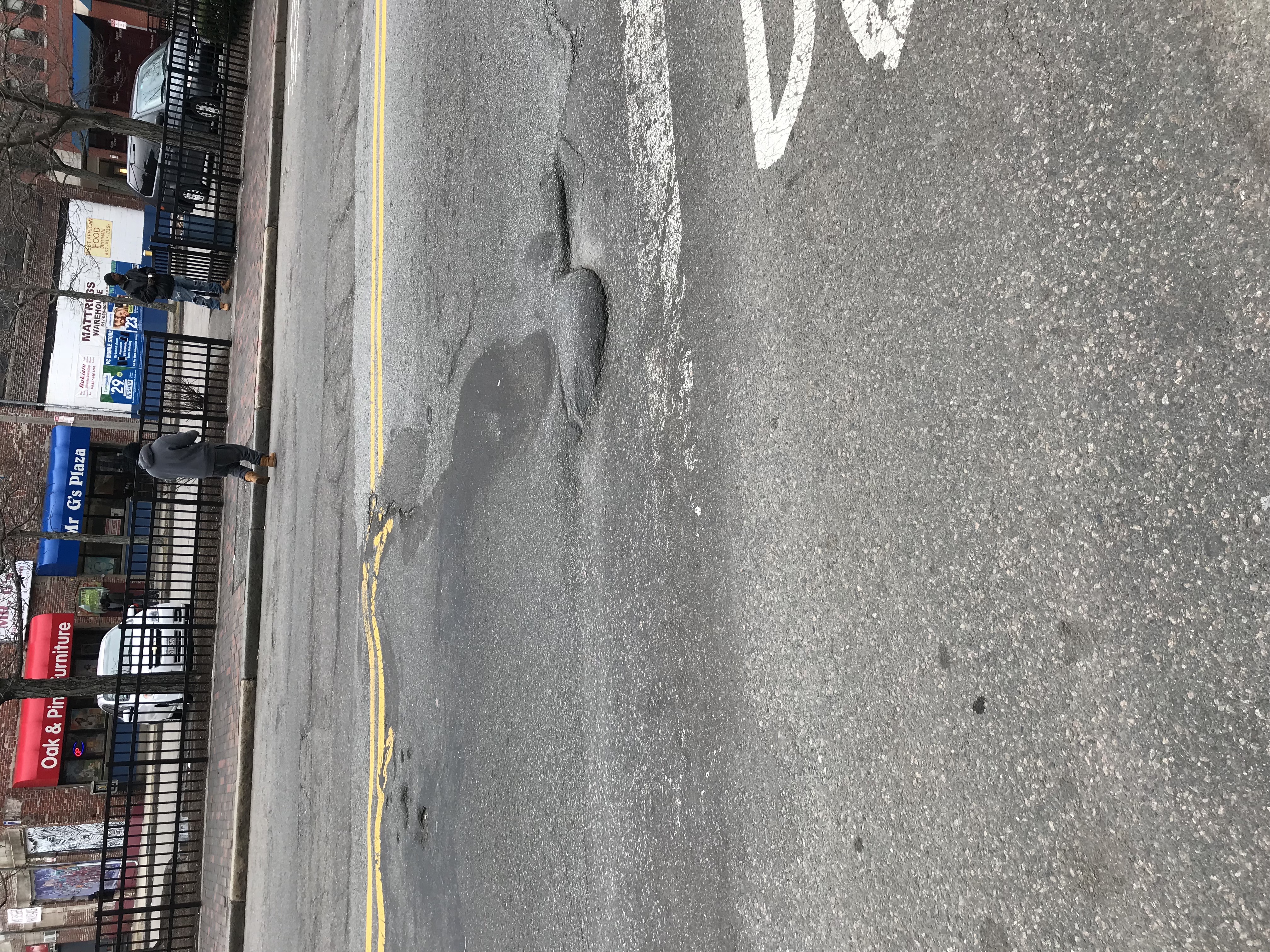 Figure 10: Asphalt Shoving
The asphalted pavement is also altered due to vehicular movement through a process called shoving. As described by James Elkins in How to Use Your Eyes, shoving describes the pushing of pavement due to the starting and stopping of vehicles, especially buses which are heavy enough and slow enough to do so . This process significantly textures the otherwise smooth asphalt and distorts any painted road markings. On a larger scale, this can be dangerous for vehicular travel.
A Neglected Neighborhood
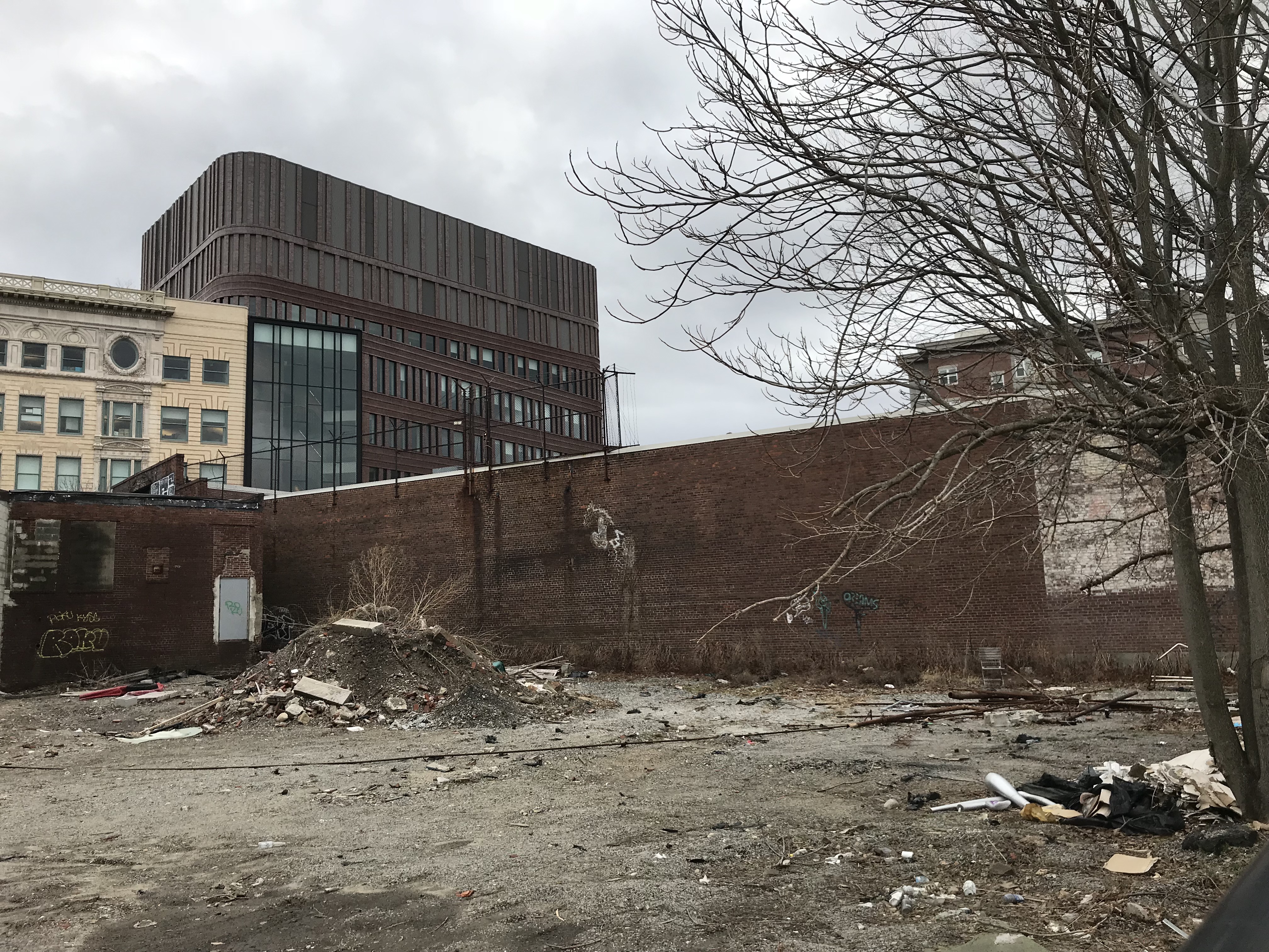 Figure 11: Empty Lot with Plants Growing
Many of the features of the site described above seem to show Dudley Square as a site that government has underinvested in and that has been left at the mercy of natural processes. Moreover, other characteristics also contribute to this neglected image. The presence of some empty lots on the site creates a sense of abandonment and absence of activity. Plants often grow in an uncontrolled manner over these lots, at least in parts containing soil. On a site with little vegetation, they are a welcome sight. However, as Spirn describes, much urban vegetation is unable to thrive because of constraints in urban environments . Similarly, these plants undergo too many stresses to thrive; the quality of soil is likely poor and walls on all sides prevent adequate sun exposure. A more intentional and thoughtful management of such lots could allow vegetation to improve the urban environment by providing shade, natural air filtration, and more simply, beauty .
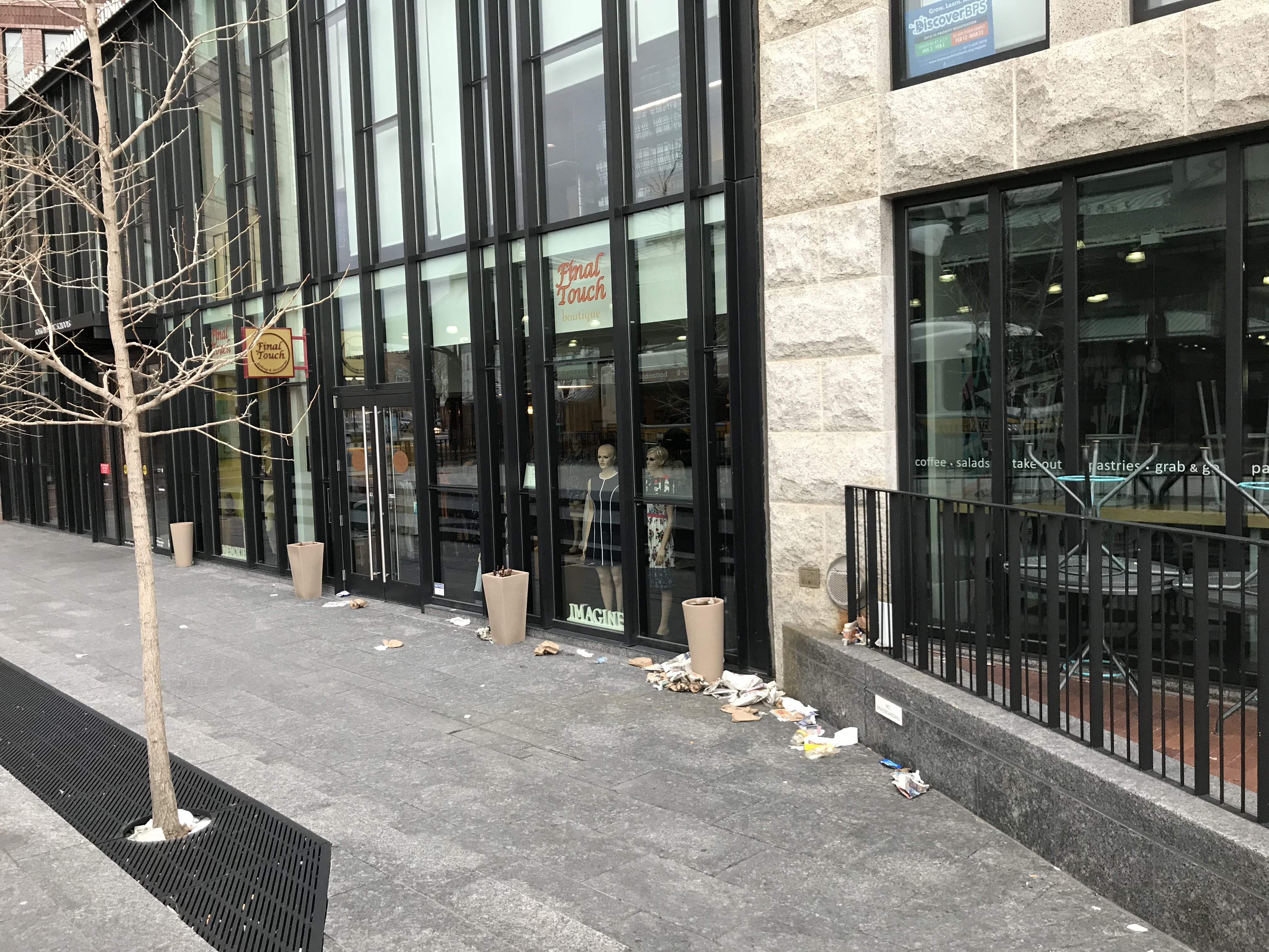 Figure 12: Litter Pile Created by Wind and Walls
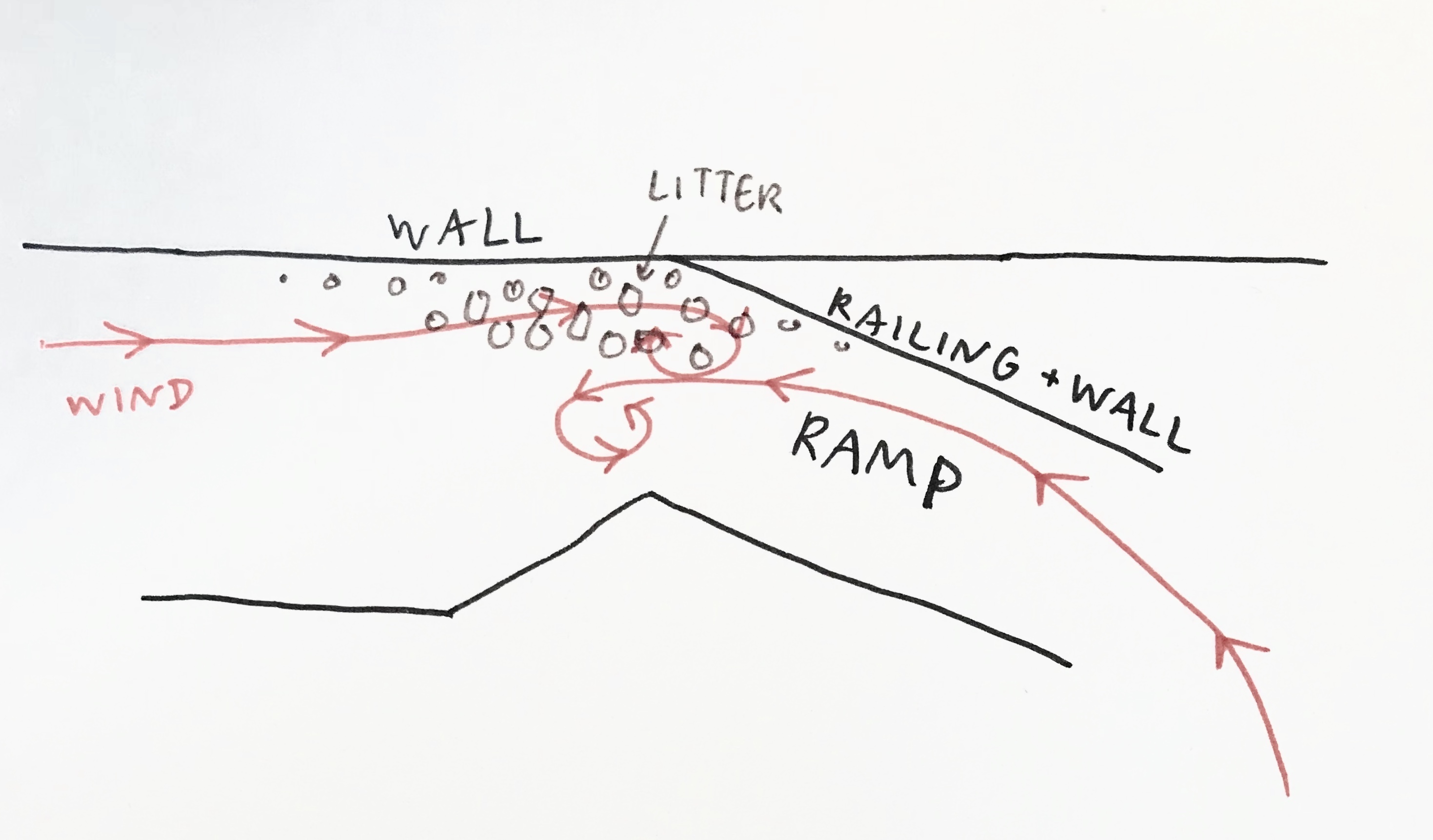 Figure 13: Diagram of Litter Movement
A similar neglect exists next to the bus station, but it is accentuated by wind effects rather than vegetation. One finds a pile of litter nestled between two walls of the Bolling Building (Figure 12). On a windy day, litter is picked up from adjacent streets, funneled through a pedestrian ramp leading to the Bolling Building, and deposited at the junction point of the two walls. This process highlights the presence of litter on the site, which is displeasing to the eye and harmful to wildlife. However, this accumulation can potentially help the cleanup of litter as it concentrates litter from all over Dudley Square into a much smaller area. Although the effect is likely unintentional, it introduces the possibility of using a better acknowledgement of architecture and wind to facilitate urban litter cleanup.
Conclusion
The Dudley Square site contains a wide variety of natural processes which demonstrates the complexity of influences that have and continue to shape not only it but all urban environments. The multi-millennial effects of the hill in terms of wind exposure, gravity, and water runoff serve as a warning to other environments with hilly terrain. Conversely, contemporary processes such as vehicular traffic highlight uneven terrain and create stresses on urban environments. Urban designers and planners must take into account the action of these processes while designing and planning urban environments so that cities exist in concurrence with nature rather than in ignorance of or opposition to it. As a neighborhood currently undergoing development, Dudley Square has the potential to be designed with natural processes and environmental history in mind.
Bibliography
Bibliography: 1. Frentzel, George Friedrich Jonas Carte von dem Hafen und der Stad Boston In: Krieger, Alex, David Cobb, and Amy Turner, eds. Mapping Boston. Cambridge, MA: MIT Press, 1999: 181. 2. Spirn, Anne Whiston. The Granite Garden: Urban Nature and Human Design. New York, NY: Basic Books, 1984: 14. 3. Brankman, C. M., comp. "Surface Geology of Boston South Quadrangle." Map. Boston Geology. 2004. Accessed March 11, 2018. http://bostongeology.com/geology/index.htm. 4. Spirn, Anne Whiston. The Granite Garden: Urban Nature and Human Design. New York, NY: Basic Books, 1984: 110-111. 5. Ibid: 51-52. 6. Elkins, James. How To Use Your Eyes. New York, NY: Routledge, 2000: 32. 7. Spirn, Anne Whiston. The Granite Garden: Urban Nature and Human Design. New York, NY: Basic Books, 1984: 175. 8. Ibid: 171. All photographs were taken by the author. All diagrams were made by the author.