After a semester at MIT, I have gained a decent sense of orientation within Greater Boston. I've visited and learned to refer to various "squares": Central Square, Kendall Square, Harvard Square, Copley Square, Kenmore Square, too many to count. There is one, however, which I hadn't visited until now even though I encounter its name every time I take the MBTA Route 1 bus, the public transit lifeline of MIT's central campus. This is Dudley Square, the southern terminus of Route 1. Despite Dudley Square's unparalleled name recognition at MIT as a point of orientation (Figure 1), I doubt the vast majority of MIT's community has ever visited it. This disparity sparked my interest led me to investigate Dudley Square.
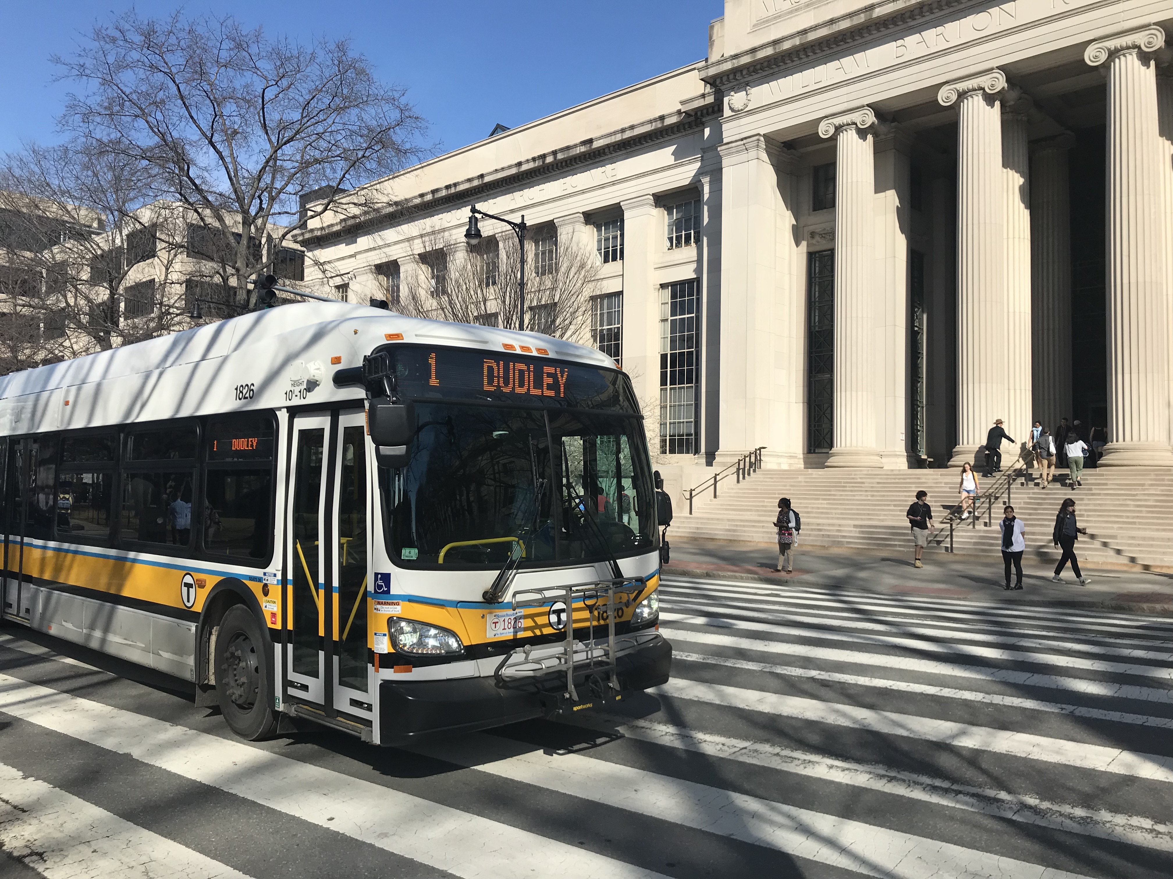 Figure 1: Dudley Square bound Route 1 bus on MIT Campus
In fact, Dudley Square is a fascinating place. It sits at a geographical crossroads, lying at the edge between Boston's South End's more regular street grid and Roxbury's irregularly shaped and sized blocks. Dudley Square marks the transition between Boston's hilly southernmost neighborhoods and its relatively flat northern city center. It also serves as a critical transfer point in the city's bus system. Architecturally, it blends historic with contemporary, dilapidated with brand new. Given its plethora of contrasts and paradoxes, I chose it as my site.
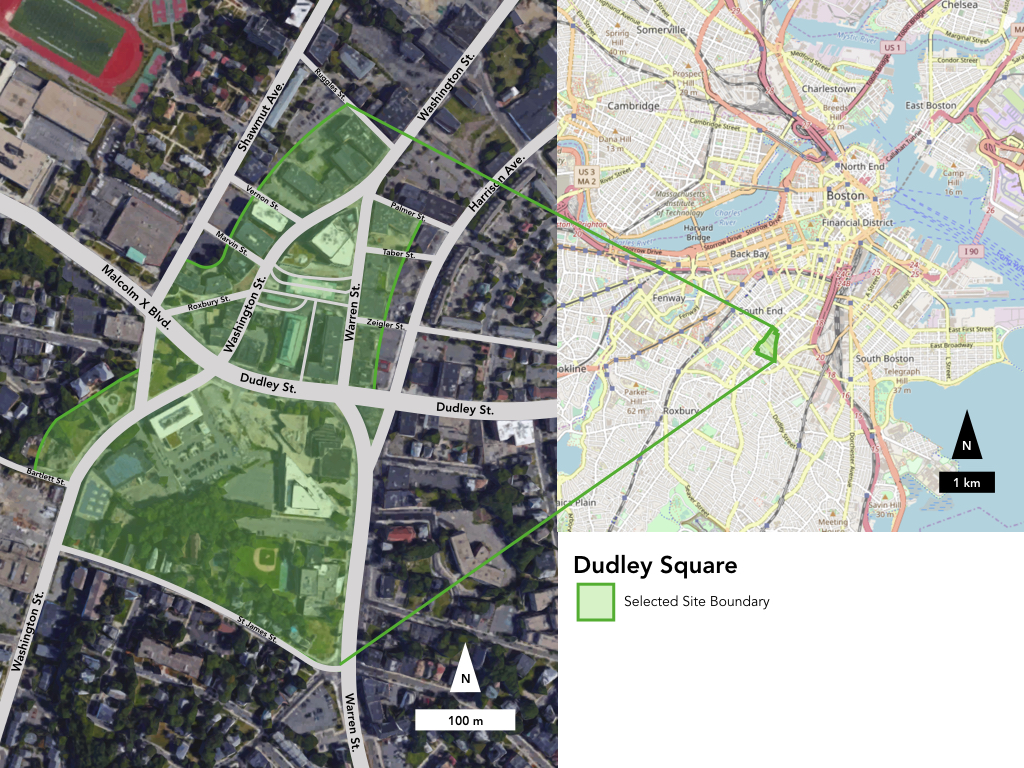 . Figure 2: Site Boundaries | Satellite Map Screenshot from Google Maps (2018), maps.google.com | Street Map Screenshot from OpenStreetMap (2018), openstreetmap.org
 In choosing site boundaries (Figure 2), I was mindful to include a diversity of land uses and a range of building types. An initial site visit drew my attention to the bus station and its adjacent blocks as well as a patch of new development just south of Dudley Street. The site boundaries I ended up choosing include the bus station, the commercial buildings adjacent to it, and a portion of the neighborhood directly south, across Dudley Street, which contains new construction, a police station, a municipal court, a public library branch, a Boys and Girls Club, and a small residential street. The site is bounded by Washington Street, Ruggles Street, Shawmut Avenue, Bartlett Street, St. James Street, Warren Street, Dudley Street, and Palmer Street. St. James Street in particular is on a hill and thus contrasts the rest of the site in terms of elevation. There is also new construction at the intersection of Washington St and Shawmut Ave.
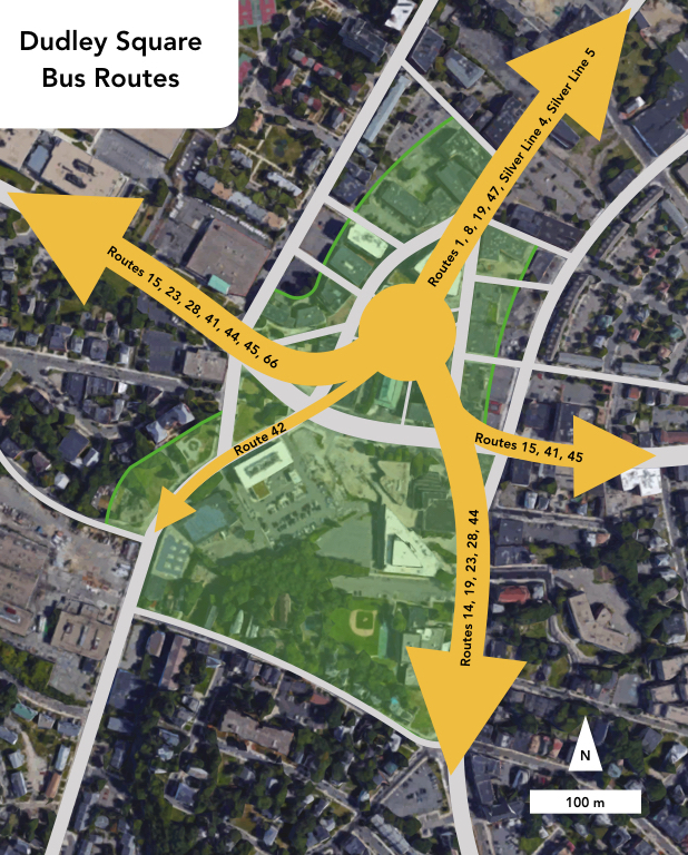 Figure 3: MBTA bus routes at Dudley Square | Satellite map screenshot from Google Maps (2018), maps.google.com
Dudley Square raises a number of interesting questions which convinced me to choose it as my site. This area particularly appeals to my interest in transportation, especially public transit. The bus station itself serves 17 bus routes, including 2 Silver Line routes which terminate there (Figure 3). Dudley Square also used to be the southern terminus of the elevated rail Orange Line, as evidenced by the historic copper-roofed shelters now used by the bus station (Figure 4). These shelters point to broader questions about transportation. Why was the elevated rail line demolished? Why was Dudley Square chosen as the southern terminus of the new Silver Line? I'm also wondering more generally how the presence of the bus station affects Dudley Square's commercial activity.
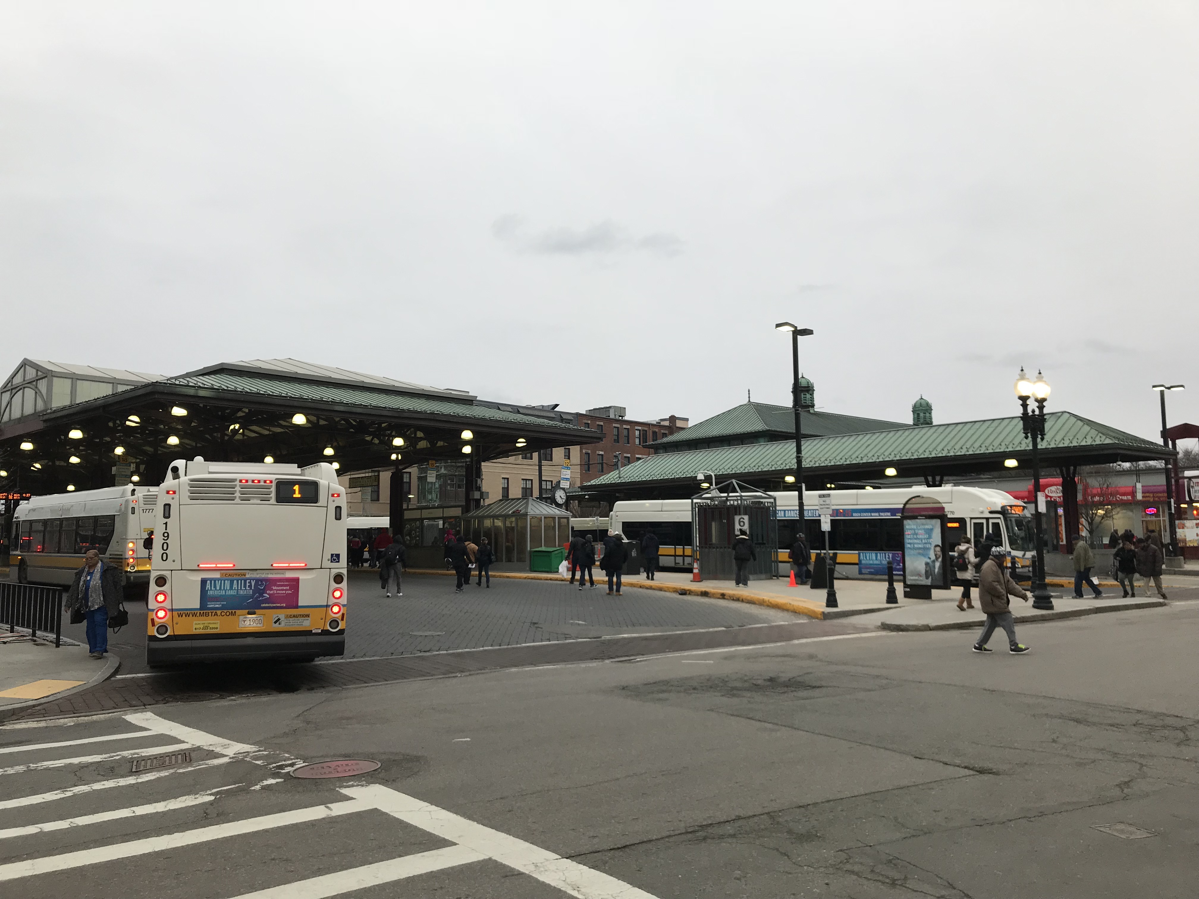 Figure 4: Bus station with copper-roofed shelters
The neighborhood also seems to be the target of a revitalization effort. While many older, poorly maintained buildings remain, construction is ongoing as contemporary buildings are added to the neighborhood. The symbol of this effort is the Bruce C. Bolling Municipal Building (Figure 5), a new building directly adjacent to the bus station containing the offices of Boston Public Schools. A mural on the corner of Washington Street and Malcolm X Boulevard (Figure 6) depicts Dudley Square as the center of a historically African-American neighborhood. The very street name, referencing Malcolm X, a prominent African-American leader during the Civil Rights Movement, hints at the strong presence of African-Americans in Dudley Square. These new additions to the landscape naturally raise more questions. Has the revitalization effort been effective? Are the new buildings welcome by the community? Is there a threat of gentrification as seen in other Boston neighborhoods? These difficult questions remain to be answered.
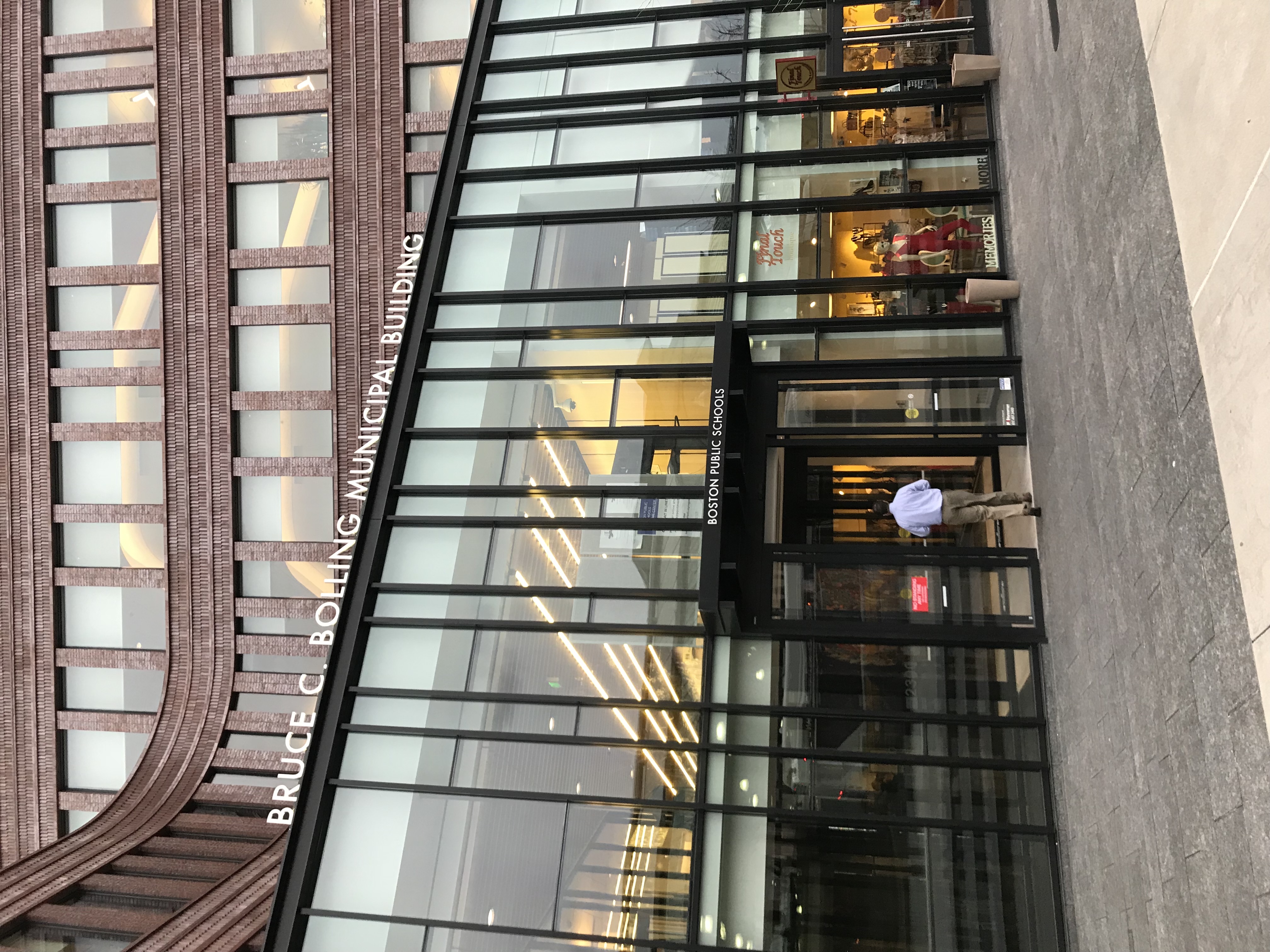 Figure 5: Bruce C. Bolling Municipal Building
 Figure 6: A mural depicting Dudley Square through time
Moreover, Dudley Square seems in many ways to be an epitome district as defined by Grady Clay in Close-Up: How to Read the American City ; it is symbolic, it lies at a break between two grids, and as a terminus for bus lines, it serves as a starting point for many bus journeys. Dudley Square is historic, especially as a symbol of Roxbury's African-American community, and it is representative of broader attempts at development and revitalization in conjunction with concerns of gentrification. Dudley Street itself serves as a dividing line between the denser northern grid and the less dense southern irregular street layout. As Dudley Square is an important bus station and Dudley Street is a major thoroughfare for automobiles, it is clear that Clay's idea of mobility at breaks between grids plays out in this area. While Clay might not consider Dudley Square a classic example of a "start" area, the many bus lines starting and ending at the bus station make it the beginning of many people's journeys. Thus, in the eyes of the surrounding community, Dudley surely feels like a "start" area. More in line with Clay's definition of epitome districts, it would be interesting to see if any rallies or protests in history have started in Dudley Square. With many more questions than answers, Dudley Square should prove to be a fascinating site to analyze through different lenses such as geography, history, politics, and geology. I am excited to see where this study leads me as I delve deeper into this complex site.