Spotlight: Mar 15, 2023
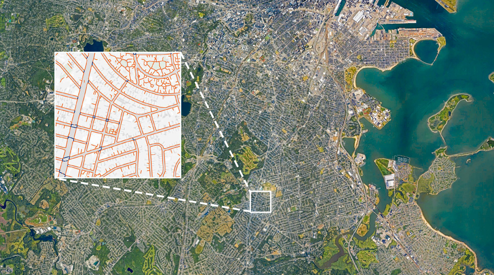
DUSP researchers have built TILE2NET, an open-source tool that uses aerial imagery and image recognition to create complete maps of sidewalks and crosswalks. The tool can help planners anywhere who want to expand pedestrian infrastructure.