Natural Processes
Boston is one of the oldest and most illustrious cities of the east coast. Copley Square is an appealing tourist destination and local hub of the city of Boston. Highlighted by the famous architecturally captivating Boston Public Library, Trinity Church, and Old South Church, it functions as both a green space and urban center on the inner edge of Boston’s famous Back Bay region. The Back Bay is an area of the city which was originally completely underwater when the colonists settled here in Massachusetts, thus making it a fascinating piece of land for my site. From the time that the area was settled, the Massachusetts Bay Colony has changed dramatically as a result of the combination of human settlement, development and natural changes over time. The landscape has given its developers enough challenges and so too have the people who have settled in such large populations learned to manipulate and work with the natural environment. The use of Copley Square in particular has been shaped by the natural elements of soil and wind and the hydrosphere, which will be evidenced by a few ongoing issues as well as some minor, noticeable details.
Urban Landscapes
The peninsula on which Boston is located was formed by seawater rising and covering all but the remains of hills created by glaciers 10,000 years ago [1]. The Native Americans inhabited the area until displaced by the colonists who arrived in 1630 as the Massachusetts Bay Company setting north of Boston. Shortly after, the settlers moved to the Boston peninsula to utilize the Charles River’s potable water. These early Bostonians set the development patterns that are still recognizable in downtown Boston.
It would have been near impossible for the colonists to have the foresight to plan for the city to accommodate the increase in population to today’s magnitude. For this reason, over the past centuries the people of Boston have needed to adapt the natural environment to meet our needs beyond those of the early settlers. Later, we will get into how the manipulation of the environment can lead to unintentional consequences. The most notable expansion, in respect to my site, is the 1855 filling of Back Bay. The following maps show the growth of Boston after this land filling (Fig.1).
Since all of Back Bay is created via filling, when investigating the earth elements on my site I must keep in mind that the foundation of the city is really filling from nearby hills to fill the water basin. Throughout all of the Copley Square earth and water are working together to physically support the area. Another notable construction of the Copley Square’s landscape is the redevelopment of the city in the 1960s and 1970s. This era is referred to as the urban renewal era.5 The office-building boom is reflected in the construction of John Hancock Building. The Hancock Building was controversial. It has transformed the area’s topology from environmental and aesthetic viewpoints.
 Fig.1 Map on Boston Landfilling via Google Images
Air
The first natural component of my site I recognized is the air. Approaching Copley Square from MIT, I walk up Boylston Street and feel huge gusts of wind (Fig.2, Node 1). The northwest wind subsides as I enter the square, shown by the flags (Fig.3). As I amble down Boylston Street I continue to feel gusts of wind especially while crossing intersections. Although on a whole the city is less windy than the country, due to the buildings blocking most of the wind by forcing it to pass above the city, the microclimates created within the city feature gusts and lulls of wind. The causes of these observations can be explained by multiple phenomena expanded upon below.
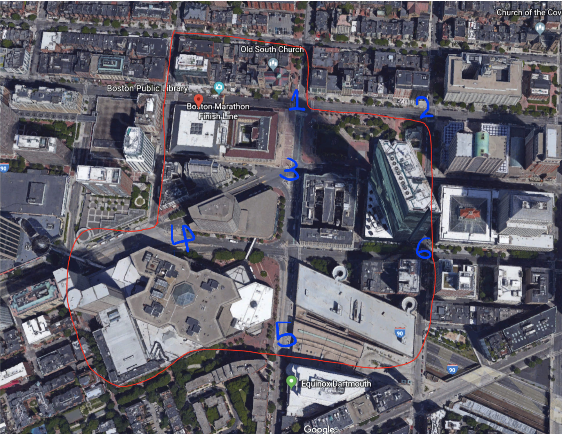 Fig.2 Windy Nodes
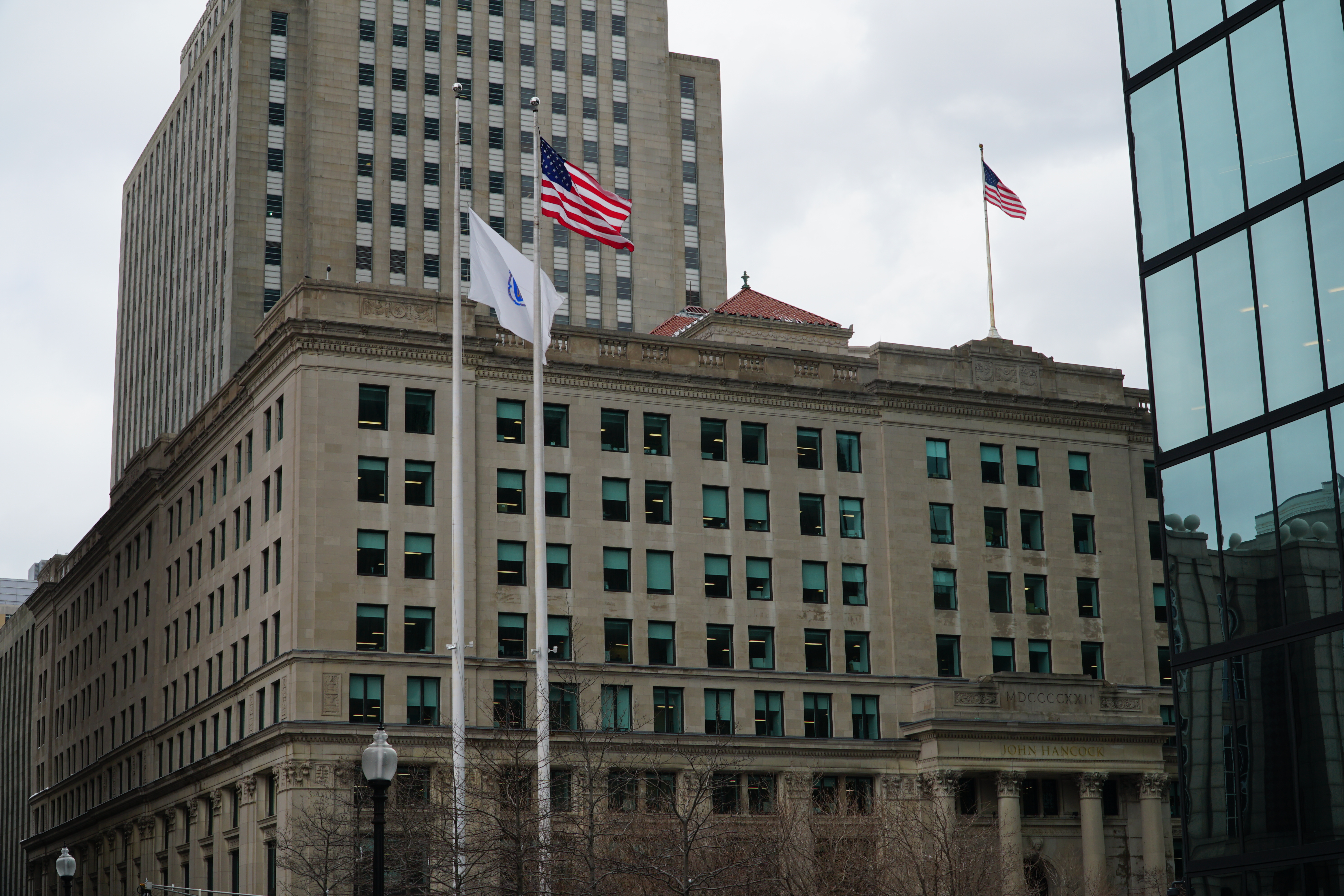 Fig.3 Flags shown the direction of wind near Hancock Tower
First, long wide avenues with relatively low friction allow wind to swoop through unperturbed. The nodes along Dartmouth Street and Clarendon Street were particularly windy. Both these streets become wider and accommodate larger traffic loads further south on the site. These areas contribute to windiness because there is nothing to impede the wind’s speed along the street’s long and wide stretches. Also contributing to the wind speed is the orientation of the streets relative to wind direction: wind accelerates along stretches parallel to its direction.
Second, whereas long avenues tolerate wind speed, frictional elements on the road, such as street trees, slow down the wind. I will explore the effects of street trees further in discussion of wildlife. It is important to recognize the intersystem dynamics at play here—the earth and water dependent trees contribute to wind effects.
Last but not least, the windiest stretch on my site was at the corner of Clarendon Street and St. James Ave along the base of the Hancock Tower (Fig.2, node 6). The tower although it overall contributes to the wind blowing over the city, on a microclimate level when wind hits the tower it is directed down towards the pedestrians walking below. When the Hancock tower opens onto Copley Square the wind speed dissipates possibly due to friction inducing trees in the square and along the street.
The air quality surrounding Copley does not have noticeable pollutants. It was not until I walked to the southeast corner of my site that I could feel noxious pollutants in the air. The area along Columbus Avenue has the most vehicular traffic and narrow sidewalks with skinny street trees, all of which contribute to the poor air quality. Columbus Avenue then stretches to I-90 behind my site. The Frieda Garcia Park is located down a steep street that creates a triangle that is removed from Columbus Ave as well as I-90 (Fig.4). Perhaps the difference of elevation level contributes to distancing the neighboring areas from I-90 and congested areas.
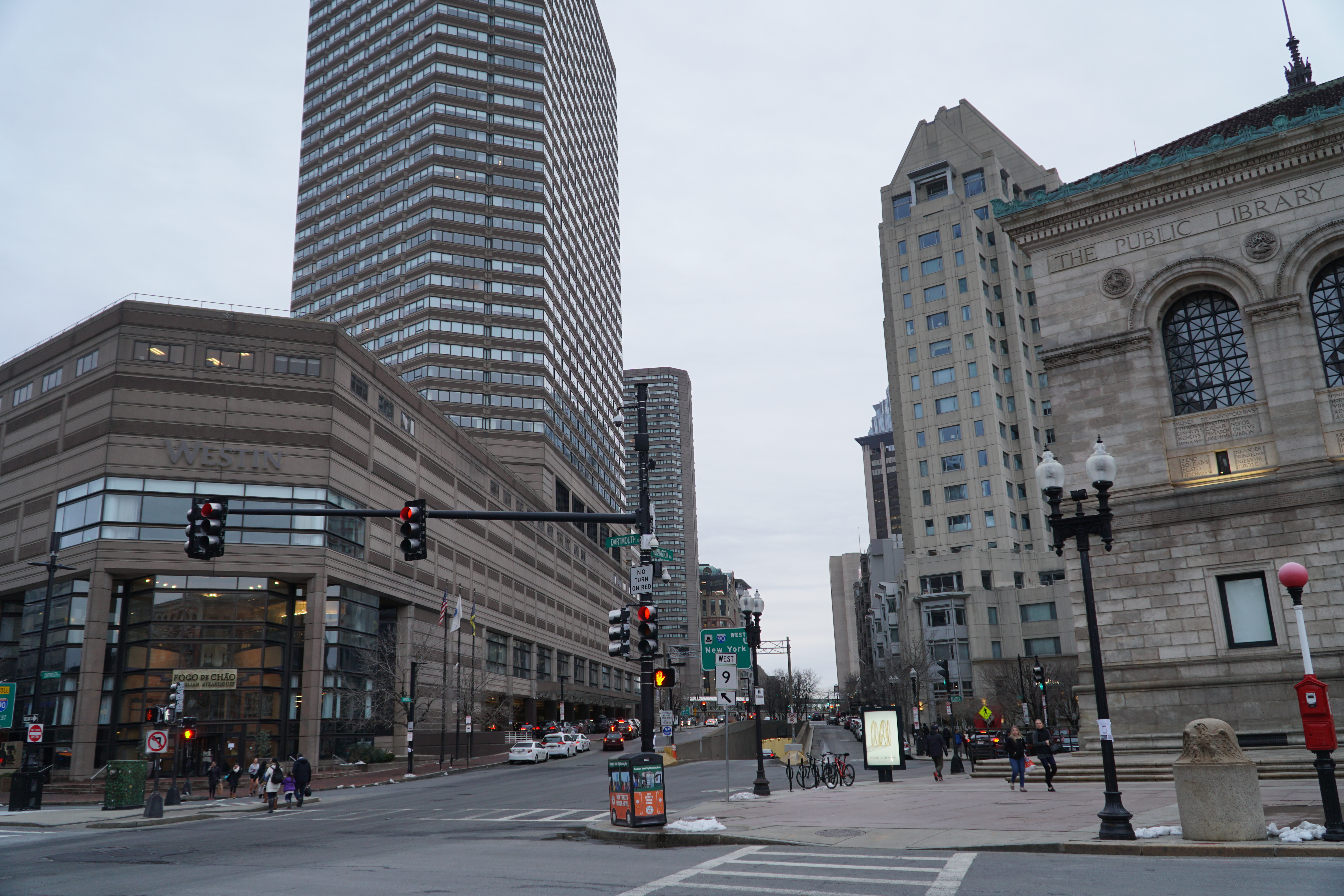 Fig.4 Air Pollutions on I-90
Wildlife
Partly because the site is a public park area, Copley Square has a more vegetation and tree life than one might see walking through other parts of Boston, and it is worth noting that Boston has a higher volume of green spaces than the typical urban landscape. Alex Krieger introduces the landscape architect who was heavily involved in the planning of Boston and was a strong proponent of parkland and city beautification, which sheds some light onto this green space abundance that can be observed. Frederick Law Olmsted’s view was that city residents needed parks and green areas among the buildings to satisfy their physiological and psychological needs as well as to give them a refuge from the crowding and noise that is constantly associated with city environments [1].
Copley is a strikingly open square, surrounded by highly developed blocks and densely trafficked roadways. The plant growth is an indication of both human intention and nature’s own willpower. Pictured below are a few of the trees that are planted around the area (Fig.5-Fig.9). Most of these trees are surrounded by concrete walkway, except for the patch of soil they are given to grow. The ones planted in the square seemed much healthier than the ones planted on the sidewalks by the buildings. This is likely because they are given more space and more soil to grow. It is evident that these trees were so healthy that they outgrew the planters’ expectations, because the grates that are placed over the roots to protect and control them are being moved out of place by the growing trees. The trees’ root growth is indicative of the strong powers of nature as well as the adaptability of these particular species. Given only a small space, although it can be concluded that the soil they are planted in is nutritious enough, the trees are struggling to grow in a highly urban environment. There are a few trees which have trunks spilling over their man-made constraints, while there are other trees which are not quite growing to their full potential, presumably because of some lack of soil, sunlight or some other limiting factor. The ones in front of the John Hancock Tower are given plenty of soil. However, they are constricted by their placement in the shade and lack of stability.
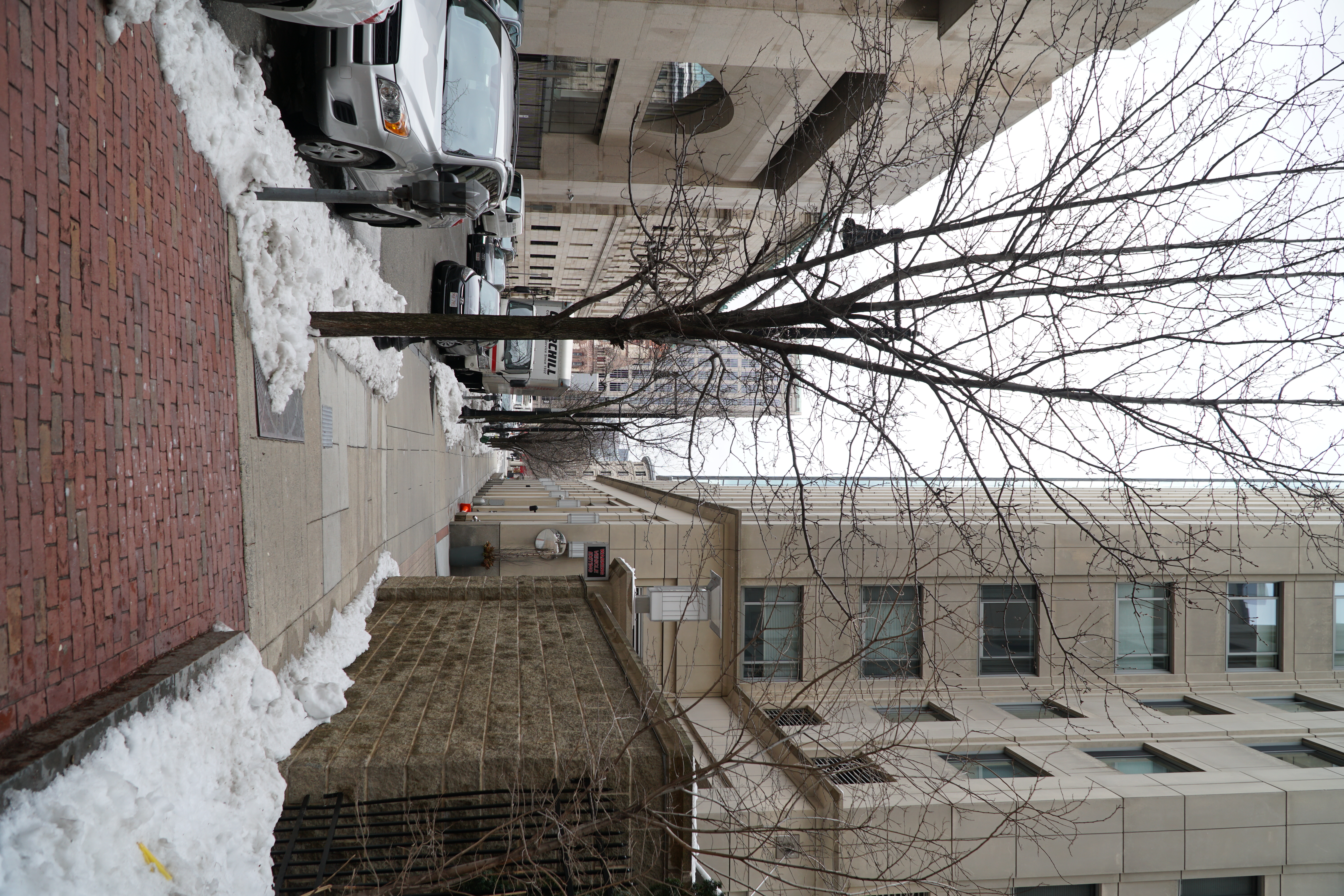 Fig.5 Trees near Boston Public Library
 Fig.6 Trees near Boston Public Library
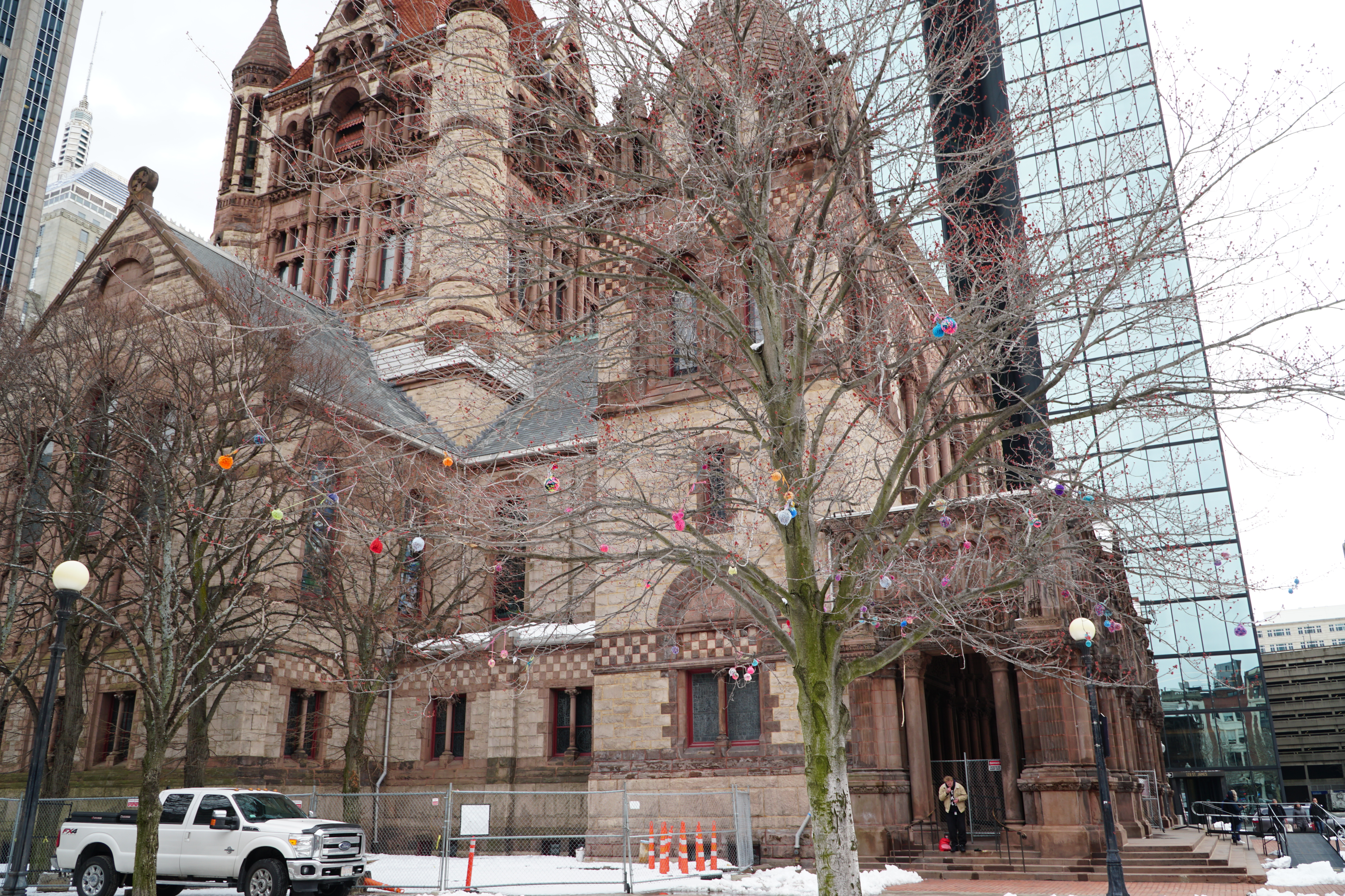 Fig.7 Trees in front of Trinity Church – More open soil
 Fig.8 Comparison of trees planted in pavements and more open soil
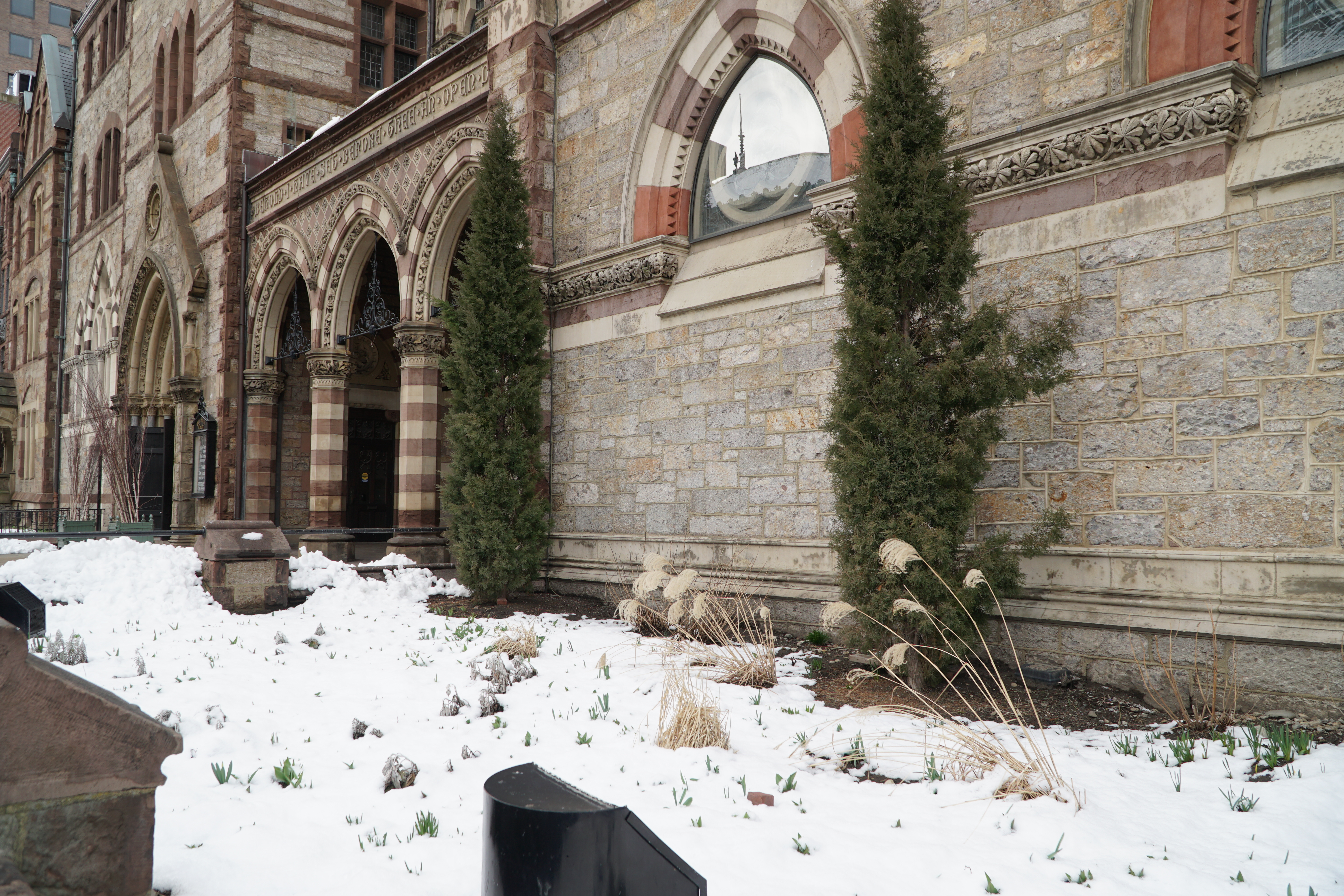 Fig.9 Small Garden In front of Old South Church
Although Copley Square is not a part of the emerald necklace of parkland, which is draped across the city of Boston from the Boston Common to Franklin Park, its development does resemble the mindset that Olmstead had when he envisioned the city. The square was originally proposed by the landscape architect Arthur Shurtleff and was part of a plan to create “rings around Boston” which would connect the city’s outlying neighborhoods to the metropolitan area and thread the open spaces into various city blocks. This incorporation is important. It is a culturally and socially significant part of the city, but it is also notably beneficial to the air quality and environment of the urban landscape.
Besides vegetation the wildlife observed is rare. I had only seen birds in front of the Boston Public Library (Fig.10).
 Fig.10 Birds in front of Boston Public Library
Earth
Again, due to the heavy snowfall this year much of the site’s ground besides pavement is covered by snow. Revisiting Copley Square after reading Elkins piece [2], what I used to perceive as a well-paved walking site I began see it as an undulating mess that clearly resists the natural environment below it. The cracks and stress in the pavement in the walkway along Boylston is most likely due to this forced development that did not keep the natural environment in mind. Especially now that the snow is melting the undulations have become more apparent. The ice patches in the Square appear to be randomly distributed because they are not only at the curb by the melting snow banks but also in the center of the shoveled plaza. The reason behind these random ice patches is due to the divots in the pavement where water rests and freezes.
Besides undulation and ice patches the most notable observations in the pavement are the cracks on the street and sidewalks. The largest and most dense cracks occur at the heavily used intersections. Especially at corners when the road and sidewalk merge into ramps, cracks appear because of the frequent use and possibly the change in elevation weakens the paved structures.
The largest cracks in the asphalt roads are those leading into the drains in the middle of the road. The cracks could be seen as the residue left behind by the movement of water that traverses the same paths as the cracks. The water seeps into the pavement and this weakening causes the cracking. Or the subterranean infrastructure of the drain causes stress on the road, and this instability leads to cracking. Either due to structural weakness or water’s influence the cracks are a sign of the weakness of our manmade roads that we are inflicting upon the natural environment.
As Prof. Spirn notes “Cities are fragile creations balanced on the earth’s crust” [3]. We impose our structures and order onto the earth, but we must maintain balance with our synthetic topography. The pavement we lay absorbs more solar heat gains than traditional soil cover; this in turn contributes to the heat island effect, which makes our cities notably warmer than the surrounding countryside. As we are in the throws of Boston’s winter, it is hard to imagine wanting to reduce solar gains, but in the summer in this central business district with tall buildings and high-volume traffic and pedestrian use the heat island effect can be atrocious. For this reasons tree coverage, and microclimates must be intentionally designed.
Conclusion
We have attempted to control nature by diverting water, filling land, razing hills in order to build and support our citizens. However, what we have failed to recognize is that each time any section of our ecosystem is damaged the rest will also be influenced. Aesthetically we have found the emulation of nature admirable, but as long as it conforms to our own terms. We develop manicured lawns and encaged street trees amongst our sprawling pavement. Although we have attempted to tame the elements, they always prevail. Our streets have buckled, our buildings shaken, our lawns flooded. Our dominance cannot match nature’s power. We must keep in mind the necessary symbiosis of the ecosystem. Every element interacts and in combination can create unintended effects. As Prof. Spirn states in Granite Garden:
“Air pollution, discomfort and energy consumption are treated separately, when they are addressed at all, not as the interrelated whole they represent. Attempt to solve one problem often create several new ones.” [3]
It is important in future designs to remain more fully informed about all of the elements. The plans should incorporate flexibility because although we may be well intentioned, the combinations of air, earth, and water can be unexpected. If we can adjust our cities response to these dynamic elements we can live more cohesively with our environment. Currently buildings with adaptable shells that can morph based on wind loads or the needs for solar gains are being developed and built. This recognition and adaptation to the natural environment will generate a better union of nature within cities.
References
[1] Krieger, Alex, David A. Cobb, Amy Turner, and David C. Bosse. A Brief History of Boston. Mapping Boston. Cambridge, MA: MIT, 1999. Print.
[2] Elkins, James. How to Use Your Eyes. Routledge: New York, NY. 2000.
[3] Spirn, Anne Whiston. The Granite Garden: Urban Nature and Human Design. New York: Basic Books, 1984.
Back to top