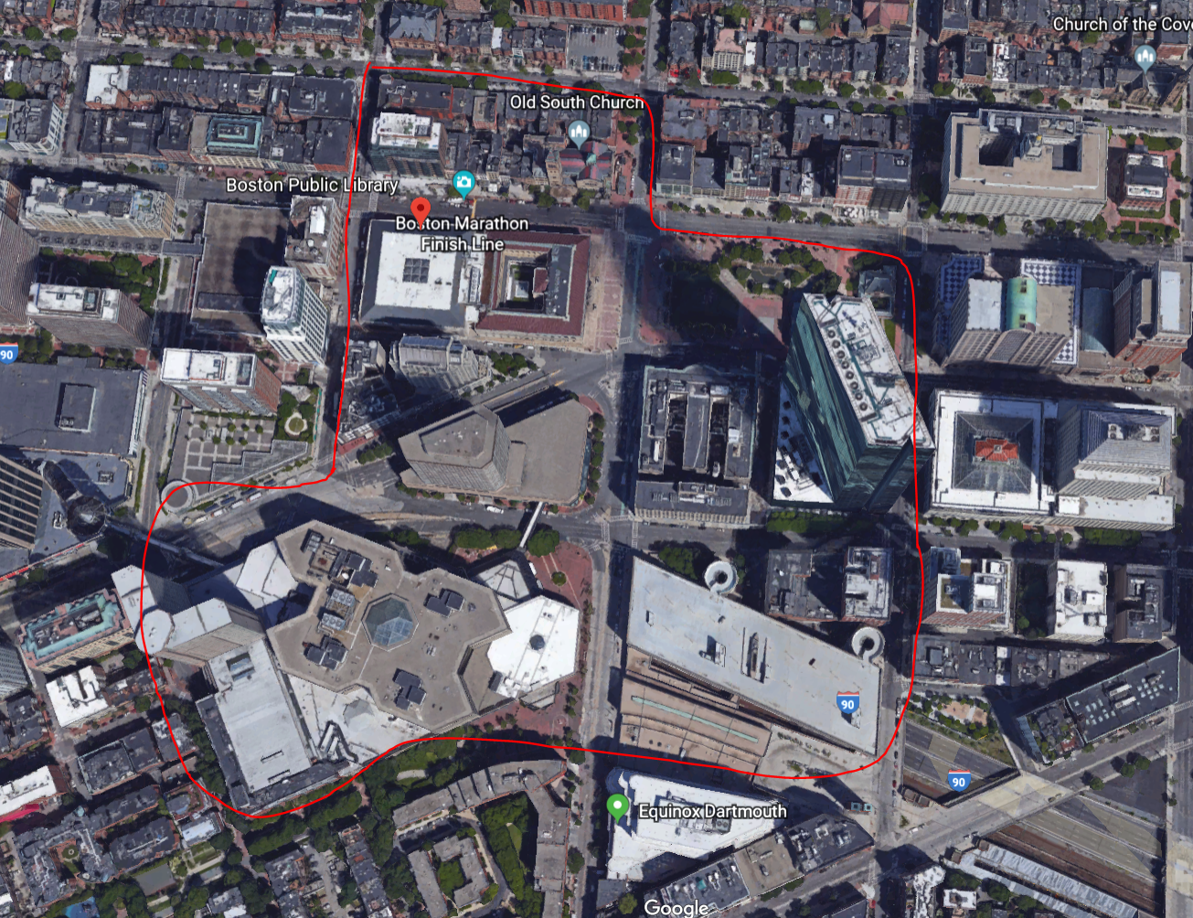
 Fig.1 Site Location
This area has a long history. Old South Church(1873), Trinity Church(1877), Boston public library(1895) and Fairmont Copley Plaza Hotel are the representatives. Contrasting these historic sites is the John Hancock Tower, which was built in 1976, nearly 100 years after the Trinity Church. The huge contrast between the Trinity church and the Hancock tower really suggests the extensive land use near this area (fig.2). Tracking back to the history, the square once featured the Museum of Fine Arts, Massachusetts Institute of Technology, Harvard Medical School, the New England Museum of Natural History, Horace Mann School for the Deaf, Boston University, Emerson College and Northeastern University. This extensive list proves the land has traditionally been a source of educational and cultural influence. The City of Boston bought ‘Art Square’ in 1883 and developed the land to make Copley Square the marvel it is today.
 Fig.2 Trinity Church & Hancock Tower
One interesting feature of the buildings in my site was a mixture of materials and decorations on one building(fig.3). This suggests changes of use for the buildings or some reinforcement and renovations of them. For example, 200 Dartmouth St clearly was not a restaurant before, judging from the contrast of the walls close to the floor(fig.4). Also, there is a contrast between the materials of walking paths around Boston Public Library and near-by places. Around the Library, the paths were made of stone while the paths in near-by places were made of red and brown bricks. This suggests different time periods when the paths were built. Look at the hotel named Courtyard Boston Copley Square near the new library, there is also a shockingly flat wall and evidence of change of facade, which suggests this might be a renovation of this building (fig.5-6).
 Fig.3 Mixture of materials of Old South Church
 Fig.4 Mixture of materials of 200 Dartmouth St
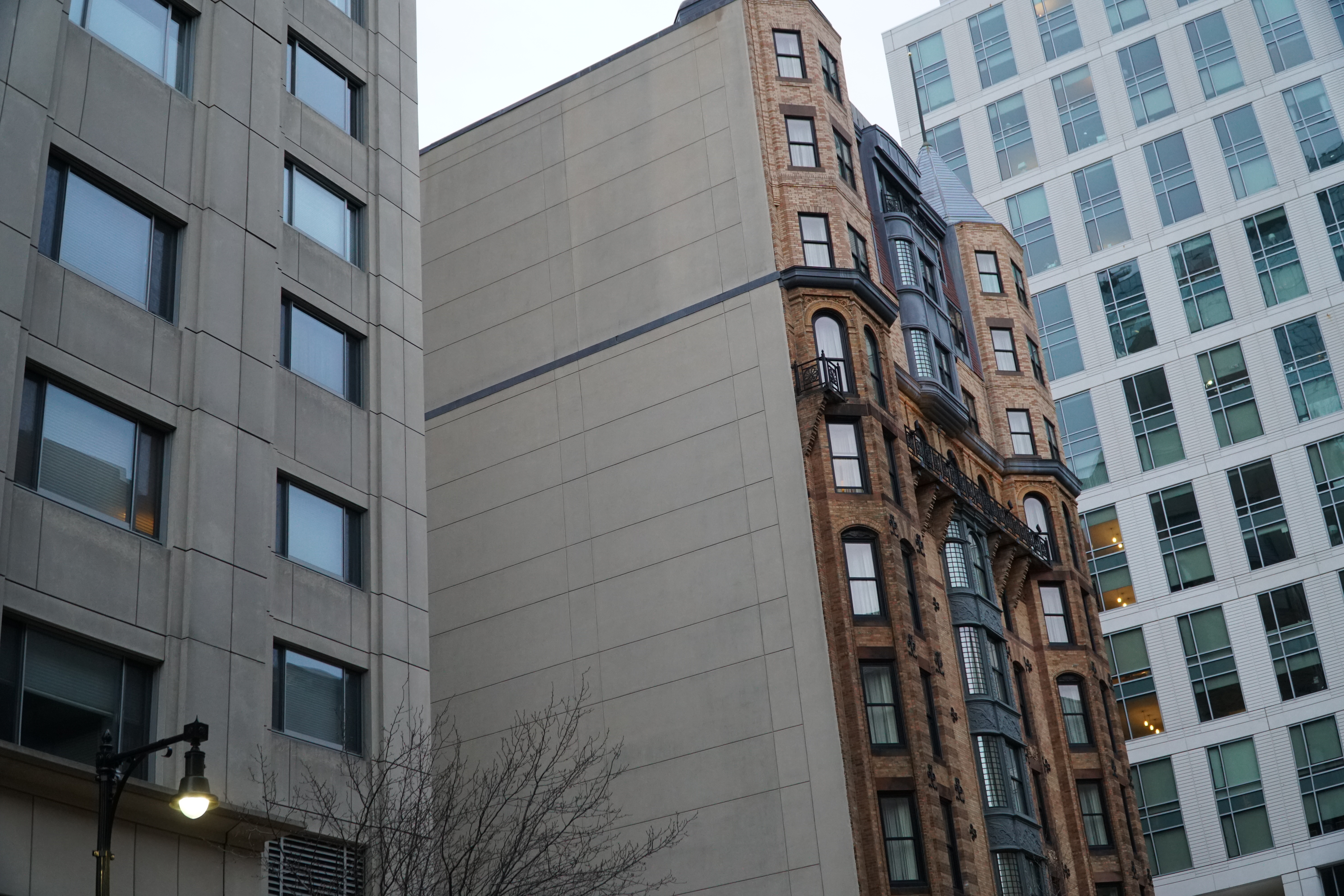 Fig.5 Mixture of materials of Courtyard Boston Copley Square
 Fig.6 Change of façade of Courtyard Boston Copley Square
Looking at the roads and grids of this site, it can be seen clearly that route 9 and I-90 both break the pattern(fig.7). This break in the grid, however, allows for interesting development of restaurants and the Frieda Garcia Park in the lower section of my site. Also, Huntington is aligned closely with the railroad tracks that run underneath the area, and I hope there is more to the story there. In the reading, Clay also mentions that the “junction of two diagonal streets has been exploited for its accessibility” (Clay, 50). It will be interesting to see what the rent prices are like in the Huntington and Copley regions then.
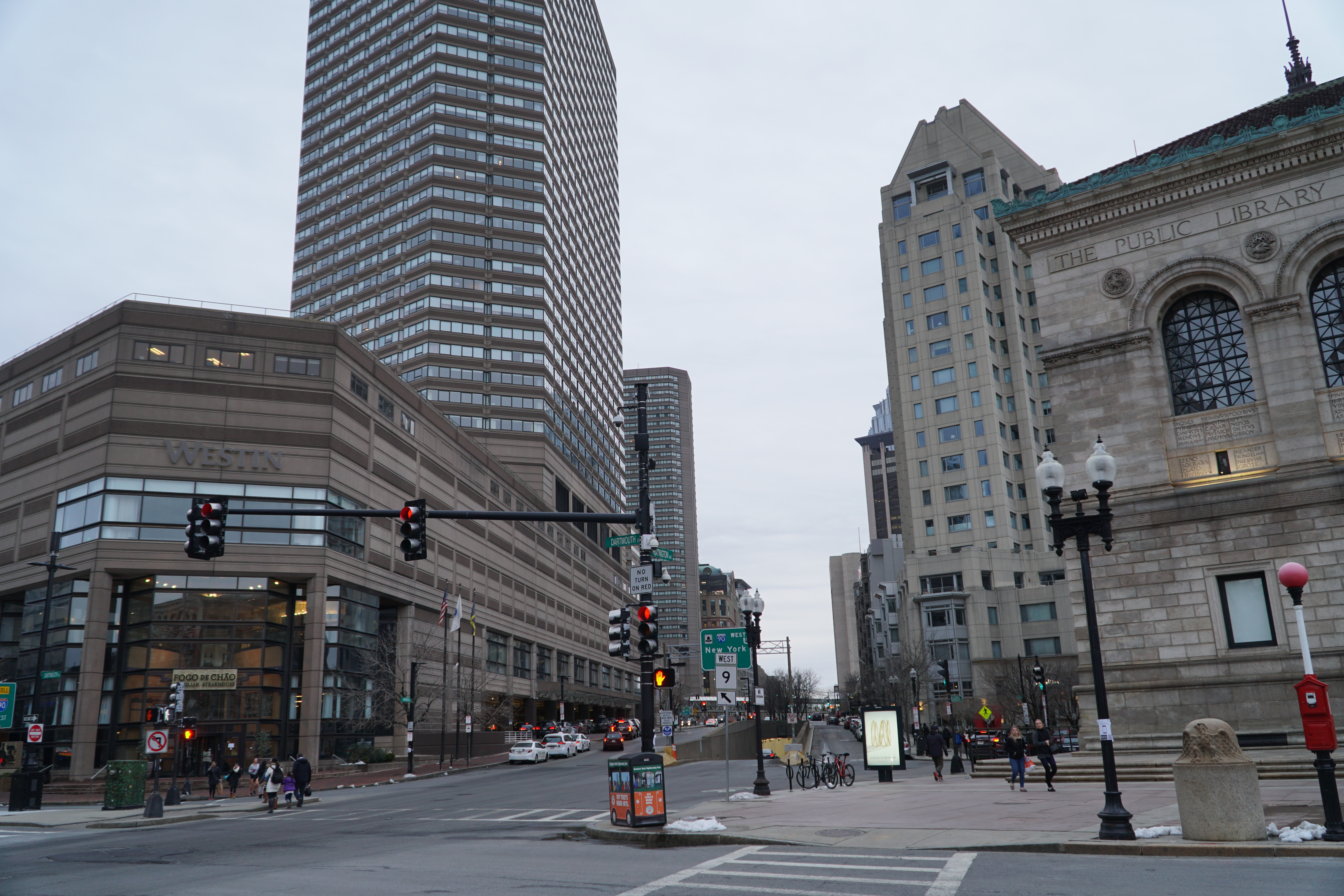 Fig.7 Route-9 and I-90 – Breaks
I was not aware that MIT’s old site is also in the neighborhood of this site when I chose my site (fig.8). It will be really interesting to see some evidence of MIT’s previous existence. Also, the sign in front of the Fairmont Copley Plaza, which states its establishment in 1916, reminded me once more that most or all of these buildings did not exist when MIT’s campus occupied the same space. It will be really interesting to uncover more about this area’s historic development by the possible existence of long-standing venturis.
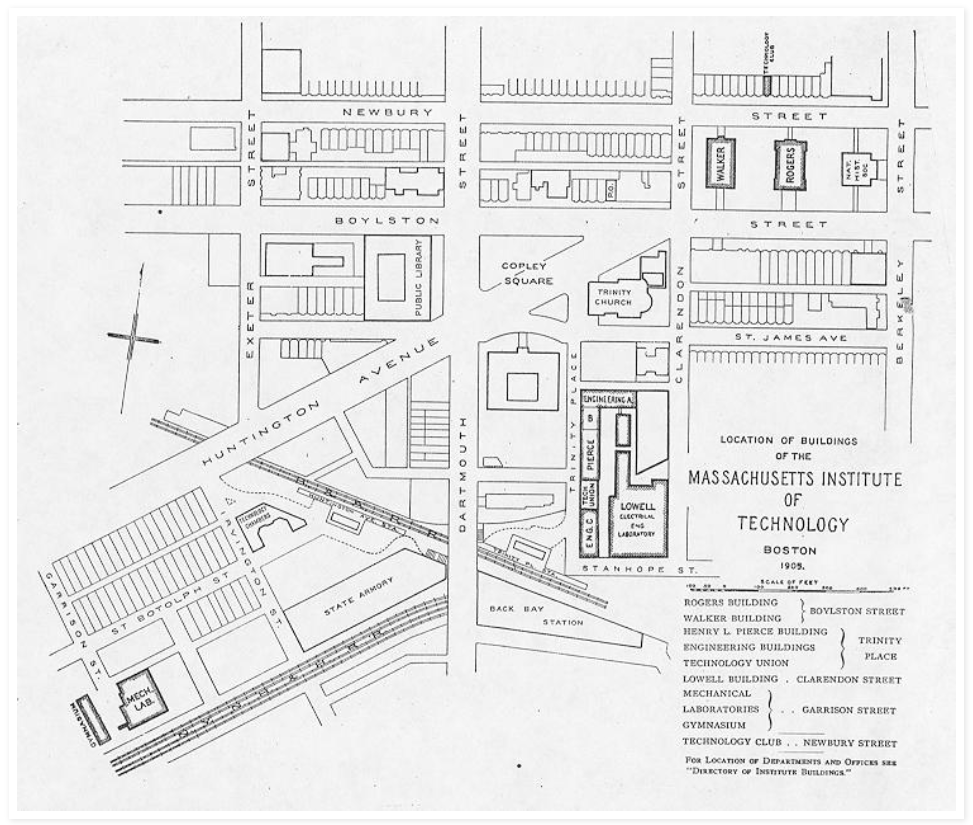 Fig.8 Old MIT Site (Via Google Images)