Bath, ME
General Description (1919 report):
"Bath, ME, is an old shipbuilding city located on the western bank of the Kennebec River, about 10 miles above its mouth. It has a population normally of about 10,000, but during the war period this was increased to approximately 14,000. It is a long and narrow town, stretching three miles north and south along the river and extending inland only about a quarter of a mile, except at the center where it is about half a mile wide...the Housing Corporation project here was for employees of the Bath Iron Works."
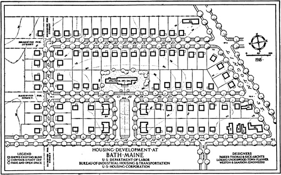
1919 excerpt describing the design of the Bath Site:
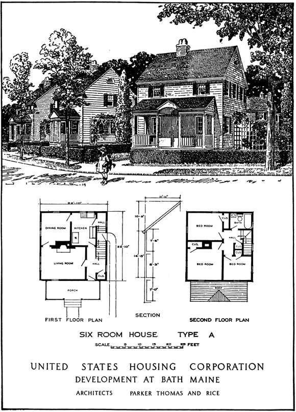
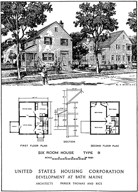
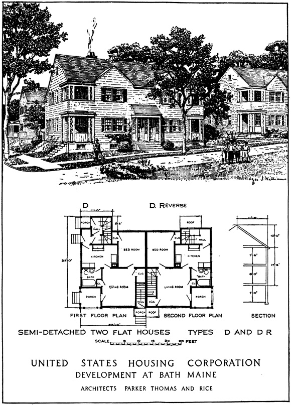
Area Planned: 9.14 acres. Housing planned and constructed: Detached houses, 74 families; semidetached two-flat houses, 16 families; total, 90 families.
"The site chosen, the so-called Palmer tract, is in the west-central part of the town and within about three-quarters of a mile of the Bath Iron Works, via Lincoln Street, nearer than any other equally available site. Traffic between the site and the plant passes conveniently through the store center of the town. The spreading of the town sideways away from the river, encouraged by this development, is an advantage, as the town is tending to become inconveniently long and narrow...[the old Palmer House] was retained for use as a community building or as an apartment house and an open green was laid out on its axis leading in from the high point on Academy Street. This was called Flaherty Park in memory of the first Bath boy to lose his life in the war."
The Bath Site Today
Street View Today
Rendering 1919