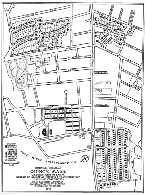
Quincy MA
General Description (1919 report):
"At Quincy, a city about 7 miles southeast of
Boston, are located the great Fore River Shipyards,
a subsidiary enterprise of the Bethlehem Steel Co.
Quincy has been until recent years a residential
suburb with but comparatively little manufacturing
and no very important industries except the
well-known granite quarries. The prewar population
was about 40,000. The present population
is about 50,000 people, of whom fully 18,000 are
foreign born. Before the war the shipyards employed
about 4,000 men. Navy Department and
Shipping Board contracts increased this number
nearly four fold, producing a most serious housing
shortage and entailing an enormous labor turnover
with limitation of output; 3,000 men had to be
hired in one month to secure an addition of 1,000
to ·the force. Unhealthy conditions due to overcrowding
were common."
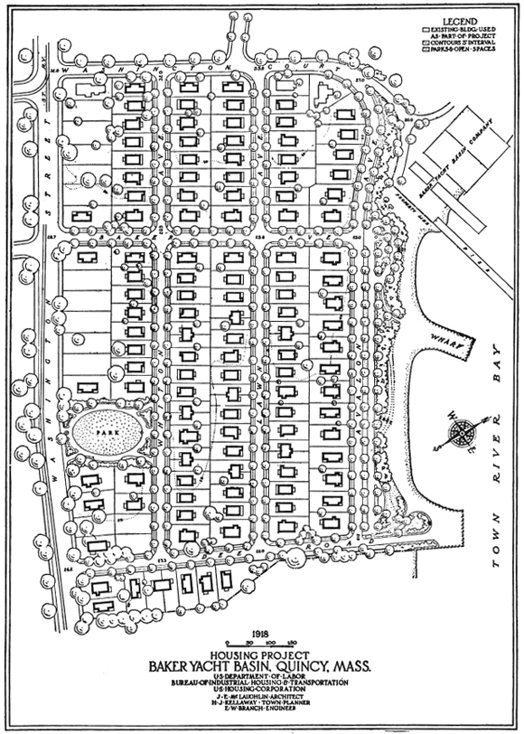 1919 excerpt describing the design of Baker Yacht Basin Site:
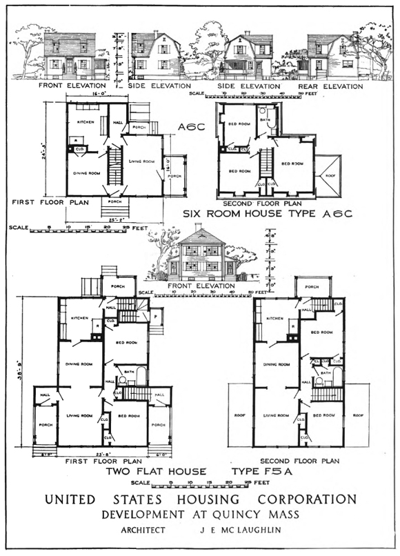
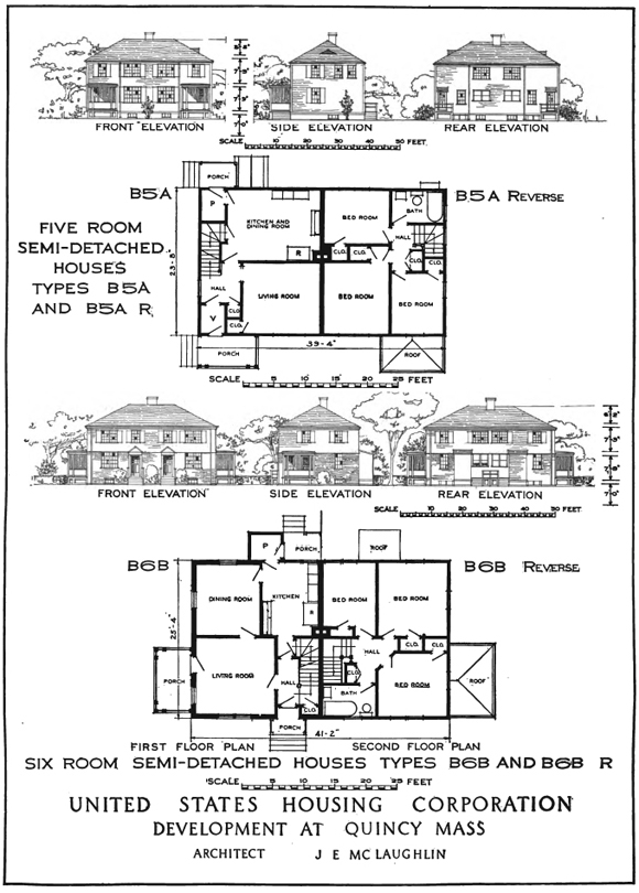
Area planned: 21.78 acres. Housing planned and constructed:
Semi-detached houses, 18 families; detached two-flat houses, 218
families. Total, 236 families.
"This tract, intended to provide for unskilled workers, had to be planned with a density of about 13 families to the acre in order to keep down the cost for lots, the presence of the seashore park offsetting the relative density of population. Row houses were considered, but the detached two-flat house was adopted as the principal type because of local custom. The side space between buildings is never less than the standard minimum of 16 feet, but seldom much exceeds the preferred minimum of 20 feet. These spaces are sufficient to provide light and air, but they are none too much in the case of three-room deep two-flat houses. The lots are generally 90 feet deep. Streets had been platted and rough graded in this tract when the Housing Corporation bought it, including Baker Avenue, another street parallel to it only a short distance east, and two transverse streets so spaced as to give a row of lots backing toward the shore. This street system left the very deep lots along Washington Street and thus made the rest of the lots very shallow. In our development of the whole area from Washington Street to the shore, every interior street was changed except Baker Avenue, the street near Baker Avenue and parallel to it being omitted as not worth its cost. The advantage of fronting houses along Avalon Avenue toward the shore park and the harbor view, together with the advantage of increasing the lot depths to 9<> feet, was added to the advantage of the gain of one row of lots. Provision was made for the future extension of Lawn Avenue (an offset continuation of Curtis Avenue) into adjacent open land east of Dee Road so as to tie our plan into the general street system of the city. Several old houses existed along Washington Street. These, being unfit for use, were removed and new houses are being built on each side of the entrance roads, giving the development a reasonably good appearance from Washington Street, the main approach. The other vacant lots are held for future development. A deep "pot-hole" which could not be immediately built on in any case, was filled with material from cellar excavations and set aside as "Whiton Park." The steep bank along the water-front was graded down, furnishing sand for house-construction and concrete walks, and for street-filling on the other tracts. This shore-front will be a permanent local park and bathing beach."
Baker Yacht Basin Site Today
Arnold Site Today
View Larger Map
Renderings, 1919
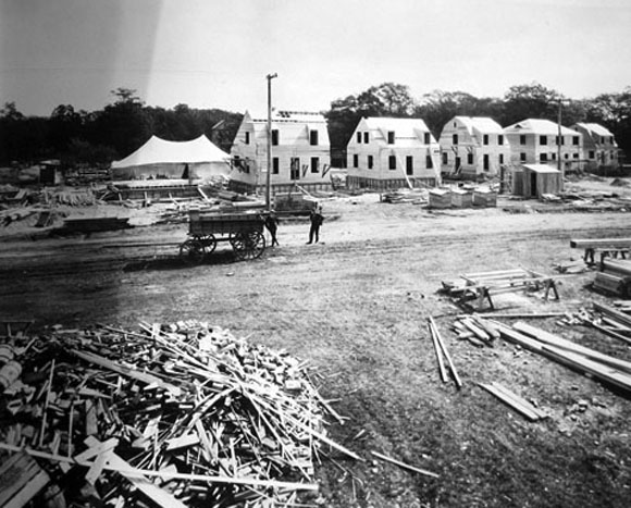
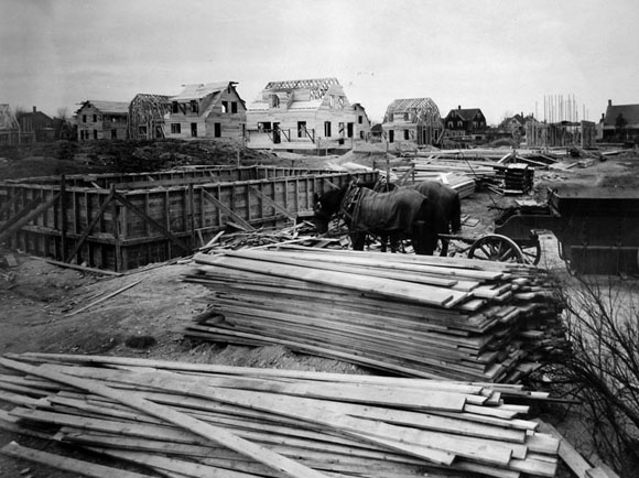
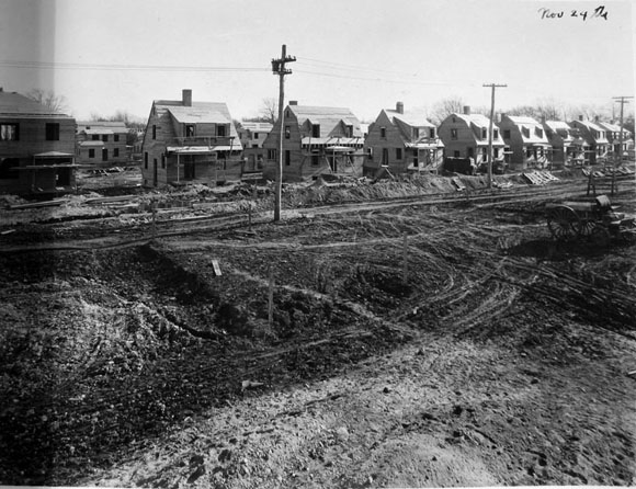
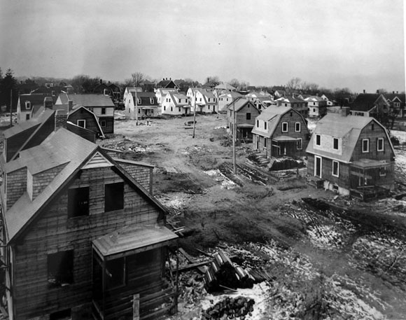
Construction Photos 1917-1919
 Arnold Street, Looking South
 Arnold Street, Looking North
 Arnold Street, Looking Southeast
 Arnold Street, Looking West Down Commonwealth Avenue
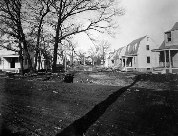 Intersection of Ruggles Street and South Street Looking North Down Ruggles