Botswana
Monalanong Hill and/or Otse Hill - ~4,900ft (both)
Eric Gilbertson
Date: September 10, 2015 (Otse Hill), September 11, 2015 (Monalanong Hill)
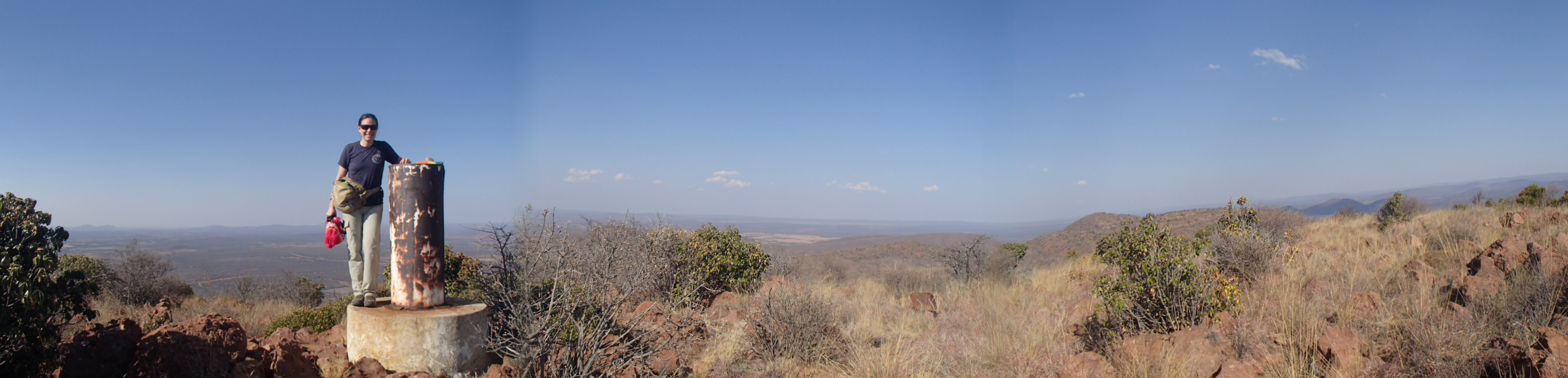
Otse Hill panorama from summit
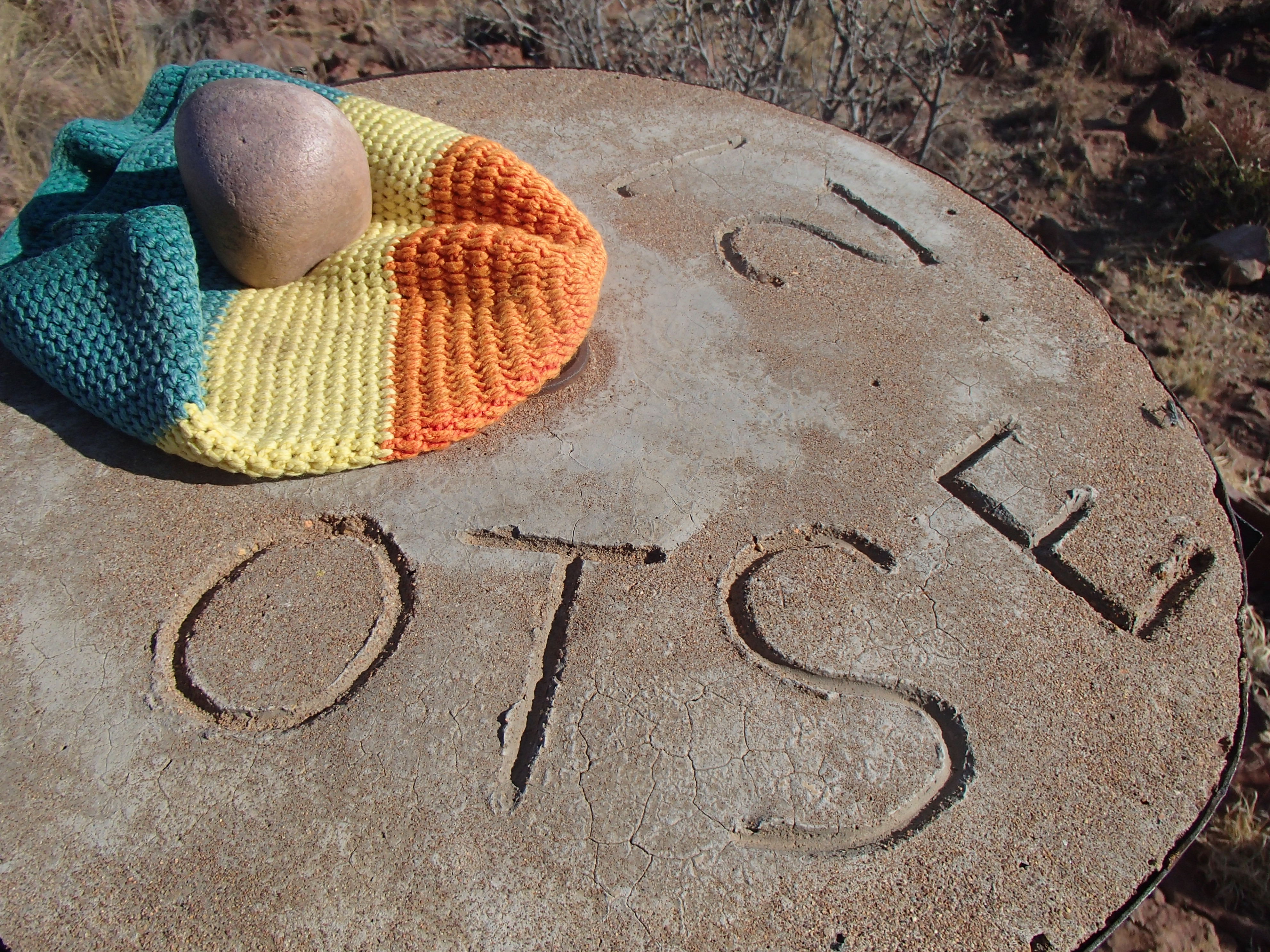
Otse Hill concrete summit marker
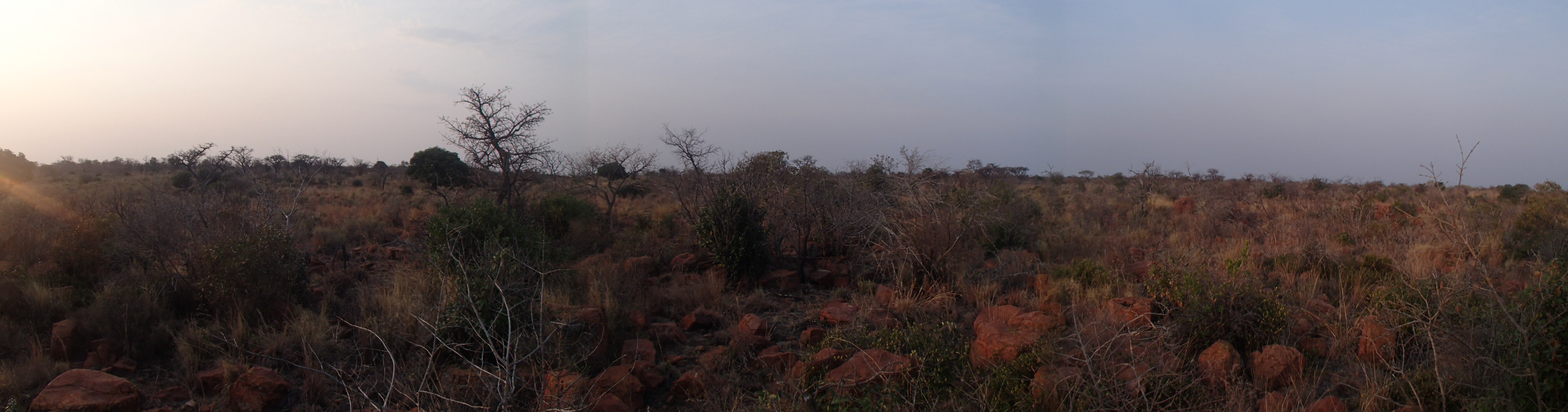
Monalanong Hill summit panorama
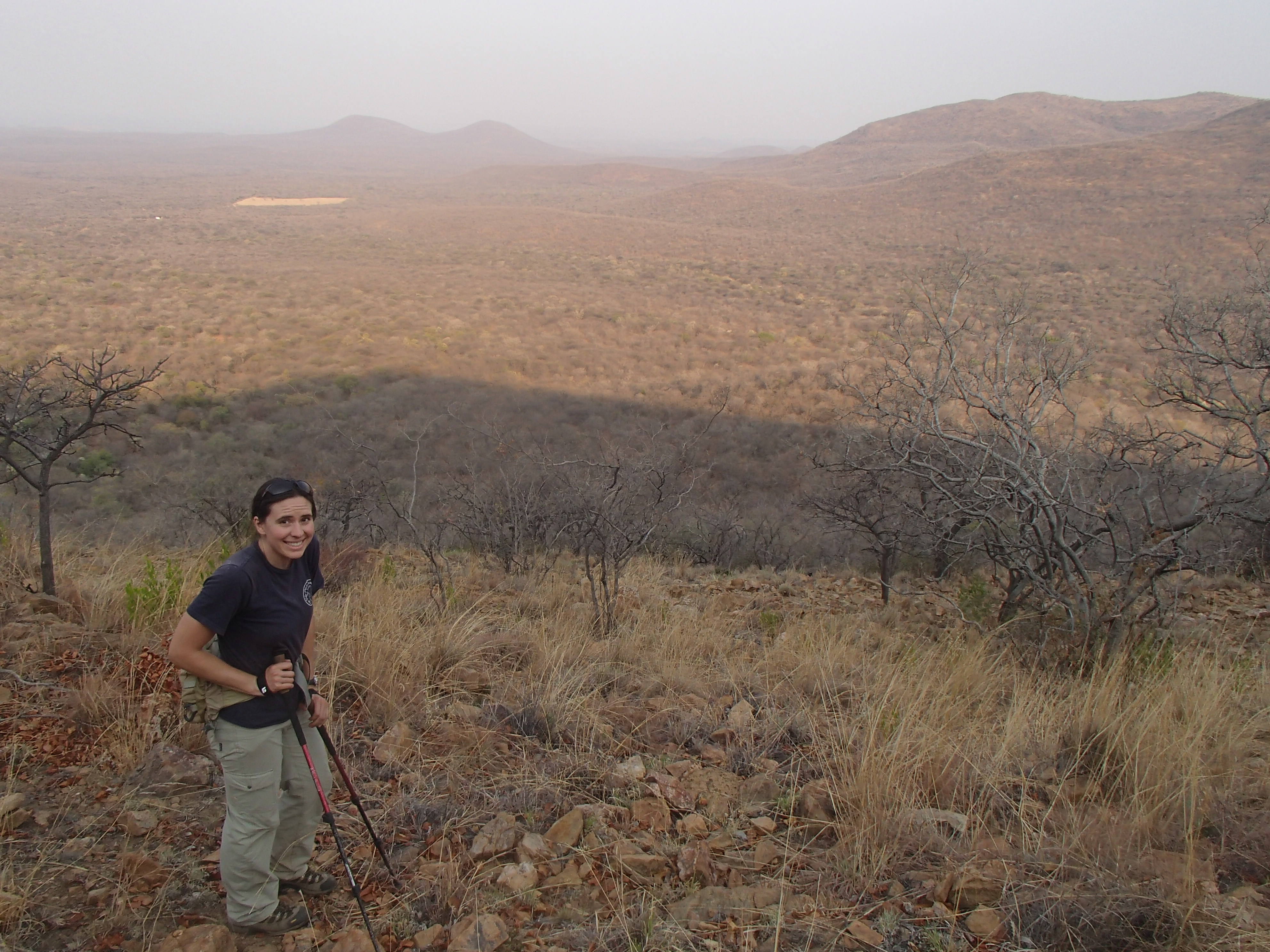
Hiking up Monalanong Hill
Otse Hill and Monalanong Hill (~4,900ft each) – Highpoints of Botswana
Eric Gilbertson and Katie Stanchak
Sept 10, 2015 (Otse Hill), Sept 11, 2015 (Monalanong Hill)
Botswana is one of only a handful countries in the world whose highpoint location is not known with certainty. Two hills – Otse and Monalanong – are both contenders for the country highpoint, but it is not clear which one is actually taller.
By SRTM-derived data Otse Hill is 1,491m tall and Monalanong Hill 1,494m tall, but errors in SRTM data can be up to 16m (http://www2.jpl.nasa.gov/srtm/statistics.html). So this data is not conclusive proof that Monalanong is higher. One highpointer, Ginge Fullen, reported that his handheld GPS unit recorded Otse Hill to be taller, though handheld GPS units also are prone to high errors. The only solution for highpointers short of bringing a survey-grade GPS to each summit is to climb both.
Otse Hill
Katie and I landed in Johannesburg, South Africa the night of Sept 9 and drove a rental car out of town towards Botswana. At 1:30am we pulled off on a dirt road and slept in the car. A few hours later at 7:30am we were woken up by a knock on the window and an old Afrikaaner woman looking inside. She and her husband were concerned about what we were doing there. Supposedly the place we picked to park is where local car thieves park stolen cars!
I explained that we were from America and had just stopped to take a nap, and they were quite relieved. The couple invited us to have coffee with them at their farm up the road, and we enjoyed chatting with them about how the country has changed post-Apartheid, and about what kind of animals they have on the farm (lots of zebras and horses!).
We soon said goodbye and made it to the South Africa-Botswana border an hour later. The South African customs officers were astounded to see Americans, and we ended up giving each of them US $1 bills as souvenirs. In their excitement, though, they forgot to give us exit stamps in our passports, and this caused a bit of confusion trying to enter on the Botswana side.
Shortly after entering Botswana we saw our first wildlife of the trip – a troop of baboons running across the road. We stopped to take pictures, and I noticed that the hill behind them was actually Otse Hill. We were almost to our first potential highpoint. Shortly up the road we passed through the small village of Otse, and turned west on a small dirt road just on the north edge of town. The road had a big vertical white sign for Segorong Gorge on the side, and was guarded only by an unlocked gate. As we found out, this is a popular party place on weekends for locals, and appears to be a popular place to swim and/or get fresh water. Many thanks to Robert Gondek for giving route beta for this approach to Otse Hill and the actual GPS location of the highest point.
We parked about a mile up this road, near a sign for Lentswe La Baratani. This sign is near the local maximum closest to the main road, and says that climbing is prohibited in respected for local religious beliefs. However, the actual highest point of the Otse Hills is several miles west of the village, and it looks like the sign luckily does not apply to the actual highpoint.
The road towards the highpoint soon became too rough for our little VW Polo, and we walked along the rough 4wd dirt road on the edge of a barbed-wire fence marking the boundary of a police training academy.
Eventually the road improved to a reasonable 2wd dirt road after another intersection, and it may be possible to drive in here from a paved road just north of Otse Hill if you want to save a little bit of walking.
We continued following a sign for an old manganese mine, where the road ends. From here the summit is only about ½ mile away, though unfortunately there is no trail. We followed the ridge directly up from the manganese mine through the bush and boulders to the highpoint. On the summit there’s a big metal and concrete pole with “Otse 21” inscribed on the top, along with a few weird metal structures with rocks inside. On the summit my GPS read 1486m, and I kept this in mind to compare to the next potential highpoint, Monalanong Hill. After a quick snack we hiked back down same way and camped at the car.
Monalanong Hill
Monalanong Hill has even less information online then Otse Hill, so I mapped out what looked like a good route on my GPS based on satellite images and hoped it would work.
The next morning we drove to nearby Mogonye Village (mislabeled Boatle on google maps), and discovered a new national park entrance at the road leading to Monalanong Hill, called Mmatshwane Gorge Park and opened in 2014. This is a gorge near Monalanong Hill, and the new park may actually include the hill (though it’s still unclear). We told the people at the park entrance that we wanted to climb Monalanong Hill, and they first said it was impossible, then that it was too dangerous, and then that it was forbidden. To me these all just sounded like excuses from people who had never actually climbed the hill themselves, or had never heard of it.
We asked to speak to their boss, and one woman got in the car with us and directed us to a small building on the other edge of town. A young Japanese woman about our age greeted us and said she was overseeing the new park. It seemed like a sort of Peace Corps-type of job. She said she didn’t want to be responsible for us if we got hurt hiking up there, and our only option was to get approval from her boss, who works at the Botswana National Museum in Gabarone. She called him, and said we’d have to go and talk in person and submit a request and a committee would decide within a week if we were allowed to proceed. I had no idea there would be so much red tape for this little hill!
We got in the car and drove an hour or so to Gaborone, and after some trouble eventually found the national museum. The receptionist paged a nice gentleman named Vasco, and we explained our situation to him, that we were trying to climb the highest mountain in Botswana and a lot of evidence showed it might be Monalanong Hill.
He suggested a few other places that might be higher, including Otse Hill and the Tsodilo Hills, but we convinced him we’d done our homework and thought Monalanong hill could very well be the tallest.
We explained our experience climbing mountains and going off trail and convinced him we would be safe. Vasco said he was actually interested in expanding the trails in the park and would consider putting a trail up there. He said if he had time he might even like to join us. Then he explained that the park didn’t want to be responsible if we got injured, so he couldn’t give us official permission but instead told us we could go at our own risk. Vasco then called up his boss, explained what we had talked about, and got approval to let us hike at our own risk. After being passed up the chain of command four times we were finally cleared to go climb the mountain.
We then drove back to Mogonye and told the Japanese girl we were permitted to go at our own risk. We wanted to go see the gorge to give the park workers something to do since we had given them so much trouble (and it looked like a slow day), but it was late in the day by then and the guides all seemed reluctance to leave the gatehouse.
So we offered to pay for a night in the campground, at least contributing something to the park.
The road to the campground was really rough and I was worried we might get a flat tire, so we tried to find a place in the village to park. After a lot of back and forth with the park staff we finally decided the simplest solution would be to try our luck driving into the campground.
The little Polo made it, and we were finally inside the gate and on our own by 3:30pm. We had originally thought we’d just wait until morning to hike, but with the days so hot we actually thought it might be more pleasant to hike in the evening. So we started up Monalanong Hill right then, on our own.
We headed SW on a dirt road I’d marked on my GPS, and the road eventually petered out at a metal fence. Here we headed northwest following a ridge for about a mile up towards the summit. The hill is basically a big plateau with cliffs on most sides, but this ridge luckily offered an easy ascent through the cliffs.
The woods were pretty open and easy to navigate through, but this area is known for poisonous snakes like black mambas so it’s a good idea to have sturdy protective boots and to be careful. When we got over the rim the top seemed mostly flat. I followed my GPS to the approximate coordinates of the highpoint based on SRTM data, but a boulder about 100m SE from the marked point appeared to be taller than anything else around. Given that SRTM data is prone to errors greater than the variation we were viewing, we stopped at this point which appeared to be the highest point around.
My GPS read 1476m, about 10m shorter than Otse Hill. This isn’t definitive evidence, but does call into question any claim that Monalanong Hill is the highpoint of Botswana. We headed down and reached the old dirt road by sunset, and the car within an hour. The campsite was kind of dirty, and we decided just to drive back to our previous campsite at Otse Hill to spend the night.
The next morning we drove back to South Africa for our next objective, Mafadi, the roof of South Africa.
For future climbers of Monalanong Hill I would recommend two options:
- Pay the park for a night at the campground and perhaps a guided tour of the gorge, then hike up Monalanong Hill on your own afterwards understanding that it is at your own risk.
- Approach the hill from the northwest, avoiding the park entirely. This may require a 4wd car and some routefinding through the cliffs on the northwest side of the hill, but satellite images do show roads here.
Email me at egilbert@alum.mit.edu if you’d like GPS tracks for either of these highpoints.