Scar Ridge
New Hampshire
Date climbed: Sept 18, 2011 (Matthew), March 26,2011 * ( Eric came within 1/4 mile of summit), Jan 16, 2012 (Eric successful via ice climbing route)
Vose Spur, East Sleeper, Scar Ridge - NE 100 Highest
Vose Spur, East Sleeper, & Scar Ridge
Matthew Gilbertson
Sep 17-18, 2011
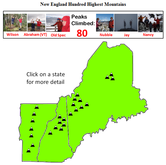
Link: Our quest for the New England Hundred Highest
After seven years of hiking in the Whites Eric and I are getting towards the bottom of the New England Hundred Highest List (I’m at #81 now). With the nice weather and a free September weekend I decided to knock off some mountains that are a little off the beaten path. Eric had already done Vose Spur and East Sleeper so I needed a good weekend to catch up to him. Even though Eric needed to rest his knee for a few more weeks, he said he’d rather “sit in the car in the mountains than sit in the lab in Cambridge” on a perfectly good summer weekend. So we picked up a car at Budget on Friday evening and headed up to New Hampshire…
Vose Spur via Mountain Bike Way:
Sawyer River Road had gotten washed out by Hurricane Irene a few weeks ago so that would mean an extra 2.5 miles of hiking each way on top of an already long hike. Ugh. But wait, we thought, what if we brought mountain bikes? Would it be possible to bike on the hiking trail all the way to the start of the bushwhack? I wanted to find out.
We had stealth-camped at the beginning of Sawyer River road so I could hit the ground running the next morning. As soon as I woke up I scarfed down my traditional power breakfast of cereal + powdered milk and started biking on what I expected would be a long day. Eric bet that it’d take no less than five hours for me to do Vose Spur, and then I’d hopefully use the remaining daylight to hike East Sleeper another Hundred Highest peak.
I pedaled up the gravel road past a massive crater that had formed due to flooding where the road used to be. There was a one-foot wide ledge that skirted the crater so I didn’t need to even dismount. I kept going up and turned onto Forest Service Road 85. Unfortunately my map must have been a little dated because it clearly wasn’t a road anymore, with all kinds of brush, downed trees, and waterbars across the path. But 80% of it was still bikeable and I made it to the intersection with the hiking trail in good time.
Since it was national forest and not wilderness it was still OK to mountain bike, so I pushed on towards Carrigain Notch. The trail got rockier and rockier however, and eventually I decided to call it quits and ditch the bike in favor of hiking. But when I pulled out the GPS I noticed that I was already at the start of the bushwhack. Eric told me it started at a big boulder. And since I saw I pretty big rock in the trail I figured this must be the right place.
So I pushed into the woods towards the summit. Vose Spur is among just a handful of trail-less Hundred Highest peaks, and some consider it to be the most challenging bushwhack of them all. But the trees weren’t too dense and I topped out at 10am. There wasn’t much to see, and I still had a long way down, so I spent about 3 minutes snapping some pictures and plunged back into the bushes.
I was starting to get the sense that I’d beat the 5 hour mark. I hopped back on the bike for some awesome downhill action. When I reached the intersection with the Mt Carrigain trail I opted to take the trail and save a little distance. It was a little rugged but at least I didn’t have to pedal. I merged with the Sawyer River road and raced towards the finish line. I ended up making it back to the car in just 3h15m roundtrip! Mountain biking was definitely the way to go this time. I ended up waiting about two more hours before Eric showed up since he didn’t expect me so early.
East Sleeper via the Runnable Route:
Vose Spur had been a piece of cake but I wasn’t about to count my chickens for East Sleeper. We headed through Bear Notch road and down the Kanc, then down Tripoli Road to the Livermore Trailhead. The bike came in handy once again and I was able to blast through the first 2 miles of gravel road. Now it was time for some hiking action. I headed up towards the South Slide of Tripyramid.
At that time of day most people were on their way down, and were incredulous that I would be heading up at 3pm. Luckily though the weather was good and I topped out on the South Peak by 4:05. The trail started unexpectedly heading down and I knew something was amiss. I tried radioing Eric down at base camp (we had brought 2-way radios), but then I noticed that there was cell service so I gave him a call. He had hiked the trail not too long ago so he knew it well.
“This is Wolverine-16 to Velociraptor-37, do you read me, over?” I asked. We both had our ultra-secret call signs.
“Velociraptor-37 to Wolverine-16, can read you loud and clear,” Eric answered.
“What’s the deal with this trail here,” I asked, “where’s the turnoff for East Sleeper? I’m already on top of the South Peak, over.”
“Wolverine-16 that is a negative. Head back down the South Slide to rendezvous with the Kate Sleeper trail at the unmarked cairn, over.”
“Dang it! Over.”
I backtracked until I met the trail in question and started running. It was starting to get a little dark so I decided to pick up the pace. With a nice, downhill trail on dirt it’s easy to get into the groove and the miles seem to fly by. Soon I was on top of the viewless, nondescript peak of East Sleeper. There wasn’t too much going on at the summit, so I snapped a couple photos and started running back.
Pretty soon I heard a big crashing sound 50 feet away and spotted a gigantic moose with wide antlers – your postcard New Hampshire moose. I must have been running quietly enough that it couldn’t hear me until I was close. I ran for most of the rest of the trail and rendezvoused with Eric at the start of the bikeable section. To the envy of all the other hikers on their way down we blasted down the mountain and reached the car with plenty of daylight to spare. Some hikers I had encountered near the beginning of my hike we just finishing now.
We tried to cook a little celebratory pasta dinner but a leaky valve in our stove turned it into a fireball which we extinguished with the rest of our water. Luckily we hadn’t added the pasta yet. Rather than risk a forest fire we caved in and drove to Waterville Valley for some pizza.
Scar Ridge via Barbed Wire Jungle:
After another refreshing night of stealth camping near Tripoli Road it was time for one last mountain: Scar Ridge. The conventional route up Scar Ridge starts on the top of Loon Mountain (you can hike up the ski trails to get there) and you “bushwhack” 1.5 miles along the ridge to the highest point on Scar Ridge.
But the bushwhack on Vose Spur had been no big deal the previous day, so I figured, one bushwhack in the Whites is the same as any other, right? Then why not start from this little pond on the map, called Little East Pond, from which it’s only a 0.8 mile bushwhack to the top? That way you’d save probably a half hour of bushwhacking over the Loon Mountain route, I thought. And plus you can probably bike all the way to Little East Pond.
I had done Vose Spur and East Sleeper both in about three hours the previous day so I expected Scar Ridge to be similar. But Scar Ridge had some tricks in store for me.
Without much difficulty I was indeed able to mountain bike all the way to Little East Pond, which saved me 2.1 miles of hiking each way. Now it was time for the bushwhack. If it’s so easy to bushwhack around here, I thought, then how about I just head to the ridge and then hike along it to the summit?
Using a combination of the GPS and compass I aimed for the target location on the ridge. But the trees quickly turned into an impenetrable barricade. I was soon plowing my way through the dense spruce trees, hoping to emerge into a clearing or punch through the thicket, but 1000 sharp little fingers were holding me back, tearing into my skin and clothes. At any given moment I was probably in contact with six different trees which each tried desperately to persuade me to retreat.
As I neared the top of the ridge at times I could probably go limp and still be supported upright by the dense undergrowth. Pretty soon the trees became so dense that I had to walk on top of fallen trees and zigzag my way across the little elevated highways. Sometimes it was hard to tell if I was walking on fallen trees or on solid ground, until suddenly I stepped into a hole and plunged through up to my waist, just like a crevasse. It was very slow going.
I ventured down to the north side of the ridge and found it was a little easier going but soon the trees closed in once again and I found myself in the midst of a dense barbed wire jungle of pine trees. After a full hour and a half of thrashing I finally made it to the top, proclaimed by a sign reading “SCAR” on a pine tree. I stayed just long enough to sign the summit register and snap a photo. I noticed in the photo that my legs were a curious red color. Then I glanced down and saw that there were cuts and blood everywhere. It seemed like I had just walked through razor wire.
Being at the top wasn’t a particularly joyous occasion though because I knew I was only at the halfway point. For the way down I decided to make a beeline to the Pond instead of taking the slightly longer route I had taken up. I figured that there probably wasn’t a single easy stretch of bushwhacking on the whole south side of the mountain, so the only way to save time would be to take the most direct route possible. I put on my long sleeve shirt and long pants, took a deep breath, and plunged back into the bushes.
On the way down there wasn’t a single clearing. I always felt like I was going to pop out into a open area soon, but it never happened. By the time I made it back to the bike my pants were shredded and there was blood everywhere. Nothing deep though, just minor scratches. But as soon as I hopped on my bike I was back in my element. This was my vindication for taking the hardest route up the mountain. I only pedaled a couple of times before finishing the final 2.1 miles back to the car.
Scar Ridge brought me just one mountain closer to the Hundred Highest, but I’d consider it to be one of the most difficult ones on the list if you decide to take the same route I took.
Scar Ridge - Long Way Home Gully
Eric Gilbertson
Aaron Yahr
3.26.11
Our plans to climb ice in Huntington Ravine were thwarted by bad weather, so we decided to climb this sheltered, moderate ice gully up the side of Scar Ridge. You can just barely see this gully if you park in the Lincoln Woods lot and look across to the other side of the Kanc. It's tucked in the corner of the ravine between Scar Ridge peak and Black Mountain, and tops out within a quarter mile of the Scar Ridge summit.
Despite this climb being in the official guidebook for northern new england ice climbing, we weren't too concerned about seeing other people up there. If the name didn't scare people off, the 3-mile bushwack approach including a difficult bridge-less stream crossing at the beginning probably would.
We parked in Lincoln Woods while it was still in the lower teens in the morning (felt more like February than late March), and started our bushwack around 8am. Unfortunately Hancock Brook, a major stream crossing at the beginning of the bushwack, was completely melted out and too wide to rock hope. However, we spied a sketchy-looking tree that had fallen across and used this to shimmy across resulting in zero wet feet.
The route finding was a bit tough after then. We thought there was just one major stream leading up to the ravine and we could just follow it, but it turned out there were quite a few decoy streams leading away from our destination. Of course I picked one of the decoy streams to follow and we only noticed the error after we were half way up Black Mountain and the clouds cleared enough for us to notice.
Long-Way-Home gully popped out of the clouds like a beacon and we headed for it, reaching the base around 11am. It looked like the base of a glacier, with all sorts of avalanche debris from a few weeks ago and little mini crevasses where water had cut through the snow.
We geared up at the base of some WI 1 ice and scrambled up. The gully turned back into snow soon and would have made for awesome skiing. At this point the gully split and we chose the largest center flow. The guidebook says 6 pitches of ice, but that must only be in lean snow years or early in the season.
We got to the base of some easy bulges and decided to get serious and bring the rope out. I led the first pitch, up easy WI1-2 ice, then Aaron led another similar pitch.
The third pitch was the most interesting, with some steeper ice steps near the summit. There was apparently some flowing water underneath because with one particular swing I created a 1-foot geyser spraying out.
We topped out after those three pitches and admired the view across the valley in to the Pemi Wilderness. The summit was only a quarter mile away, but it would be a difficult bushwack and we were trying to get back to boston at a reasonable hour, so we decided to head back down. That decision may have officially disqualified the trip as a true mountaineering venture, but it was a fun climb nevertheless.
We rappelled over the steeper ice and then downclimbed the snow gully, returning to our car with an hour to spare before dark.
Mountaineering up Scar Ridge
Scar Ridge (3774ft) via Long Way Home gully
97th Tallest Mountain in New England
Jan 16, 2012
8am – 1am
Eric Gilbertson
Erika Uyterhoeven
Rick Abbot
Scar Ridge had thwarted my attempts twice already – once due to lack of daylight on an ice-climbing attempt, and another due to an injury – but this time had to be different, I thought to myself. I looked down at my belay device and quickly pulled in more slack from the red and purple ropes. I had just finished leading the last pitch of the Long Way Home Gully ice climbing route up the north face of Scar Ridge, and was now belaying up Erika and Rick. We were just a quarter mile from the summit now, but that quarter mile could potentially be some of the densest and most difficult bushwacking in New England. And we wouldn’t have the advantage of daylight to help in navigation – the sun would officially set in about 10 minutes. Luckily I had brought my GPS with the summit marked just for this last push.
After Erika and Rick made it up safely I dropped the ropes and whipped out my Garmin Etrex Vista to turn it on and start acquiring satellites – but it was already on. Shoot!
“Warning – Low Batteries,” it complained in a popup message.
I had mistakenly left it on all day, and now - the only time I really needed it – it could run out of batteries at any instant (and I didn’t have any spares)! This might very well turn into failed attempt number three!
Our day had started at 5:30am at Camelot Cabin and we spent the 45-minute drive to Lincoln, NH strategizing how to approach our climb. The Long Way Home Gully is actually (surprisingly!) in the New England ice climbing guidebook, and they say the best approach is to park at the Lincoln Woods trailhead, cross the Hancock Branch stream, and then bushwack to the base of the climb. I had tried this approach in March of 2011 and the stream was unfrozen and too deep to ford, but luckily I had found a fallen tree to scramble across. This year, however, I didn’t expect that tree to be there anymore. Hurricane Irene had caused massive flooding the previous summer and probably wiped out any fallen trees across that stream. It also hadn’t been cold enough recently for us to trust that the stream would be frozen.
However, I remembered briefly walking along an XC ski trail on the opposite side of the river last time, and knew it had to somehow connect to the Loon Mountain Ski Resort area, which was conveniently on the south side of the stream. We decided we’d rather look for that ski trail and follow it in (potentially adding a few miles of hiking), rather than chance the shorter stream crossing which might turn out to be an impossible stream crossing.
When we got to Lincoln we turned off on the bridge to Loon Mountain and followed roads as far East up the river as we could. Eventually we reached the edge of the condos and found a nice little parking lot at a trailhead. Perfect! According to my GPS we were only a mile away from where we would have crossed the stream. That wouldn’t add too much time, though, since we would be following trails for that mile instead of bushwacking.
We suited up and left the cars at 8am. I was a little nervous about some XC skiers getting mad at us for walking on their trail, but there were all sorts of other footprints on it, and it hadn’t even been groomed yet (probably not enough snow?). We soon passed by the stream crossing location I remembered, and I didn’t see a single tree across the stream. There wasn’t any ice over the stream either, so we had definitely made the right decision to park on this side.
The trail then veered right up towards Black Mountain, but I remembered from last time that we needed to follow the stream up farther. We officially started bushwacking then, but the woods were so open it was hardly any more difficult than walking on a trail. Last time I was here I had cut up into the woods too early and ended up climbing halfway up a gully on Black Mountain, so this time I made sure to go farther up the stream.
After about half a mile I recognized the area that led up to the ice climb and started heading up into the woods. Rick and Erika had never been here so had to blindly trust me, but I was confident we were on the right route. The bushwacking continued to be extremely tame, and we made good time up the ravine. By 11am we were catching glimpses of the slide paths on the side of Scar Ridge and knew we were headed in the right direction. Along the way I actually saw some bear tracks in the snow. Shouldn’t they be hibernating now?!
By noon we were at the base of the slides and had to make a decision – there were actually two huge slide paths separated by a ridge in the middle. I saw quite a bit of ice on both of them, but remembered looking on Google Earth that the right slide topped out 0.26 miles from the summit of Scar Ridge while the left one topped out 0.29 miles from the summit. I knew from my brother Matthew’s description of the top of Scar Ridge that even 0.03 miles could take an agonizingly long time in all the impenetrable spruce. (Matthew had bushwacked up from the south last summer). The right slide was also the one I had climbed last year, and had fewer unknown variables that could affect our speed. Speed would be crucial here, because I definitely didn’t want to get stuck bushwacking to the summit in the dark.
Rick casually mentioned that the left slide looked like it had a lot of ice, but since I was leading I made the call to try the right slide. They both looked like they’d be equally fun anyways.
The terrain started getting steeper and at the base of some low-angle ice we finally switched out snowshoes for crampons. I kept my snowshoes for the final summit push, but Rick made the decision that he would leave his snowshoes behind to save weight, and just let me and Erika tag the summit.
The ice wasn’t steep enough to need ropes yet (maybe WI 1) so we soloed up , getting to swing the tools some to warm up for the steeper stuff. We climbed up a mix of snow and ice in the gully for about an hour until we reached the base of the true ice climbing. Now the guidebook claims “5-8 pitches” of ice, but last time I only found three actual pitches, and this time looked about the same. Maybe if all the snow were gone (like after the slide avalanched), or very early season you could squeeze out 8 pitches of ice. Oh well, it would still be fun.
Rick and Erika set up the ropes at a nice tree belay on the side and I started racking up my ice screws and slings. By 1:30pm I was swinging the tools and climbing up. It was probably only WI2 or so ice, but was still steep enough to warrant a rope. I placed most of my screws on that pitch but saved three for a nice belay anchor in the middle of the slide. I guess I could have weaved back into the trees, but most of the fun about this day was making the mountain harder (ie funner) than it needed to be. Usually an odd number of climbers means the group moves really slow, but I belayed Erika and Rick up at the same time and we actually weren’t that much slower than a two-person team would have been.
I led up one more similar WI2 pitch, and then the final pitch got a little bit steeper. At the very top of the ice one of my swings actually produced a one-foot geyser of water spurting out! I guess all that ice starts as water somehow, and I’d found the source of the water. I carefully avoided making any more geysers and climbed up into the trees for the final belay. Surprising I saw a sling wrapped around one of the trees with a caribbeaner on the end. I didn’t think anyone else would bother to bushwack in so far for an ice climb, but apparently there’s at least one other person out there as devoted as we were.
By this point it was about 4pm and I was getting a little nervous that we would be benighted while still bushwacking to the summit. To make matters worse, I had somehow managed to tangle the ropes behind me on this pitch and Erika and Rick were having trouble untangling them (in hindsight I should have clipped both ropes to each screw as I climbed instead of alternating ropes, since my route didn’t really zig-zag much).
This error cost us precious minutes and it was already 4:45pm by the time Erika and Rick made it to the top. That left us with 10 minutes of official daylight, and maybe 30 more of twilight before needing the headlamps.
Since my GPS could quit at any moment from low batteries, I knew our best bet was to go fast and light to try to beat the darkness to the summit. I stuffed a few emergency supplies into the lid of my pack, ditched the crampons and climbing gear, and grabbed the snowshoes. I turned off the GPS and stuffed it in my jacket pocket. I’d have to find the summit on my own, and only when I felt I was on the top would I whip out the GPS to help find the summit register.
Rick decided to prepare the ropes for a speedy rappel the instant we got back. I had no idea how long it would take us, but guessed probably an hour or so. Erika decided to go super-ultralight – carrying nothing but what she was wearing.
With one final glance to the north at the setting sun hitting Franconia Ridge, I pulled up my hood and plunged into the forest. The snow was deep enough to warrant snowshoes, but the terrain was steep enough to make them a hindrance. And the trees were dense enough that most steps landed in a spruce trap – where you sink down a foot farther than you anticipated into a thicket of branches. The best analogy I can think of for this bushwacking was swimming up a waterfall. Most steps did not result in any progress up the mountain, and rarely would I step on solid ground. I probably made the most progress when I could find a solid tree branch to hold on to and pull myself up and over the mess of snow and branches beneath.
Eventually I put on the snowshoes and the steepness lessened, and these helped a little. At times it was actually easier to crawl under the branches, and Erika said I looked like a mole tunneling through the snow and branches.
Perhaps halfway up to the top the trees started becoming slightly less impenetrable and we actually encountered a few 5ftx5ft clear sections. This definitely helped us move faster. The slope got less and less steep until, looking around I couldn’t discern whether any other direction would bring us higher. Were we at the top?
I didn’t see any sign (I knew there should be one on the true summit), and it was finally too dark to see without artificial light, so I donned my headlamp and started searching for higher ground. I also whipped out the GPS, and it said we were within 50ft of the top! Within another minute I spotted a rectangular piece of wood on a tree that said “SCAR”. We’d made it!
We could even rest easy that all we had to do was follow our tracks back to the top of the climb – no need to do any route-finding in the dark. We snapped a few victory shots on the top and signed the register. I noted that the last person up there was from back in October (three months ago), and I also found Matthew’s sign-in from back in September (I guess now I truly believe him that he got to the top).
It had taken us an hour to get to the top, and we knew Rick would probably be expecting us soon, so we quickly turned around and retraced our steps back to the climb. We made it back by 6:15pm, and Rick immediately started rappelling down the slide. It was completely dark now, but we knew exactly how to get back so that wouldn’t be a problem. Unfortunately since we’d topped out in the middle of the slide we had to do a diagonal rappel to get to more trees, but we managed without too much sliding on the ice. I guess we could have rappelled straight down the middle, but that would have required setting V-threads for anchors for subsequent rappels and trees would be a whole lot faster.
We did two more tree rappels, and then finally reached easy snow terrain. Erika and Rick had fun glissading most of the rest of the way down the steep gully, while I decided to keep my butt dry and walk down.