Vose Spur
New Hampshire
Date climbed: November 14, 2010 (Eric), Sept 17, 2011 (Matthew)
Vose Spur - 3862 ft
Noveember 14, 2010 (Eric)
Vose Spur is one of those mountains in the Whites that you definitely have to earn. There's no trail you can just blindly follow with your mind on cruise control - you have to find your own route up this one.
We started our bushwack near a giant boulder shortly before the carrigan notch pass. The branches got pretty dense and the terrain really steep most of the way, until we stumbled upon a herd path near the summit. From there it was a cake-walk to the top, even passing through a slide zone that gave us a cool view to the south.
Vose Spur, East Sleeper, Scar Ridge - NE 100 Highest
Vose Spur, East Sleeper, & Scar Ridge
Matthew Gilbertson
Sep 17-18, 2011
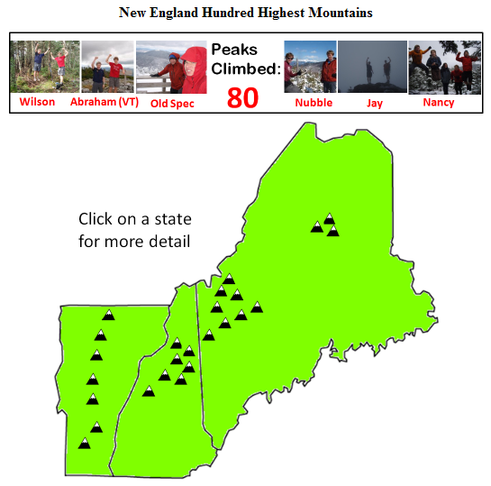
Link: Our quest for the New England Hundred Highest
After seven years of hiking in the Whites Eric and I are getting towards the bottom of the New England Hundred Highest List (I’m at #81 now). With the nice weather and a free September weekend I decided to knock off some mountains that are a little off the beaten path. Eric had already done Vose Spur and East Sleeper so I needed a good weekend to catch up to him. Even though Eric needed to rest his knee for a few more weeks, he said he’d rather “sit in the car in the mountains than sit in the lab in Cambridge” on a perfectly good summer weekend. So we picked up a car at Budget on Friday evening and headed up to New Hampshire…
Vose Spur via Mountain Bike Way:
Sawyer River Road had gotten washed out by Hurricane Irene a few weeks ago so that would mean an extra 2.5 miles of hiking each way on top of an already long hike. Ugh. But wait, we thought, what if we brought mountain bikes? Would it be possible to bike on the hiking trail all the way to the start of the bushwhack? I wanted to find out.
We had stealth-camped at the beginning of Sawyer River road so I could hit the ground running the next morning. As soon as I woke up I scarfed down my traditional power breakfast of cereal + powdered milk and started biking on what I expected would be a long day. Eric bet that it’d take no less than five hours for me to do Vose Spur, and then I’d hopefully use the remaining daylight to hike East Sleeper another Hundred Highest peak.
I pedaled up the gravel road past a massive crater that had formed due to flooding where the road used to be. There was a one-foot wide ledge that skirted the crater so I didn’t need to even dismount. I kept going up and turned onto Forest Service Road 85. Unfortunately my map must have been a little dated because it clearly wasn’t a road anymore, with all kinds of brush, downed trees, and waterbars across the path. But 80% of it was still bikeable and I made it to the intersection with the hiking trail in good time.
Since it was national forest and not wilderness it was still OK to mountain bike, so I pushed on towards Carrigain Notch. The trail got rockier and rockier however, and eventually I decided to call it quits and ditch the bike in favor of hiking. But when I pulled out the GPS I noticed that I was already at the start of the bushwhack. Eric told me it started at a big boulder. And since I saw I pretty big rock in the trail I figured this must be the right place.
So I pushed into the woods towards the summit. Vose Spur is among just a handful of trail-less Hundred Highest peaks, and some consider it to be the most challenging bushwhack of them all. But the trees weren’t too dense and I topped out at 10am. There wasn’t much to see, and I still had a long way down, so I spent about 3 minutes snapping some pictures and plunged back into the bushes.
I was starting to get the sense that I’d beat the 5 hour mark. I hopped back on the bike for some awesome downhill action. When I reached the intersection with the Mt Carrigain trail I opted to take the trail and save a little distance. It was a little rugged but at least I didn’t have to pedal. I merged with the Sawyer River road and raced towards the finish line. I ended up making it back to the car in just 3h15m roundtrip! Mountain biking was definitely the way to go this time. I ended up waiting about two more hours before Eric showed up since he didn’t expect me so early.
East Sleeper via the Runnable Route:
Vose Spur had been a piece of cake but I wasn’t about to count my chickens for East Sleeper. We headed through Bear Notch road and down the Kanc, then down Tripoli Road to the Livermore Trailhead. The bike came in handy once again and I was able to blast through the first 2 miles of gravel road. Now it was time for some hiking action. I headed up towards the South Slide of Tripyramid.
At that time of day most people were on their way down, and were incredulous that I would be heading up at 3pm. Luckily though the weather was good and I topped out on the South Peak by 4:05. The trail started unexpectedly heading down and I knew something was amiss. I tried radioing Eric down at base camp (we had brought 2-way radios), but then I noticed that there was cell service so I gave him a call. He had hiked the trail not too long ago so he knew it well.
“This is Wolverine-16 to Velociraptor-37, do you read me, over?” I asked. We both had our ultra-secret call signs.
“Velociraptor-37 to Wolverine-16, can read you loud and clear,” Eric answered.
“What’s the deal with this trail here,” I asked, “where’s the turnoff for East Sleeper? I’m already on top of the South Peak, over.”
“Wolverine-16 that is a negative. Head back down the South Slide to rendezvous with the Kate Sleeper trail at the unmarked cairn, over.”
“Dang it! Over.”
I backtracked until I met the trail in question and started running. It was starting to get a little dark so I decided to pick up the pace. With a nice, downhill trail on dirt it’s easy to get into the groove and the miles seem to fly by. Soon I was on top of the viewless, nondescript peak of East Sleeper. There wasn’t too much going on at the summit, so I snapped a couple photos and started running back.
Pretty soon I heard a big crashing sound 50 feet away and spotted a gigantic moose with wide antlers – your postcard New Hampshire moose. I must have been running quietly enough that it couldn’t hear me until I was close. I ran for most of the rest of the trail and rendezvoused with Eric at the start of the bikeable section. To the envy of all the other hikers on their way down we blasted down the mountain and reached the car with plenty of daylight to spare. Some hikers I had encountered near the beginning of my hike we just finishing now.
We tried to cook a little celebratory pasta dinner but a leaky valve in our stove turned it into a fireball which we extinguished with the rest of our water. Luckily we hadn’t added the pasta yet. Rather than risk a forest fire we caved in and drove to Waterville Valley for some pizza.
Scar Ridge via Barbed Wire Jungle:
After another refreshing night of stealth camping near Tripoli Road it was time for one last mountain: Scar Ridge. The conventional route up Scar Ridge starts on the top of Loon Mountain (you can hike up the ski trails to get there) and you “bushwhack” 1.5 miles along the ridge to the highest point on Scar Ridge.
But the bushwhack on Vose Spur had been no big deal the previous day, so I figured, one bushwhack in the Whites is the same as any other, right? Then why not start from this little pond on the map, called Little East Pond, from which it’s only a 0.8 mile bushwhack to the top? That way you’d save probably a half hour of bushwhacking over the Loon Mountain route, I thought. And plus you can probably bike all the way to Little East Pond.
I had done Vose Spur and East Sleeper both in about three hours the previous day so I expected Scar Ridge to be similar. But Scar Ridge had some tricks in store for me.
Without much difficulty I was indeed able to mountain bike all the way to Little East Pond, which saved me 2.1 miles of hiking each way. Now it was time for the bushwhack. If it’s so easy to bushwhack around here, I thought, then how about I just head to the ridge and then hike along it to the summit?
Using a combination of the GPS and compass I aimed for the target location on the ridge. But the trees quickly turned into an impenetrable barricade. I was soon plowing my way through the dense spruce trees, hoping to emerge into a clearing or punch through the thicket, but 1000 sharp little fingers were holding me back, tearing into my skin and clothes. At any given moment I was probably in contact with six different trees which each tried desperately to persuade me to retreat.
As I neared the top of the ridge at times I could probably go limp and still be supported upright by the dense undergrowth. Pretty soon the trees became so dense that I had to walk on top of fallen trees and zigzag my way across the little elevated highways. Sometimes it was hard to tell if I was walking on fallen trees or on solid ground, until suddenly I stepped into a hole and plunged through up to my waist, just like a crevasse. It was very slow going.
I ventured down to the north side of the ridge and found it was a little easier going but soon the trees closed in once again and I found myself in the midst of a dense barbed wire jungle of pine trees. After a full hour and a half of thrashing I finally made it to the top, proclaimed by a sign reading “SCAR” on a pine tree. I stayed just long enough to sign the summit register and snap a photo. I noticed in the photo that my legs were a curious red color. Then I glanced down and saw that there were cuts and blood everywhere. It seemed like I had just walked through razor wire.
Being at the top wasn’t a particularly joyous occasion though because I knew I was only at the halfway point. For the way down I decided to make a beeline to the Pond instead of taking the slightly longer route I had taken up. I figured that there probably wasn’t a single easy stretch of bushwhacking on the whole south side of the mountain, so the only way to save time would be to take the most direct route possible. I put on my long sleeve shirt and long pants, took a deep breath, and plunged back into the bushes.
On the way down there wasn’t a single clearing. I always felt like I was going to pop out into a open area soon, but it never happened. By the time I made it back to the bike my pants were shredded and there was blood everywhere. Nothing deep though, just minor scratches. But as soon as I hopped on my bike I was back in my element. This was my vindication for taking the hardest route up the mountain. I only pedaled a couple of times before finishing the final 2.1 miles back to the car.
Scar Ridge brought me just one mountain closer to the Hundred Highest, but I’d consider it to be one of the most difficult ones on the list if you decide to take the same route I took.