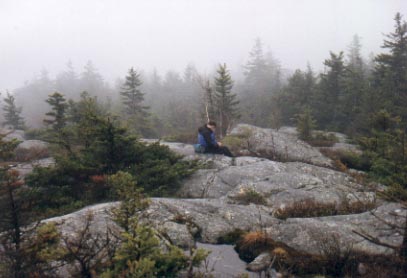
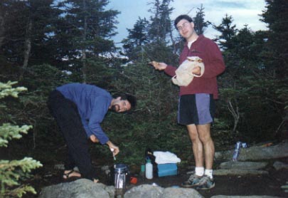
with Rad and Gunter
A nice mountain with a lot of trails. I recommend the Cliff Trail. It has nice views from numerous rocky ledges. Unfortunately, it gets crowded on the mountain since it's pretty close to Boston. But since we went on a cloudy, drizzly day, we saw more salamanders than hikers.
with Darcy, Rad, and Steve
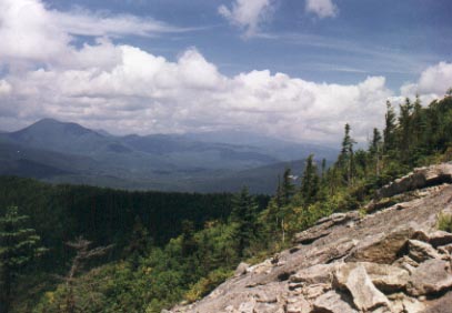
Near Waterville Valley, this is a short loop hike (approximately 5 miles) over two peaks. The views are fantastic almost the entire way. A lot of the hiking is on open granite, so wet days may be dangerous. The views out to Mt. Tripyramid are great and there are some nice ledges to enjoy the views from.
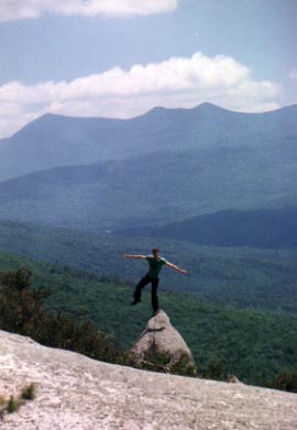
Rad is up to his usual tricks, balancing on a pointy rock. The three peaks of Mt. Tripyramid are in the background.
Backpacking trip with Steve and Gene
The trailhead to the summit of Moosilauke is west of I93, just north of NH 118. We did a loop starting from the Moosilauke Ravine Lodge (run by the Dartmouth Outing Club). We began by ascending the Asquam Ridge Trail, joining up with the Appalachian Trail near the summit of Mt. Jim. We then crested the wooded summit of Mt. Jim and skirted the peak of Mt. Blue. At 5.5 miles, we reached the summit of Moosilauke, above treeline, and enjoyed gorgeous views in all directions. It was really windy up there, so we came off the summit and found a sheltered campsite where we set up camp.
with Bob, Rad, Jim, Gene, Marie, and Amy H.
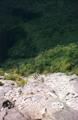
Starting from the Livermore Road near Waterville Valley, we did the loop counterclockwise going over North, Middle, and South Peaks. The North Slide leading up to North Peak is a very steep and fairly long ascent on open granite. We stopped periodically to catch our breaths and to admire the grand view which included Mt. Osceola and Mt. Tecumseh. The summit is wooded except for a small opening in the trees. There are better views from Middle Peak, although that is also for the most part wooded as is South Peak. The South Slide is considerably looser than the hard granite of the North Slide and would make for a difficult climb.
Looking across the rocky north slide (left). Looking back down the north slide as Gene and Marie make their way up (right).
with Darcy, Ryan, and Amy S.
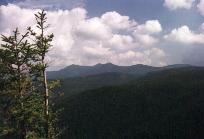
Near Waterville Valley, the trailhead is just off of NH 49. We took the Sandwich Mountain Trail (a couple of pretty steep sections!) up to Noon Peak and continued on to Jennings Peak. There are great views from Jennings Peak from a couple of rocky ledges. Views are out to Mt. Tripyramid, Sandwich Mountain, and Mt. Osceola. The trail continues on for about another mile to the peak of Sandwich Mountain, but we turned back and headed down the Drakes Brook Trail to complete the loop.
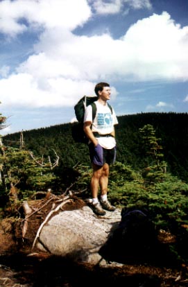
June 2000 with Rad Roberts
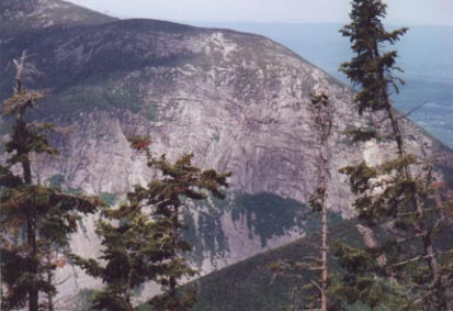
The Falling Waters trail starts at an elevation of approximately 1800 feet and begins to climb through a deciduous forest, paralleling a rushing creek. This was my first hike of the season and it was a great feeling to be back on the trail. As the name of the trail would suggest, we soon came across a waterfall. The sunlight shone through the gaps in the trees and illuminated the water as the creek tumbled about 30 feet down a series of steps. The next waterfall was even more spectacular, with the creek cascading down a sheer 60 foot cliff. We climbed the steep trail along the side of the falls and continued on our quest to reach the ridge. Ninety minutes and a little over three miles after leaving the trailhead, we broke out of the trees and onto the rocky summit of Little Haystack Mountain, elevation 4700 feet. The views were absolutely stunning. The 360 degree panorama included the summit of neighboring Mt. Lincoln to the north. Off to the east was the Presidential Range and the lofty summit of Mt. Washington, smoke from the cog railway rising into the sky over New England's highest peak. Looking west across Franconia notch, we saw the Cannon cliffs (photo at right), home of the Old Man of the Mountain. We were sitting on the rocks and taking a well deserved rest when we noticed a sailplane coming in from the north. Silently and gracefully, the glider skirted the peak of Mt. Lincoln and headed straight at us along the ridge. With only the sound of rushing wind, the plane sailed over us, only a couple of hundred feet above the ridge.
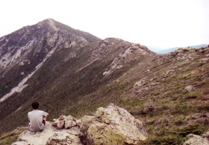
Me, gazing off at the Franconia Ridge Trail and Mt. Lincoln
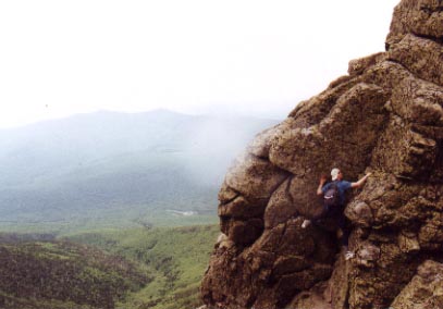
We started along the ridge trail towards Mt. Lincoln, but were quickly distracted by a granite outcropping with a nice vertical face. We had to stop and do some bouldering. Rad is a very accomplished climber, having done many routes including the Cannon cliffs and Yosemite Valley. I am not, my longest climb being a 30 foot wall in an indoor gym. Regardless, we had a great time climbing around and discovering routes to the top. We found several of these granite playgrounds along the way, some as high as 30 feet, others only 10 or 12 feet high. We had no ropes, so were climbing unprotected. Rad, very confident of his climbing skills, took on some of the longer and more difficult climbs (photo at left), whereas I generally stuck to the shorter ones. It was still a great feeling of accomplishment for me when I got over the top, especially after making some moves which were pretty difficult (for me).
We continued along the wide open ridge, enjoying the views along the way. About a mile after leaving the summit of Little Haystack, we reached the 5089 foot summit of Mt. Lincoln. Just below the summit of Lincoln, there was a spur ridge with a rock formation resembling a giant turtle. We scrambled down to it and took some photos. We named it the Old Turtle of the Mountain. After climbing back to the summit of Lincoln, we hiked the one and a half miles to the highest point of the hike, the summit of Mt. Lafayette at over 5200 feet. From there, we began our descent on the Old Bridle Path Trail down towards the valley. Twenty minutes into our descent, we came to a clearing with views back up to the ridge. Some bad weather had begun to roll in and the summit of Lafayette was no longer visible. I imagined the wind whipping through the summit, with visibility down to a hundred feet, and was glad that we weren't up there anymore. Another half hour later, we caught sight of the ridge again and saw that the whole of the ridge was now socked in with clouds. About an hour after we got back to the trailhead, it started raining down in the valley. Fortunately, by that time, we were gorging ourselves with pizza. We had been very lucky with our timing.