Hiking in the Rocky Mountains
Dayhike from Lake Louise to Summit of Fairview Mountain, Banff National Park, Alberta, Canada
July 1997
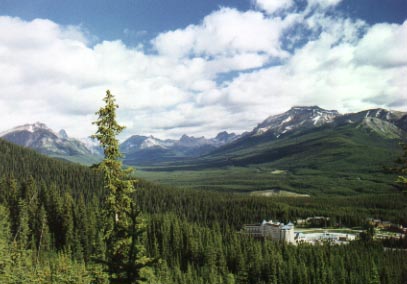
Fairview Mountain (9000'), looms above world famous Lake Louise in Banff National Park, Alberta, Canada. The trail starts at Lake Louise and climbs fairly steeply through a subalpine forest. Eventually I broke out of the forest into a clearing with great views across the Bow Valley, and looking back, I caught a glimpse of Chateau Lake Louise far below me. I continued up the trail stopping to admire the wildflowers along the path. The trail started switchbacking up a steep section and as I climbed higher, I saw that the slopes were still covered by snow patches. The cries of a colony of Columbian ground squirrels attracted my attention and I followed them to their underground tunnels. A squirrel gave one last cry of alert to his friends before disappearing into the safety of its tunnel. Continuing on, I eventually arrived at Saddle Pass, a pass between Fairview Mountain and Saddle Peak. I took a brief rest at the beautiful subalpine meadow filled with wildflowers such as Red Indian Paintbrush, Yellow Columbine, and Subalpine Buttercup. From the pass are grand views of the north face of 11,000 foot Mt. Temple as well as Sheol Mountain and Mt. Aberdeen. Paradise Valley is visible at the base of Mt. Temple (photo below).
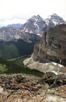
Paradise Valley with 11,000 foot Mt. Temple towering above it in the background.
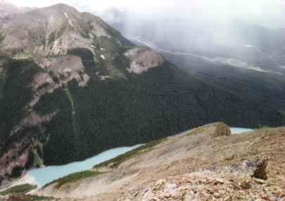
I continued on the trail to the summit of Fairview Mtn. It soon crossed the treeline and entered an open rocky slope. I was amazed at the wildflowers that were growing on this barren rocky landscape. There was moss campion, white and pink mountain heather, and saxifrage. After about 45 minutes of steady climbing, I reached the summit. The view from the top was amazing! You could see Lake Lousie 4000 feet below, almost straight down, as the north face of Fairview Mtn. is quite steep. Victoria Glacier and Lefroy Glacier, two of the glaciers that feed Lake Louise were visible from the summit, as well as Mt. Victoria.
On the way down, I took a detour to Fairview Lookout, a point about 300 feet above Lake Louise. From there, I descended down to the shore of the lake and made my way back to the starting point at Chateau Lake Louise.
Observation Peak, Yellowstone National Park
August 1999 with Gene Van Buren
 The hike starts from a picnic area just north of Canyon Junction. The trail heads briefly downhill through some trees before entering a meadow. The walk through the meadow is fairly easy and lasts for about 3 miles before reaching Cascade Lake. Along the way we saw a bear print on the trail which was larger than my hand. Shiver... From there, the trail heads up. It's not especially steep, but this being our first hike of the summer combined with the high altitude (the meadow is at 7500') made the climb pretty tough. With our heads down and legs pumping, we made our way up. About a mile into the climb, we met up with a couple who were resting on the side of the trail.
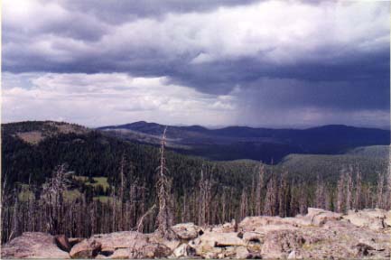
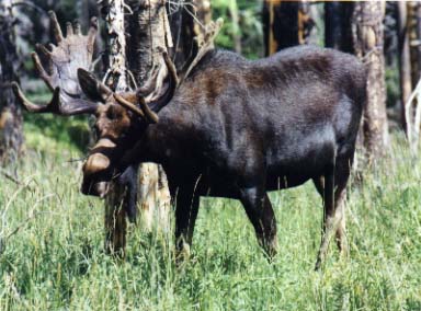 They asked us, "So how'd you like those moose?". Gene and I looked at each other and said, "What moose?". We headed back down the trail. In our determination to get to the top, we had walked right past a pair of big bull moose who were browsing in some trees no more than 25 yards from the trail! The moose seemed undisturbed by our presence and continued to feed on the brush, although we kept a wary eye out for any signs of aggression. We snapped some photos and then continued on our trek to the summit. As we approached the top, we were startled by the sudden sound of rustling grass. We looked up in time to catch a glimpse of a herd of elk taking flight. A few hundred yards later, we came across a pair of young mule deer bucks, sporting small sets of antlers. They obliged and posed proudly with their heads held high long enough for me to snap a photo before scampering off. Eventually we did make it to the top. The bare summit provided a stunning panorama of the Yellowstone Valley and the rolling hills beyond. We enjoyed a well deserved drink and snack while admiring the view. However, as we looked to the west, we saw dark ominous clouds moving in and decided we'd better book it on down before we got drenched by the rains. We made it about halfway back to the trailhead before the rain hit. It was a cold hard rain and we were nearly blinded as we alternately ran and walked the remaining three miles to the trailhead.
The Epic Day Hike: Lake Solitude and Paintbrush Divide, Grand Teton National Park
August 1999 with Gene Van Buren
It was a little past nine on a gloriously clear summer morning. Gene and I took the boat across Jenny Lake to the start of the Cascade Canyon trail. Our plan for the day was to hike the 7.2 miles up to Lake Solitude, enjoy a nice picnic lunch, and hike back out the same way. 14.4 miles with 1500 feet of elevation change would have been a long but reasonable day hike. However, as we started up Cascade Canyon, we had no idea that we were in for a whole lot more than that.
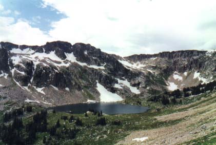
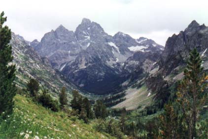 We were in high spirits as we hiked along the rushing Cascade Creek with the peaks of Mt. Teewinot and Mt. Owen towering above us to the left. We stopped to admire the beauty of Hidden Falls as it tumbled down a rock staircase from 200 feet above. Continuing on, we encountered a slight delay when we came up to a cow moose ambling along the trail ahead of us. She would stop every now and again to browse on the bushes along the trail. We certainly didn't want to get too close since a kick from those hind legs could have sent us flying all the way back down to Jenny Lake! Eventually, she stepped off the trail to get at some particularly appetizing bushes and we were able to sneak by. As we carefully walked past, I saw just how big she really was - easily five feet tall at the shoulders. We were able to make pretty good time for the rest of the way up to Lake Solitude, although we stopped a few times to play hide and seek with a marmot and to enjoy the beautiful wildflowers. The final climb up to the lake was fairly steep, but we made it. The lake is a crystal clear glacial tarn bordered on three sides by a steep rock face. Looking back down the valley which we had just come up, we saw the stunning 13,000 foot peak of Grand Teton perfectly framed by the U-shaped glacial valley. We sat down on the rocks and munched hungrily on beef jerky and Clif Bars as we admired the view and watched some people fishing for cutthroat trout. We were thinking about heading back down when another hiker mentioned an alternate return to Jenny Lake. This would take us up over Paintbrush Divide and down Paintbrush Canyon instead of simply returning down Cascade Canyon, adding another 5 miles and 2000 feet of elevation gain to our trip. I looked down at my watch and saw that it was past 1:30.
 The last boat across Jenny Lake leaves at 6. That leaves four and a half hours to hike over twelve miles. If we miss the last boat across, that would add another 2 miles since we would have to hike around the perimeter of the lake back to our campground. I looked up skeptically at Gene, but his mind was already made up. So off we went, up the switchbacks towards Paintbrush Divide. We knew we had to make good time, so we huffed and puffed up the trail, stopping occasionally to catch our breaths and to look back down at Lake Solitude growing smaller and smaller. The views were spectacular as we had a bird's eye view of the valley and the neighboring peaks. We arrived at 10,700 foot Paintbrush Divide out of breath but exhilarated. We allowed ourselves to feel content for a moment before beginning our descent down the steep switchbacks. Although it was the middle of August, there were still some snowbanks on the hills. And we took advantage. Sliding down a snowbank on your butt surely beats pounding your knees hiking down a rocky trail. And it's also faster, which at this point started to become rather important. As we continued on, it became clear that we needed to pick up the pace. So we ran most of the last four miles through the forest, checking our watches constantly. Finally the boat dock came into view. We jumped down onto the dock, clambered into the boat, and collapsed in a heap. I checked my watch. 6:01pm. Soon thereafter, the boat left the dock and we headed back to the other shore and to our campground. We were utterly exhausted, but it was well worth it.
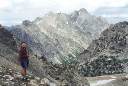
Here we are, atop 10,700 foot Paintbrush Divide, looking across at the backside of Mt. Moran.
Grinnel Glacier, Glacier National Park
August 1999 with Gene Van Buren
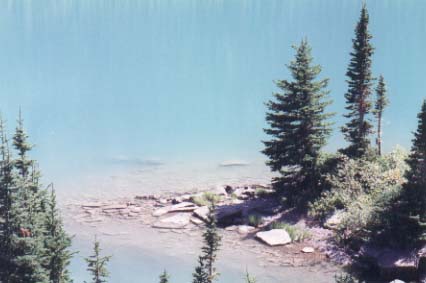
We started the hike under clear blue skies from a picnic area near the Many Glacier Hotel. It was another hot day with temperatures in the upper 80's, but we couldn't complain since we had been blessed with good weather throughout the trip. We were spared from the harsh rays of the sun during the early part of our hike as the trail wound through a forest, providing ample shade. We began to climb gradually, the trail overlooking a glacial lake with the baby blue waters shining brightly in the sunlight. I am always amazed by the color of these glacial lakes, thinking that the pastel turquoise colors could only be the creation of some master painter. We continued to climb and the subalpine forest gave way to a meadow, with Indian Paintbrushes, Yellow Arnicas, and other wildflowers providing bright splashes of color. With the shade of the trees gone, the sun was beating down on us relentlessly. We would take a quick rest whenever we were able to find any shade, whether it be from the occasional lone pine tree or from an especially large rock.
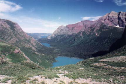
 The trail began to steepen and we climbed continuously for a couple of miles. We were now well above the valley floor where we had started earlier that afternoon, and the unobstructed view of Lower Grinnel Lake far below us and the mountains beyond it were absolutely majestic. The light blue water of the lake, surrounded by the deep dark green of the lush pine forests. The green forests climbing midway up the slopes of the mountains, fading into the light gull gray of the granite, and culminating in jagged peaks. All of this under a bright blue sky mottled only by a few puffy fair weather clouds. I don't think any artist could have painted a picture as beautiful as the landscape that lay before us.
We continued on. The heat was not nearly as stifling at the higher altitudes, but we were still thrilled by the unexpected treat that we came across. Ahead of us, the trail passed under a waterfall, the crystal clear water cascading down a 15 foot high wall. We put down our backpacks and jumped into the natural shower. The water, which most likely came from glacial or snow melt, was very cold. And it was incredibly refreshing. We regained our inspiration and with soggy boots, climbed on in high spirits. After a couple more miles, we reached Grinnel Glacier, our destination. The glacier has been receding rather rapidly in recent years and now only occupies a small section of the giant amphitheater that it once created. The rest is filled with its meltwater forming a partially frozen lake, with small icebergs floating about. The water was so cold that putting my hand in it caused a sharp pain to shoot up my arm. I could not leave my hand in there for more than a few seconds. We took advantage of this natural refrigerator and dropped in our now warm bottles of Gatorade to cool while we explored the area.
We were standing in a natural amphitheater about a half mile across, the result of thousands of years of scouring by the glacier on the mountainside. The walls were nearly vertical and extended a few hundred feet above the lake. Across the lake on the far wall was a high cascade, the water falling like a long thin string onto the rocky moraine below. After hopping around on the rocks and looking around, we began our descent back down to Many Glacier. The descent was not nearly as strenuous as the climb up, but it was still warm and we felt obliged to stop and take another shower under the waterfall. It just felt so good. Sopping wet and with water squishing in our boots, we made our way back down to the trailhead to finish off a great day of hiking.
Snowshoeing in the Canadian Rockies, Banff National Park
December 1999
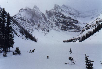
Lake Louise was completely frozen over, covered by more that a foot of snow. It was a cold, overcast day and a light snow was falling. With snowshoes in hand, I set off on the well traveled path along the lake shore leading away from the posh Hotel Chateau Lake Louise. The trail up to Lake Agnes branched off of the lake shore trail and began to climb steadily through an evergreen forest. Occasional breaks in the trees afforded views down to Lake Louise and up to Fairview Mountain looming overhead. After about a mile, there was a fork in the trail. The sign showed two trails leading to Lake Agnes, one which was considerably shorter than the other. I opted for the shorter way, thinking that, well, shorter is better. Unfortunately, I hadn't considered the possibility that shorter can also be steeper. The trail was unbroken, so I strapped on my snowshoes. I slowly made my way up the hill, trampling on virgin snow. The snow was a couple of feet deep in some places, and even with snowshoes on, I sank in halfway to my knees, making it very difficult to make progress. As I traversed across the slope, every step caused minor avalanches to go cascading down the steep hillside. A couple of times, I thought I would lose it and go sliding down with the snow, but I managed to keep my feet under me. I took a deep breath and scrambled the rest of the way up the hill. The trail eased considerably after that and I was soon greeted by the view of Lake Agnes. And what a view it was. The lake, much smaller than its neighbor Louise, is surrounded on three sides by towering peaks. The peaks seem to rise up right from the shoreline, creating the effect of a giant amphitheater. I sat down in the soft white snow and admired the view, feeling incredibly lucky to have this moment to myself. There is something about the winter which adds to the peacefulness of such a scene. Maybe it's the loneliness that comes from the snow, the frozen landscape and it's lack of bright colors. Whatever the reason, as I sat there in silence, I felt completely at peace. It was a wonderful feeling.

This is Mirror Lake with the 9000 foot peak of Fairview Mountain towering over it in the background.


 The hike starts from a picnic area just north of Canyon Junction. The trail heads briefly downhill through some trees before entering a meadow. The walk through the meadow is fairly easy and lasts for about 3 miles before reaching Cascade Lake. Along the way we saw a bear print on the trail which was larger than my hand. Shiver... From there, the trail heads up. It's not especially steep, but this being our first hike of the summer combined with the high altitude (the meadow is at 7500') made the climb pretty tough. With our heads down and legs pumping, we made our way up. About a mile into the climb, we met up with a couple who were resting on the side of the trail.
 They asked us, "So how'd you like those moose?". Gene and I looked at each other and said, "What moose?". We headed back down the trail. In our determination to get to the top, we had walked right past a pair of big bull moose who were browsing in some trees no more than 25 yards from the trail! The moose seemed undisturbed by our presence and continued to feed on the brush, although we kept a wary eye out for any signs of aggression. We snapped some photos and then continued on our trek to the summit. As we approached the top, we were startled by the sudden sound of rustling grass. We looked up in time to catch a glimpse of a herd of elk taking flight. A few hundred yards later, we came across a pair of young mule deer bucks, sporting small sets of antlers. They obliged and posed proudly with their heads held high long enough for me to snap a photo before scampering off. Eventually we did make it to the top. The bare summit provided a stunning panorama of the Yellowstone Valley and the rolling hills beyond. We enjoyed a well deserved drink and snack while admiring the view. However, as we looked to the west, we saw dark ominous clouds moving in and decided we'd better book it on down before we got drenched by the rains. We made it about halfway back to the trailhead before the rain hit. It was a cold hard rain and we were nearly blinded as we alternately ran and walked the remaining three miles to the trailhead.

 We were in high spirits as we hiked along the rushing Cascade Creek with the peaks of Mt. Teewinot and Mt. Owen towering above us to the left. We stopped to admire the beauty of Hidden Falls as it tumbled down a rock staircase from 200 feet above. Continuing on, we encountered a slight delay when we came up to a cow moose ambling along the trail ahead of us. She would stop every now and again to browse on the bushes along the trail. We certainly didn't want to get too close since a kick from those hind legs could have sent us flying all the way back down to Jenny Lake! Eventually, she stepped off the trail to get at some particularly appetizing bushes and we were able to sneak by. As we carefully walked past, I saw just how big she really was - easily five feet tall at the shoulders. We were able to make pretty good time for the rest of the way up to Lake Solitude, although we stopped a few times to play hide and seek with a marmot and to enjoy the beautiful wildflowers. The final climb up to the lake was fairly steep, but we made it. The lake is a crystal clear glacial tarn bordered on three sides by a steep rock face. Looking back down the valley which we had just come up, we saw the stunning 13,000 foot peak of Grand Teton perfectly framed by the U-shaped glacial valley. We sat down on the rocks and munched hungrily on beef jerky and Clif Bars as we admired the view and watched some people fishing for cutthroat trout. We were thinking about heading back down when another hiker mentioned an alternate return to Jenny Lake. This would take us up over Paintbrush Divide and down Paintbrush Canyon instead of simply returning down Cascade Canyon, adding another 5 miles and 2000 feet of elevation gain to our trip. I looked down at my watch and saw that it was past 1:30.
 The last boat across Jenny Lake leaves at 6. That leaves four and a half hours to hike over twelve miles. If we miss the last boat across, that would add another 2 miles since we would have to hike around the perimeter of the lake back to our campground. I looked up skeptically at Gene, but his mind was already made up. So off we went, up the switchbacks towards Paintbrush Divide. We knew we had to make good time, so we huffed and puffed up the trail, stopping occasionally to catch our breaths and to look back down at Lake Solitude growing smaller and smaller. The views were spectacular as we had a bird's eye view of the valley and the neighboring peaks. We arrived at 10,700 foot Paintbrush Divide out of breath but exhilarated. We allowed ourselves to feel content for a moment before beginning our descent down the steep switchbacks. Although it was the middle of August, there were still some snowbanks on the hills. And we took advantage. Sliding down a snowbank on your butt surely beats pounding your knees hiking down a rocky trail. And it's also faster, which at this point started to become rather important. As we continued on, it became clear that we needed to pick up the pace. So we ran most of the last four miles through the forest, checking our watches constantly. Finally the boat dock came into view. We jumped down onto the dock, clambered into the boat, and collapsed in a heap. I checked my watch. 6:01pm. Soon thereafter, the boat left the dock and we headed back to the other shore and to our campground. We were utterly exhausted, but it was well worth it.


 The trail began to steepen and we climbed continuously for a couple of miles. We were now well above the valley floor where we had started earlier that afternoon, and the unobstructed view of Lower Grinnel Lake far below us and the mountains beyond it were absolutely majestic. The light blue water of the lake, surrounded by the deep dark green of the lush pine forests. The green forests climbing midway up the slopes of the mountains, fading into the light gull gray of the granite, and culminating in jagged peaks. All of this under a bright blue sky mottled only by a few puffy fair weather clouds. I don't think any artist could have painted a picture as beautiful as the landscape that lay before us.


