Just as a note, the original boundaries of my site of study in Central
Square have not changed. They are presented here in the same map I used for my
previous assignment:

Figure
1: Area of study.
The
Beginning of the Bigger Picture
The city of Cambridge
was originally founded as Newtowne in 1630 by pilgrims who settled in the area around what
is currently Harvard Square. In 1638 the town name was changed to the now familiar Cambridge. The
original area of Cambridgeport, where Central Square would later be, was a
marshy area referred to as "The Neck" and remained mainly unpopulated until the American Revolution,
when the American army occupied Cambridge and built several forts along the
river. The site was a strategic location, since it represented the most direct
route from Boston to the west and northwest. This important fact was soon
realized by speculators, and after the war it was
decided that a new bridge had to be built uniting Cambridge and Boston. Enter
Francis Dana.

Figure 2: Military map of Boston and Cambridge, showing the importance of Cambridge Neck as a link between the two towns. 1777

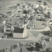
Figure 3: Cambridge in 1776
By 1791, most of the land on The Neck was owned by two men: Judge Francis Dana, chief justice of Massachusetts, and Colonel Leonard Jarvis of Boston. Two plans for bridges were presented in 1791, but it was the one proposed by Judge Dana and his business associates that was chosen, doubtlessly due to the political influence of both Jarvis and the Judge. The resulting West Boston Bridge, completed in 1793, took the Boston travelers directly to Pelhamís Island, a site that encompassed both Jarvisís and Danaís properties. They immediately built a settlement in the area, which is presently Lafayette Square.

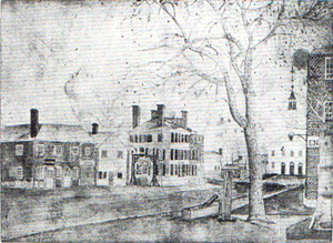
Figure 4: The West Boston Bridge in 1797. The opening of the bridge in 1793 started
the
land rush that resulted in the development of the Central Square Area.
With the completion of the West Boston Bridge, the Neck suddenly acquired tremendous value in the eyes of development companies, land speculators and other investors. The following twenty years saw a surge in new development projects as different groups tried to increase the value of their properties through the construction of roads and such. Meanwhile, the settlement that Jarvis and Dana had established at Pelhamís Island continued to grow. Development slowed down in 1798 when Jarvisís property was seized by the government as a result of his being charged for misappropriation of funds from his job as a U.S. Inspector of the Revenue. The sale of his land by the government in 1801 encouraged even more rapid settling of the area . By 1822, the area included several large stores, hotels, houses, taverns and a church. The settlement had expanded way beyond its original boundaries. Central Square had been born.

Figure 5: Pelham's Island Settlement. 1825
The Development of the Square
Figure
6: Map of Cambridge. 1830
Hales's 1830 plan of Cambridge provides a simple, yet useful view of how the city stands at the beginning of this new period of growth. We can see the three main settlements: Old Cambridge in the Harvard Area, Cambridgeport in the Central Square Area and East Cambridge to the northeast. Hale's map clearly shows the difference between the street patterns of East Cambridge and the other two villages. East Cambridge is arranged in a neat grid. Old Cambridge and Cambridgeport have streets connecting the main settlement points to points of interest such as bridges and main roads. This is probably due to the fact that East Cambridge is younger, having been established after the opening of the West Boston Bridge, with the clear intention of becoming a town. These street patterns, along with the fact that Cambridgeport is right in middle of the other settlement points (Boston included, via the bridge) must have been a crucial factor in turning Central Square into the center of business that it would become. "All the roads," one could say, "led to Central Square."
It is also clear from this map that the streets that define the Central Square area today were already in place by this time. Therefore, from now on we expect the properties in the site to develop commercially and residentially while the layout remains the same, instead of the simple settlement and expansion process we have seen until now.
Figure 7: Central Square. 1888.
This 1888 detailed map of the Central Square area displays the obvious growth that the region has experienced since the times described above. The abundance of carriage houses implies considerable transportation through the area by horse carriage. Also, several service establishments can be seen for roofer, plumber, bank, locksmith and the likes. A few manufacturing companies such as Geo. S. Phillips and Keeler & Co. are now present in the site too. Also notable are the presence of the City Hall and the YMCA. A look at the surroundings of the site shows an abundance of flats. This all suggests an area with two aspects: a self-sufficient residential community, and a center of commerce.
By 1888, the population of the Central Square area had increased greatly, in part due to the great number of Irish immigrants that had arrived over the last few years. Several manufacturing companies had established themselves in the area, and employed this new workforce. They shared the surrounding residential areas with Boston workers who wished to live in a more suburban environment. The site's geographical location and the improvements in transportation means were instrumental in turning the heart of Central Square into a thriving center of business.

Figure 8: A horse-drawn bus on Central Square. 1852.
The New Century

Figure 9: Central Square map. 1930.
Note: Some of the digital images containing the rest of the site were lost, and are therefore not shown here. The rest of the site was however studied and analysis on it is included in this section.
The most striking thing about this map from 1930 is the abundance of non-residential buildings owned by private individuals rather than companies, with some individuals like Annie Southwick owning several buildings in the site. Also, the manufacturing companies (Geo. S. Phillips and Keeler & Co. in the case of the area shown) have been replaced by large stores like Corcoran's and the Manhattan Market Provision Company. The Cambridge Electric Light Company Offices are now present, along with a movie theater. The site has without a doubt become mainly commercial. The roofers, plumbers and the like have disappeared, indicating that businesses in the area now serve the needs of customers outside the community. The once abundant carriage houses are now gone as well. The buildings they once occupied are now owned by private real estate developers. Also, the City Hall has moved to its current location.
The presence of the subway is responsible for the majority of these changes. The area is now visited much more by members of outside communities, which has increased the viability of larger retail businesses, as well as the value of the properties. The small businesses that once served the needs of the residents are no longer profitable. Real estate has become a very lucrative business, which would explain the private ownership of so many buildings by a few people.

Figure 10: Map of The City of Cambridge. 1947. Note how densely developed the city is.
Once an area favored by those who wished to live away from the city, Cambridge has now equaled Boston.
Figure 11: Central Square Map. 1970.
The thing that stands out the most from this map from 1970 is the presence of new, and numerous, parking lots. These parking lots are located where buildings once stood (the 1930 map shows that these were privately owned non-residential buildings at the time.) This indicates that there must have been a considerable decline in the commercial success of the area, as buildings housing profitable businesses would not have been torn down. The movie theater and the large stores are now gone, replaced mostly by restaurants and smaller stores. Several apartment buildings are now present too.
People now rely on their cars for shopping. It is my opinion that the parking lots were the product of urban renewal, as the government tried to revitalize the site by adapting it to new consumer needs. However, the competition of newer shopping malls was too much and the effort failed. The new businesses that emerged catered to the needs of another customer group that did not posses automobiles; mainly college students from Harvard and MIT. We can see from this map that Central Square is no longer the center of commerce that it once was.
Figure 12: Central Square Map. 1981.
The changes between this map and the previous one are minimal, and do not convey any significant information. We can assume that the site is still under the same conditions described above.
Central Square Today

Figure 13: Zoning Map for the Central Square Area. 2001.
This 2001 zoning map shows that indeed little has changed in term of land use during the last thirty years or so. The site is still mainly commercial (pink) with some office space (blue) corresponding to the City Hall and Post Office. However, by personal observation over the past three years, I can guarantee that Central Square has stepped out of its economic decline and is now on the way to becoming a center of business once again. The site has adapted to its new target customers. New bigger chain stores have moved in to cater the needs of the college students, and other smaller stores (mostly low cost boutiques) have emerged to serve the needs of a new community of immigrants from all over the world. The numerous ethnic restaurants in the area (Italian, Indian, Mexican, Chinese) are enjoyed by both of these customer groups. The best proof of this adaptation is that residents and business owners in the area have abandoned the once traditional "true downtown" reference when talking about the square. Central Square is now publicly recognized as "the heart of Cambridge", and it is a heart that still beats strong.
Sources
1. Boyer, Sarah. Crossroads: Stories of Central Square.2001. Cambridge Historical Commission.
Figures:
1. Official Website for the City Of Cambridge.
2. Boyer, Sarah. Crossroads: Stories of Central Square.2001. Cambridge Historical Commission.
3. Official Website for the Cambridge Historical Commission.
4. Boyer, Sarah. Crossroads: Stories of Central Square.2001. Cambridge Historical Commission.
5. Boyer, Sarah. Crossroads: Stories of Central Square.2001. Cambridge Historical Commission.
6. Rotch Library Map Collection. MIT.
7. Cambridge, Volume 1.New York: Sanborn Map & Publishing. 1888.
8. Boyer, Sarah. Crossroads: Stories of Central Square.2001. Cambridge Historical Commission.
9. Cambridge. G.W. Bromley & Co. 1930.
10.Rotch Library Map Collection. MIT.
11. Cambridge, Volume 1.New York: Sanborn Map & Publishing. 1970.
12. Cambridge, Volume 1.New York: Sanborn Map & Publishing. 1981.
13. Official Website for the City Of Cambridge.