Walking through Fanueil Hall, I notice the fruit and vegetable stands set up just one street over. Making my way through the construction and traffic, I start my walk down the crowded sidewalk, weaving through people, their faces passing close to mine. I peer into some of them, trying to decipher their facial features to determine what their heritage could be. I look even more closely at the vendors, their thick Boston accents reminding me of my family's. I often wonder how long their families have had stands set up here, if on Saturday mornings when they were young they came shopping here with their grandparents.I make my way past the last of the vendors, cross the street, and walk under still more construction to the heart of the North End, Hanover Street. Strolling down Hanover Street at midday, I pass many older people, people I assume to be life-long residents of the North End. I often want to stop and ask, "Did you know the Lattanzi's? They lived on the next street over." But I stifle my questions, hoping it is enough just to observe as an outsider, learning whatever I can about these people whose family history is so similar to mine just by watching and listening .
My fascination with the North End of Boston began shortly after I came to MIT three years ago. I suppose I had always known that my grandmother spent the first 20-odd years of her life there, but until I moved to Boston, the North End was simply just another place in Boston, where my grandmother happened to grow up. I didn't know about the rich culture that flourished there, nor did I know just how popular it was with the tourists. Since discovering what a fun place it is to have dinner or just walk around, I've spent a lot of time there. I often go on my own, so that I can just wander the streets, observing people as I go, trying to glean any information about the North End that I can.
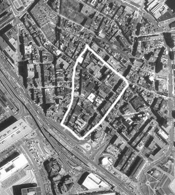
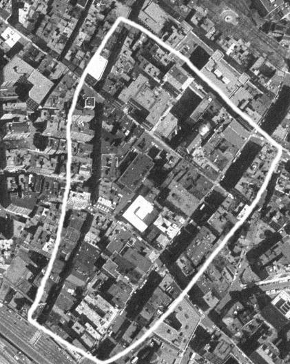
I assume that the North End has a different "feel" today than it did when my great-grandparents first moved there from Italy, and part of what prompted me to choose this site was to get an idea as to how the North End has evolved into what it is today. The area that I am looking at is enclosed by North Bennet and Cross streets on the north and south, and by Hanover and Salem streets on the east and west. More realistically, however, the boundary of my area on the south is the highway and areas of construction, part of the Big Dig.
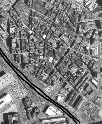
This separation to the south of the North End is interesting for a number of reasons. The North End has been physically divided from the rest of Boston since the construction of the Central Artery/I-93. The highway physically, visually, and mentally separates the residents of the North End from downtown. However, once the Big Dig is completed, this highway will be put underground, reuniting the North End with the rest of Boston. I am curious to see what kind of impact this has on the North End, whether it will retain the same qualities that it does now once the physical separation is gone.
The division of the North End from downtown has allowed it to develop its own unique culture, by keeping the inflow and outflow of people to a minimum. It has been a predominantly Italian-American neighborhood since the 1920s. Though there have been other immigrants groups that have settled in the area, there has not been a great deal of mixing in the neighborhood. It would be interesting to note how the ethnicity of the residents has affected the development of the neighborhood over time.
The area of the North End that I am examining contains two of the main streets that run through the North End, Hanover and Salem streets. The two run almost parallel to each other from where they begin at the Central Artery until the run into the waterfront. Hanover Street is a two way street, while Salem is one way. Hanover St. is the better known of the two, it being the street where Mike's Pastry and many of the other most popular restaurants are. The land use on this street is a lot of commercial, generally eating establishments, bars, and small grocery stores. Above the stores are apartments that generally take up the remaining two or three stories of the buildings. On this stretch of Hanover Street, there are not any purely residential buildings. Hanover Street is fairly homogenous in that it contains an even mix of restaurants and upper floor apartments throughout the stretch of the North End that I am examining and does not switch back and forth between commercial and residential land use on the street level.
One street over, on Salem Street, there is a slightly different look and feel. If Hanover St. is the main show, Salem St. is the opening act. It is a smaller, more intimate version of Hanover. The street is narrower and one way, restaurants are not as tightly packed, and there are more strictly residential buildings. Salem St. also seems to me to have the resident of the North End in mind, as there are more small grocery and specialty shops, a hairdressers, doctor's office, hardware store, meat shops and other office type spaces. There is an interesting change in land use where Prince Street, which runs perpendicular to both Hanover and Salem, intersects Salem. Before Prince Street, there is a fairly homogenous mix of restaurants, specialty grocery stores, and apartment houses. However, once you cross Prince St., it becomes mainly residential. This is very different from Hanover Street.
I'm curious to find out why these two streets have developed such different "feels" over the years. One to me seems to be geared towards the toursist, while the other towards the resident. When was the distinction between the two made, and why was it made? Maybe there are clues as to why this is so in the layout of the streets or buildings, the types of people who settled on each of the streets, or perhaps it just happened that way.


