| Natural Processes: |
|
|
|
| Massachusetts Avenue
and Main Street |
|
|
| |
|
|
| People cannot simply create cities. They may help shape
them by pushing in one direction or another. They may be able to move
land and raise it out of water, but they need a place to start and a reason
to continue. Larger forces play a role in the development of human communities
than the beings themselves. Original landforms profoundly impact the location
of settlements and their movement, and the native climate and wildlife
do not simply disappear when humans appear -- at least not quickly or
willingly. This development is a continuous process, a compromise between
human and natural preferences -- perhaps an unfair one, but a compromise
nonetheless. Cambridge Port was not exempt from this reality. It is truly
at an intersection, not just of streets but also of land and water and
of human construction and natural processes. |
|
|
| |
|
|
| |
Original Landscape |
|
|
| |
|
|
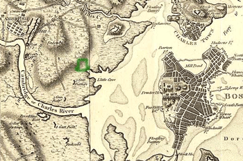
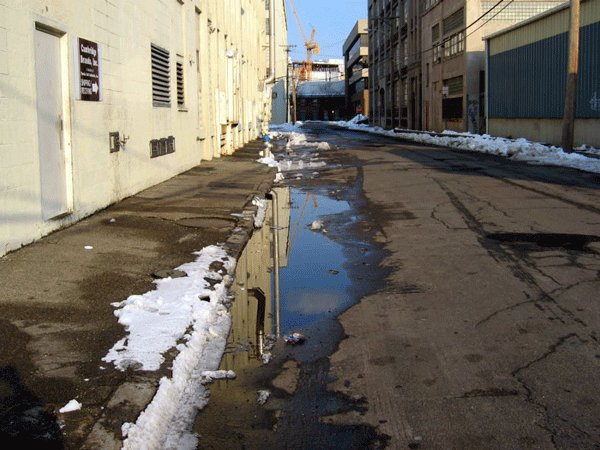
| Despite its original name, what was once Cambridge
Port does not appear to have developed as a stereotypical port. While
it was situated along the banks of Little Cove, just off of the Charles
River, those banks were swampy and anything but ideal for transportation
and shipping like those of Boston or for military protection like those
of East Cambridge. Rather, the land around the cove decided the settlement’s
location, at the point most convenient to West Cambridge and Boston. Designed
as an extension of the West Boston Bridge, Main Street hugged the banks
of the river as closely as possible while still remaining on land. Its
Front Street ran perpendicular to the water and was not lined with wharves
or docks. In fact, only a short time after the intersection was established,
the Union Railroad blocked any direct access to the Charles River when
it was build across the swampy river banks. The most distinguishing feature
of this site – the one that lent itself to be used as an intersection
between existing communities -- was that it was on dry land. |
|
|
|
|
|
|
Boston,
and its Environs [map]. Circa 1800. Scale not given. Archiving
Early America. <http://earlyamerica.com/earlyamerica/maps/bostonmap/bostonmap.jpeg>
(March 2004).
|
Boston, its environs and harbour, with the rebels
works raised against that town in 1775, from the observations of Lieut.
Page of His Majesty's Corps of Engineers, and from those of other gentlemen.
[map].
1775. Scale not given. American Memory. <http://memory.loc.gov/cgi-bin/map_item.pl>
(March 2004). |
|
|
| |
|
|
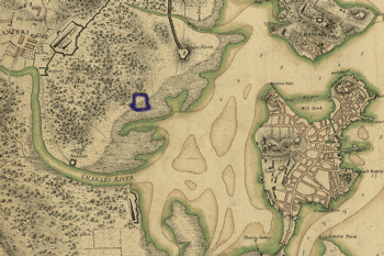
| How far removed this area was from the surrounding swamps
is not readily obvious, however. The Boston area is a large basin, created
by earthquakes and shaped by a massive glacier (Spirn 14). When “the
land of the basin sank, […] the sea flooded the valleys,”
but left the hills and drumlins that the glacier had formed (14). While
the corner of land defined by the curve of the Charles River was not a
drumlin, early maps of Boston show that it rose distinctly above the water
and swamp levels into a hill or plateau (Boston, and its Environs).
Sometimes its base appears closer to the Charles River than others, suggesting
that Cambridge Port perhaps rested partially on it and not in the swamp. |
|
|
| |
|
|
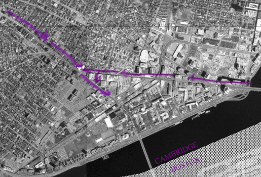
| Not only would such elevated placement have been logical
at the time (protecting this important road and later street car route
from flooding), but its position is also evident today. The path from
Central Square to Harvard Square along Massachusetts Avenue is distinctly
downhill. Central Square is situated slightly higher than Lafayette Square,
where Main Street intersects Massachusetts Avenue, so it too must have
shared this higher elevation. However, the other side of the original
landform is better hidden within an artificial mold. In 1858, when Boston
began filling its surrounding bays in order to support a growing population
and demand for land (Spirn 18), its northern neighbors soon reshaped their
shorelines as well. Cambridge Port filled the river past the Union Railroad
and, except for a constructed slope down to the water’s edge, effectively
covered or reconstructed the original shoreline’s shape. Although
now disguised, the hill did exist and guaranteed that Cambridge Port was
the most natural connection between Boston and West Cambridge. |
|
|
| |
|
|
| |
|
Cambridge
[map]. Produced by the Metropolitan Planning Council GIS Lab. 1995.
|
| |
Air Flow and Pollutants |
|
|
|
| |
|
| The streets themselves no longer simply link
two communities, but their air as well. Boston’s proximity to the
water makes it particularly susceptible to winds, so much so that it “rivals
Chicago for the title ‘Windy City’”(Spirn 28). Main
Street, a wide, building-lined stretch helps channel the eastern winds
off of the water and direct them into the center of Cambridge. Unfortunately,
they do not come alone, but carry industrial air pollutants and car exhaust
as well. Massachusetts Avenue, its width, and its buildings corral the
northern and southern air flow with equally impressive power. Yet even
though the two currents intersect at a shallow angle, they do not necessarily
flow into one another. Instead, where these winds collide, they slow into
“swirling masses of stationary air which trap and concentrate pollutants,
rather than dispersing and diluting them” (51). So this area is
not simply a street intersection but also an intersection for pollution
from the heavy traffic on Massachusetts Avenue and the industries surrounding
Main Street. |
|
| |
|
| These two major streets are subjected to the harshest,
most direct currents, but the flow of air and airborne pollutants is not
so limited. Smaller streets and parking lots break up the wall of buildings
on the northern side of Main Street, whereas the longer block and taller
buildings on the southern side constrict the air’s movement. To
the north, on Bishop Allen Drive is a triangular plot almost identical
to and probably planned by the same group as the “pitiful park”
in Central Square that Anne Whiston Spirn describes in her book, The
Granite Garden (58). Although this intersection is not as busy, it
is almost as unhealthy a location as Central Square. Positioning it on
the other side of the street would have been worse, however. The wind
that flows over the large industrial buildings to the south, notably the
Tootsie Roll Industries, Inc. factory, picks up whatever waste particles
come out of their giant smoke stakes and drops them onto State Street,
creating a polluted “street canyon” from which they have little
chance of escaping (56). Whether from neglect or air patterns, debris
collects along the sides and allies of this street. Its only regular traffic
consists of trucks, but their drivers contribute to the problem by idling
their engines for extended periods of time while they load or unload.
The best evidence for the unseen air pollution is olfactory. While the
air actually smells like candy sometimes even blocks away from the Tootsie
Roll Industries, Inc. factory, the artificial sweetness is probably not
the factory’s only contribution. Channeled by these long, straight
streets, the air from Harvard Square and eastern Boston connect the area
and people around Central Square even more fundamentally than the streets
themselves could have. |
|
|
| |
|
|
|
|
|
State Street
from Mass Ave |
|
Vegetation |
| |
|
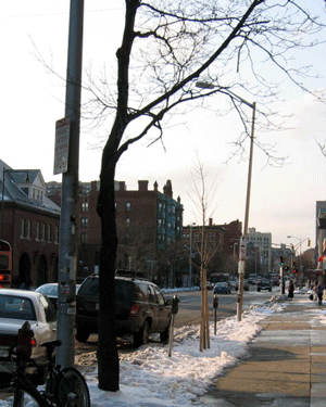
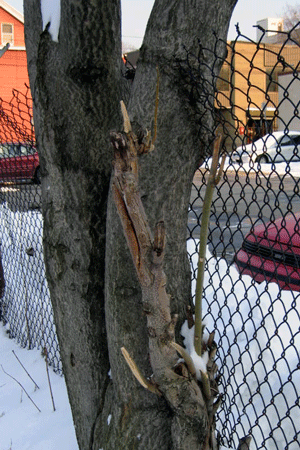
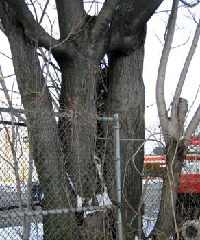
| These directed gusts of wind and concentrations
of pollutants have as much of an effect on the city’s wildlife as
on its human inhabitants. Nothing can survive on Massachusetts Avenue.
The one section between State Street and Main Street boasts two trees,
one dead and the second recently transplanted. Although “the average
lifetime of a street tree planted today may be only ten years” (Spirn
171), the future of the newer tree will very likely be even more grim.
With little sunlight, less soil, and drenched, heavily packed soil, it
does not have much of a chance. The street trees on Main Street are hardly
fairing better, but they are alive. One curves away from the high traffic
street at its base, but its branches reach back towards it, seeking light.
Even the evergreen bushes in planters outside of La Groceria are not well
situated. The one on the left is directly beneath the edge of an awning
where it is subjected to such increased rainfall that its roots are probably
downing. |
|
|
|
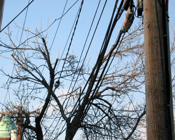
| Similar limitations restrict the growth of trees on lesser
streets as well. The trees along Windsor Street are slowly dying, but,
in contrast, they seem to have established themselves fairly well and
even broken through the pavement in some places. The street is not as
wide, so they may have been able to take advantage of the open, grassy
area on the other side. They are also on the eastern side of the buildings
and are not blocked by a tall complex. However, the street does not have
suitable drainage, certainly nothing capable of handling a pile of melting
snow, and their roots must be rotting like those of the unfortunately
positioned potted shrub. In addition, the city must have overlooked their
proximity to the telephone poles or not expected them to last as long
as they have. While the birds do not seem to mind this mess, if they tangle
themselves much more, even the living ones will have to be cut back. And
that could prove to be too much of a blow to their delicate existence. |
 |
| |
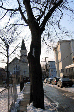
| The few street trees that seem to be thriving
are situated in the more residential areas where a space has been cleared
for a parking lot or left vacant for someone’s back yard. The difference
is much more than noticeable; it is really quite impressive. But these
are rare. In the compromise struck between the street trees and man along
these high-traffic areas, the street trees are not winning. |
|
|
| |
| |
|
street tree by open parking lot |
birds, trees, and power lines on Windsor Street |
|
|
|
|
| |
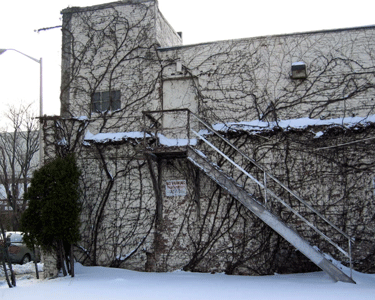
| However, in nature’s struggle against man’s
negligence, at least in these few blocks, there are at least two types
of plants that are not just surviving, but thriving. The first is ivy,
which benefits from the wire fences that separate every yard and the fact
that it is accepted and useful. If provides a barrier between neighbors
and a creative way to cover a blank wall. The other plant can most easily
be described as a survivor. The tree-of-heaven (Ailanthus altissima) “gives
up in strength, longevity, and elegance what it gains in fast growth and
hardiness. It is a messy tree with coarse silhouette and vile-smelling
male flowers” (Spirn 182). And it must be difficult to kill. It
grows along every fence line and every building, particularly beside parking
lots where sunlight is available, but it is not especially discerning.
They weave in and out of (and encompass, if no other option is viable)
fences if snowplows push them in the way; they grow together into one
enormous tree or sideways if necessary; and they demonstrate all of these
configurations multiple times within only a few blocks. The tree-of-heaven
provides the truest example of nature’s relationship with the city.
The natural processes may be disturbed, but they will not be tamed, nor
will they disappear. |
|
|
|
|
| |
|
|
|
|
|
| |
| |
| |
Clement G. Morgan and Pine Street
Parks |
| |
| Even parks are not exempt from this struggle, because for
many of them, the outward appearance of a natural space is not enough
to make it a reality. The neighborhood on this corner claims two of Cambridge’s
city parks, Clement G. Morgan Park and Pine Street Park. They are adjacent
and form an L-shape of open space between Columbia and Pine. The land
is gently sloped, with the highest corner at the southwest bend. Perhaps
this shape gradually developed as the winds across the open ends of the
park moved soil toward the one shared corner. In support of this theory,
snow does pile higher in this one corner, and a row of evergreen trees
was planted across one of the legs of the L, ostensibly to prevent such
winds. Curiously, even though the park has been open for over ten years,
many of its trees, including the one on top of the small hill, are no
taller than the ones that line the streets. Anne Whiston Spirn argues
that “density of city soils is one of the primary reasons for the
demise of trees in city parks and streets” (105). This probably
explains the youthful appearance of the Clement G. Morgan Park. In 1950,
the area was a gas station and motorcycle dealership, so not only was
the soil beneath it well packed, but it was probably also liberally coated
with gasoline and oils. The hill in the park hides the exact spot where
the pump had stood just decades earlier. This fact probably had more of
an effect on the shape of the land than any recent gusty breezes did.
|
|
|
|
|
Public
Parks and Playgrounds: Cambridge, MA [map]. Community Development
Department. January 2004. |
|
|
|
| |
| When human influence hides beneath what should be or what
could be natural, like the Clement G. Morgan and Pine Street Parks, the
effect is not artificial. Rather, it is simply a different kind of natural:
the result of an interaction between what is human and what is not. The
ability to affect natural processes is a strong one, but it cannot compete
with the forces themselves. People should not depend too heavily upon
the resilience of the natural environment in the face of their demands.
Where would they be without the tree-of-heaven? If it can no longer survive,
nothing can. |
| |
| |
| Spirn, Anne Whiston. The Granite Garden: Urban Nature
and Human Design. Basic Books. 1984. |
| |
| |
| |
|
Back to "The City" Class Site
Home
|
|