Brookline Street and Memorial Drive
Brookline Street and Memorial Drive
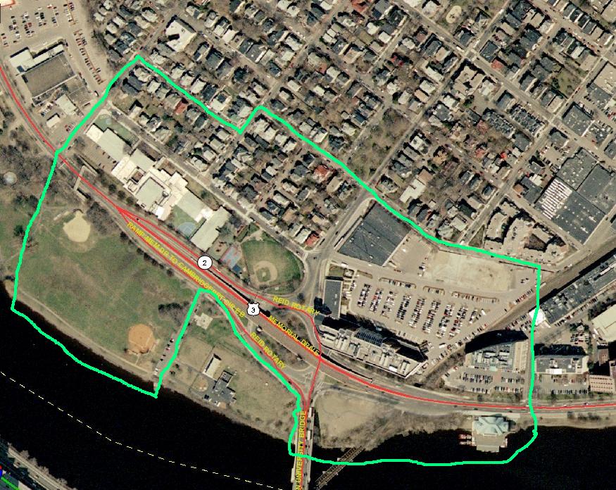
I have selected a site in Cambridge between MIT and Harvard. It runs from Vassar Street to Magazine Street, across Brookline Street, going from the Charles River to two blocks inland. This is a seven block site, six of which are on solid ground and Magazine beach being the 7th block. I have been to this area several times but have only once gone North of Memorial Drive. I was curious what there was to be found behind the initial buildings facing Memorial Drive. Now I will explore that area in depth.
I think that this will be a good site to study because it is an intersection of many types of area zones and contains several prominent features. There is an overpass where Brookline Street meats Memorial Drive, train tracks, two bridges, and a school. There are also modern Industrial buildings right across the street from a residential area and a small commercial area. With all these different features I think that there will be plenty of information to research.
I am on the MIT crew team and see this area from the river every time I row by it. On the river this area is marked on the east side by Boston University’s Boathouse and on the west by the Riverside Boathouse. Magazine beach is also the site of the annual Head of the Charles regatta, one of the largest rowing regattas in the world. I can see this site from a distance almost every day while the river is thawed, but I know almost nothing about it.
I know that much of the river front land in Cambridge including the MIT campus was claimed from the Charles River, but I do not know how or to what extent this happened at my site. Just from initial inspection a trend can be seen in the age of the buildings with the oldest being the houses located the farthest inland and newer buildings closer to the river. So I know that my site has grown with time, but I wonder if there were also buildings which were demolished to put in the new industrial technology buildings. I also think that when ever two different land uses zones meet that there may be conflict or at least interactions of some kind between them which should be interesting to observe.
I chose an area of seven blocks to be sure to get in some of each type of development. Three of the blocks are large and four are small so I think that it will be a very nice sized peace of land to work with. None of the past projects for this class on the web that I have seen studied this site so it will be new research in that respect. The Charles River was my most obvious boarder on one side and Vassar Street basically marks the end of MIT affiliated land in this direction. My site is close to campus and will offer an easy commute but I also wanted it to be clear of any MIT controlled land. To the north of my site extends a large housing development but I feel that the peace of it that I have included will be sufficient to study it. The western boarder was set just to keep my site within the suggested manageable size of eight blocks.
I think that this site has many features that will be interesting to research. The diversity in the types of regions found here will give me a chance to apply the skills I will learn in 11.016 to the different types of areas found in a city. This will give me a chance to learn more about a site that I am familiar with but have not yet been able to explore.