Assignment 4: Artifacts, Trends, Traces and Layers
Throughout any urban landscape, one can learn about the history of a site by observing the architecture and noting the clues that the environments give away. Given that it is marked as a historical district, Bulfinch Triangle is rife with such links to the past, with many older structures, like tenements converted from industrial buildings. Despite the preserved details of the past, the Bulfinch Triangle has constantly transformed architecturally to meet the needs of its inhabitants. Parking spaces allude to the changing importance of transportation in the Triangle, while prevailing structures like the Suffolk Co. Sheriff’s Office show the far-reaching effects of the initial street-layout in an urban setting. Advertising methods and reconstruction illustrate how certain driving forces and trends continue to prevail through the centuries. Finally, the complicated puzzle of the buildings themselves that have survived, wholly or partially, through the years provides insight into how the inhabitants of a living space alter their environments to their requirements. By examining the artifacts, trends, layers and traces of the architecture of the Bulfinch Triangle, one can piece together the patterns and features that make up the history and the future of the site.
Parking Spaces
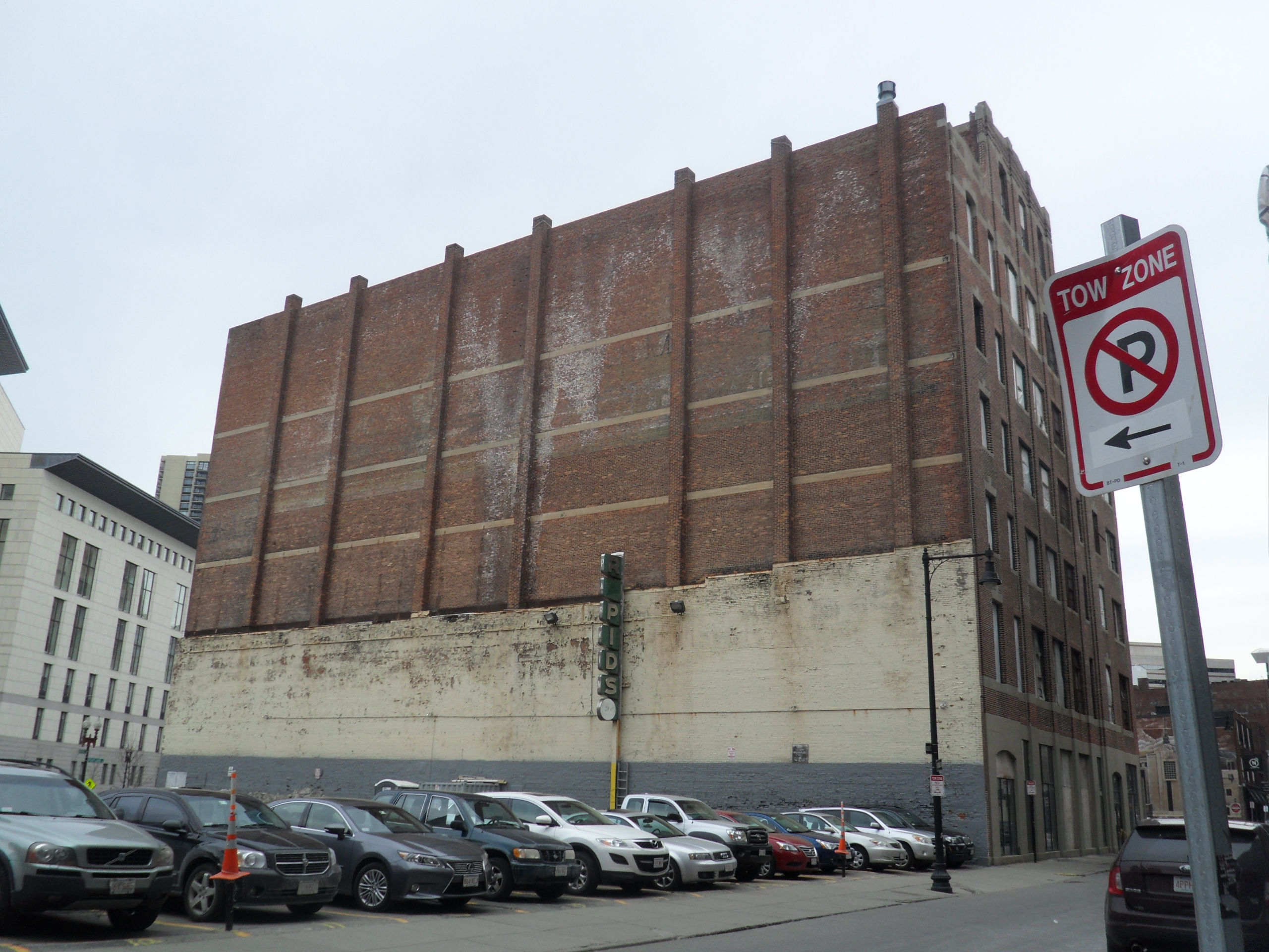
The structural supports and lack of windows indicate that the building that previously occupied this parking lot was most likely as tall as the remaining building, even if the wall remnant only climbs a third of the way up.
Bulfinch Triangle today has a parking lot around almost every corner, with most of them having been in place since at least the 1950’s. Although the lots today are filled with modern automobiles, the age of the RAPIDS sign in the Merrimac-Friend St. parking lot along with the weather-beaten walls of most of the other parking hint at the fact that many of them have been part of the site for over half a century. While they may seem like a modern eyesore introduced by the monstrosity that is the automobile, the need for transportation has always existed in the Triangle, with many of the parking lots tracing back to horse stables from at least as far back as the turn of the 20th century. These parking spaces are a trace of Bulfinch Triangle’s past as a transportation hub for horse-borne vehicles, and demonstrate the significant role that transportation has played in the development of it over time. While this site continues to provide for people’s transportation needs, the focus has most certainly shifted from transporting people to and from a train station to providing parking for the TD Garden sports stadium. The trend of switching from horse-drawn vehicles to automobiles was most certainly a national trend, reflecting how revolutionary the automobile was to American lives, while the change from transportation to sports is most likely a more local change, spurred on by the modernization of Boston’s public transit system.
Breaks and the Suffolk Co. Sherriff’s Office
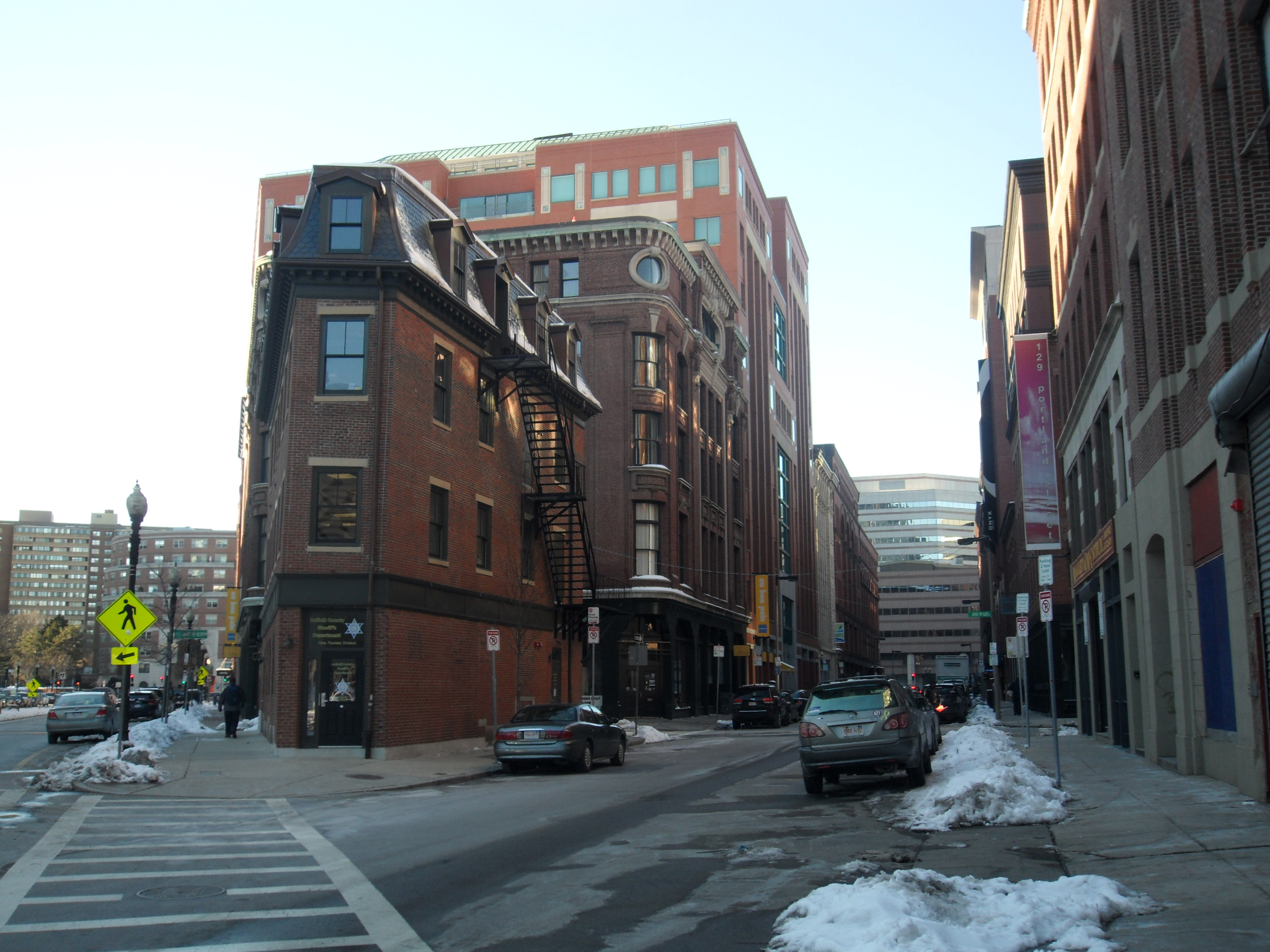
Bounded by streets on all three sides, the Sheriff’s Office remains a very visible and accessible location.3
While the structures in the Bulfinch Triangle have been built, torn down, rebuilt, and modified many times over the 200 years since it was first back filled and laid out, there is one building whose footprint has been present since the 1867 Sanborn map, and likely since the Triangle was first built. Maps up to the 1950’s mark it as a store, although it now serves as the Suffolk Co. Sheriff’s Office: Civil Process Divisions. Grady Clay discusses in Close-Up: How to Read the American City how triangular breaks in the gridiron of street layouts create opportunities for increased traffic and accessibility1 , which I believe is the main reason why this site has remained to this day. As a store, the triangular block it inhabits by itself would allow greater entrance and visibility to the building than normal. The newer Bulfinch Hotel farther north up Merrimac is also favorably located in a similar vertex of a diagonal street and the regular gridiron, although it has only had its modern-day foot print since the 1929-1951 Sanborn map. Regardless, the hotel, and the liquor business before it, appears to have prospered due to its location, as it has newer upper floors and still survives to this day, in contrast to its neighboring buildings that have not stood the test of time. What is more uncommon about these artifacts than the examples discussed in Clay’s book is the fact that this area was planned out from the beginning as a triangle, which has probably contributed to these two buildings having had a higher intrinsic value due to accessibility from the start. These two sites demonstrate how the initial conditions of the establishment of streets can have a large impact on what buildings, and the businesses within them, thrive and survive the test of time.
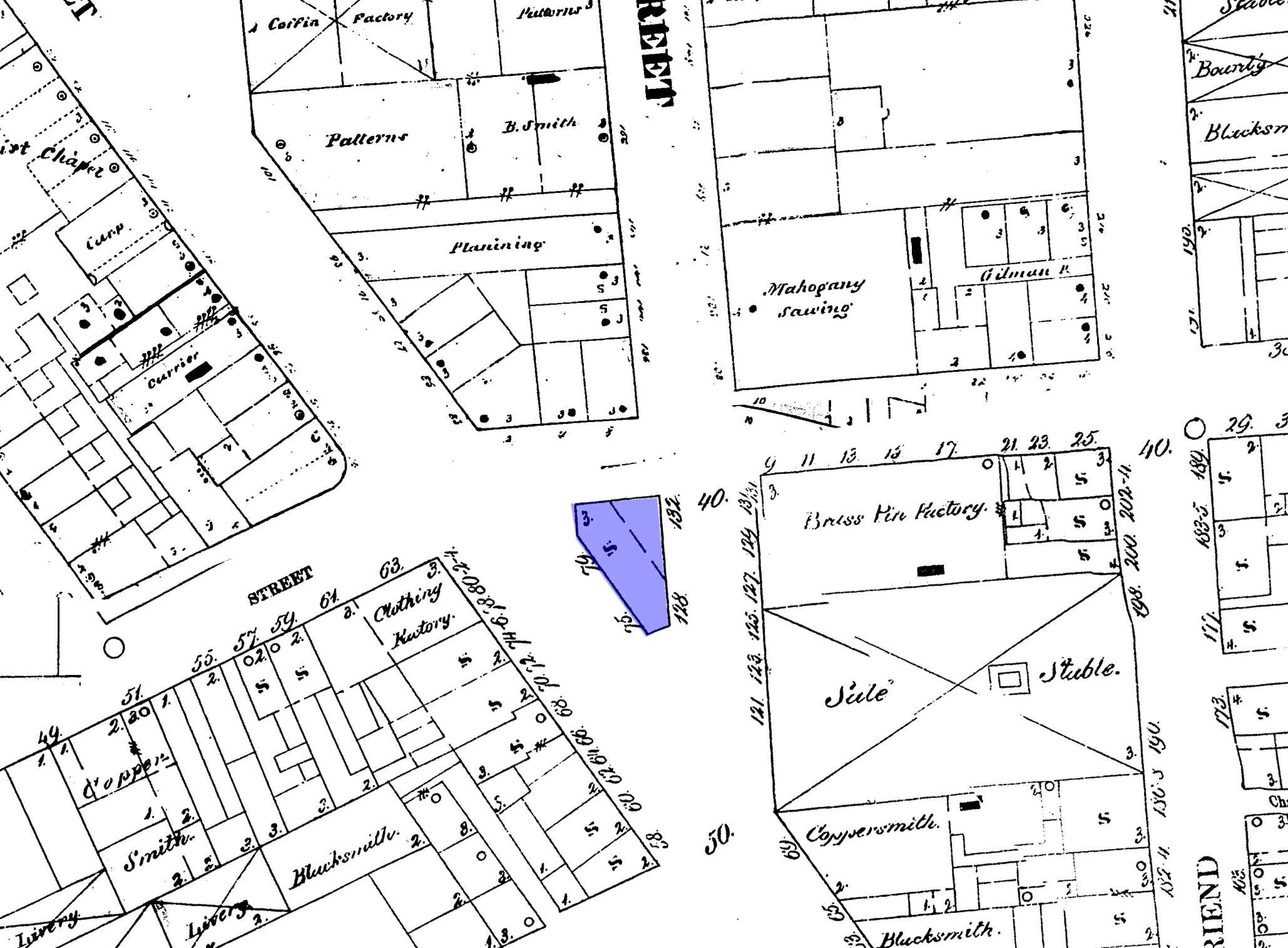
1867 Map of the Bulfinch Triangle with the site of the current Suffolk Co. Sheriff’s Department: Civil Process Division marked in blue. The building’s footprint has not changed over the course of 150 years. Composite map of Plates 5 and 6 of the collection, annotations by author. 2
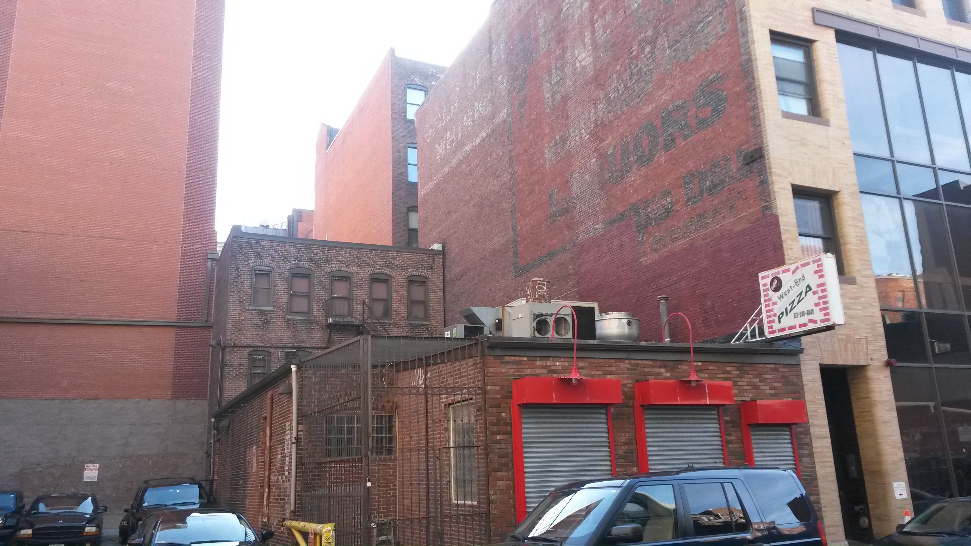
Billboards and Advertising
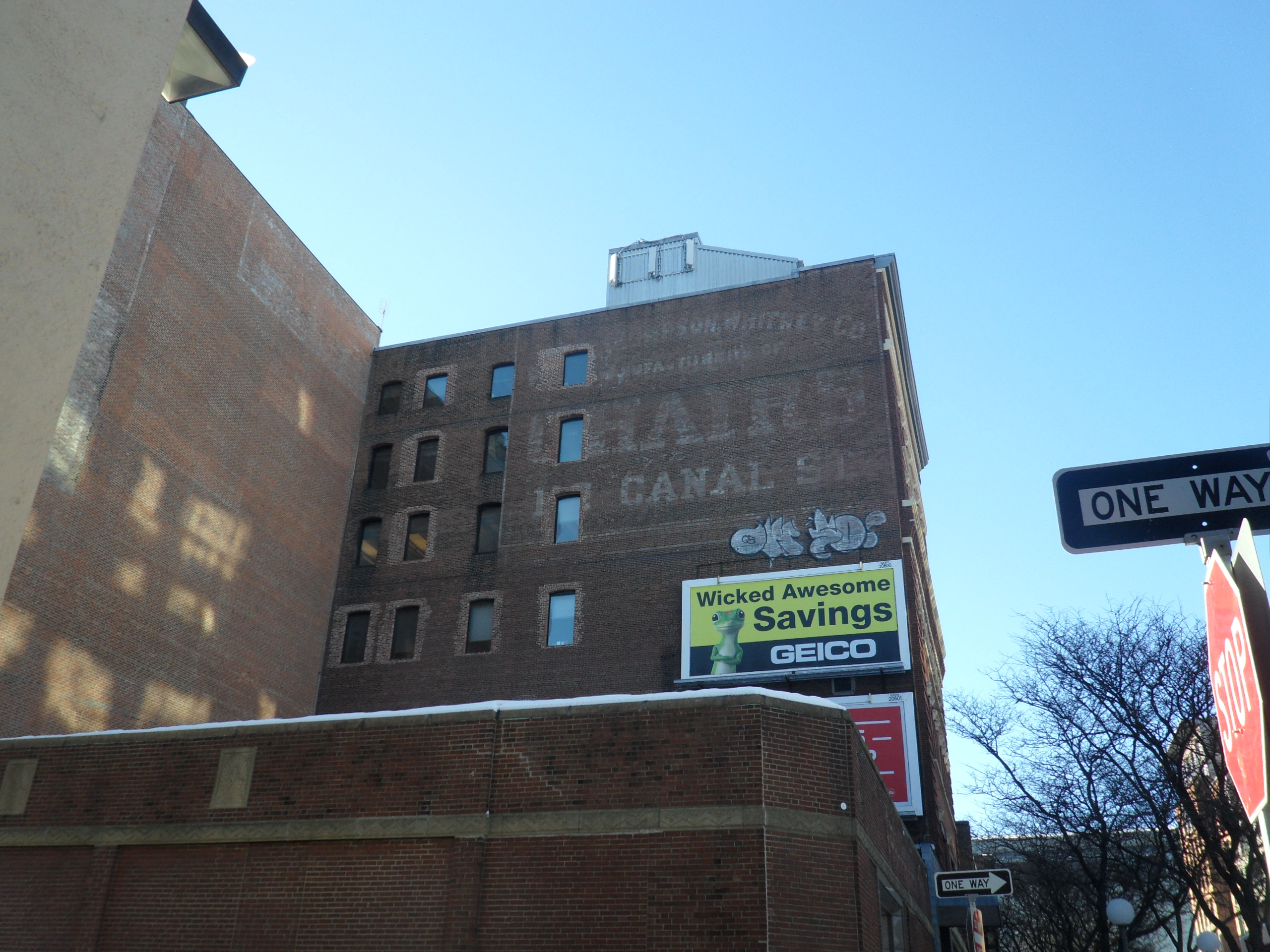
While technologies and times may change, the need to sell goods lives on, as shown by this 20th century advertisement for chairs flanked by more contemporary billboards.
Much like the rest of the older parts of Boston, there are faded, washed out wall signs advertising goods throughout the Bulfinch Triangle. Whether they survived to this day due to owners not investing the money or effort to have them removed, or genuine attempts at conservation, they provide a very visible trace of the past, giving hints at the types of products that were marketed, and their intended audience. The barely-legible signs in the Bulfinch Triangle advertising liquor, chairs, and lumber are traces of the past, showing the vitality of the site, especially in moving goods. These advertisements show the continuing importance of traffic (especially on foot) through the Bulfinch Triangle, especially when taking into account that many 19th century signs have modern billboards next to them. It signals which streets were important at the time and continue to be important today, while the old advertisements that sit by themselves hidden away in alleys mark where streets are considered less important and less heavily traveled.
Reconstruction
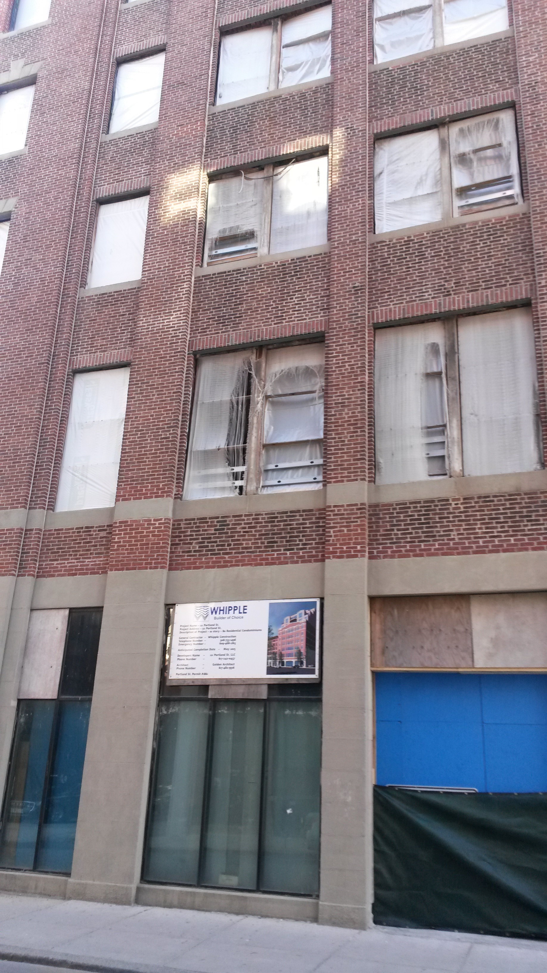
Boarded-up, vacant-looking building with a sign announcing the builder chosen for its renovation.
There are a handful of areas throughout my site that show signs of being rebuilt, renovated, or otherwise physically revitalized with modern construction efforts. Some buildings are draped in scaffolding and safety nets, while one in particular appears to be a vacant, boarded-up building with a sign announcing that a builder had been awarded the contract for that project. This trend hints that the site continuous to be economically viable despite the age of the architecture, with the renovation a visible marker of the site being continuously updated to fit the needs of the period. While there are certainly many complex factors that decide which buildings are rebuilt, updated, or left alone, one of them is likely to be which sites are more heavily trafficked, as the more out of the way portions of the triangle tend to have less well maintained, older architecture. The fact that the Bulfinch Triangle is a historic district will most likely prevent any sort of wholesale destruction and reconstruction of the buildings, but changing economic needs and the march of time will inevitably ensure that the site will continuously change over time and remain a hodgepodge of buildings from different eras nested within each other. This continuous process of reconstruction is also present on the older maps of the site, with many small changes happening to individual blocks between each era.
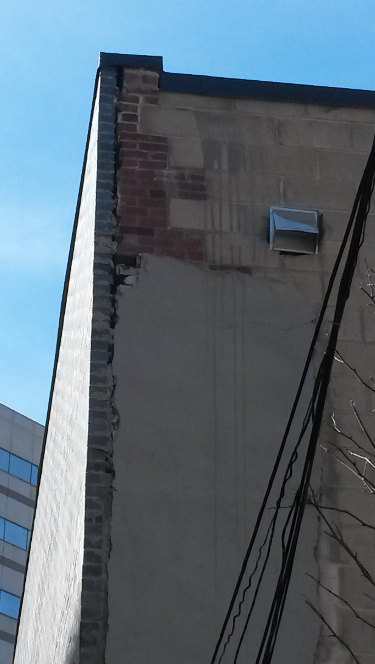
Multi-layered buildings
The older red brick and wall signs give away the age of the building with the beige-bricked façade to the right, while the smaller tenement in the middle is flanked by two newer buildings that dwarf it in height.
Many of the buildings in the Bulfinch Triangle feature a newer façade dressing up an older building with either a cleaner or more modern look. The facades often create vertical layers in the buildings that line the streets, with facades at the ground floor contrasting with the older upper floors. Such an arrangement caters to both foot traffic and people travelling by car, with the updated ground floor facades often housing bars and restaurants to cater to sports fans heading to or from the nearby stadium. Aside from providing evidence of how the purpose of the site has adapted over time, facades are also an interesting marker of the relative age of a building, as they often do not cover more than just the street-side wall of a building. Several of the buildings throughout the site also had what appeared to be upward extensions built upon the older architecture, creating a third vertical layer that gives evidence of which particular buildings have had enough financial success to expand their space. Unsurprisingly, many of the buildings that have been expanded are bounded by streets that get heavy foot traffic, supporting the notion that street access is an important factor to the financial success of a businesses. In the gated back alleys, one can find traces to the older architecture of the site, such as windows that no longer see sunlight, bricked up doors and windows, and patchwork repairs of a different material than the original material of the building. These additions and modifications to buildings trace how previous owners have manipulated the environment around them in order to best suit their needs, and how they have extracted additional utility from buildings that had different intended purposes.
The back of this building shows signs of having been rebuilt, with red brick peeking out from underneath cement and a newer skin of gray bricks.
Throughout much of the Bulfinch Triangle, the white outlines of old torn down buildings are visible, ghosts of past structures. In addition to providing an eerie, dramatic backdrop to the historic site, they also offer hints about the surviving buildings, and the space the building once occupied. From facades to fading outlines of buildings long gone, these architectural anomalies reflect the fluid, temporal nature of the structures that inhabit the Bulfinch Triangle, along with every other city in the world. While catastrophic changes like natural disasters or large scale construction projects can completely wipe out the personality and history of a site, change has always been present in the development of an urban site as the inhabitants adapt to changing economic conditions.
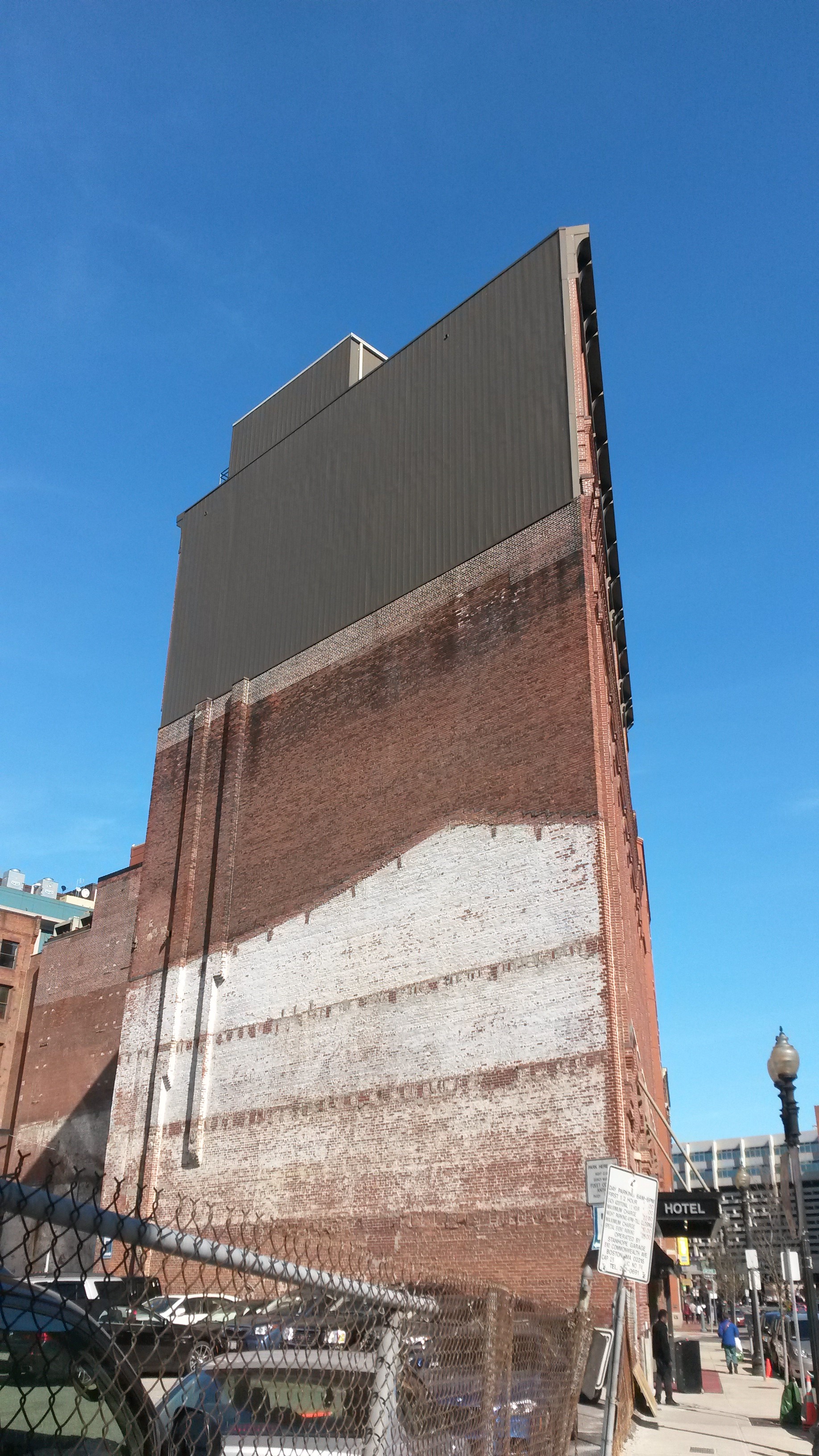
This picture is a cross-sectional view of both the side of the Bulfinch Hotel and its history. The upper floors show signs of newer construction and expansion, while the obvious outline of a long-gone building is a trace from before the parking lot was established.
In exploring the Bulfinch Triangle, one can get a sense of the conflict of two opposing forces that underline the development of older urban sites such as this one. Along with the rest of older Boston and surely many other cities like it, the need to survive and thrive in changing conditions and thus the demand to optimize living spaces to fit those needs, and the desire to preserve and protect the historic and the past. Even in the Bulfinch Triangle, which has been specifically protected through the years by both luck and scholarly decree, practical needs and aging structures ensures that the site will continue to change and evolve over time.
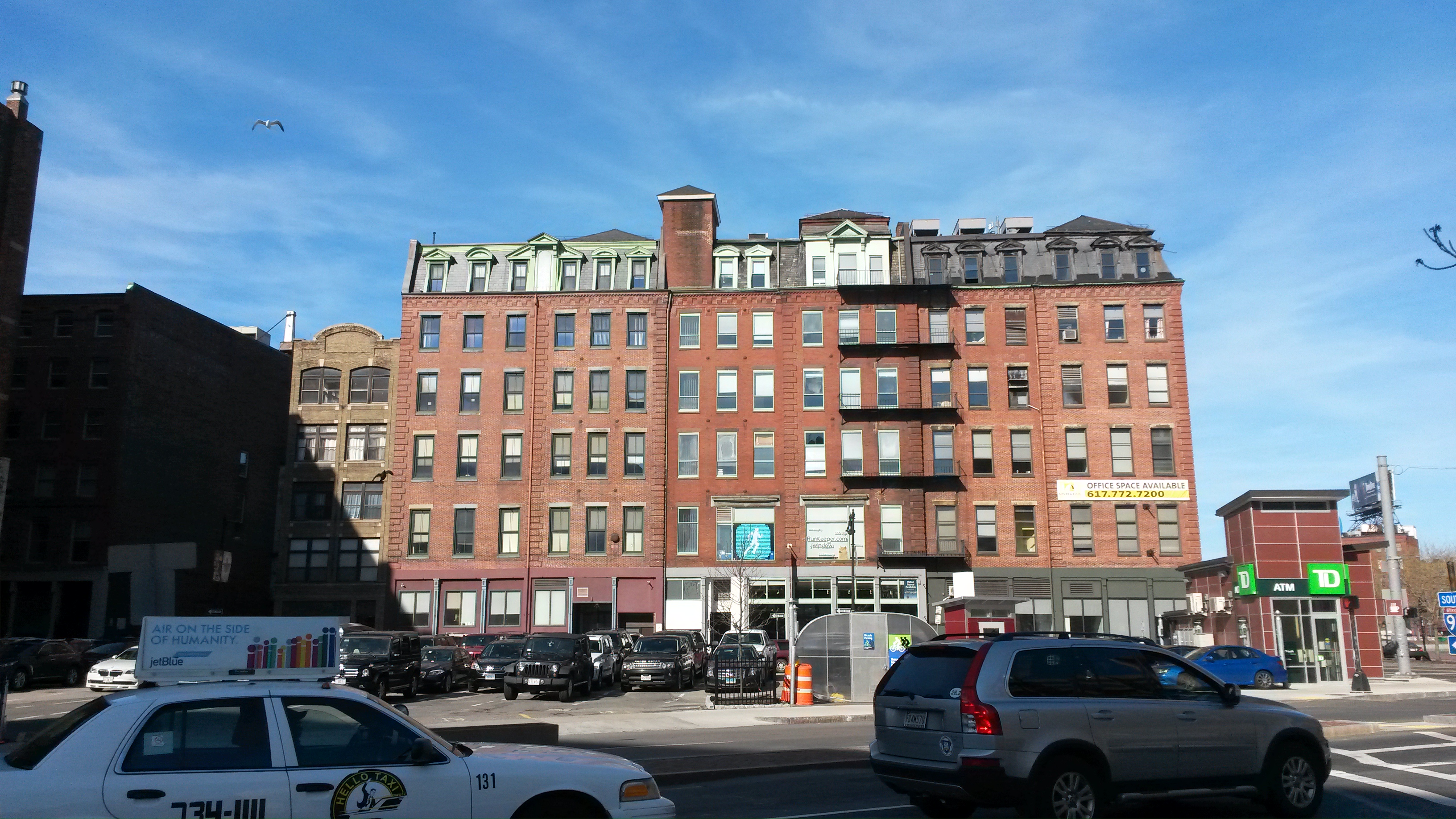
While the upper floors of these buildings show their age, the ground floors are quite modern and do not reflect the style of architecture of the floors above.
1 Clay, Grady Close-Up: How to Read the American City The University of Chicago, IL. 1980, 42.
2 Sanborn Company. Insurance Maps of Boston, Massachusetts. New York. Map. 1867. http://sanborn.umi.com.libproxy.mit.edu/ma/3693/dateid-000001.htm?CCSI=254n
Bibliography
Clay, Grady Close-Up: How to Read the American City The University of Chicago, IL. 1980.
Hayden, Dolores, The Power of Place: Urban Landscapes as Public History (MIT Press), 14-43, 226-238
Massachusetts Institute of Technology Department of Urban Studies and Planning. The West Philadelphia Landscape Project. http://www.wplp.net.
Sanborn Company. Insurance Maps of Boston, Massachusetts. New York. Map. 1867. http://sanborn.umi.com.libproxy.mit.edu/ma/3693/dateid-000001.htm?CCSI=254n
Spirn, “The Yellowwood and the Forgotten Creek,” in The Language of Landscape (Yale University Press)