How do you begin to look at a city? How do you begin to understand the intricate workings of what is going on both on and below the surface? What are some of the important features you need to look at in order to understand a place and the group of people that use it? These are just some of the questions I began to ask myself, when choosing my particular site.
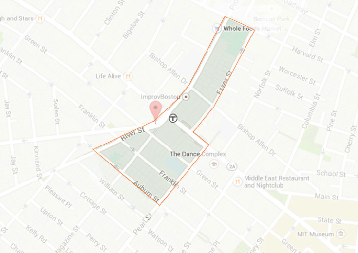
 Site Map - Site Includes: River Street, Pleasant Street, Harvard Street, Essex Street, Massachusetts Avenue, Pearl Street, and Auburn Street. Google Map Data, 2015.
I wanted to study a site that catered to a number of user groups at once, and a site that would allow me to look at a range of residential, commercial and transportation uses. Cambridge provided this diversity. I began by studying the surrounding commercial space types, identifying the commercial spaces that might be used by the largest user group – i.e. a pharmacy or super market. A pharmacy and a supermarket cater to the basic necessities of the community. I also took into consideration, access, and questioned just how accessible said site would be for all user groups. Within the parameters of our Cambridge site, I identified four commercial zones: Central Square, Kendall Square and One Kendall Square (Broadway), Area Four (Main Street), and The Cambridge Side Galleria. Of these commercial zones, Central Square was the most accessible in terms of transportation, and provided two Pharmacies - a CVS Pharmacy and Walgreens and two food markets: Whole Food and Harvest Food Market.
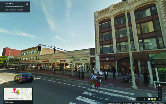
 Street view of Massachusetts Avenue CVS Pharmacy side, Image: Google Maps Street View, 2014.
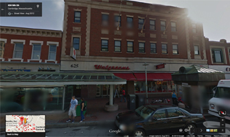
 Street view of Massachusetts Avenue Walgreens Pharmacy side, Image: Google Maps Street View, 2014.
The pharmacies are two particular points of interest to me. Walgreens and CVS sit in the center of my site, along Massachusetts Avenue. Walgreens is open until midnight, and sells everything, from basics like toilet paper and diapers to DVDs and canned food. In front of the store entrance, the sidewalk narrows, a bus station on one side. The small bus station, which, throughout the course of the day is occupied by people waiting for the bus, is, some night’s, occupied by homeless individuals who sleep on the benches, wrapped in blankets, and surrounded by their belongings. Buses leaving from Central Square extend out toward Watertown, BU medical Center (South-End, Boston), Franklin Street (Financial District, Boston), Broadway Station (South Boston). During the higher traffic times of day, between 8am and 8pm, someone is always standing outside the Walgreens door, a small cup in hand, asking for spare change.
Diagonally across the street is a 24 Hour CVS. The sidewalk space on this side of the street is wider, but no less congested. A Central Square train station entrance is a few meters from the entrance of the store. Fewer people stand directly outside CVS. Instead they choose the small park to the right of the store. The bus station on this side of the street is situated further from the CVS entrance, and therefore pulls some of the congestions away from the store entrance.
Walgreens, CVS, Harvest, and Whole Foods, are not the only commercial spaces in the area. Central Square offers a great quantity and diversity of commercial spaces, and it is the quantity and diversity of these spaces that was also important. In fact, this small portion of Mass Ave, includes, Bars, Restaurants, Cafes, Liquor Stores, 24-Hour Convenience Stores, Clothing and Shoe Stores, Art Supply Stores, Gyms, and Banks.
These commercial spaces, can offer us a great deal of information when it come to understanding the type of user groups present in Central Square. Understanding, how it is that people get to and from the site, can also offer us a great deal of information, and understanding for how the site fits in to the larger urban context of the city. Central Square offers multiple forms of access and transportation. With a wide main street of Massachusetts Avenue, you can enter Central Square by foot, bike, car, bus, or train. These multiple modes of transportation open up the site’s access to a larger user group. How might modes of transportation change depending on the site’s varied users?
As I continue to explore Central Square, and the surrounding Cambridgeport neighborhood, I will also look at the different architectural styles, and how those styles have worked to create particular zones within the neighborhood. Cambridgeport, is a far quieter, more residential area outside of Central Square. Architecturally, it is a mixture of wood construction triple-deckers, brownstones, and stand alone wood construction, Victorian homes. Toward Central Square, buildings become a taller, eclectic mix of old and new, brick, stone, and wood. How do these physical elements, create particular zones for users? How do the streets change as you walk through the site?
As I move through the course of the semester, I will look at these commercial, residential, and infrastructural elements, and begin to understand what processes make this space possible. Through a personal, visual analysis of these elements, I will begin to understand how the city unfolds.
Bibliogrpahy
"Central Square, Cambridge, Massachusetts." Map Data. Google Maps. Google, September 2014. Web 18 February 2015
"Central Square, Cambridge, Massachusetts." Street View Lite Mode. Google Maps. Google, September 2014. Web 18 February 2015