When selecting a site, diversity was of the utmost importance. One can imagine that an interesting, colorful history would create a multi-faceted site in the present. The site I have chosen intrigues me primarily because of its location relative to Cambridge and Boston, its location relative to the break at the intersection of Main Street and Massachusetts Avenue, and its varied land use. These qualities create the complex personality that hints of an exciting history and raises questions of my site’s past and future.
The plot itself is bounded by Washington St. to the north, Windsor St. to the east, State St. to the south, and Columbia St. to the west. The site also includes Lafayette Square at the intersection of Massachusetts Ave. and Sidney St.
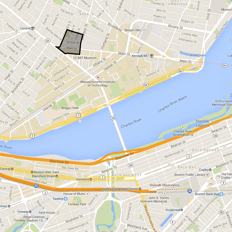 Figure 1: The site boundary and
surroundings in 2015 | (Google Maps 2015a)
Figure 1: The site boundary and
surroundings in 2015 | (Google Maps 2015a)
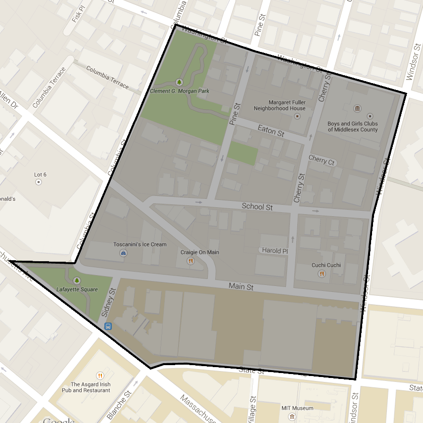 Figure 2: The site boundary and
surroundings in 2015 | (Google Maps 2015b)
Figure 2: The site boundary and
surroundings in 2015 | (Google Maps 2015b)
On a large scale, the location of the site between Boston and Cambridge raises several interesting questions. As a crossroads between these two larger hubs, one would assume that this location would be influenced by both Boston and Cambridge. In some ways, this site could be what Grady Clay refers to as a Venturi Path (Clay 1980). As leaders and influential people journeyed from the center of Boston to Central Square or to Harvard, could this site have been shaped and transformed by the ideals of the larger hubs?
With inspection on a smaller scale, one notices the break in the grid as Main Street connects to Massachusetts Avenue (Clay 1980). This intersection meets at Lafayette Square, which appears to be a relatively new development. Sure enough, historical maps indicate that previously, Massachusetts Avenue did not exist south of this intersection and was merely an extension of Main Street to the north as the road turned on its path from Boston to Central Square (Gray 1883). This break is interesting because it furthers the question of influence from Boston and Cambridge. Clay notes that a break is a physical point of contention as the influences of two grids meet. I wonder if this tension is more than skin deep and further colors the site’s development.
Examining the area closer, the most interesting aspect is the diversity in land use. In this very small region, one can find residences, commercial businesses, an industrial plant, city parks, a college fraternity, and even three churches. Walking the streets reveals even more diversity within each of these subgroups.
The residences range from small, multi-family residences to large, single-family homes with small yards. Additionally, the age of these homes seem to span many decades with older, brick structures juxtaposed with newer developments. Given the diversity in the residences, one wonders why such variety exists. Who lives here, and has this changed over time? Does the variety indicate slow settlement over a long period of time, or rather several periods of rapid development? Did the newer structures replace older buildings, or was the land previously undeveloped?
The commercial businesses are largely restaurants, but there is no shortage of variety. French, Italian, and Chinese cuisine all find their way into the mix with a cocktail bar, deli, and ice cream shop rounding out the smorgasbord. In addition to spanning many types of cuisine, the eateries cater to different customers. Bertucci’s is more of a family-style restaurant while Cuchi Cuchi is fit for a more adult crowd. Again, the variety asks questions of the past. Why does this location have such selection in food? Is this a product of the site’s location as a crossroad, or have other influences brought the restaurants to the area? Do the types of cuisine reflect the population of the area? Or do many of the customers come from elsewhere? If so, why is this location desirable relative to others?
The “green” spaces include Clement G. Morgan Park, a traditional park with basketball courts and green space, the Anthony Paolillo Tot Lot, a play area for young children, and Lafayette Square, an area with seating and some urban landscaping. These spaces all serve different groups within the population and, I predict, see varying amounts of traffic through- out the year. While Lafayette Square is at the center of a busy intersection, the tot lot is tucked away and is used by only a small portion of the population. I am especially looking forward to observing how the community uses this space over the course of the semester. Does the particular location of other buildings within the site have a dramatic influence on how the space is used?
The location of the site between Boston and Cambridge, the break at Main Street and Massachusetts Avenue, and the diverse land use combine to create an interesting location for study this semester. Already, one can see how this plot could be shaped by physical geography, the different populations of people that live in and pass through the site, and the economic success of Boston and Cambridge. The diversity found on this site hints at a complex story with many layers, influences, and actors—one that I am excited to uncover over the course of this semester.
Clay, G. (1980). Close-Up: How to Read the American City. The
University of Chicago Press: Chicago, IL.
Google Maps (2015a). Cambridge, MA. Retrieved from
https://www.google.com/maps/@42.3590097,-71.0894877,15z on May
9, 2015.
Google Maps (2015b). Cambridge, MA. Retrieved from https://www.google.com/maps/@42.3649395,-71.0980976,17z on May 9, 2015.
Gray, O. (1883). Boston and Adjacent Cities. Philadelphia: O.W. Gray and
Son, 1883; from The National Atlas.