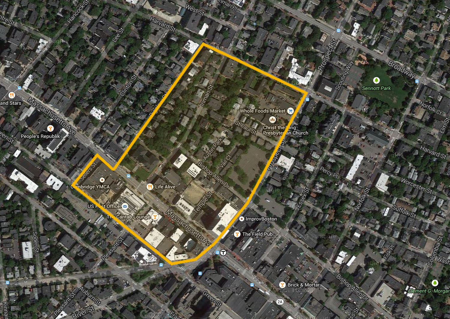
 Figure 1: Map of my Site spanning the commercial and residential blocks just north of Central Square.
Massachusetts Avenue is one of the longest and most trafficked roads in Cambridge, and a center of activity and commerce. If one were to take this road from MIT and Harvard, they would find my site right in the middle, just north of the Central Square T Station, equidistant from these two major universities that dominate the economy as well as reputation of the city (Figure 1). Within my site lies a patchwork residential, commercial, public-serving, and civic buildings, including one of the most important places in Cambridge, City Hall (Figure 2). I chose this site for its distinct culture and diversity, to me, epitomize Cambridge as whole and creates an area that I find fascinating for its eclectic modern and historic styles, widely varying uses, and extensive community draw.
When walking through Central Square I was first intrigued by the contrast that exists within my zone. On Massachusetts Avenue, there is quite a variety of multi- and single-story buildings, representing different points of time in Central Square’s history. Some look fairly modern and typical for a downtown area, like the 13-story building that houses a Leader Bank and T-Mobile on the intersection of Massachusetts Ave and Prospect Street southern border of my site (FIGURE X). Others, like the Richardsonian Romanesque City Hall building at the opposite end of my site, a landmark of Cambridge’s historic district, allude to a whole other time and place (FIGURE X). There are some buildings in between the two that tell conflicting stories of grandeur and humility, value and disregard-–like the ornately decorated stone building with “Cambridge Gas-Light Company” engraved on the side but currently houses a Convenience Plus hardware store and Bank of America, revealing how the area’s business has changed over time. There is also a large range in the customer base targeted by the different businesses within the area from the higher-end small business organic veggie/vegan restaurant, Life Alive, to the low-end chain convenience store, 7-eleven, directly across the street (Figure 3).
When heading west, away from Mass Ave, the area turns fairly residential, but there are still some other land uses mixed in, such as the Whole Foods grocery store by the corner of Prospect St and Harvard St, and the small park off Inman Street. The houses in this area are mainly a mix of old large Victorian, Brownstone, and Colonial style homes, many of which are now converted into apartments with additional mailboxes and doorbells suggesting occupancies differ from the original intention (Figure 4). This shows that the neighborhood was likely developed fairly early on in Cambridge’s history and served an affluent population but the properties values have declined over time and the homes themselves have shifted to accommodate that. There are also some larger and newer apartment buildings in the area as well that were likely built more recently to account for the increased population density in the area. This trend also display how urban life has changed in more recent years as Boston/Cambridge has become a more expensive place to live and demographics may have shifted as people living in the area may be overall younger, without a family, and simply require less space.
The residential area also has a very interesting grid layout with a few dead-end streets that are fairly hidden from the more trafficked routes. Some of these streets have nice houses that seem quite appealing to families who want a more quiet and secluded living situation. Others, however, work to hide older run-down buildings from pedestrian view, like apartment buildings off Vail Court (Figure 6), with boarded up windows and graffiti on the back side. The non-standardized street layout along with the lack of any dominant architectural style suggests that there were numerous different developers over a broad span of time and gives clues to the various economic and cultural and economic stages that the neighborhood has gone through. And the current construction project on Temple Street shows that this process of development is still going on as the area is forever transforming with the times (Figure 7).
Full of cafes, restaurants, bars, shops, and public spaces, Central Square in general is a main gathering point for people from all across the city and beyond. Unlike other nearby commercial areas like Harvard Square or Newbury Street, in Central Square, small locally-owned businesses outnumber the chain stores. There are also some public recreational centers such as a YMCA and Senior center that offer support to a wide range of demographics within the city and create a place where people of all ages can come together. Furthermore, there are three churches all within my area demonstrating the importance of religion to many people in and around the area and potentially the role religion played in bringing people together to shape the neighborhood (Figure 8). Many locals frequent area to take advantage of these distinct commercial and institutional resources and even tourists often pass through this area when traveling between the two universities. This is aided by its easy access by public transportation with the Central Square T stop and multiple bus stops.
Grady Clay defines an epitome district as a place in the city that really exemplifies the character of the city at large (Clay, 1980). My site is defined by high rise business-oriented buildings on the south, the public-oriented City Hall, Post Office, and YMCA to the north, the largely ignored industrial back sides on the west, and residential neighborhood on the east. I believe that the mix of all these places, along with the people, communities, and culture that accompany these physical features, makes my site more than just a civic center for Cambridge, but an epitome district that reflects the values of, and serves as a symbol for, the city as a whole.
References:
“Cambridge, Massachusetts.” Map. Google Maps. Google, April 2015.
Clay, Grady. Close-Up: How to Read the American City. The University of Chicago Press: Chicago, IL. 1980: pp.11-16, 38 -65.
*All photographs taken by author
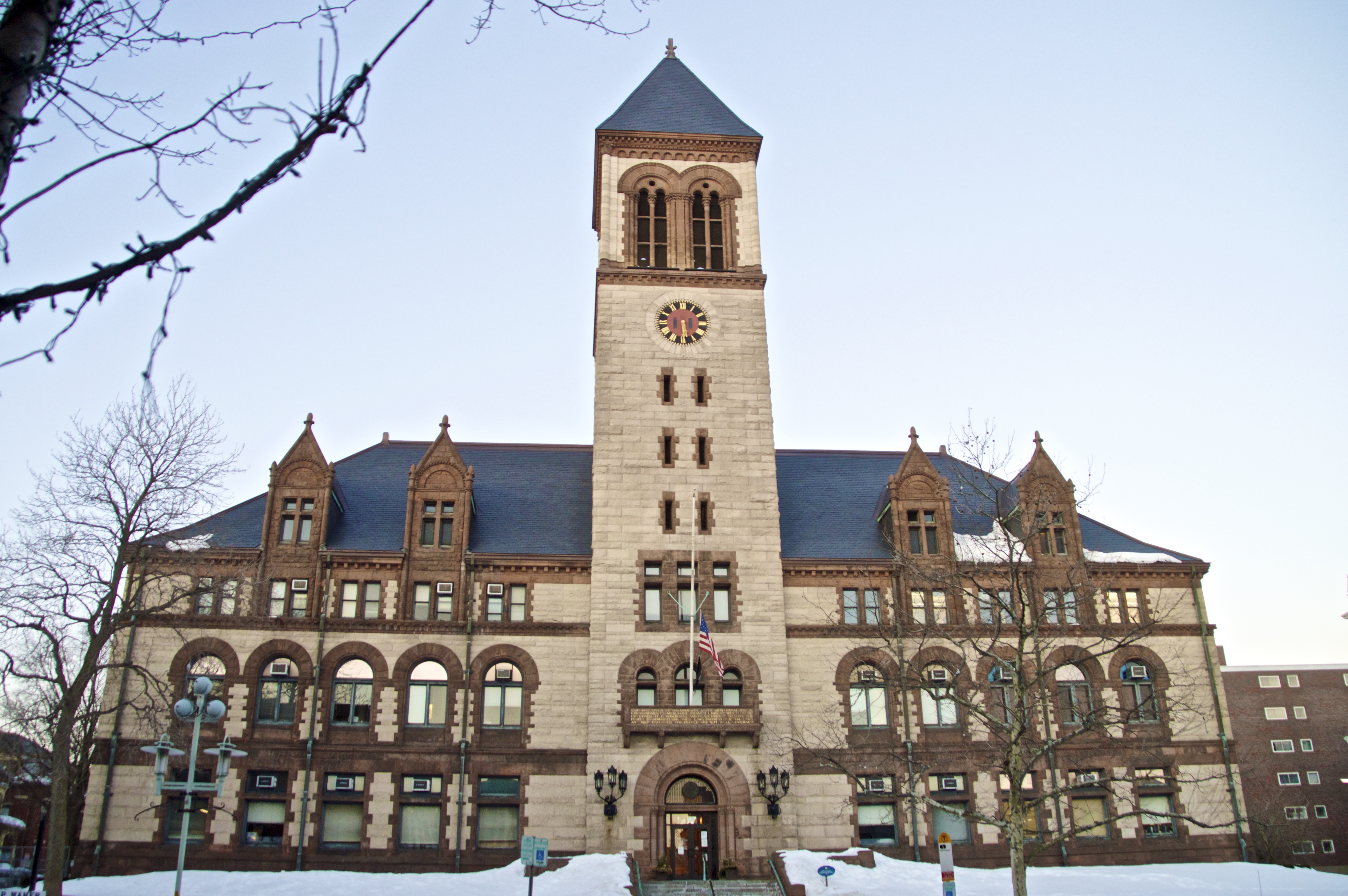 Figure 2: Cambridge City Hall on Massachusetts Avenue. Built in 1988, city hall serves as gathering place and center of political action for the people of Cambridge.
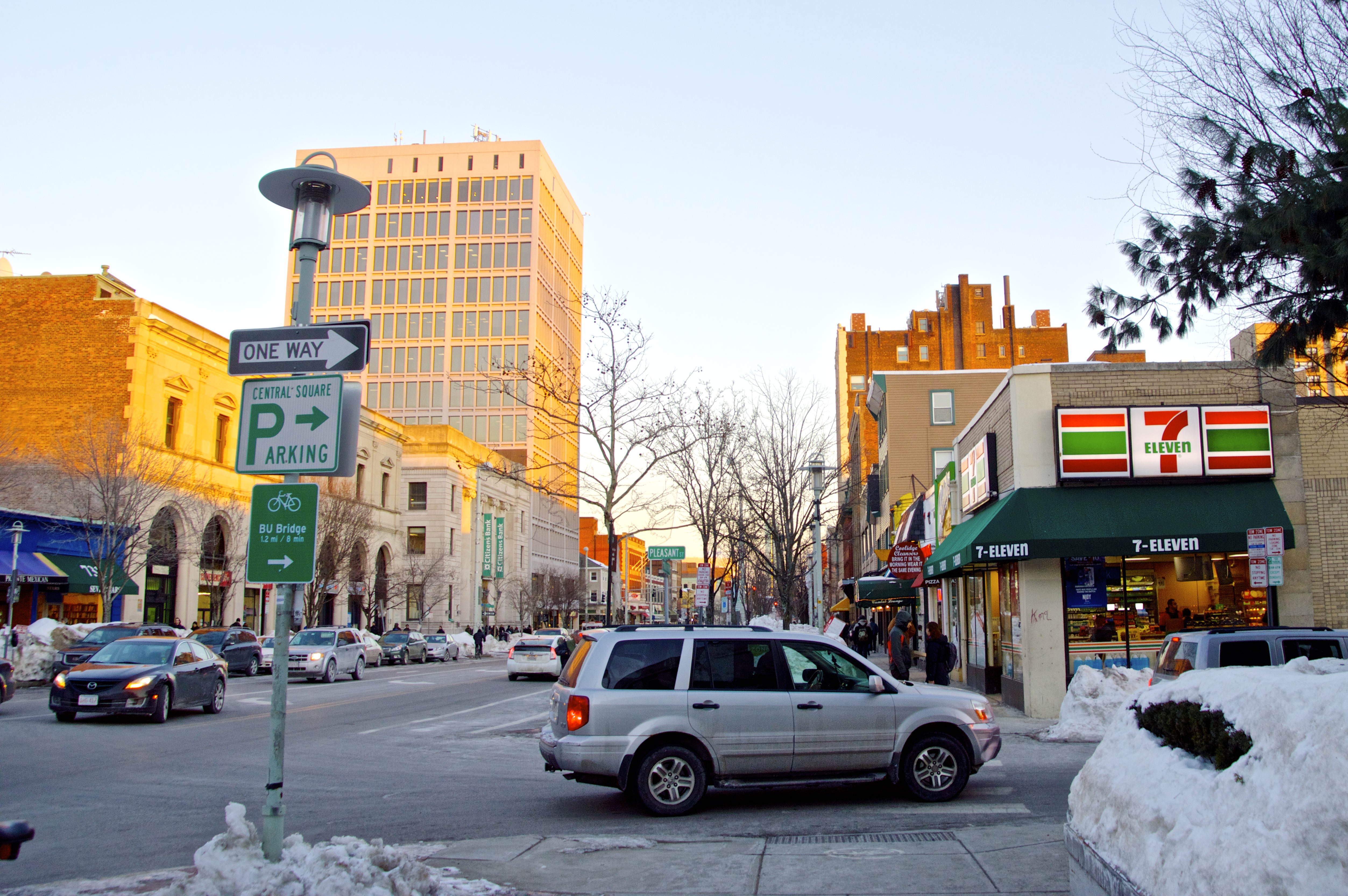 Figure 3: View of Massachusetts Avenue from Prosepect Street. One can see the older bank and commercial buildings on the left hand side and a more modern high-rise behind them. On the right hand side, there is a 7-eleven and other smaller, more humble shops. This juxtaposition alludes to how the commercial value and use of site has changed over time.
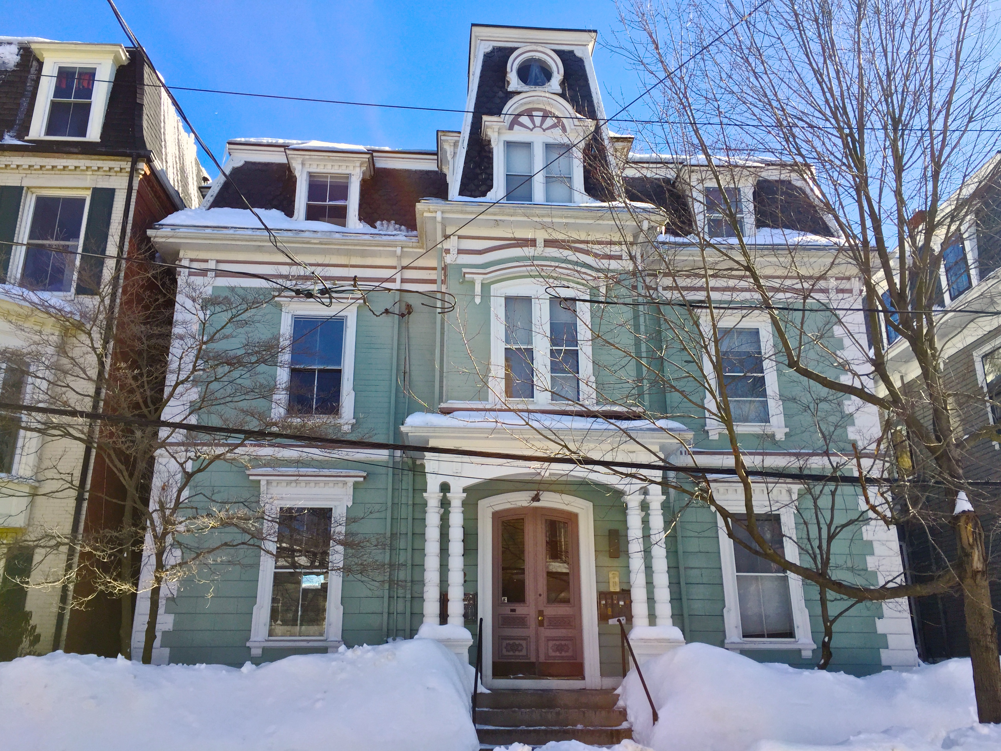 Figure 4: One large grand house on Bigelow street that was likely built around the turn of the 20th century to serve a single wealthy family now has eight mailboxes, and seems to serve as an apartment for many lower-income family or single tennents in the area.
 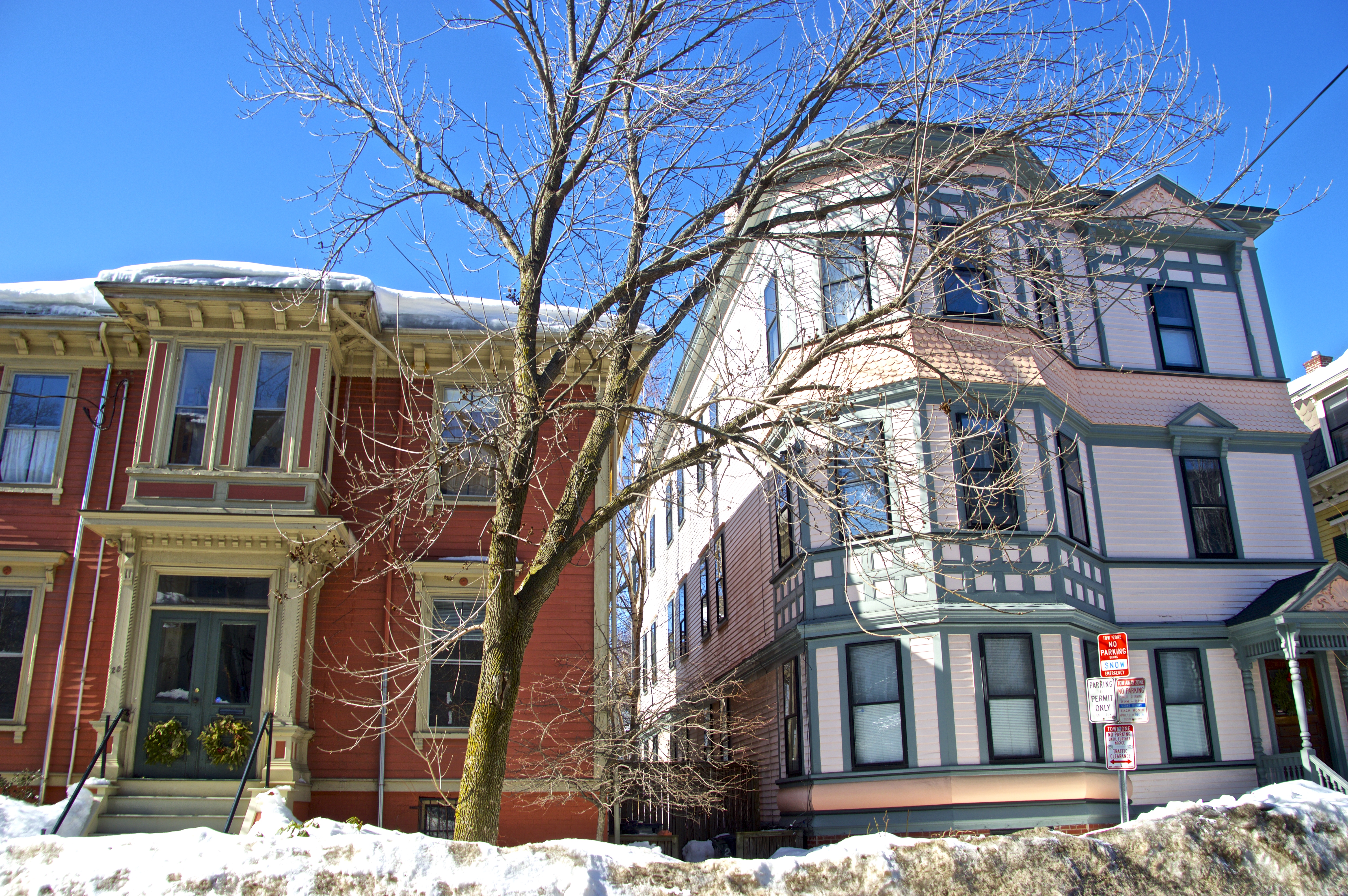 Figure 5: Two other houses on Bigelow Street that show there is still diversity of architecture and size of buildings that were likely built at different times by different developers, but still meant to serve the same kind of affluent population.
 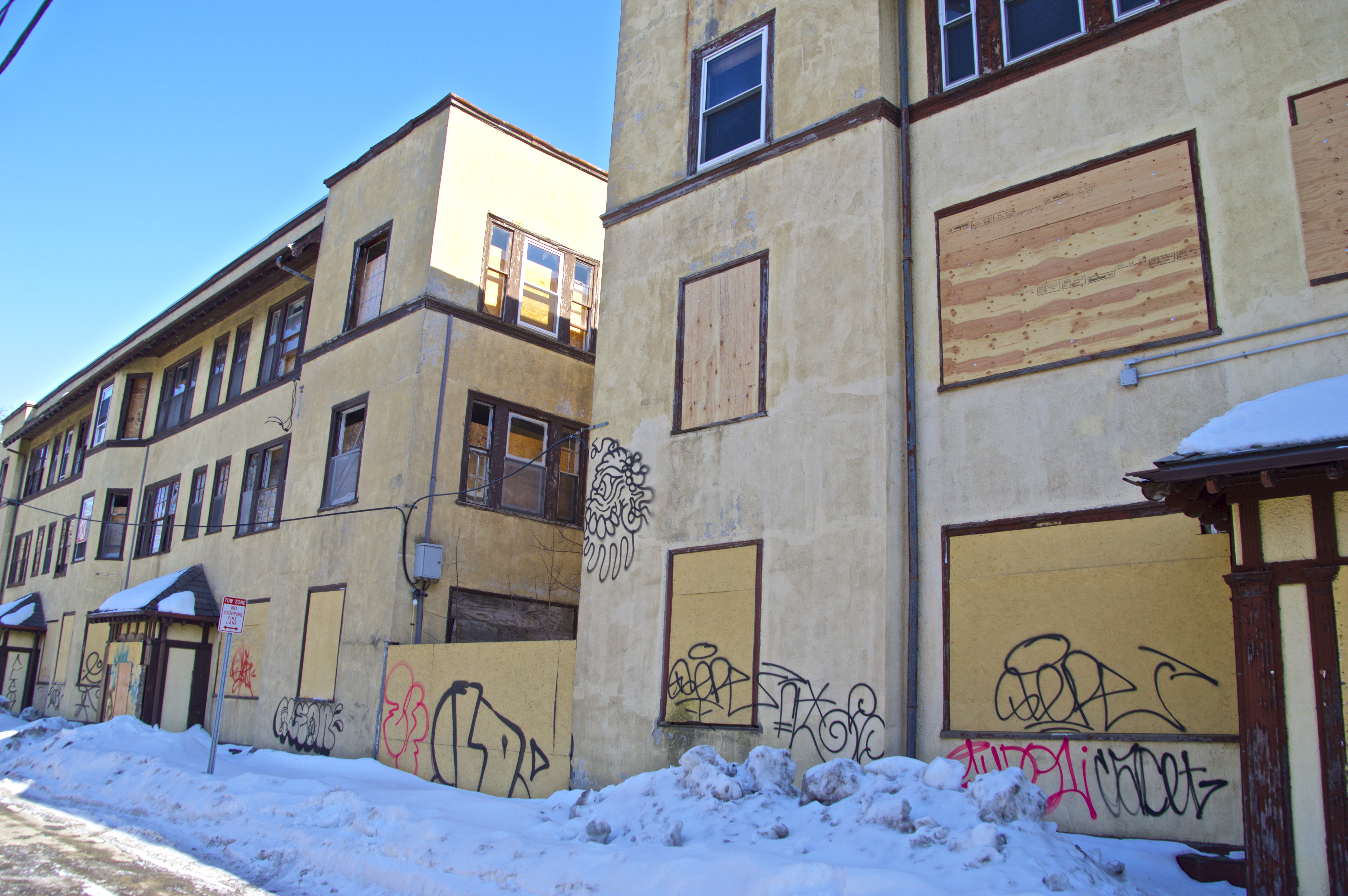 Figure 6: The boarded up apartment buildings on Vail Court seem out of place in the same neighborhood as the houses shown above. With a more modern and less ornate style, these seem to have been built muchlater on and to serve a less affluent community. The fact that these building have been abandoned in such an unattractive way alludes to a darker period of Central Square's history.
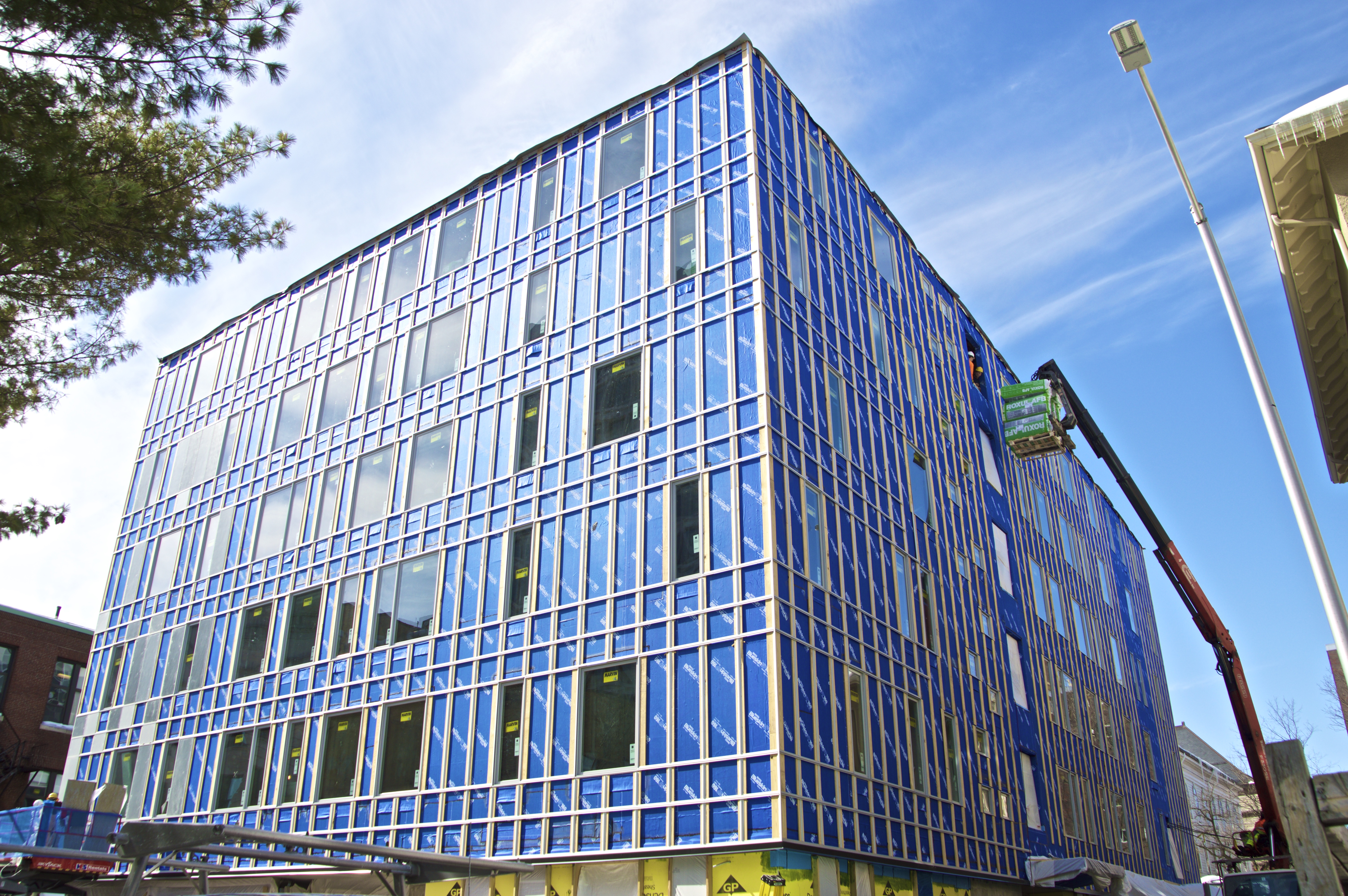 Figure 7: The construction project on Temple Street shows that the area is once again in a period of growth as new businesses are seeing the area as valueable realistate to develop.
 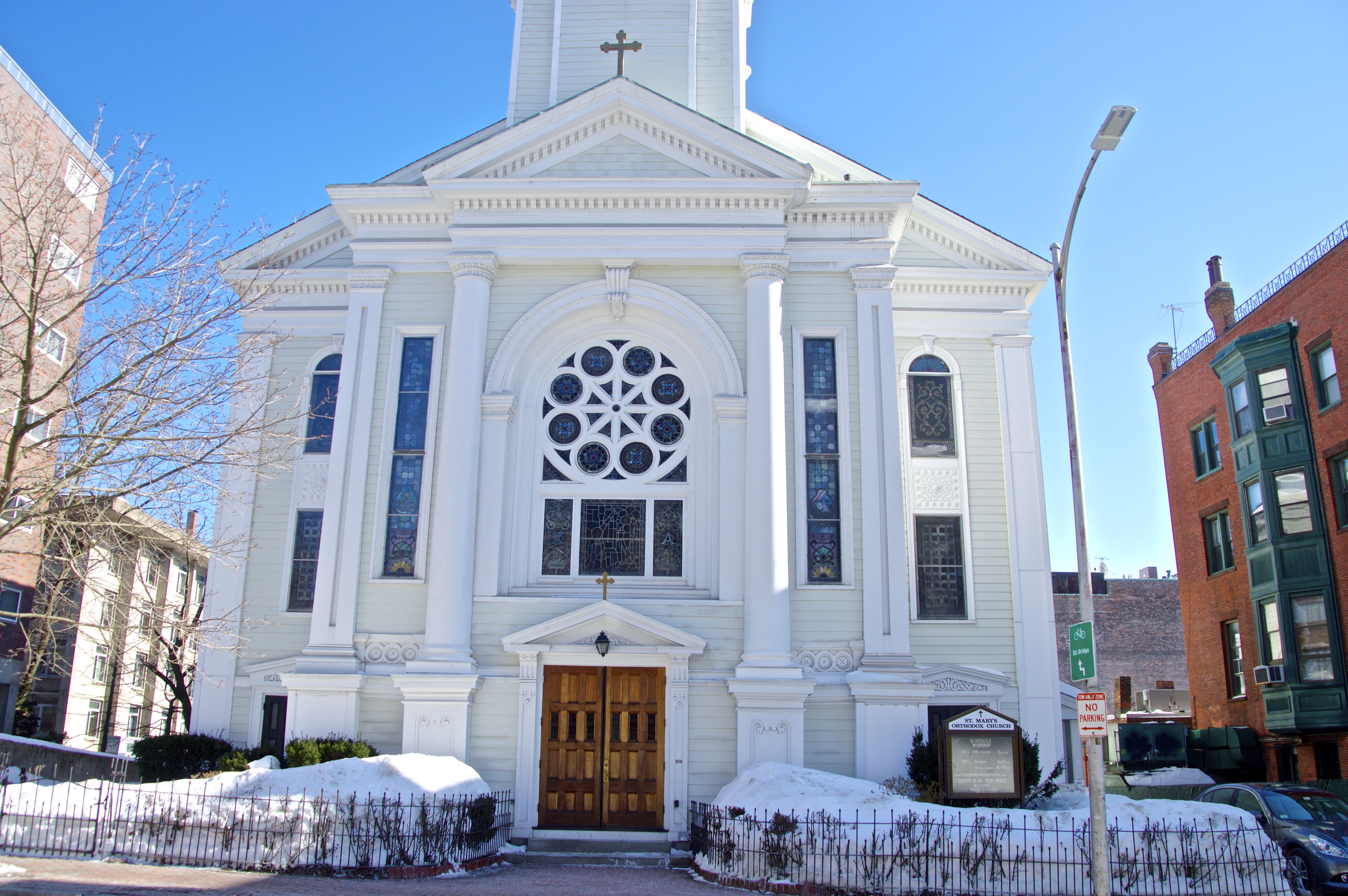 Figure 8: Saint Mary's Orthodox Church on Inman Street. Nestled in between the commercial and residential areas on my site, Saint Mary's is one of the many churches in the area that serves as a landmark point in area where the community can come together.