Introduction:
I was first attracted to my site for its diversity and eclectic character. I was struck by the juxtaposition of large and small, old and new, cared for and decrepit. When taken in as a whole, the Central square area and surrounding residential neighborhood can seem like a nonsensical hodgepodge of different building types, architectural styles, uses, and users. However, when the layers of time are overlaid onto the eclectic picture, the trends become much clearer and tell the story of a neighborhood full of personality that has gone through numerous transitional periods in the past few hundred years.
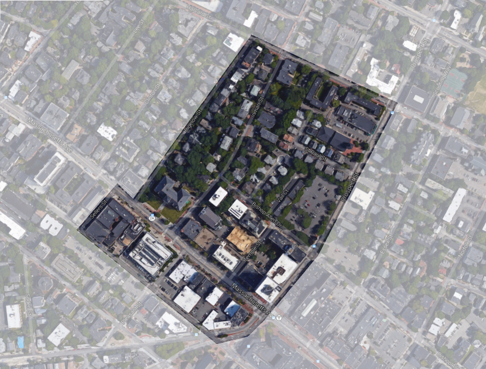 Figure 1: Map of my site situated on the northern half of Central Square and nearby residential neighborhood.
 Starting at the Beginning: A Historic District
One of the most striking features of my site is the abundance of historical evidence and signs that lie all around––from the fairly obvious grand old commercial and civic buildings, to the more subtle architectural details of the residential houses, to even the most direct and blatant historic markers.
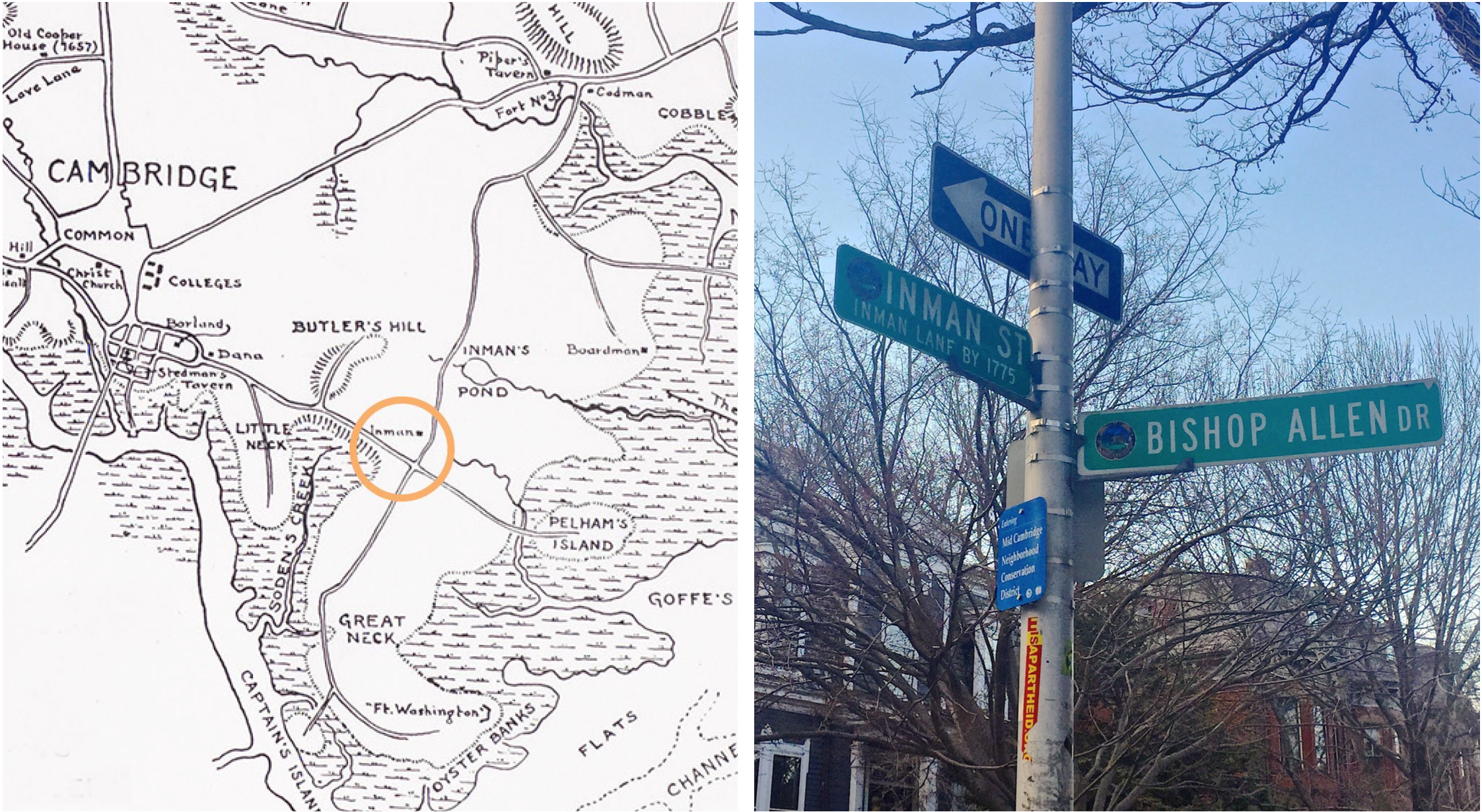 Figure 2: Left: Map from 1777 (Revolutionary War times) showing the Inman Estate and the site of Central Square Currently. Right: Street Sign designating the area a Neighborhood Conservation District and denoting the historic past of Inman Street (or Inman Lane) dating back to 1775.
 The grid street layout is one of the oldest parts of my site and has set the framework for development through the centuries. On the corner of Inman Street and Bishop Allen Drive, there is a street sign that quite clearly indicates the historic quality of the neighborhood (Figure 2). There is a blue plate that reads “Entering Mid Cambridge Neighborhood Conservation District,” showing that this block is not only old, but also conserved, valued, and protected for its historic characteristics. Above that, is the green Inman Street Sign that also notes “Inman Lane by 1775.” Inman Lane was the road that lead to the Inman estate, which during the Revolutionary War was used as a Military Base set on an important crossroads, as depicted in the 1777 map (Figure 2). While the original estate did not make it though the 19th Century, traces of its influence on the area can be detected today.
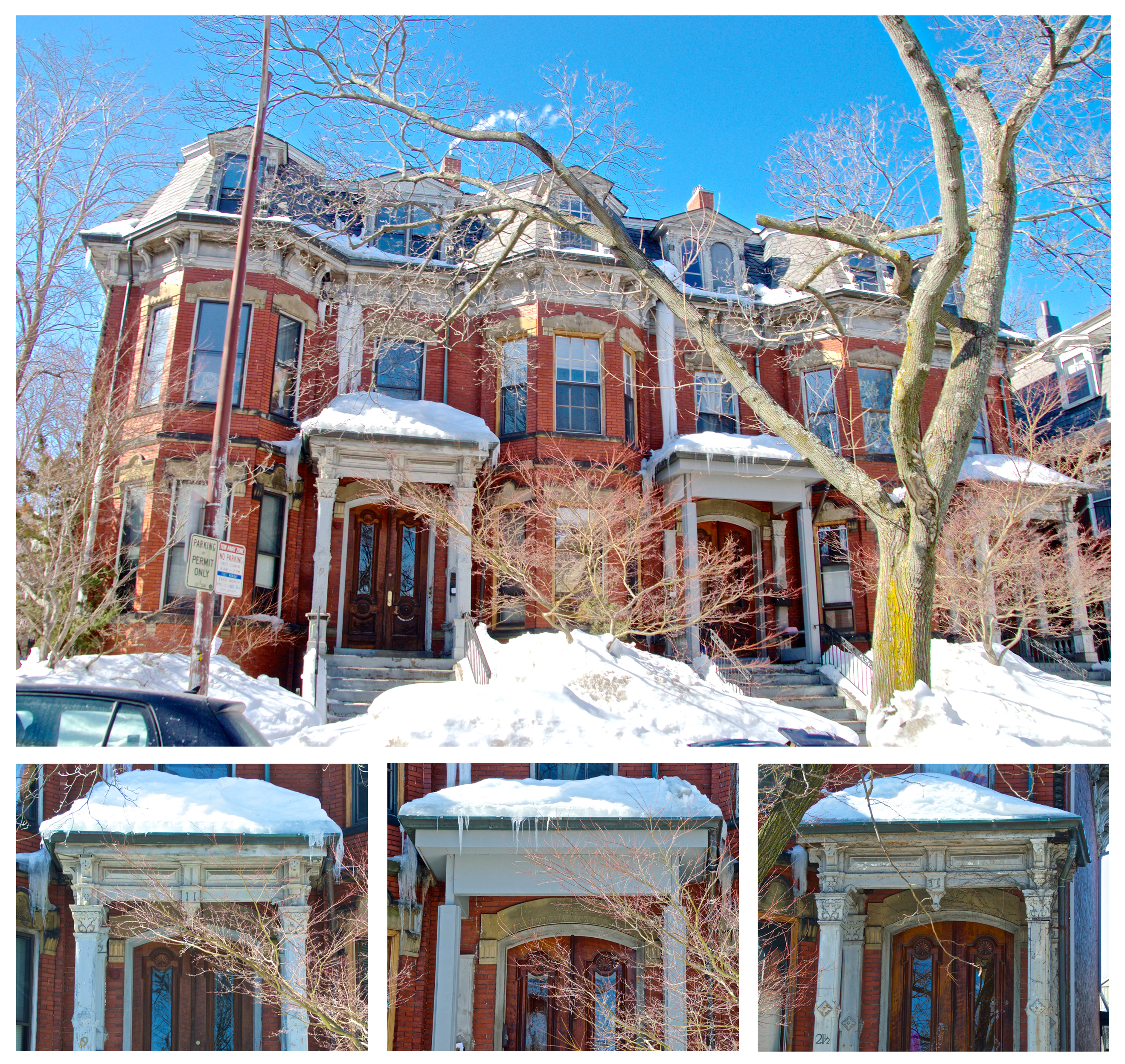 Figure 3: Mansard style brick house on Inman Street that dates back to the 19th Century (see Site Through Time, Fig. 5). The three-part home has been fairly well maintained over time, but note the detail on the middle porch overhang and columns did not hold up. While the owner did not restore the middle porch to match the other two, effort was put in into making the defect blend in with the overall scheme.
 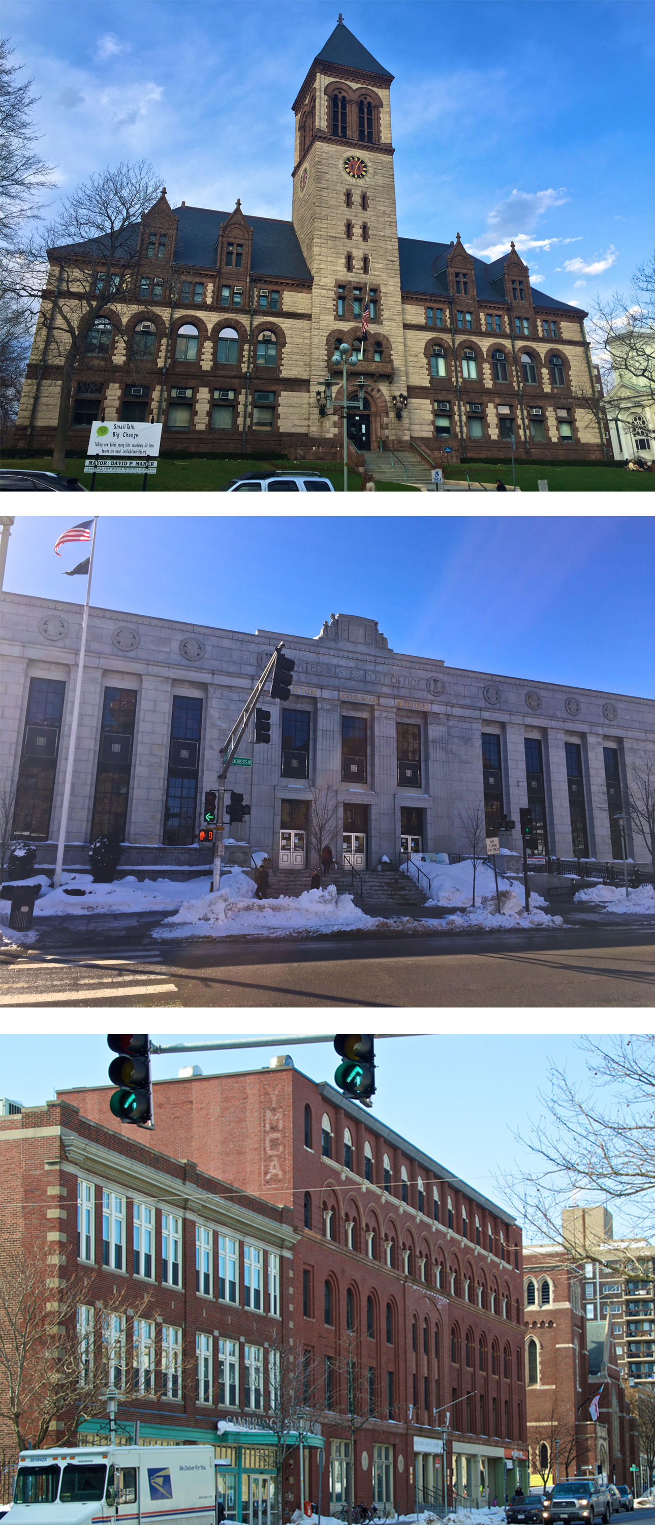 Figure 4: From top down: Romanesque Cambridge City Hall, Neoclassical Post Office, and Italian Renaissance Revival YMCA. These three different styles of buildings are all meant to evoke a sense of grandeur and civic importance as they serve the community of Cambridge.
 Some of the oldest remaining buildings are houses of Late Victorian, Mansard, and Queen Anne styles, characteristic of the late 19th or early 20th century. These houses, mostly lying on Inman, tell the story of affluence in the neighborhood, as they are very large, detailed and generally built for a single family. (Figures 3, 8, and 9). Many of these buildings have withstood the test of time fairly well and maintain the treasured classical aesthetic that gained the neighborhood its official historic recognition.
At the center of my site lies one of the most important and iconic buildings in the area, the grand Cambridge City Hall. Across the street is the Post Office and YMCA (Figure4). This cluster of old buildings is an artifact of a time when Central Square served to unite the people of Cambridge and shows the important role my site has played over time as a center of political and public serving resources. These buildings have also been fairly well preserved over the years, demonstrating the value that the city and it’s inhabitants place on maintaining their historic character and grand presence.
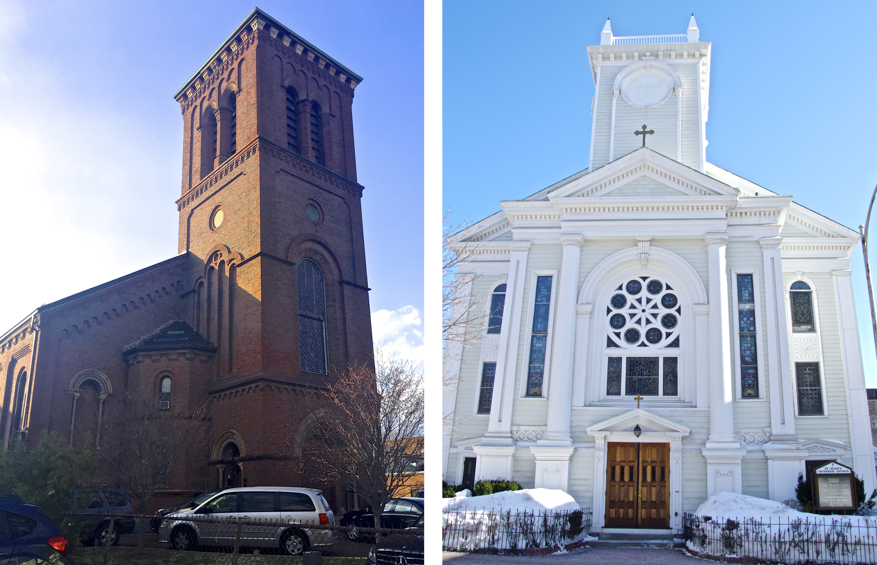 Figure 5: Left: Presbyterian Church on Prospect Street (was originally First Congressional Church, see Site Through Time, Fig. 4). Right: Saint Mary's Church on Prospect Street (was originally First Universalist Church, see Site Through Time, Fig. 8).
 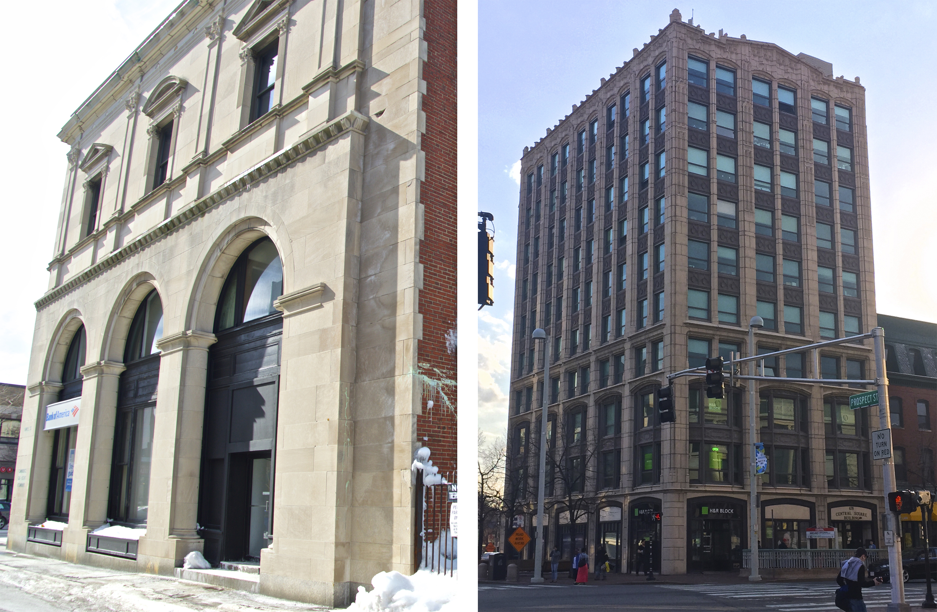 Figure 6: Left: Original Cambridge Gas-Light Company, now Bank of America and a hardware store. Right: Central Square Building, the first "skyscraper" in the area, currently houses an H&R Block on the first floor.
 Other kinds of old buildings also give insight into key aspects that were vital in the early development of my site. The Presbyterian Church on Prospect Street or St. Mary’s on Inman Street (Figure 5) are only two of the many churches in the area and have stood in the site for over a century. While the occupancy has changed over time, the buildings have remained a gathering point for the community and demonstrate the lasting importance of Christian religion to the neighborhood. And older commercial buildings around Massachusetts Avenue can tell the story of businesses and industries that were important to the center’s economic development. The Central Square Building (Figure 6) was the first “sky scraper” in the district and marks the growth of business in Central Square in the early 20th century. The Guaranty Trust Building (Figure 7) is one of the largest and grandest buildings in the area and was once a large bank and insurance company but is now made up of smaller shops and apartments. On the side of what is now a Bank of America and Convenience Plus hardware store, one can see the title “Cambridge Gas-Light Company” (Figure 6), another important industry in the early 20th century.
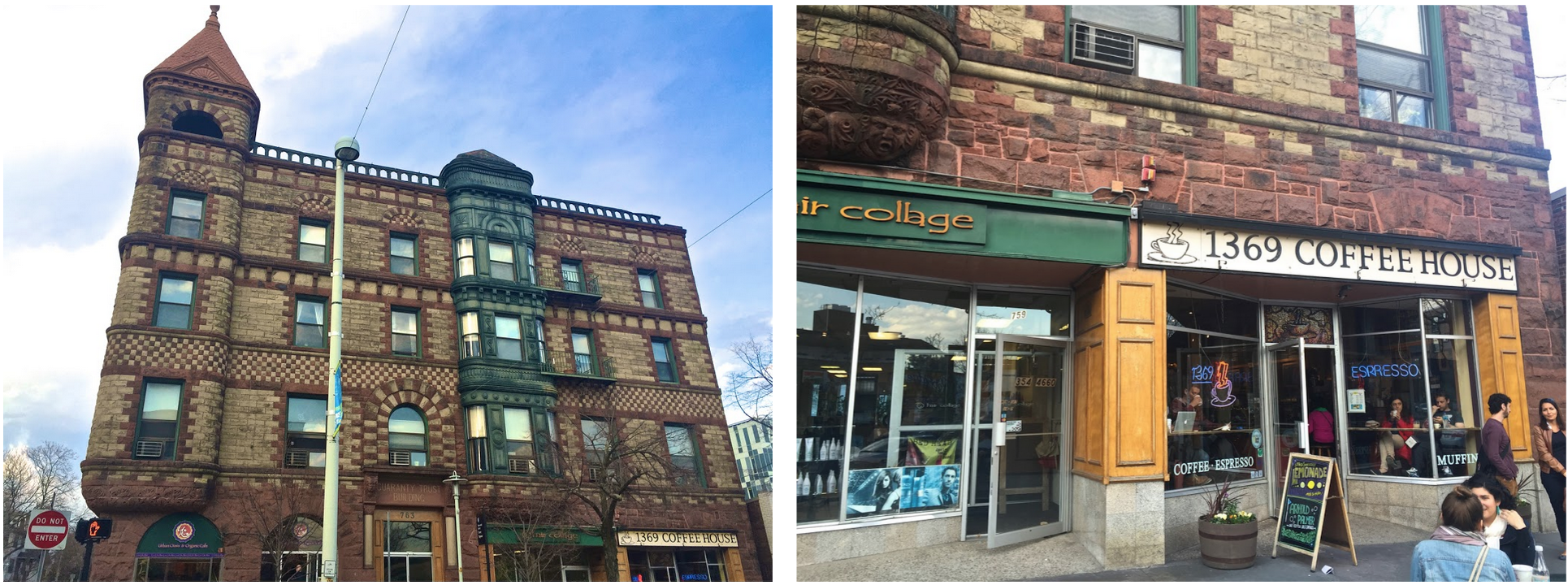 Figure 7: Left: The Romanesque Revival Guaranty Trust Building on the corner of Massachusetts Avenue and Prospect Street. The building has housed a bank, insurance company, and even library. Now there are four restaurants/shops on the first floor and residences on the top three floors. Right: note the detail indicating that the bottom storefronts have likely been renovated in recent years as stone arches that once made up the facade have since been replaced by more modern rectangular entrances. The trace of the past arches can be seen in the stonework above the entrances, as the newer mortar is a lighter pink color and the keystones that once stood at the top of the old arches are still present.
 ___
Decline in the Middle: Downfall of the Downtown
While remnants of the strong historic past still stand tall and proud, there are other aspects of the site that pale in comparison. A decline of the former grandeur can be seen in both the residential and commercial areas along with clues of a shifted population demographic and decreased property values.
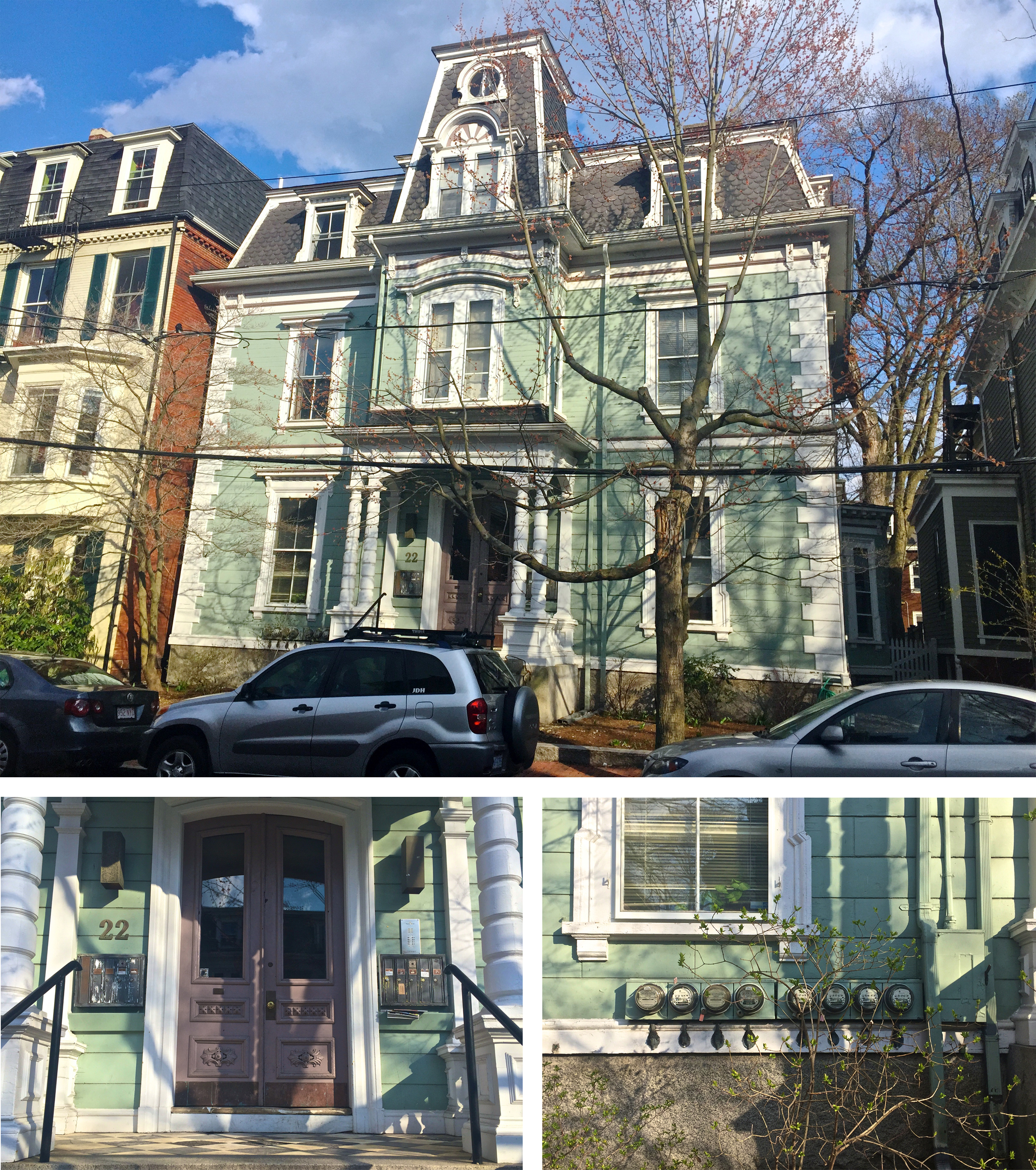 Figure 8: 22 Bigelow Street displays grand Mansard Architecture and was likely built for a single wealthy family in the late 19th century (see Site Through Time, Fig. 7). Now, however, the house seems to have eight separate tenants judging by the mailboxes and utility monitors.
 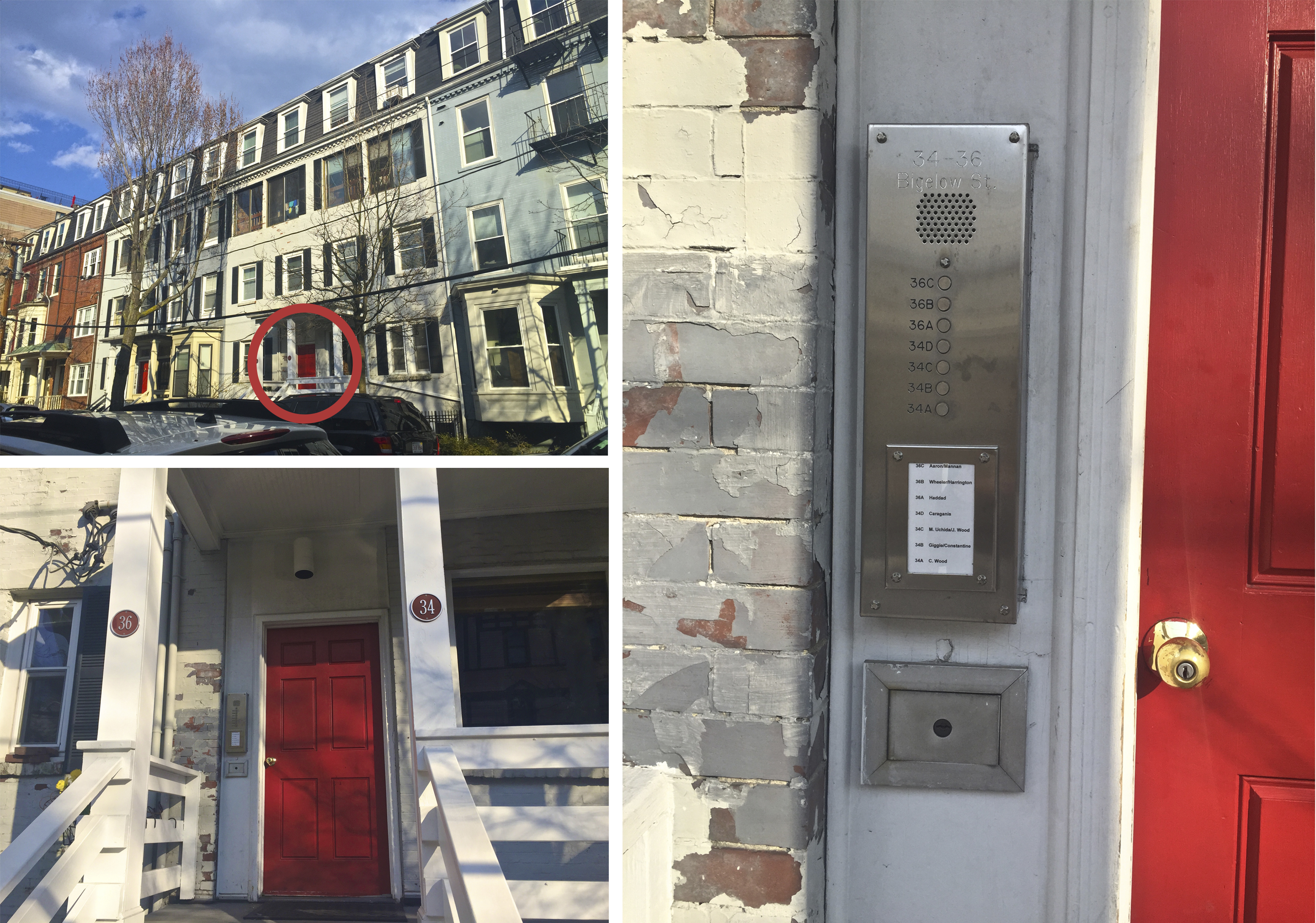 Figure 9: The row houses on Bigelow Street date back to the mid 19th century (see Site Through Time, Fig. 4) and are the only development of this kind on my site. House numbers 34 and 36 seem to have possibly at first been owned by one family (based on the one door), and then perhaps later divided up into two homes (judging by the two street numbers), and then more recently divided up into 7 separate apartments (as shown by the seven doorbells). Also, note the severe chipping in the paint implying a lack of maintenance over the years.
 ___
___
In residential districts some of the most obvious signs are large single-family houses that have over time turned into multi-family apartments. For example, at 22 Bigelow street (Figure 8), a large house that once belonged to a large family now has eight different mailboxes and eight different utility meters revealing that the demographics of the neighborhood underwent a transition from single-family homeowners to more dense, lower-income apartment renters. Similarly, at 34 and 36 Bigelow Street (Figure 9), two separate street addresses share a single door and house seven separate tenants, implying that the house may have gone from a single-family home to a duplex, to an apartment building. Furthermore, the paint on both houses is chipped, implying a decrease in maintenance over the years.
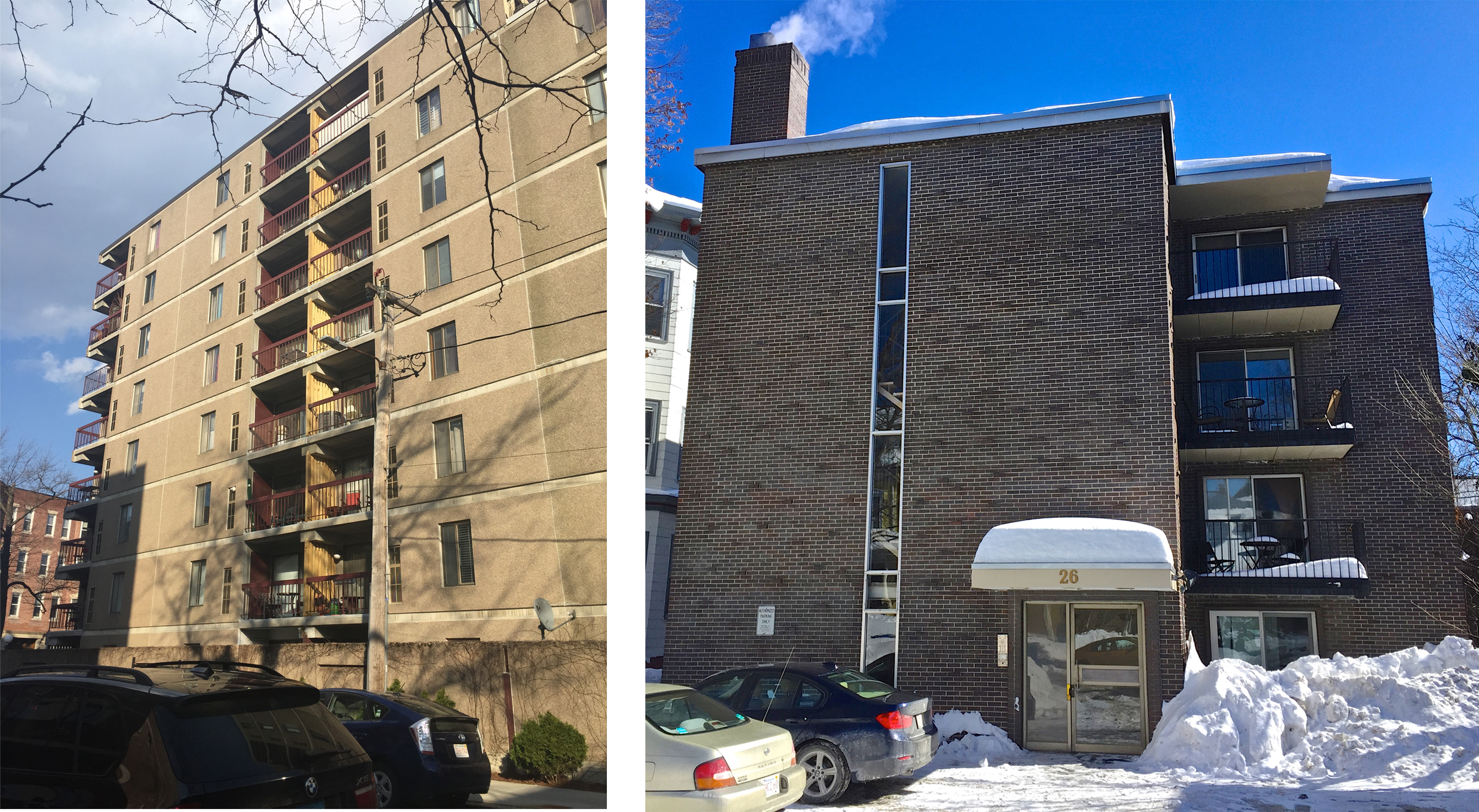 Figure 10: Left: Apartment Building on Bigelow Street. Right Apartment Building on Inman Street. Both were constructed in the mid- to late- 20th century and represent a change in demographics of residents in the area from wealthier single family homeowners to lower-income renters.
 It seems that the only homes on my site built past the mid 20th century are all apartment buildings. Complexes like the ones on Inman Street and Bigelow Street (Figure 10) are designed in a newer, more modern style and lack the ornamentation and stylistic details that adorn their historic neighbors. These apartments are aimed towards lower-class tenants and show a harsh clash in property values between the older and newer developments.
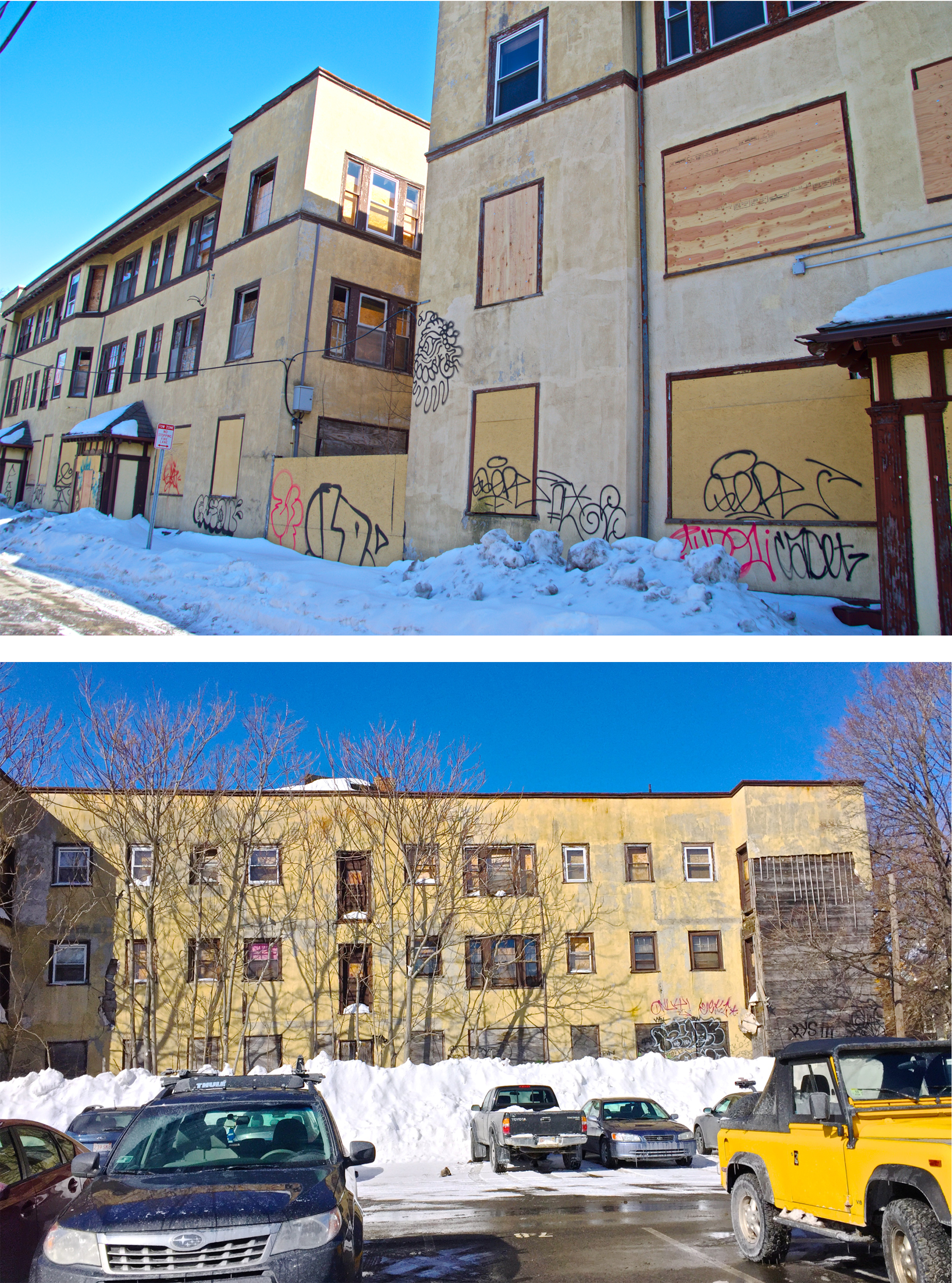 Figure 11: Vail Court was first built around 1930 and was the first apartment complex in the area (see Site Through Time, Fig. 9) Today it stands empty with boarded up windows and graffiti on the walls, a remnant of a failed housing attempt simply waiting for redevelopment.
 The most extreme example of this is Vail Court (Figure 11). Vail Court is an inlet off of what is now Bishop Allen Road and was the first apartment complex on my site. However, since its construction in the early 20th century, the two neighboring buildings have fallen into ruin. They currently sit with boarded up windows and graffiti on the walls and the lot is used only for parking, if at all. It is intriguing that such a derelict property shares a block with some of the highest valued properties in the area and implies that, likely due to economic challenges, the property owner has not yet seen the value of redevelopment or sale.
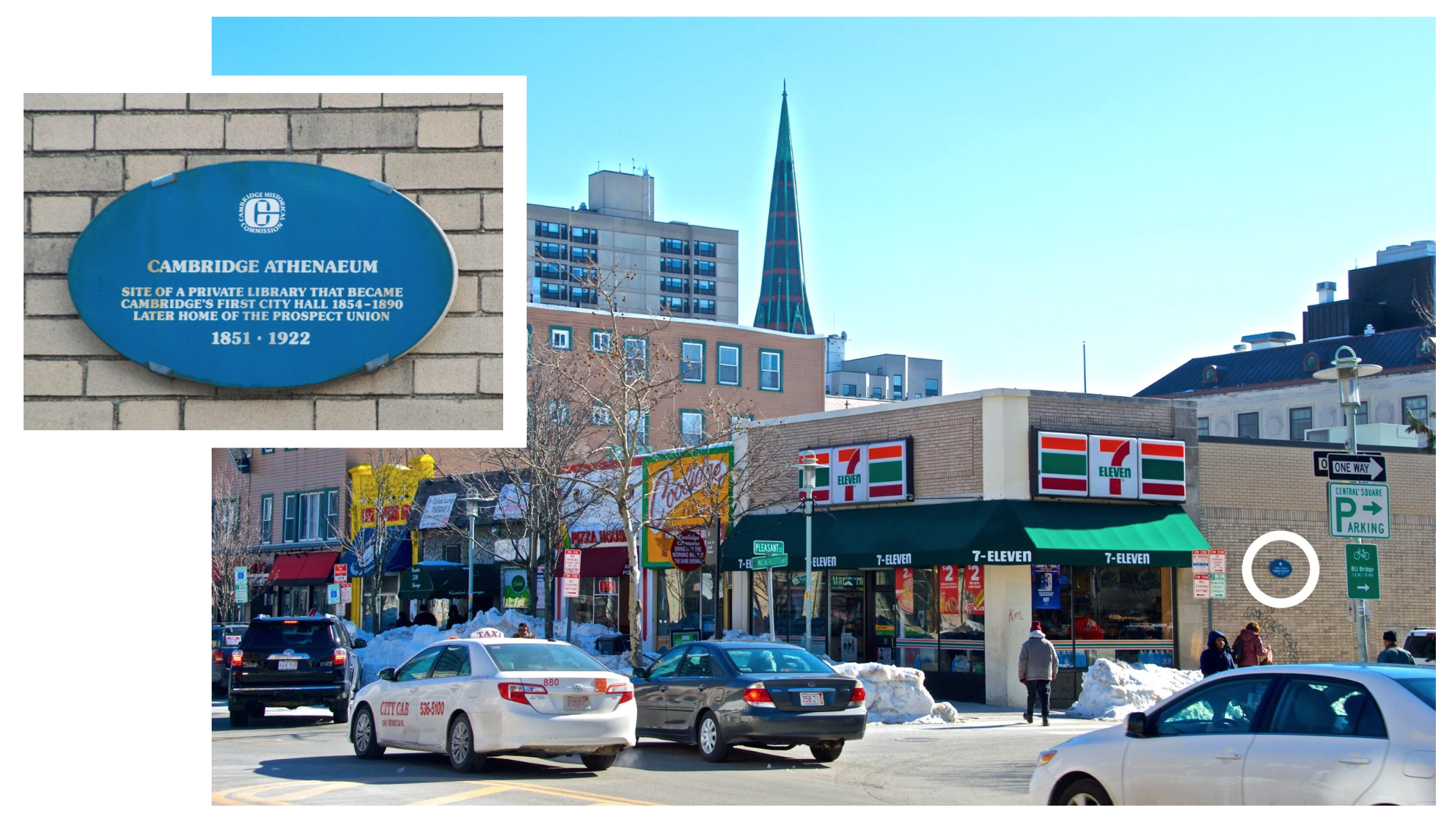 Figure 12: While these single-story shops that line Massachusetts Avenue are not the most exciting or historic-seeming parts of a downtown area, there is an interesting plaque on the side of the 7-eleven. Placed by the Cambridge Historical Commission, it speaks to the historic significance of the site as a former site of City Hall and a place of community gathering, if not the buildings themselves.
 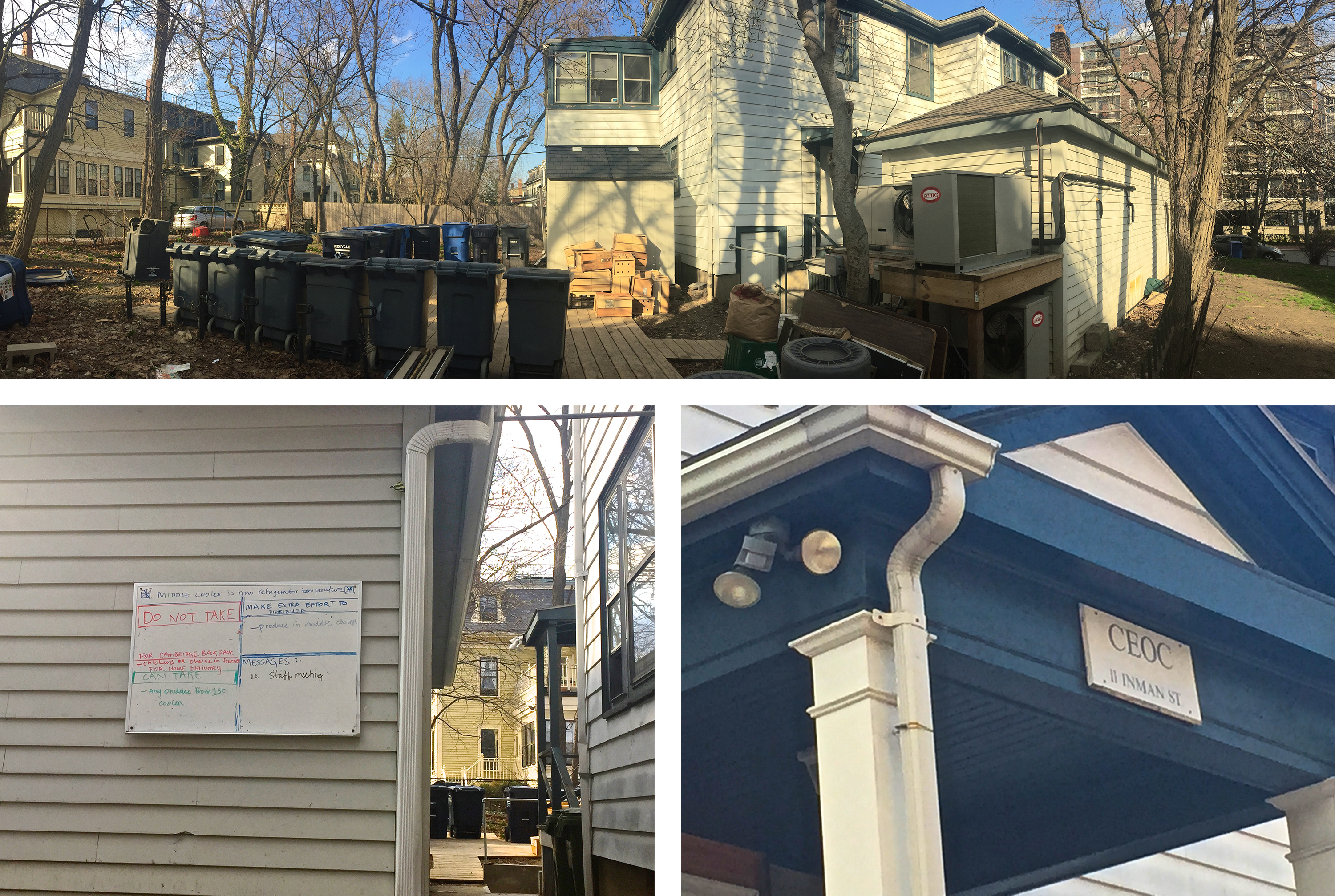 Figure 13: The Cambridge Economic Opportunity Committee (CEOC) on Inman Street right behind City Hall is an old house turned into a headquarters for "anti-poverty" agency.
 ___
Furthermore, on Massachusetts Avenue there are businesses that are obviously aimed at a lower-income audience. For example there are many single story shops such as a 7-eleven, Pizza House, dry cleaners, barbershop, and hardware stores that rather un-impressively line the downtown streets (Figure 12). On the corner of Inman Street and Dorthy Dottie Doyle Way, there is the Cambridge Economic Opportunity Committee (CEOC) (Figure 13), which was, established in 1965 to fight poverty and support communities in need (SOURCE). They offer many resources including educational workshops, food pantry services, and even childcare. Additionally, on my site there are many other community resources centers such as the YMCA, YWCA, Cambridge Senior Center, and Cambridge Housing Authority. These centers are all aimed to help the lower-income communities in the city and their presence demonstrates, not only the prevalence of poverty in the area, but also the strength in local community and support networks dedicated to helping.
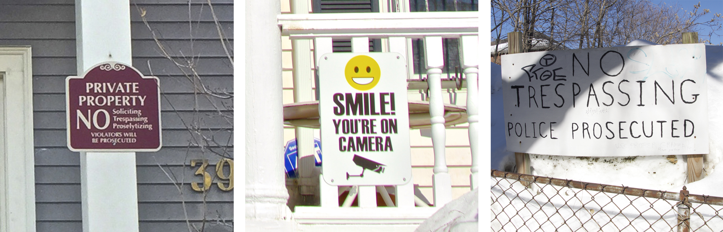 Figure 14: Private property, security camera, and no trespassing are scattered all around my site showing that safety is protection is a concern for the residents.
 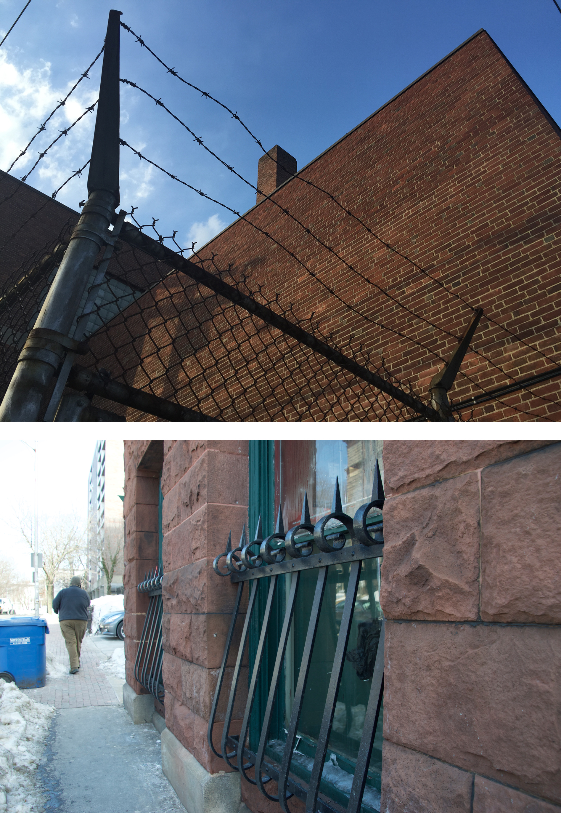 Figure 15: Physical protection steps are taken as well such as barbed wire and barred windows to protect private property. Top: The back of the YMCA on Green Street. Bottom: The side of the Guaranty Trust Building on Prospect Street.
In addition to the building uses themselves, there are smaller details and overall patterns that permeate throughout my site that point to a trend of worsening of conditions, safety, and value. No trespassing signs and security cameras are all too common (Figure 14), even in neighborhoods, indicating that loitering “undesirables” are common in the area. Furthermore, barbed wire, such as seen on the fence behind the YMCA, and railed lower windows, as seen on the Guaranty Trust Building, suggest that crime and theft likely are (or have recently been) an issue as well (Figure 15). My site also has an overabundance of parking lots that show that the property is underutilized. Most of these lots are never full and seem to just be holding space until the owners view the property as worth redeveloping. On Prospect Street there is a very large parking lot that used to be home to a wide array of commercial, residential and public-serving buildings. Yet those buildings were all demolished by the 1980s and now the only trace of what stood before is a utility meter that stands by the sidewalk with no building attached (Figure 16).
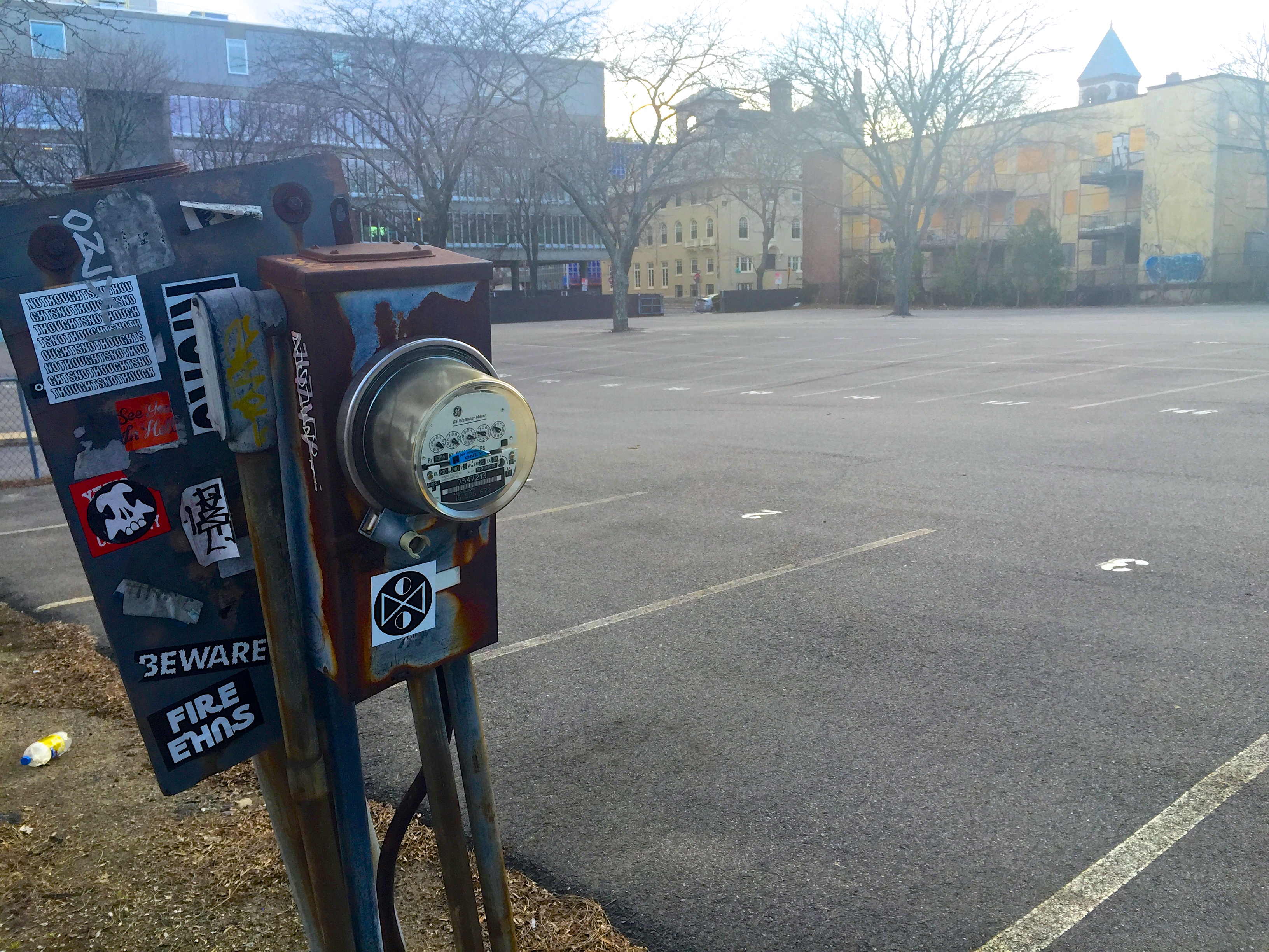 Figure 16: Lone Utility meter stands by the sidewalk on Prospect Street in front of a large parking lot. The lot used to have many diverse buildings (see Site Through Time, Fig. 12) but this meter is the only trace of that more colorful past.
 ___
___
___
___
___
21st Century Revival: Growth and Gentrification
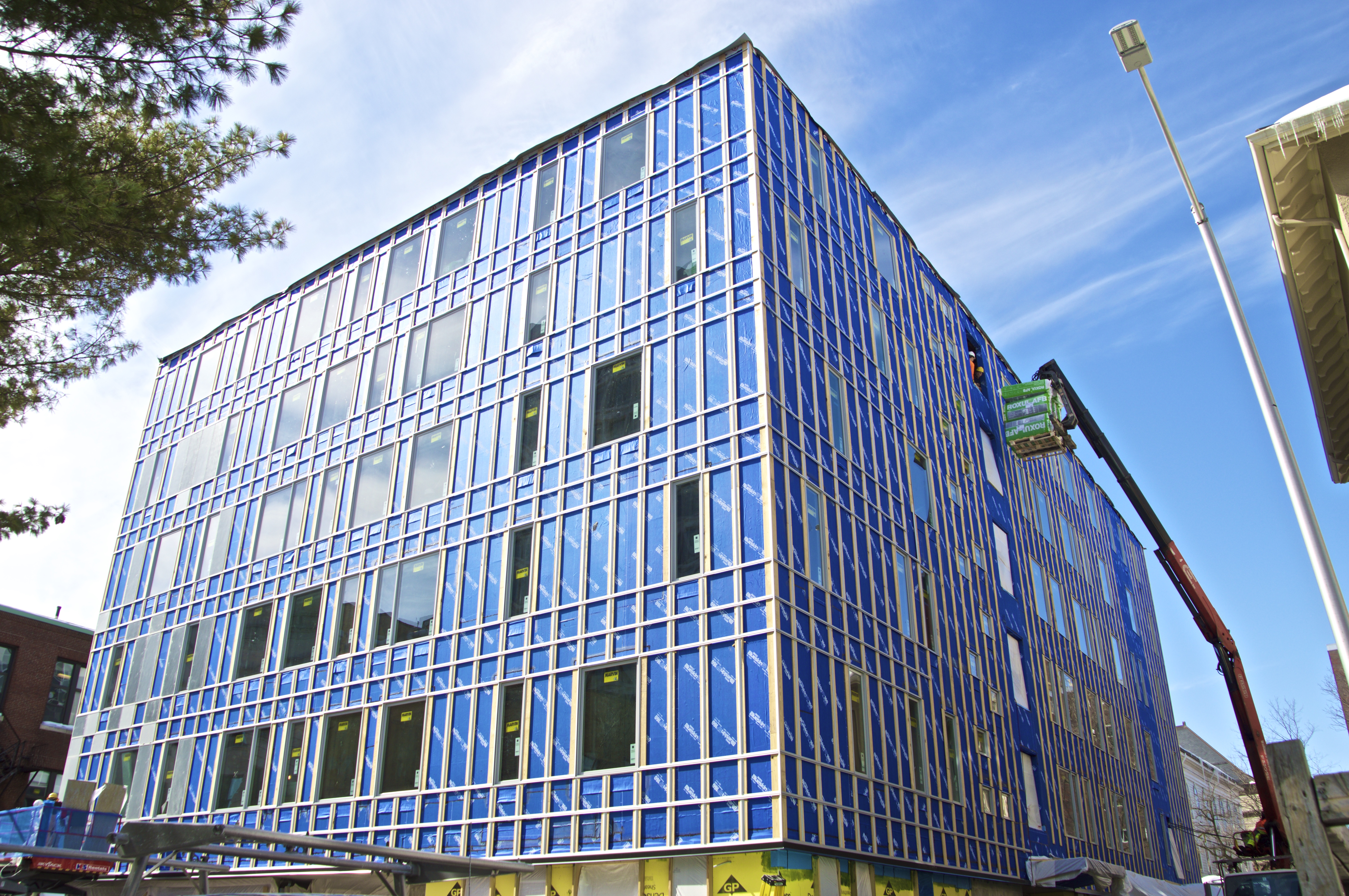 Figure 17: New Construction Project on Prospect Street.
 Despite the clear signs of depreciation in the 20th Century, recent years have undergone quite a turnaround. New businesses have been flooding the area and properties that have lain vacant for decades are getting developed. Construction on Prospect Street (Figure 17) is only part of a trend of large office buildings rising up throughout the larger Central Square district. Restaurants and shops aimed at middle to upper-income shoppers have started to emerge in the past 15 years or so––from large chains like Whole Foods, to smaller local businesses with a quirky personality like Life Alive and Shine. And newer non-retail businesses are appearing as well, like Workbar on Prospect street, that appeal to the growing tech industry and start-up culture that is so common in the Boston area, especially around MIT (Figure 18).
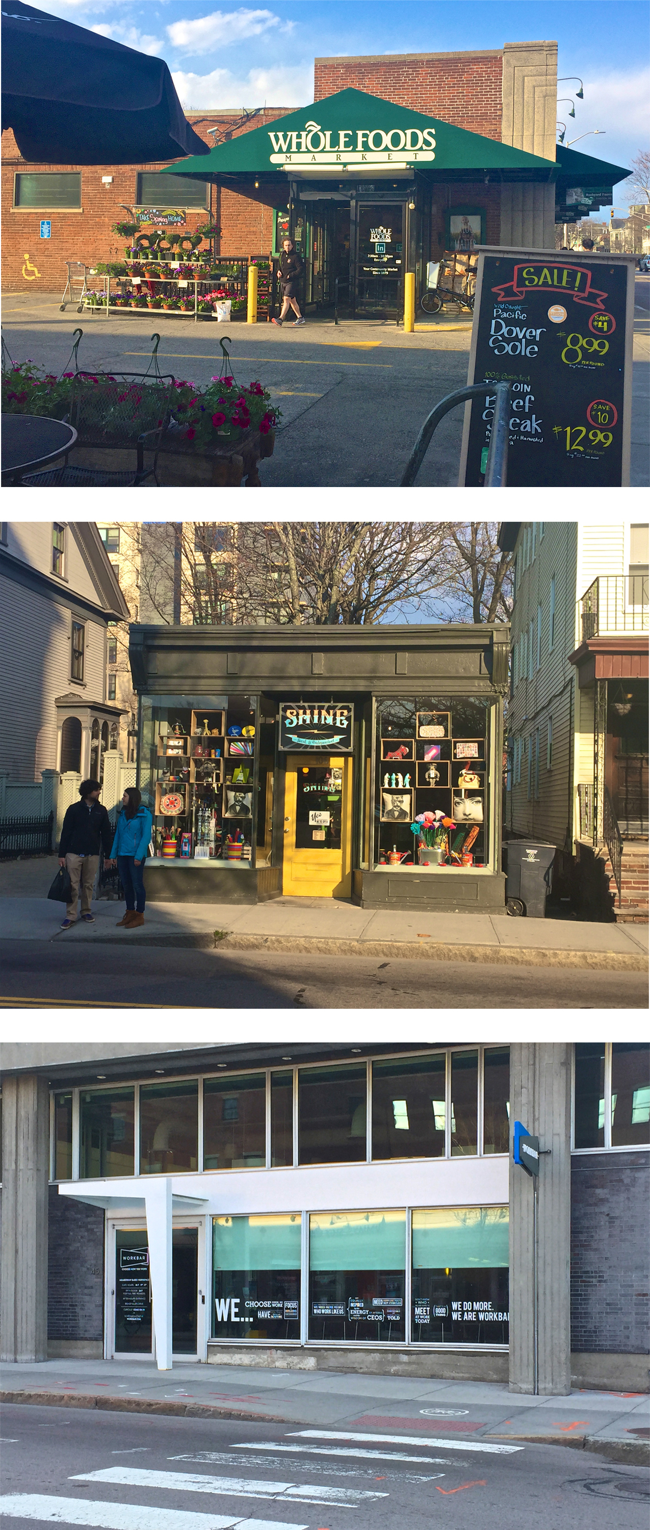 Figure 18: Top: Whole Foods, representing an influx of large corporations and chain stores into the area. Middle: Shine, representing the quirky, local small businesses that are making a come-back in this area. Bottom: Workbar, representing up-and-coming tech and start-up industries in Central Square. All three businesses are on Prospect Street.
 And this modernity of the rapidly changing 21st century extends beyond the storefronts. From 18th century roads, to streetcars to the subway system, Central Square’s place as a transportation hub has been a defining aspect of its development. Now the fundamental shifts in transportation that have occurred in recent years can also be found on my site. On Green Street there is a Zipcar parking lot and on Massachusetts Avenue there is a Hubway station (Figure 19). These new transportation systems illustrate the modern shift towards sharing and being more concerned about environmental issues. And movement towards greener living are apparent in other parts of the area as well. For example, an old home on Austin Park has been retrofitted with solar panels (Figure 19).
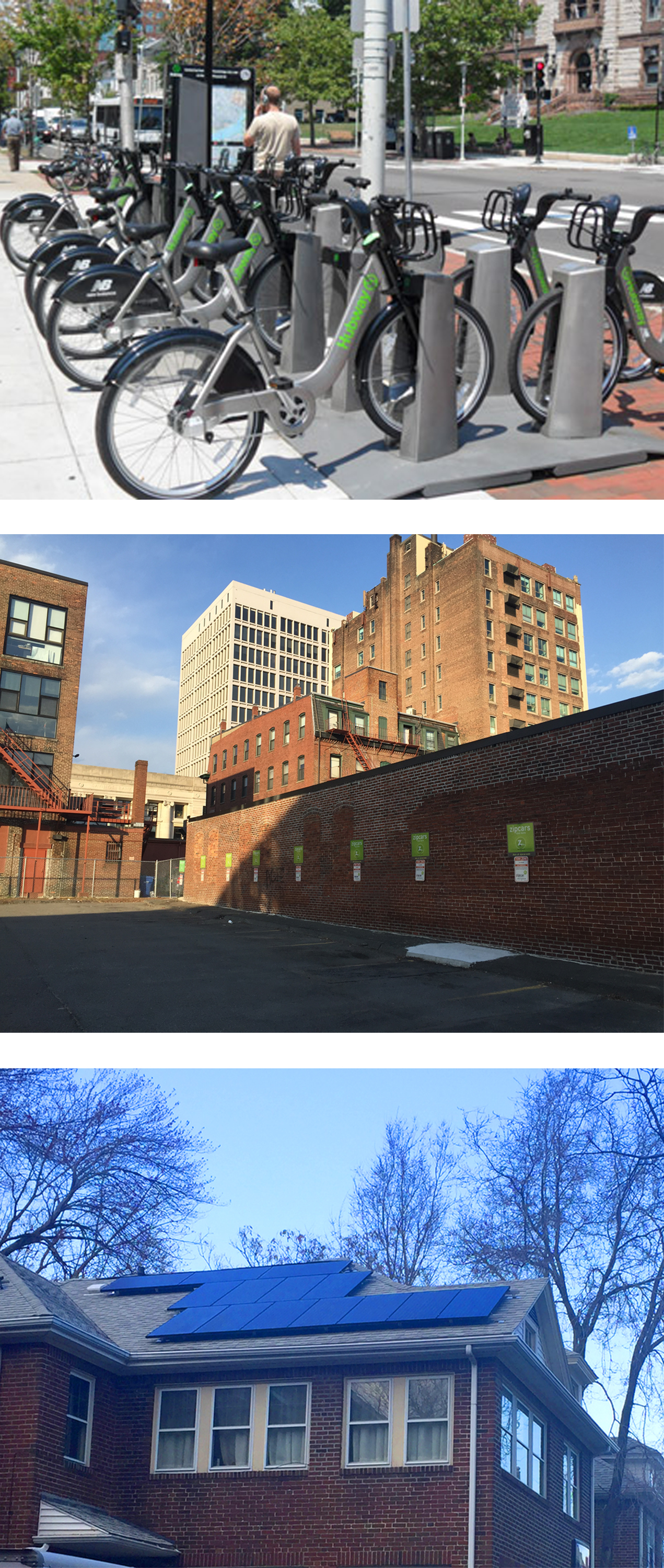 Figure 19: Top: Hubway bike-share stop on Massachusetts Avenue. Middle: Zipcar car-share parking lot on Green Street. Bottom: Solar panels on house on Austin Park. All three of these technologies represent the growing emphasis on more environmentally friendly systems and behaviors.
 These trends are likely to continue and development will take over the vacancies but could also significantly change the demographics of the people who live in the area and decrease the economic and cultural diversity. However, it seems like most of the public serving buildings are here to stay, at least for quite a while, and the easy access to public transportation means that people do not need to live or even work locally to enjoy the amenities.
___
The Human Touch: Personality throughout the Centuries
There are so many details that can one notices when walking on a street to gauge the kind of neighborhood and community that exist there. Delores Hayden said, “one can’t simply turn to economic geography (or any other kind of quantitative analysis) because there the human experience of place is often lost” (Hayden, 17). Many observations that can not be quantified are generally are n0t included on a map or historic records but these more “human” details can arguably be more important than the larger architecture and cityscape when it comes to creating a place with a distinct spirit and persona.
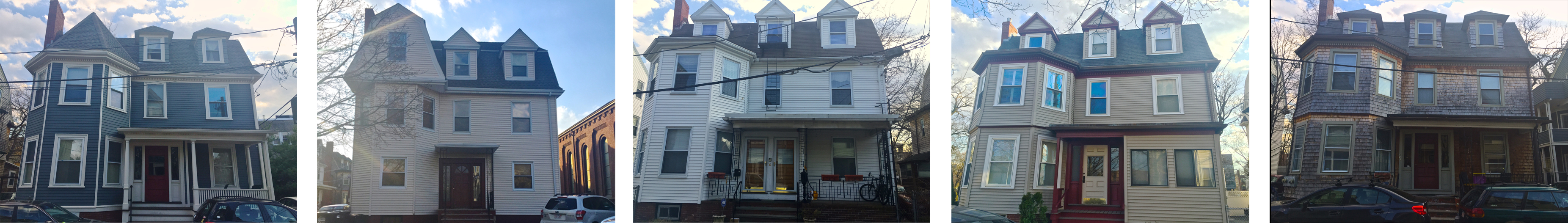 Figure 20: Five different homes along Saint Paul Street were all built by the same contractor at the same time around the turn of the 20th century (see Site Through Time, Fig. 7). This was the first multi-home development on my site made up of large, separate, single-family houses. Despite the original uniformity, over the past 100 years, many details in the homes have varied such as porches, railings, columns, doors, windows, and paint color. Some homeowners have even added additions, like at the top left of the second house and bottom right of the fourth house.
 For example, the first multi-home development of my site is located on Saint Paul Street and, built around the turn of the 20th century, is made up of large, separate, single-family houses. As these houses were all constructed at the same time by the same owner it is likely that they had the same original construction plans. However, over the past 100 years, many details in the homes have varied such as porches, railings, columns, doors, windows, and paint color (Figure 20). These changes represent how occupants of the city affect the neighborhood they reside in by contributing their own sense of style and aesthetic priorities. This human touch is able to transform a monotonous block into something that reflects the character and personality of the residents.
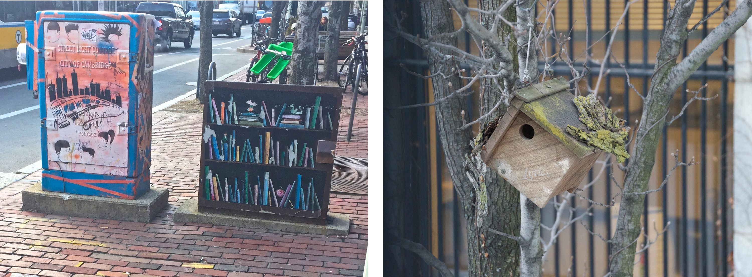 Figure 21: Public art: painted utility boxes on Massachusetts Avenue (left) and a birdhouse that is part of a row of birdhouses down Pleasant Street (right).
 Similarly, public art, like the decorated utility boxes on Massachusetts Avenue or birdhouse series on Pleasant Street (Figure 21), give an outlet for people in the community to express themselves creatively while adding to the beautification of their neighborhood.
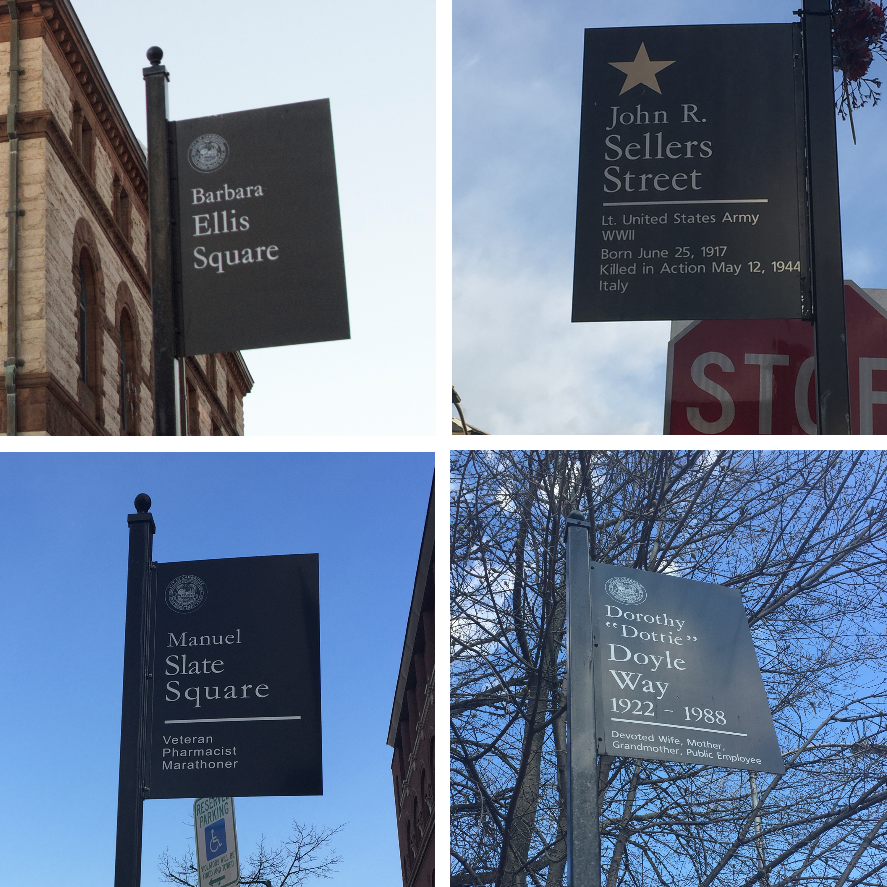 Figure 22: Four sign posts designating squares and streets named in honor of significant Cambridge residents.
 ___
Furthermore, on various corners on my site, there are signs naming streets and “squares” after people who had a significant impact on the public (Figure 22). Honoring these leaders and role models in such a public way adds a personal touch to the defined cityscape and further strengthens the sense of a united community.
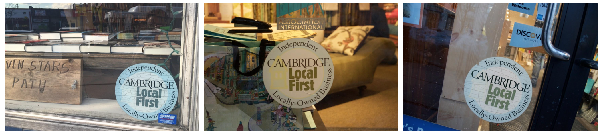 Figure 23: "Cambridge Local First" Stickers on shop windows on and around Massachusetts Avenue to emphasize the value of local independent businesses in the area.
 Lastly, “Cambridge Local First” stickers appear proudly and prominently on storefronts all across my site. The Local First movement started in 2005 has shaped the economy of the area and steered it primarily away from chain retailers to give it a more contrasting and non-mainstream makeup. Today Central Square is known and loved by many for its off-beat and independent day and night life and organized, community-driven movements such as this one have helped, and will likely continue to help, keep it this way despite the competition from larger more powerful companies with recent economic interests in the area.
___
Conclusion:
Where once I saw an odd assortment of non-flowing buildings and uses, I now see the multiple layers of time that tell the story of where my site has been as well as where it is going. I have been able to divide the traces and artifacts I discovered on my site into three separate layers in time: the grand and growing 18th and 19th centuries where what started as a Boston suburb became a unifying center to a newly developing city, grew and thrived for years as a wealthy residential district and downtown area; the declining 20th century as the area then faltered and took a took a downward economic turn, lost business, and gained an edge; and the recently rising 21st century as now the area is on the rebound with small businesses and large companies blooming once again. I have also added a fourth layer of “personality”¬–the details that are not noted on a map or go down in history, but give a place its distinct character and vibe.
At this brief moment in time, one is able to see a very particular snapshot as all of these layers are distinctly represented in the current cityscape. Due to its mix of different communities and orientations, my site has various qualities that epitomize the Cambridge as a whole, giving insight into the larger zoomed-out picture of trends throughout the city. However, while the historically designated and protected areas are not likely to change much in the future but rather remain a celebrated layer of the history, other areas, businesses, and populations are under threat. Right now my site is in a transitional period as the new and economically profitable are moving in and likely to push out the older and less economically secure.
___
Sources:
Dolores Hayden, The Power of Place: Urban Landscapes as Public History (MIT Press, 1995)
Figure 1 (map): “Cambridge, Massachusetts.” Map. Google Maps. Google, April 2015.
Figure 2 (map): Batchelder, Samuel F. "Cambridge & Vicinity in Revolutionary Times." WardMaps LLC. Cambridge Historical Society. Showing Cambridge Circa 1777.
All images/photographs by author unless otherwise noted.