i. introduction
ii. aqua
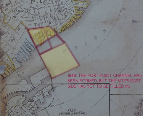 James Slade, Plan of Boston, Corrected under the direction of Committe on Printing of 1861, 1862.
 Sandy flatlands lie far beneath the dense streets and red-brick lofts of eastern Fort Point. Indeed, this section of my site isn't mentioned on maps from before circa 1880. I gather that, after the land had been filled in, the east side became a hub for industry. I presume the channel served as a mechanism of wastewater disposal when east Fort Point's factories were first constructed. From the same maps, I notice that the western side of the channel was lined with wharfs before the east was filled in. I suspect that filling Fort Point may have devastated the channel's natural environment and eliminated the possibility of a fish enterprise. I envisage historically that the west side followed the east's model of commercialization. In a time when water pollution was not a consideration, and with both sides acting as centers of commerce, the channel must have been a melting pot of urban pollutants
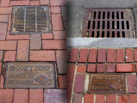 Relying on good faith: from left, drain on west and east side of the Fort Point Channel
 Outland from the South Boston Public Works building, the Fort Point Channel transports treated combined sewage to Boston Harbor. East and west of the channel, you can find sign-postings disclosing that street water is drained directly to the harbor. I expect that after a storm these drains lead directly to the channel. Spirn explains that sediment and pollution in urban water systems can deoxygenate water, which may eventually lead to a shift in fish species (Spirn 210). Discharging storm water directly into the harbor will obviously draw pollutants from the city into the water. Pollutants from storm drainage and even snow-melt can accumulate and begrime aquatic species' environments – hence the illustration of fishes on the “don't dump” signs.
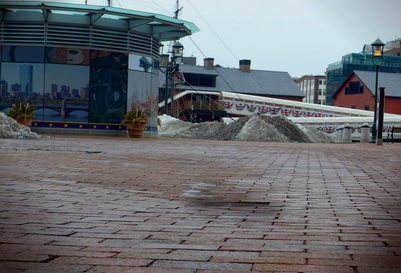 West side: a well-functioning drain near the Harborwalk
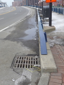
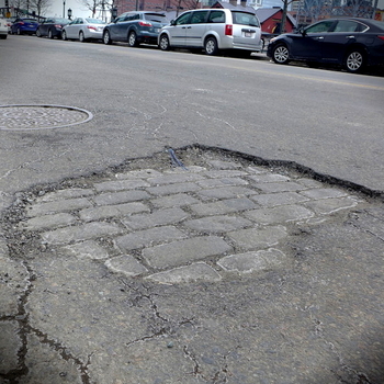
 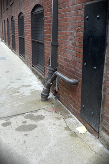 East side: a drainage pipe and cracked sidewalk.
 Standing on the west bank, between Seaport Boulevard and Congress Street, I spot a drain lying at the bottom of a brick basin. There's a trace of luminous white salt between the drain and a neighboring pile of snow, indicating that snow may have been piled strategically to reach this drain as it melts. In any case, I find no indications of warped foundation. It appears the drain has been recently built and inset deliberately to collect water. The historic buildings on the east side often have drain pipes running from their gutters. One particular pipe on A Street, near its intersection with Congress Street, cuts right into the sidewalk. Close to the pipe, a large cracks spans the paving – this may be due to leaking water from the pipe that causes the concrete (which is slightly porous) to expand. As far as I can see, it's unusual to happen upon a well-functioning drain in Fort Point. I find sunken foundation, cracks in the pavement, or pooling at nearly every street-corner – especially on the east side.
 West side: pooling water.
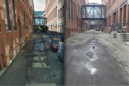 East side: pooling water: left, google maps - right, own photo.
 (©2014 Google · Sanborn, DigitalGlobe, MassGIS, Commonwealth of Massachusetts EOEA, USDA Farm Service Agency · Imagery Aug 25, 2013.)
I turn another street-corner, now on the west bank of Seaport Boulevard, and my eyes fall to a pool of water by the road side. Why, I wonder, isn't the water collected by the drain? Upon inspection, I notice there's a pothole in the road that accumulates sediment and water. Roads on the eastern side face the same issues. On the east side, I discover an anonymous alleyway between Farnsworth St. and Thomson Pl. in which water pools in the middle of the street. Comparing with Google Streetview, this appears to be a persistent problem for the alleyway. Drainage pipes run from the gutter to the ground level, aiming for the sewers, but instead the road has sunken and large puddles seep into its foundations.
ii. terra
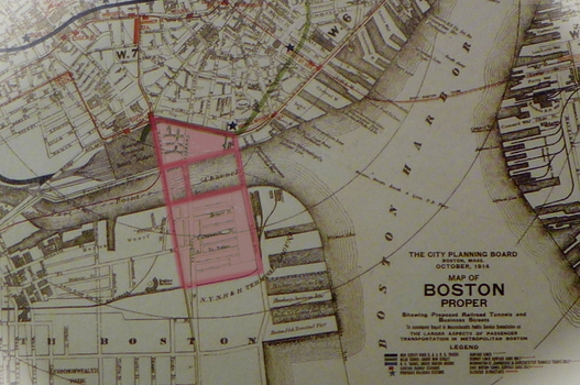 "Map of Boston Proper," City Planning Board, Boston Mass, October 1914.
You can see here on Atlantic Avenue, between Congress and Seaport, the sidewalk has sunken beneath the curb. Salt residue is left on the sidewalk by evaporated water that drifted towards the sunken curb.
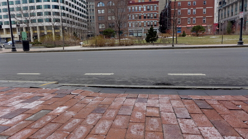 West side: sunken pavement.
I also see alligator cracks on the left of the "West side: pooling water". Elkins defines alligator cracks as the result from road overuse or thin road surface (Elkins, 28). These cracks jar the surface of Fort Point, especially at intersections of large roads. Both sides of the channel contain stripped roads. “Roads are stripped – when the underlying layers lose their bond with the top asphalt layer. Trucks can strip pavements, and so can storms” (Elkins, 33). Interestingly, both sides seem to have a layer of stone cobbling beneath the upper asphalt. The eastern example appears more extreme, but the asphalt's purpose is unclear. Perhaps the asphalt was used to mend some foundational issue with the road? The asphalt has rough edges and lies near protruding tree roots, suggesting that the asphalt may have been laid to remedy major cracks in the road surface. In the western example, the road has torn away in a patch, clearly revealing the underlayer. I think the road traffic ravaged a chunk of the top layer in the western example.
 West side: stripping.
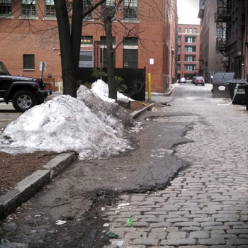 East side: stripping.
iii. caelum
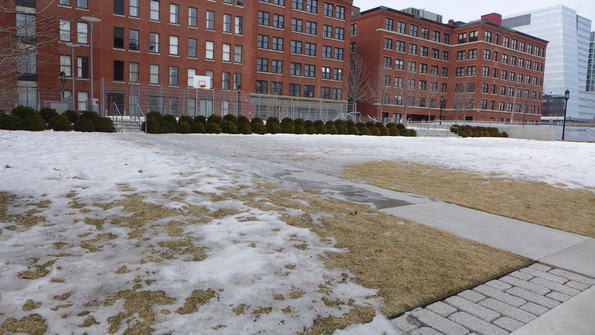 East side: a patch of cold.
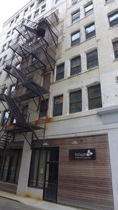 East side: weathering fire-escape.
 West side: sunken pavement.
Specifically, the only plot of land in my site that remains mostly coated in snow lies near a playground on the east side. This playground rests on Boston Wharf Road, south of its intersection with Seaport. The play equipment and a basketball court sit atop a windy patch of grass, in the shade of tall brick buildings. This area doesn't receive much sunlight and the open grassland doesn't absorb heat like concrete and urban materials do. Hence, I believe this area has its own microclimate - similar to that at the water’s edge - that still supports a layer of snow despite the rising temperature.
I imagine that the proximity to the ocean brings in precipitation with relatively high concentrations of salts. Much of the construction on Fort Point makes use of iron that reacts with the rain water, oxidizing into rust. Thus, you see many rust stains on the bridges and pipes and fire-escapes from the rough, weathering maritime climate.
iv. aer
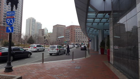 West side: street canyon.
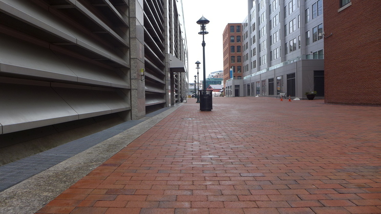 West side: ventillation into Pearl Street.
Across the channel on the east side, the large streets lie parallel to the northwest wind. Walking down Congress St. away from the water, my hair blows forwards and presumably the exhaust fumes follow, but I can't smell them, and the air seems cleaner. The dense grid of smaller roads and tall buildings without much traffic appears to control air pollution. However, on the same nameless alley between Thomson Place and Farnsworth Street where the water pools in the road, there's a multistorey parking lot that opens into the alley. Even on a peaceful Sunday afternoon, the alley reeks of emissions. What can Fort Point do to purify its air? East side: parking lot in alleyway.
v. plantae
The trees in Figure "East side: parking lot in alleyway" lean south-east, towards the morning and afternoon sun. In fact, the monotone height of buildings on the eastern side forces most trees beyond a certain height to bend towards the center of the streets. Otherwise, the trees live in the shadows of buildings, starved of the sunlight they require to prosper.
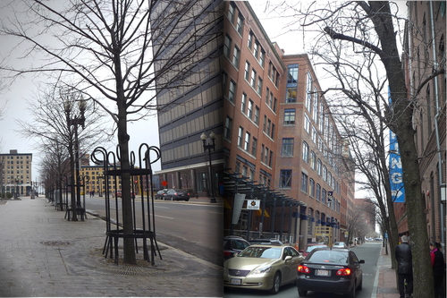 Left, trees of the west. Right, trees of the east.
 Woe be ye teacup tree!
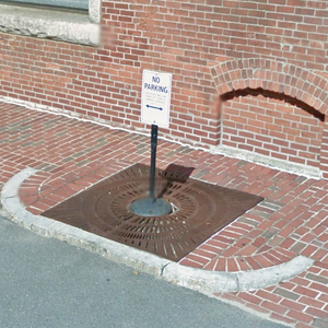 No parking on this tree!
©2014 Google · Sanborn, DigitalGlobe, MassGIS, Commonwealth of Massachusetts EOEA, USDA Farm Service Agency · Imagery Aug 25, 2013.
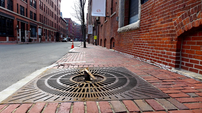 East side: tree stump on Thomson Place.
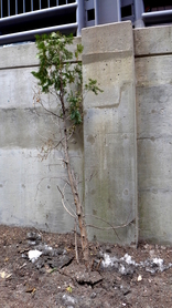
On Summer St, where it runs over Boston Wharf Road, I witness another tree-fence interaction much like the one from our field trip. Although I initially empathize with the tree, I realize these interactions are a symbol of hope. The fence dilapidates the tree, and the tree dilapidates the fence. But imagine if we change that verb – and dilapidates become accommodates. Fort Point has a long way to go, but I have faith that nature and Fort Point can coexist.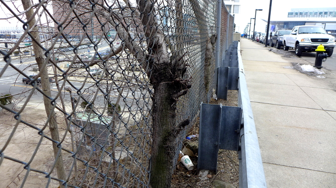 East side: a sign of hope?
vi. conclusion
Bibliography:
Elkins, James. How to Use Your Eyes. Routledge: New York, NY. 200: pp. Vii-xi, 12-19, 28-33, 170-175.
Spirn, Anne Whiston. The Granite Garden: Urban Nature and Human Design. Basic: New York. 1984.