I'm standing at the corner of Vassar Street and Massachusetts Avenue, watching people and cars pass by during rush hour, listening to the sounds of screeching tires, impatient bus drivers tooting their horns, the laughter of kids across the street and the beautiful singing of birds on a nearby tree. It's hard to believe that the ground I'm standing on today used to be a tidal flat (figure 1 & 2).
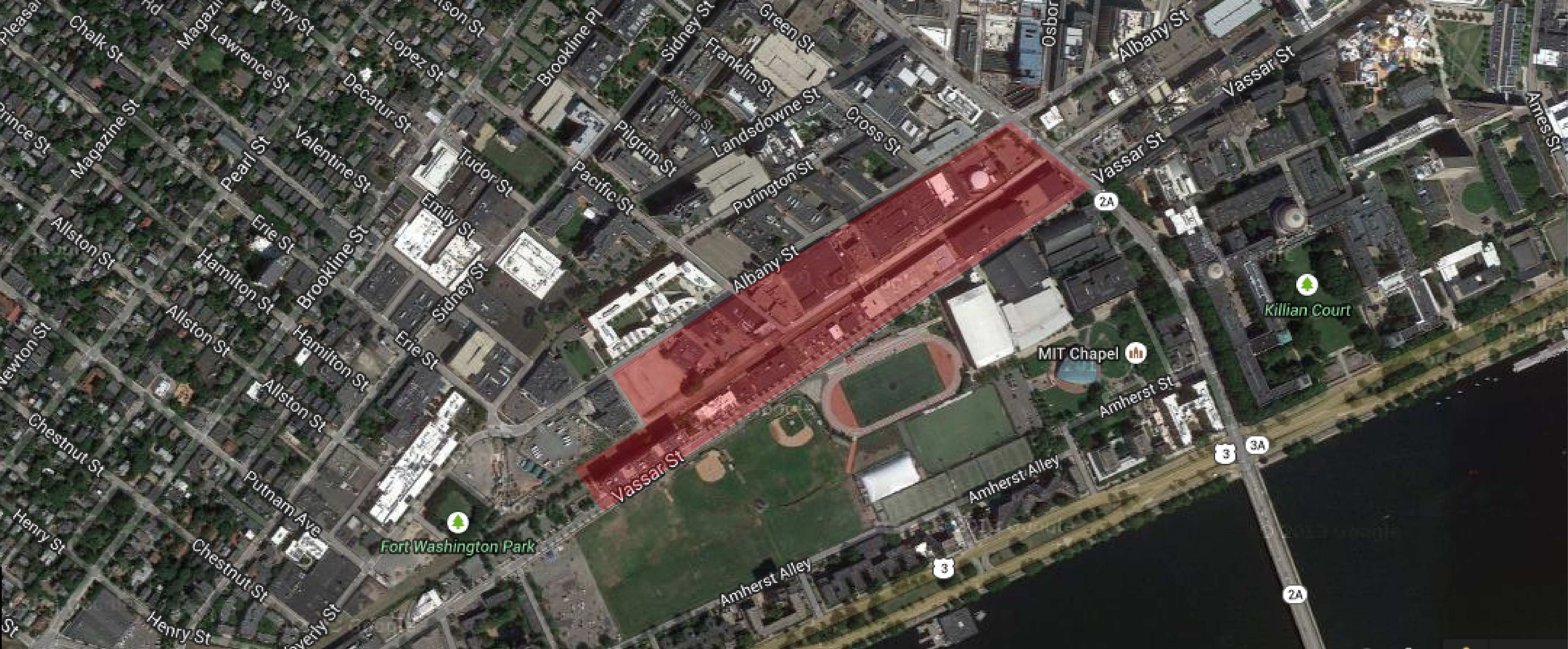 Figure 1: Map showing site highlighted in red | Map data ©2015 Google, Sanborn, Cnes/Spot Image, DigitalGlobe, MassGIS, Commonwealth of Massachusetts EOEA, USDA Farm Service Agency.
Since the dawn of history, mankind has asserted itself at the expense of nature. Like most parts of Boston today, my site owes its existence to the endless human need for space and expansion. The city of Boston was expanded over the centuries mainly through landfill and through annexation of neighboring municipalities. Between 1630 and 1890, the city more than tripled its size by land reclamation, specifically by filling in marshes, tidal flats and gaps between wharves along the waterfront.
 Figure 2: Possible site location highlighted in red | Map of Boston from "Marshall's Life of Washington", published by P. Phillips, Bridge Street, Black Friars, London, on Sept. 18, 1806.
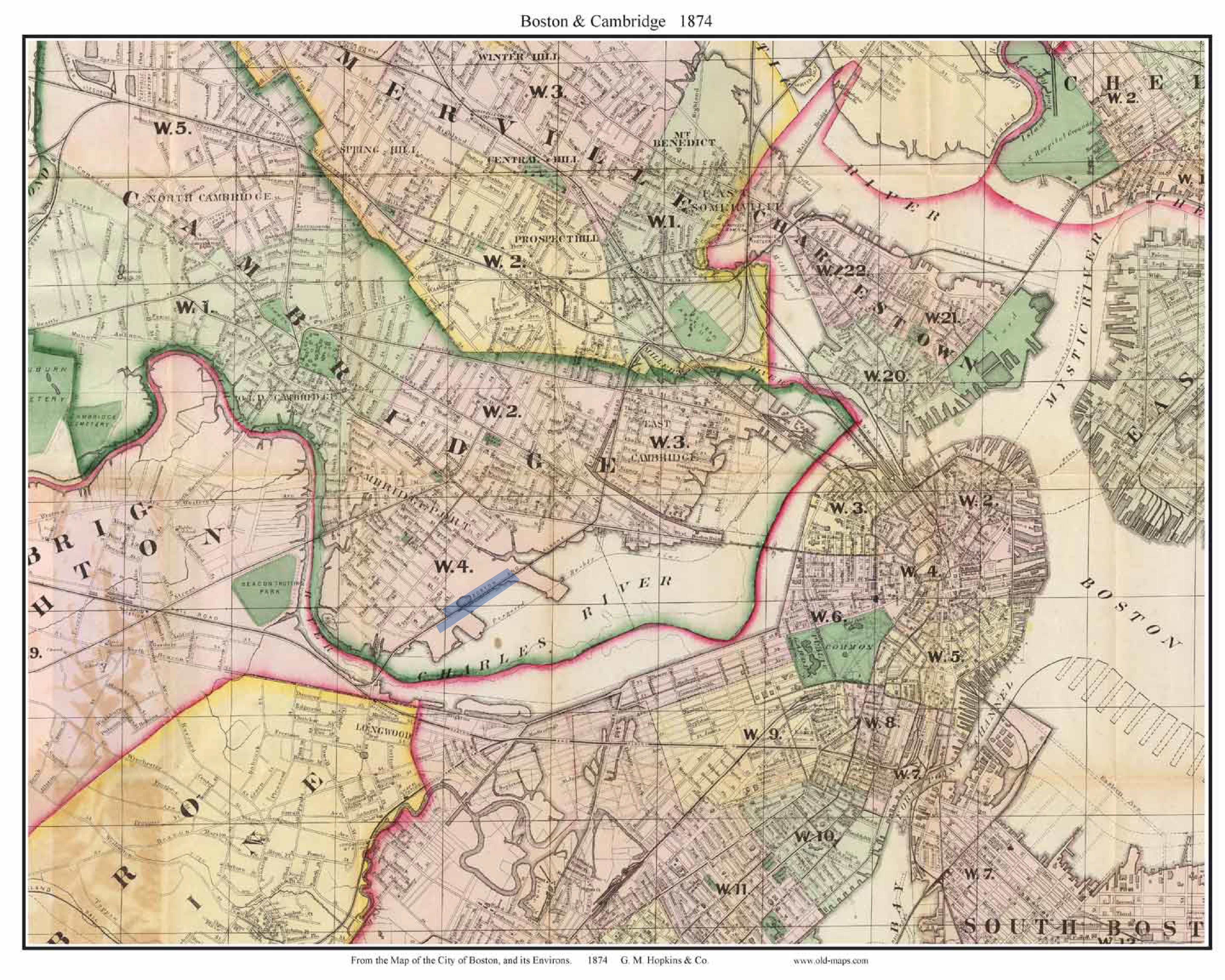 Figure 3: Possible site location highlighted in blue | Map of the City of Boston and its Environs, published by Griffith M. Hopkins & Co., Philadelphia, 1874. Map shows that my site is divided by the railroad, where half of the site was on tidal land and the rest is filled land.
A brief look at the site's original location reveals the dramatic evolution of Boston at the hands of humanity. The map above from 1806 depicts a Boston almost unrecognizable from the one we know today (figure 2). It’s hard to believe that more than one hundred and seventy years ago, my site along Albany Street was a tidal flat on which local inhabitants still dug for clams and oysters, as it is a far cry from the bustling urban area it is today (figure 3). This evolution of site started in 1853 when a railroad was built across the flats to tie Boston to East Cambridge. A quarter century later, the Charles River Embankment Company built the sea wall on Memorial Drive and filled the rest of the land. [1]
From building railroads and the sea walls to extensive landfill projects, Boston’s urban environment and shape seem to be under human control, however the exact opposite is true. This incorrect assumption of a disconnect between city and nature is widespread. As Anne Spirn states in her book, The Granite Garden, “nature in the city is far more than trees and gardens, and weeds in sidewalk cracks and vacant lots. It is the air we breathe, the earth we stand on, the water we drink and excrete, and the organisms with which we share our habitat” . Upon closer examination of the site, it is clear that it is impossible to fully extricate natural processes from the city and its associated human processes. In fact, human actions coupled with existing environmental conditions and natural processes all produce the consequences and conditions we see today in Boston.
Environmental conditions and natural processes, such as soil erosion by wind and water, depositions of minerals or gravel, decay of materials due to time and harsh weather and plant growth, continue to shape the urban environment. These processes can be observed by looking at street shoulders, pavements, twigs, sand, grass, and all the ordinary stuff we tend to ignore everyday. Once you start seeing these small details, you start uncovering new layers of meanings helping you understand your environment and the conditions shaping it.
This paper will discuss how natural processes have shaped and continue to shape my site, and how my site has shaped nature in return. I started with an explanation of the environmental development of my site over the past few centuries to put my observations in context, and now I will walk you through my observations of three main natural processes – plant growth, pavement cracking, and wind - and try to explain their significance and effects on my site.
You can learn a lot about a site by looking at the plants and trees growing in it, such as the sun direction, soil conditions, water availability and much more. My site between Vassar Street and Albany Street has plenty of trees and various plants. These plants provide substantial shade and absorb solar energy. They also help alleviate the urban heat island effect, a phenomenon described in The Granite Garden by Anne Spirn, where cities are significant hotter than nearby countryside because “concrete, stone, brick, and asphalt absorb heat more quickly and store it in greater quantities than the plants, soil, and water that make up forest, fields, and ponds” in the countryside. [3]
The site has different types of trees, some are able to weather the freezing cold and endless series of snowstorms in Boston better than others, even though they have similar site conditions, such a amount of sunlight and soil conditions, like the example seen in figure 4 below.
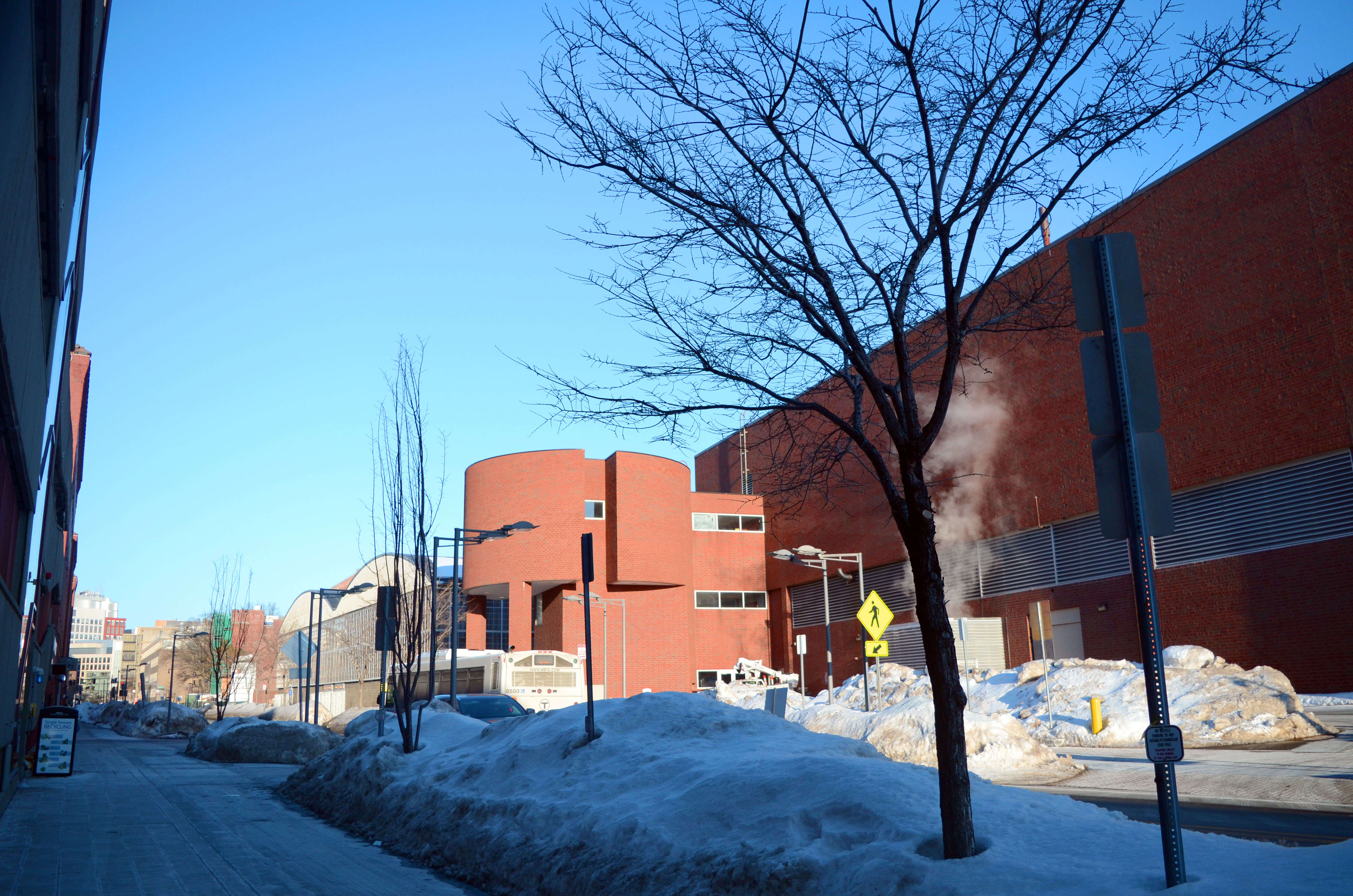 Figure 4: Trees on Vassar Street opposite to the MIT West Garage, Cambridge, MA. The tree on the right is healthier than the tree on the left and is able to withstand colder weather | Photo by Lina Kara’in.
This variation is due to the type of plants and their various adaptation mechanisms to survive the cold and drying conditions of winter. Trees cannot change their location or behavior like animals can, so they must rely on physiological and structural adaptations. Most trees drop their leaves in the autumn, as leaves are a major source of water loss and are difficult to protect from winter conditions (figure 3). However, some trees are able to keep their leaves during such harsh conditions as the example in figure 5 below.
 Figure 5: Tree on Vassar Street, Cambridge, MA. This tree is able to withstand the snow and still even have leaves | Photo by Lina Kara’in.
Another factor influencing the growth of street trees is the solar aspect. Buildings lining city streets effectively create valleys, which cast the North-facing side in shadow and expose the South-facing side to more solar radiation on average. Thus, the placement of trees in relation to buildings has a tangible impact on how healthy the tree will be. In figure 5, below, trees on both sides of the street receive similar amounts of sun, as there are no buildings to shade the North-facing trees, so they recieve as much sun as the South-facing trees on site.
 Figure 6: Tree on Vassar Street, Cambridge, MA. The image shows different types of trees and their adaptations in winter, as well as the same types of trees with similar sizes growing on opposite sides of the street. There are no buildings to shade the north facing trees, so they get as much sun as the other trees on site | Photo by Lina Kara’in.
You can also learn a lot about the site by looking at its road shoulders and pavements. The road surface in figure 6, below, is heavily distressed. This pattern that resembles the speckled skin of reptiles is called fatigue cracking or alligator cracking by James Elkins. It could have been caused by overuse, as the stress of traffic as well as snowplows can create small cracks in the road surface. The freezing and thawing of meltwater expands the cracks allowing even more water to reach the subsurface. As that water freezes, it expands and pushes the pavement up and the subsurface down. When the ice melts, a cavity is left under the pavement, which collapses when vehicles drive over it. When a surface stars to crack as this one, it is only a matter of time before trucks and cars will dislodge the pieces, creating potholes. [4]
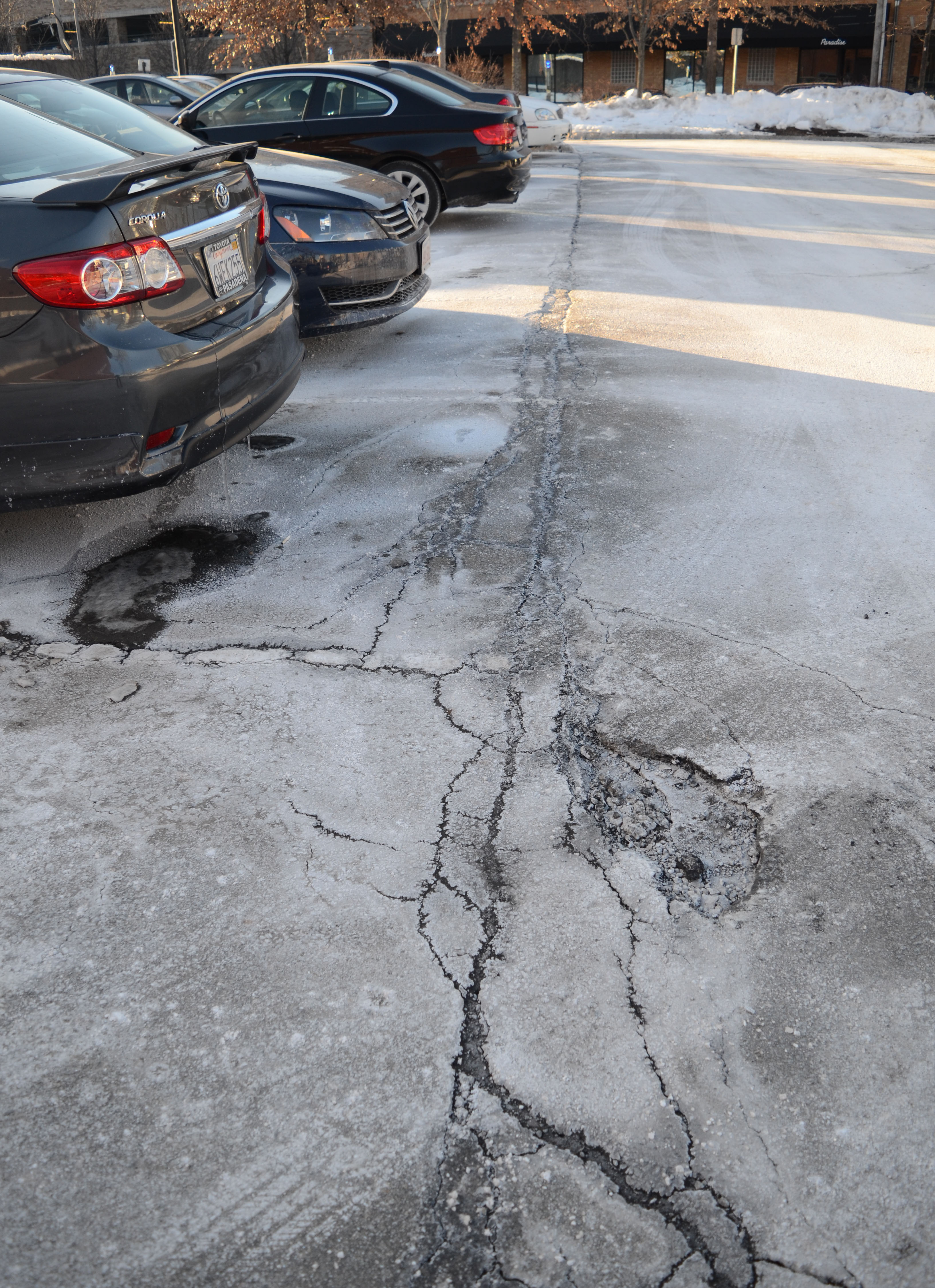 Figure 7: Image showing alligator cracking in the parking lot on the intersection of Albany Street and Massachusetts Avenue, Cambridge, MA | Photo by Lina Kara’in.
Once the potholes are deepened and the fragments become loose, wind becomes an important contributor to the weathering processes. The wind carries the detached pieces away, exposing the interior layers of asphalt and causing loose gravel to accumulate by the curbs.
These alligator cracks are dangerous to drivers and pedestrians. Many people will swerve their vehicles in an attempt to avoid potholes. This leads to them swerving towards cars and trucks in the opposing lane, or towards pedestrians on the sidewalk. Another problem with potholes is that they can cause serious damage to a person’s vehicle. This may not seem like a big deal, but it costs drivers nation wide millions of dollars a year. These cracks are hazardous, they cut into the streets and reveal their worn state, suggesting that either Cambridge city does not concern itself in the upkeep of its roads or that the distress is occurring more rapidly than the maintenance can mitigate.
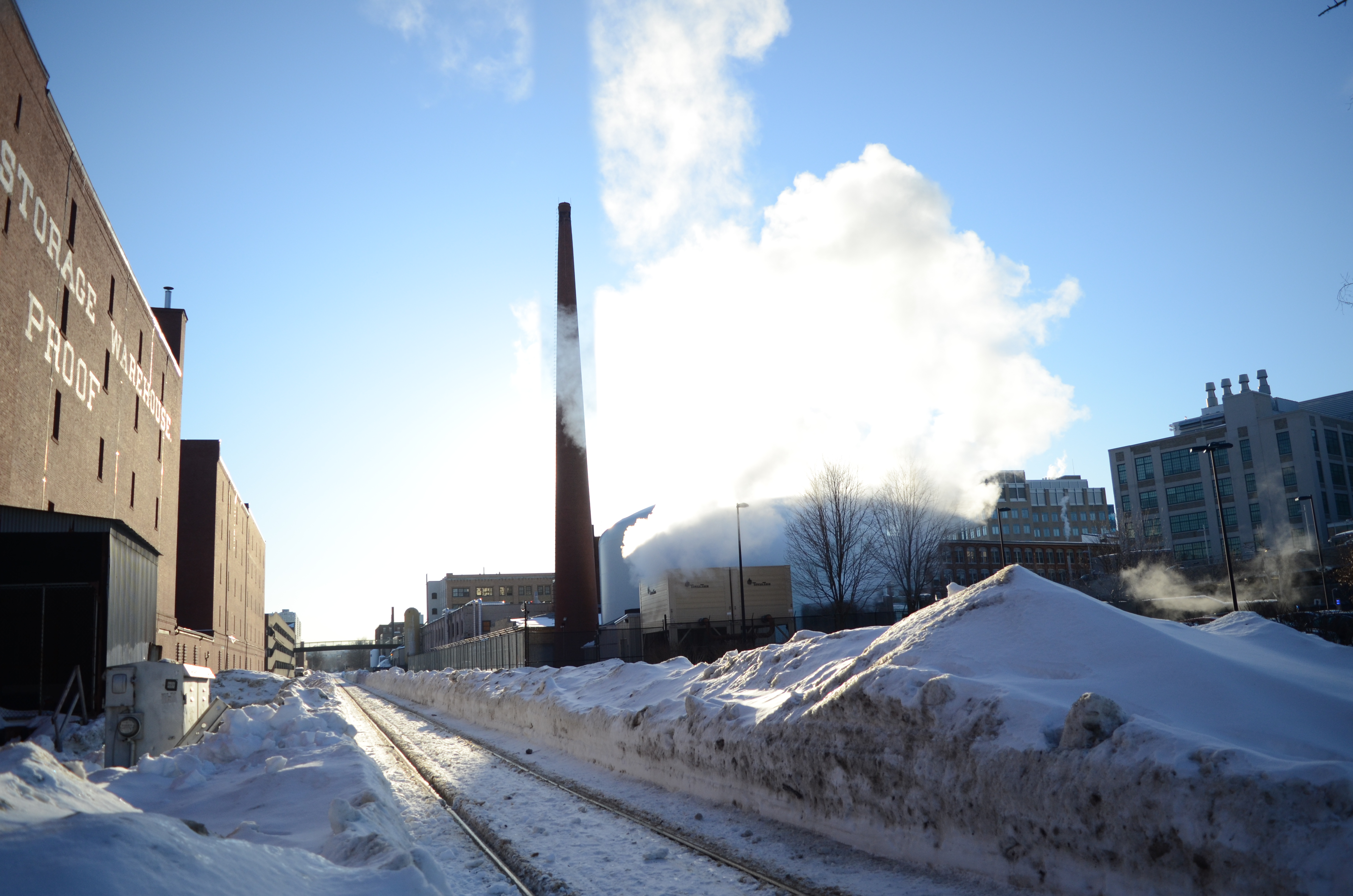 Figure 8: Image showing steam from the MIT nuclear reactor near the intersection of Albany Street and Massachusetts Avenue, Cambridge, MA | Photo by Lina Kara’in.
Another element of the site to study is the wind and airflow. The steam shown in figure 7, above, allowed me to measure the wind direction on Albany Street and to compare it to the wind direction measured by the National Weather Service at Boston Logan Airport.While the airport measurement was at approximately 247 degrees (SWS), this steam was consistently travelling up Albany Street at 230 degrees (SW). It seems that, even though the buildings on Albany Street are not that tall, their orientations have forced the wind to change slightly from its natural path. [5]
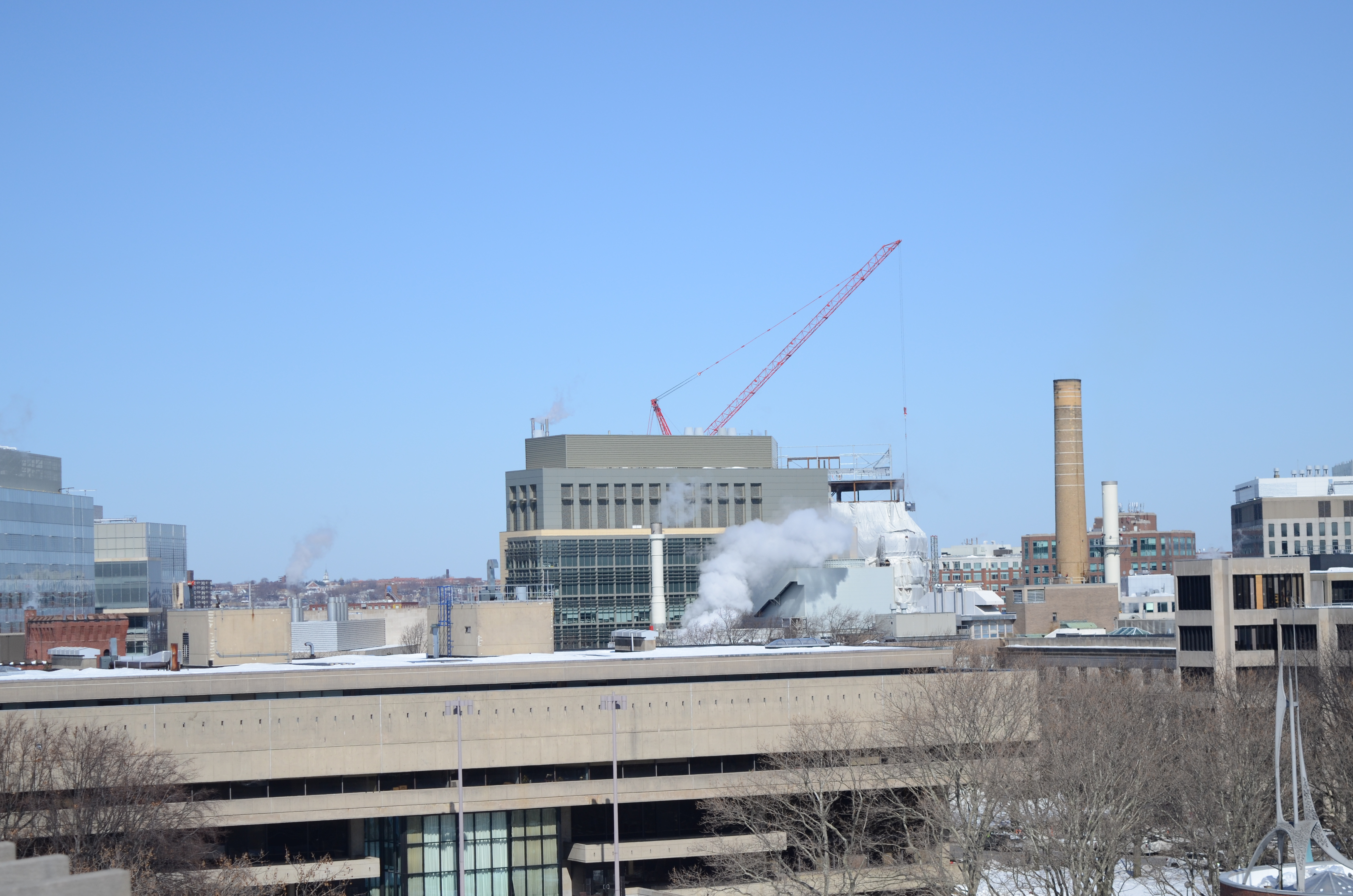 Figure 9: Image showing a chimneys emitting smoke on site, Cambridge, MA | Photo by Lina Kara’in.
In addition to wind direction and airflow, it is important to note what the wind is carrying. In the distance, we see a chimney emitting smoke that, with slight aid of a wind gust, could spread everywhere. The wind and the pollutants it carries could then get trapped in the alleyways or stir up dust from streets and sidewalks. The poison is then inhaled by the residents on the streets and drawn into buildings through openings.[6]
Effects expand beyond the obvious inhaling of pollutants. Toxic dust and soot from the city air settle on soil, old building sites transformed into playgrounds or urban gardens may contain toxic soils. Contaminated soils means plants that thrive today could be in trouble in the coming years. When it rains or snows, toxic water may enter the drains and flow into the Charles River.[7]
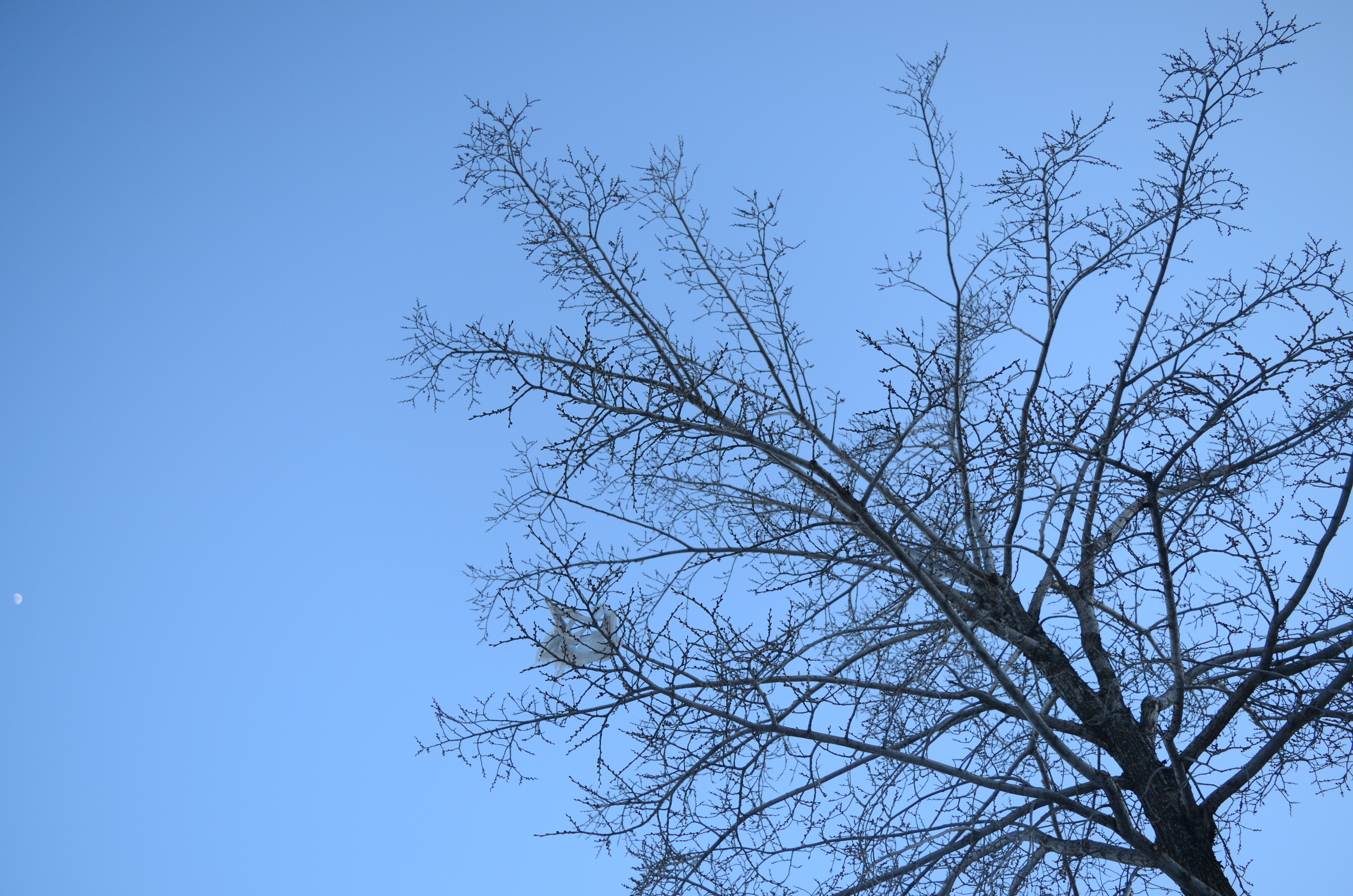 Figure 10: Image showing a plastic bag stuck in tree branches, Cambridge, MA | Photo by Lina Kara’in.
Boston’s urban environment and shape seem to be under human control, however the exact opposite is true. Every space is continuously shaped by natural processes, such as plant growth, wind and water flow, erosion, cracking and many more. No environment can exist in a vacuum, as human actions coupled with existing environmental conditions and natural processes all produce the consequences and conditions we see today in Boston. Water, wind, sun and plants all leave their mark on the urban environment. Each trace of natural processes or local geography tells a story, both about the history of a site and what the future may hold in store.
1.Simha, O. Robert. MIT Campus Planning, 1960-2000: An Annotated Chronology. (MIT Press: Cambridge, MA. 2001), 135.
2.Spirn, Anne Whiston. The Granite Garden: Urban Nature and Human Design (New York: Basic Books, 1984), 4.
3.Ibid.,54.
4.Elkins, James. How to Use Your Eyes. Routledge: New York, NY. 2000: pp. 28.
5.National Weather Service:
http://forecast.weather.gov/MapClick.php?lat=42.365586994845046&lon=71.10414786203341&site=all&smap=1#.VPnwfynafN4
6.Spirn, Anne Whiston. The Granite Garden: Urban Nature and Human Design (New York: Basic Books, 1984), 57-58.
7.Ibid.,102-104