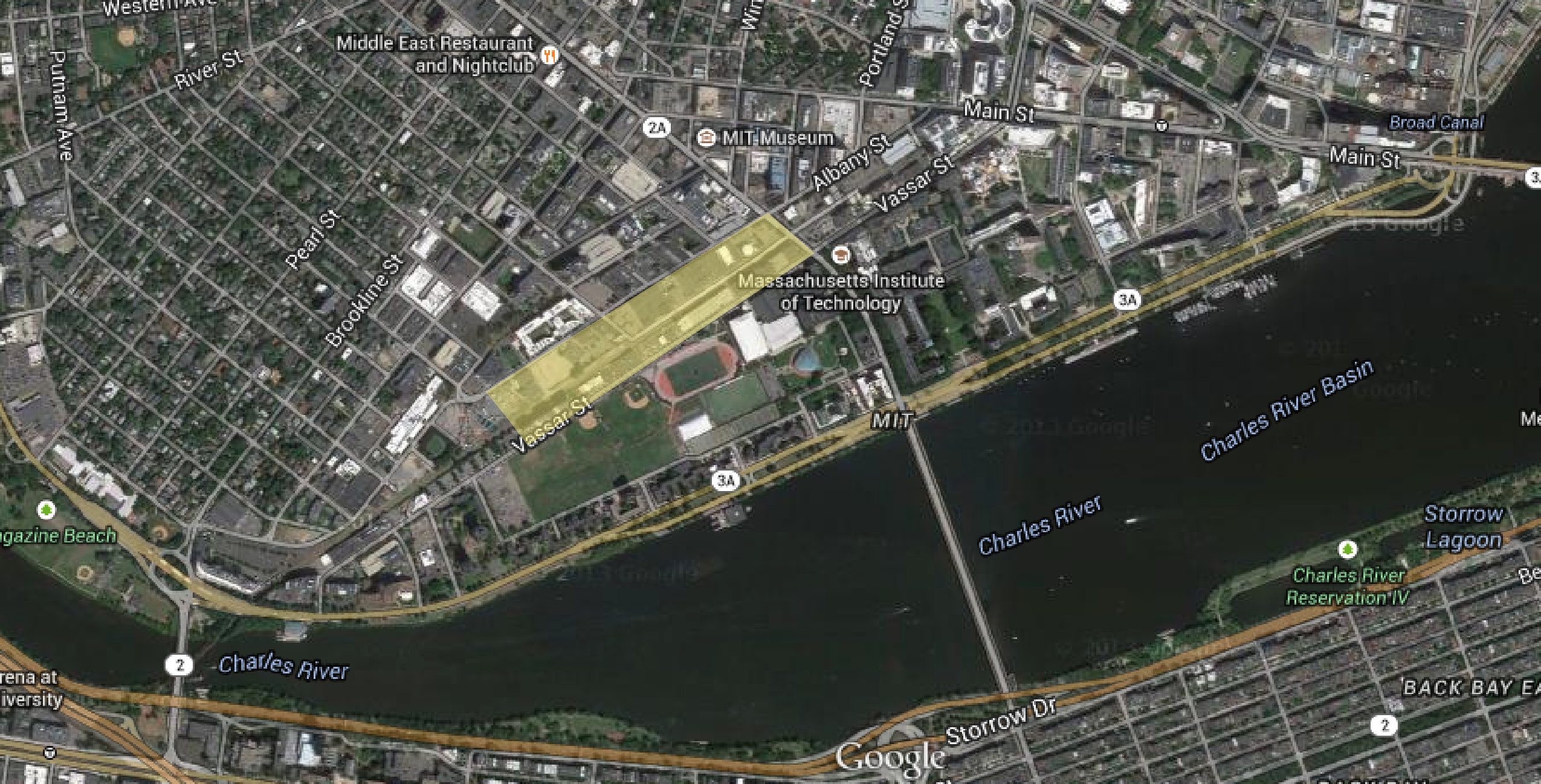
 Figure 1: Map showing site today highlighted in yellow, Cambridge,MA| Map data ©2015 Google, Sanborn, Cnes/Spot Image, DigitalGlobe, MassGIS, Commonwealth of Massachusetts EOEA, USDA Farm Service Agency.
Hidden in the artifacts, traces, and layers of my site are stories of powerful individuals, institutes, entire communities, even national and global historical events, economic and social trends. On my site today, artifacts, traces and layers represent three transformational periods: the railroad arrival in the mid-19th century, the industrial heyday in the early 20th century, the institutional expansion in the mid-20th century and the rise of the automobile age of the late 20th century (figure 1).
In this paper, I attempt to find these physical traces and artifacts present in the current environment, to discover signs and trends that indicate future changes, and to interpret their significance using photographs, historic maps and atlases.
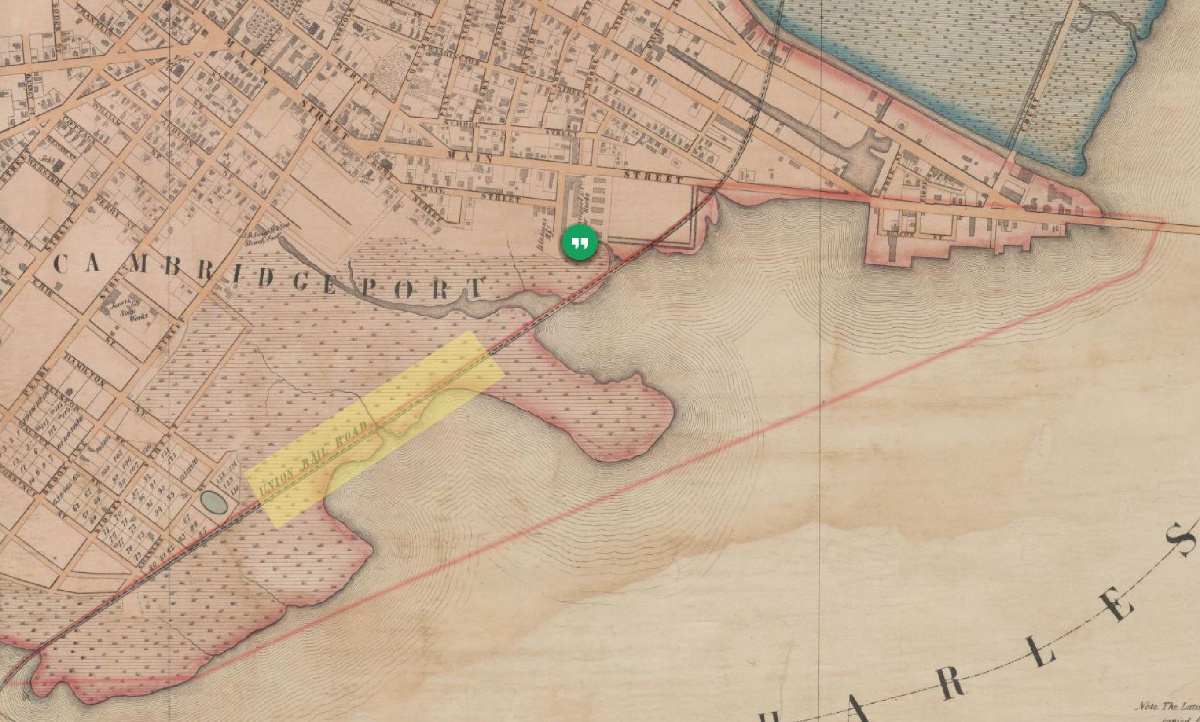 Figure 2: Site location highlighted in yellow, Cambridge, MA | 1854 Map of Cambridge by H.F Walling.
Map showing the Grand Junction Railroad cutting through my site in 1853.[1]
Figure 2: Site location highlighted in yellow, Cambridge, MA | 1854 Map of Cambridge by H.F Walling.
Map showing the Grand Junction Railroad cutting through my site in 1853.[1]
In 1853, The Grand Junction Railroad was built across the flats to tie Boston to
East Cambridge industries (figure 2). The railroad revolutionized the movement of goods
on my site, making it cheaper and faster to move large quantities of freight.
The railroad has expanded through out the years, starting with one main track in
1853 to an additional three tracks by the year 1916 (figure 3). Factories and storage
warehouses along the Grand Junction Railroad also added railroad spurs connecting them
to the main railroad, allowing shipments to be delivered directly to and from factories and
ensuring that traffic can flow freely along the railroad without blocking traffic flow with
stopped trains.
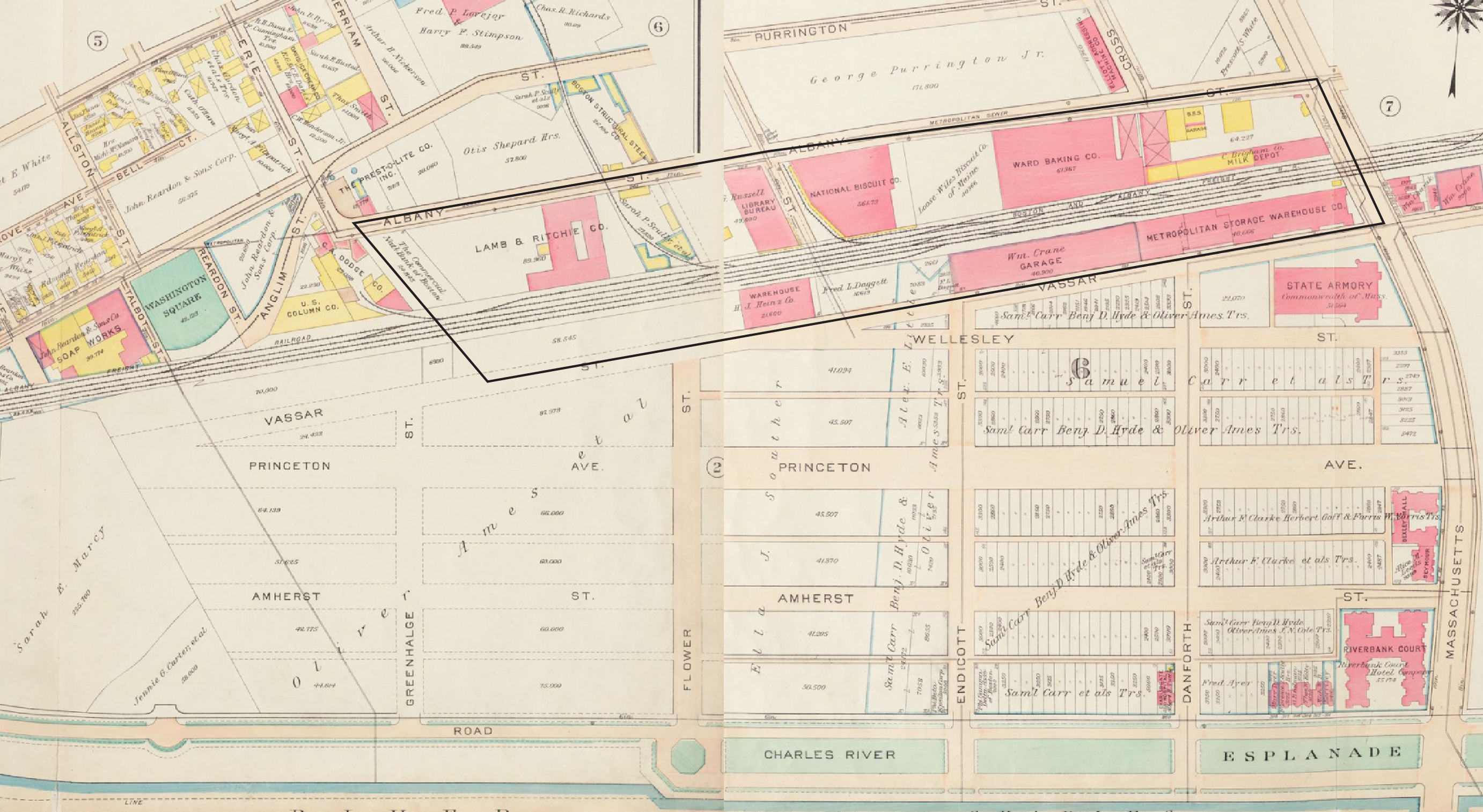 Figure 3: Site location inside black border, Cambridge, MA. Map showing the expansion of the Grand
Junction Railroad in 1916 by the addition of 3 tracks to the main railroad | 1916 Map of Cambridge, Atlas
of the City of Cambridge, Massachusetts by G.W. Bromley and Company. [2]
Figure 3: Site location inside black border, Cambridge, MA. Map showing the expansion of the Grand
Junction Railroad in 1916 by the addition of 3 tracks to the main railroad | 1916 Map of Cambridge, Atlas
of the City of Cambridge, Massachusetts by G.W. Bromley and Company. [2]
The Grand Junction Railroad is currently owned by the MBTA and controlled by the MBCR (The Massachusetts Bay Commuter Railroad Company) dispatcher. The railroad remains active nowadays yet sees little to no use due to inactivity in the area as all the factories on site moved out (figure 4). It is mostly used now for carrying scrap either inbound or outbound to the Schnitzer steel scrap yard on the Everett waterfront or freight to the Chelsea Produce Market, and non-revenue transfers of Amtrak and MBTA passenger equipment between the lines terminating at North Station and South Station. [3]
 Figure 4: The Grand Junction Railroad between Vassar Street and Albany Street, Cambridge, MA. The number of main railroad tracks has been reduced to one main track and a right-of-way track instead of the previous 4 main tracks | Photo taken by Lina Kara’in, Cambridge, MA, 2015.
The number of main tracks has thus been reduced from four tracks in 1996 to one main track and a right-of-way track, which is currently owned by MIT (figure 4). Many of the railroad spurs connecting factories to the main railroad were also removed, as they were no longer in use. As Hayden mentions in her book, The Power of Space, the removal of these railroad tracks shows how “change in time can be traced in incremental modifications of space as much as in original city plan or building plan”.3 Traces of the previous tracks and spurs can still be seen on site, as small sections of the tracks remain covered with weed and grass (figure 5 & 6).
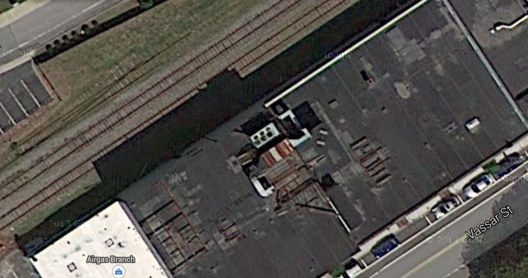 Figure 5: Aerial view of the Grand Junction Railroad between Vassar Street and Albany Street, Cambridge,
MA. Image showing traces of the previous railroad tracks now covered by weed and grass, as only a small
section of these tracks remain. | Map data ©2015 Google, Sanborn, Cnes/Spot Image, DigitalGlobe,
MassGIS, Commonwealth of Massachusetts EOEA, USDA Farm Service Agency.
Figure 5: Aerial view of the Grand Junction Railroad between Vassar Street and Albany Street, Cambridge,
MA. Image showing traces of the previous railroad tracks now covered by weed and grass, as only a small
section of these tracks remain. | Map data ©2015 Google, Sanborn, Cnes/Spot Image, DigitalGlobe,
MassGIS, Commonwealth of Massachusetts EOEA, USDA Farm Service Agency.
 Figure 6: Image showing a small section of a track left behind. The section could have been part of one of the main tracks or the previous spurs on site | Photo taken by Lina Kara’in, Cambridge, MA, 2015.
The industrial evolution of my site starts in the early 1800s when Cambridge was
billed as a shipping port. Money was invested heavily in roadways to funnel traffic across
the new bridges between Cambridge and Boston. But the War of 1812 brought a
blockade to the East Coast, hindering plans for Cambridge’s rise as a commercial center.4
The city of Cambridge was left with a grid of roads and vacant spaces in between. By the
late 19th century, Cambridge had plots and streets laid out and the Grand Junction railroad
system, but didn’t have a huge residential population, making it a great area for new
industries to move into.
By the early 20th century, Cambridge was thriving as an industrial town. During
this industrial heyday, many factories and warehouses were built on my site due to its
proximity to the Grand Junction railroad and the large land properties available. By 1930,
My site hosted the main complex of the Whiting Milk Company, the Ward Baking
Company, the National Biscuit Company, John Cain Salad Dressing Company, a Heinz
warehouse, The Metropolitan Storage Warehouse and many more (figure 7).
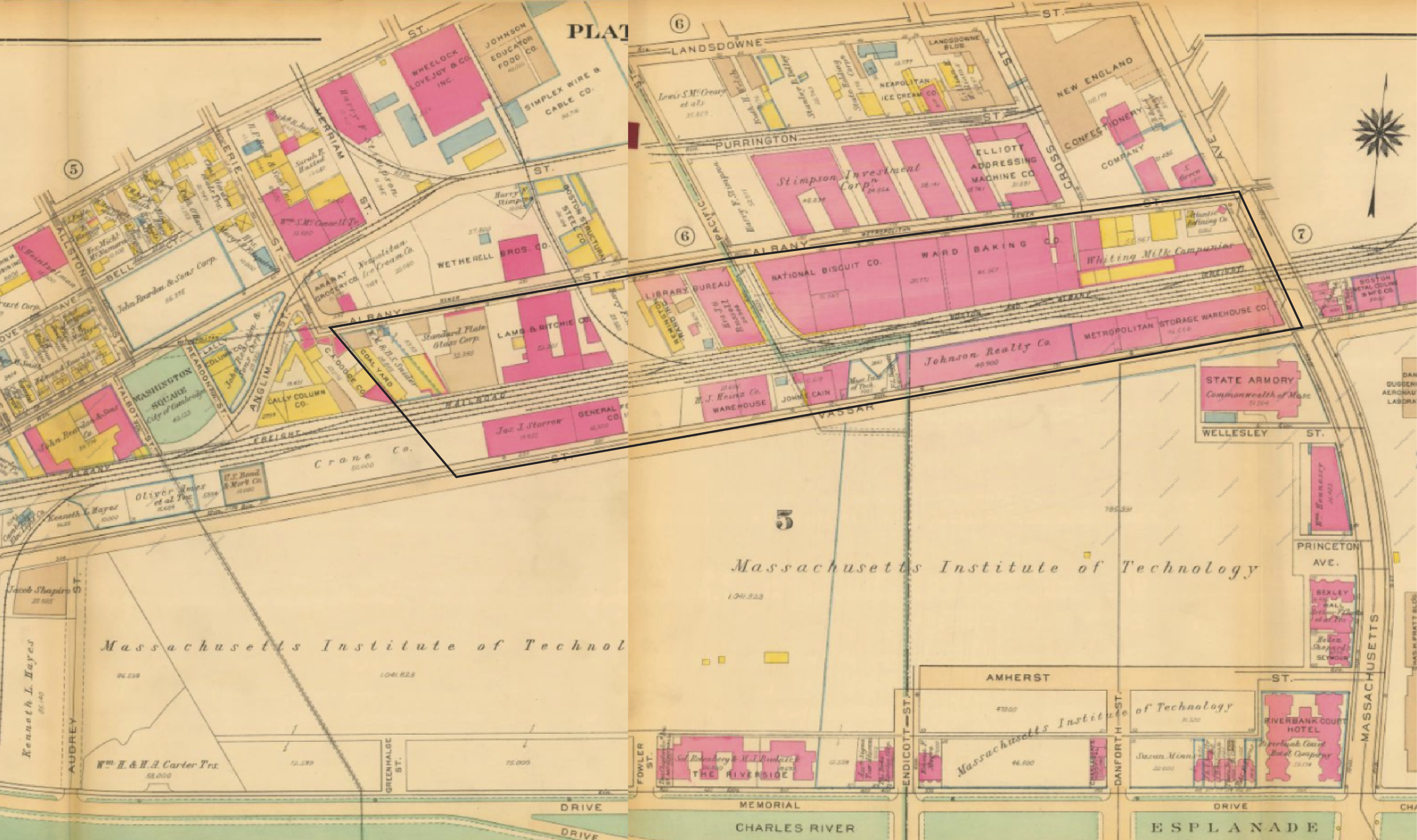 Figure 7: Site location inside black border, Cambridge, MA. Map showing the industrial expansion on my
site to include the Whiting Milk Company, the Ward Baking Company, the National Biscuit Company,
John Cain Salad Dressing Company and a Heinz storage warehouse | 1930 Map of Cambridge, Atlas of the
City of Cambridge, Massachusetts by G.W. Bromley and Co.5
Figure 7: Site location inside black border, Cambridge, MA. Map showing the industrial expansion on my
site to include the Whiting Milk Company, the Ward Baking Company, the National Biscuit Company,
John Cain Salad Dressing Company and a Heinz storage warehouse | 1930 Map of Cambridge, Atlas of the
City of Cambridge, Massachusetts by G.W. Bromley and Co.5
During rapid suburbanization in the mid-20th century, many of these factories and warehouses moved out of the city to the suburbs. As a result, many of the buildings on site were destroyed and replaced with newer buildings or converted into vacant parking lots. For example, the Whiting Milk Company, the Ward Baking Company, and the Standard Plate Glass Company all moved out of my site to suburban areas or simply went out of business by 1970 (figure 8).
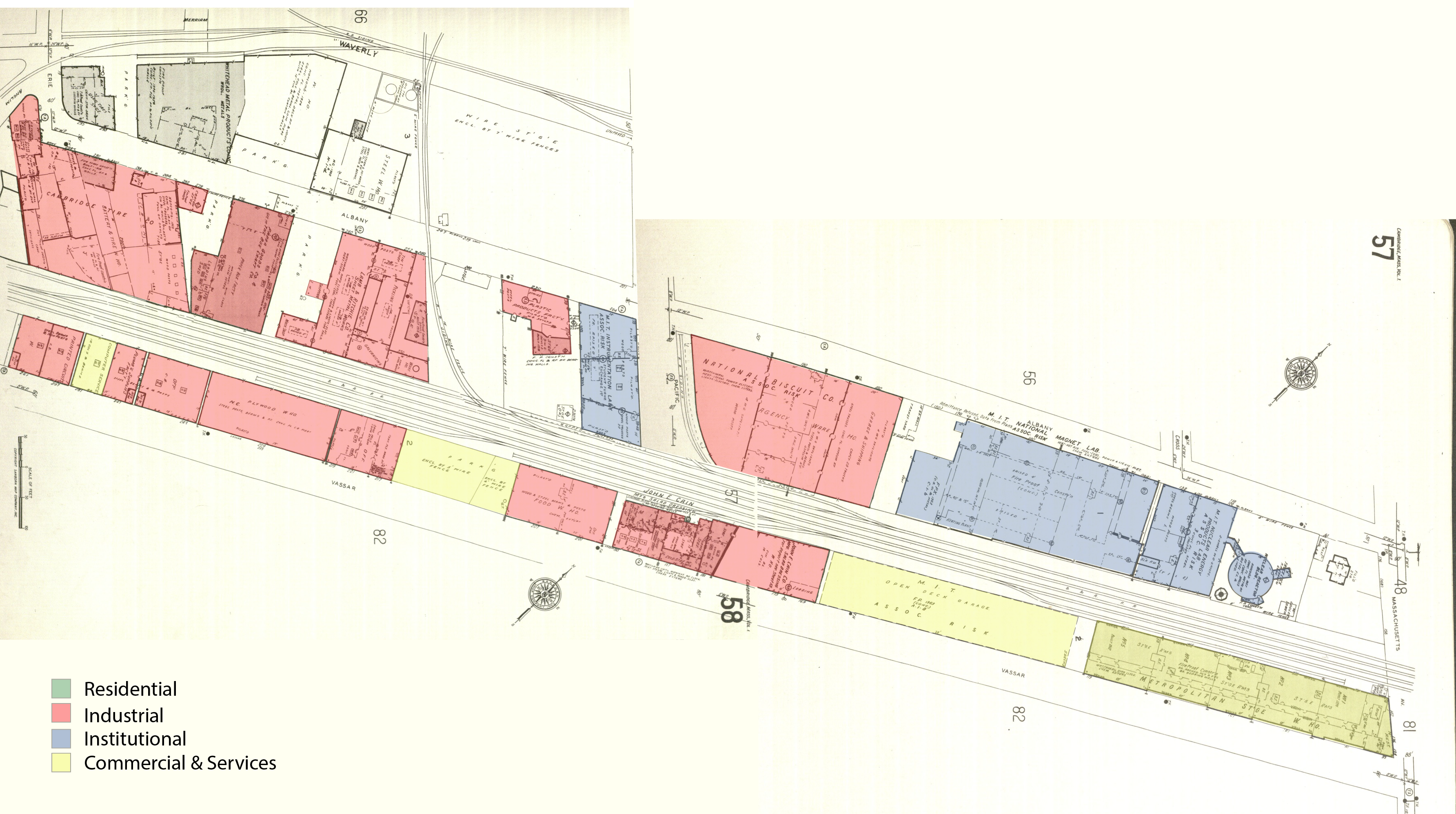 Figure 8: 1970 Sanborn map showing my site highlighting the different land uses, Cambridge, MA. By
1970, the Whiting Milk Company, the Ward Baking Company, and the Standard Plate Glass Company, all moved out of my site to suburban areas | 1970 Sanborn Atlases of Cambridge.[6]
Figure 8: 1970 Sanborn map showing my site highlighting the different land uses, Cambridge, MA. By
1970, the Whiting Milk Company, the Ward Baking Company, and the Standard Plate Glass Company, all moved out of my site to suburban areas | 1970 Sanborn Atlases of Cambridge.[6]
However, there are some buildings that continue to exist today on site. For instance, The Metropolitan Storage Warehouse, which was built in stages starting in 1894, still stands today and is still operating as a storage warehouse, making it the largest and oldest self-storage facility in New England (figure 9).7 The storage warehouse today is mainly for household and commercial storage instead of what might have been mainly industrial previously. As a result, many of the loading docks on the railroad are now closed, as storage shipments don’t arrive by railroad anymore (figure 10).
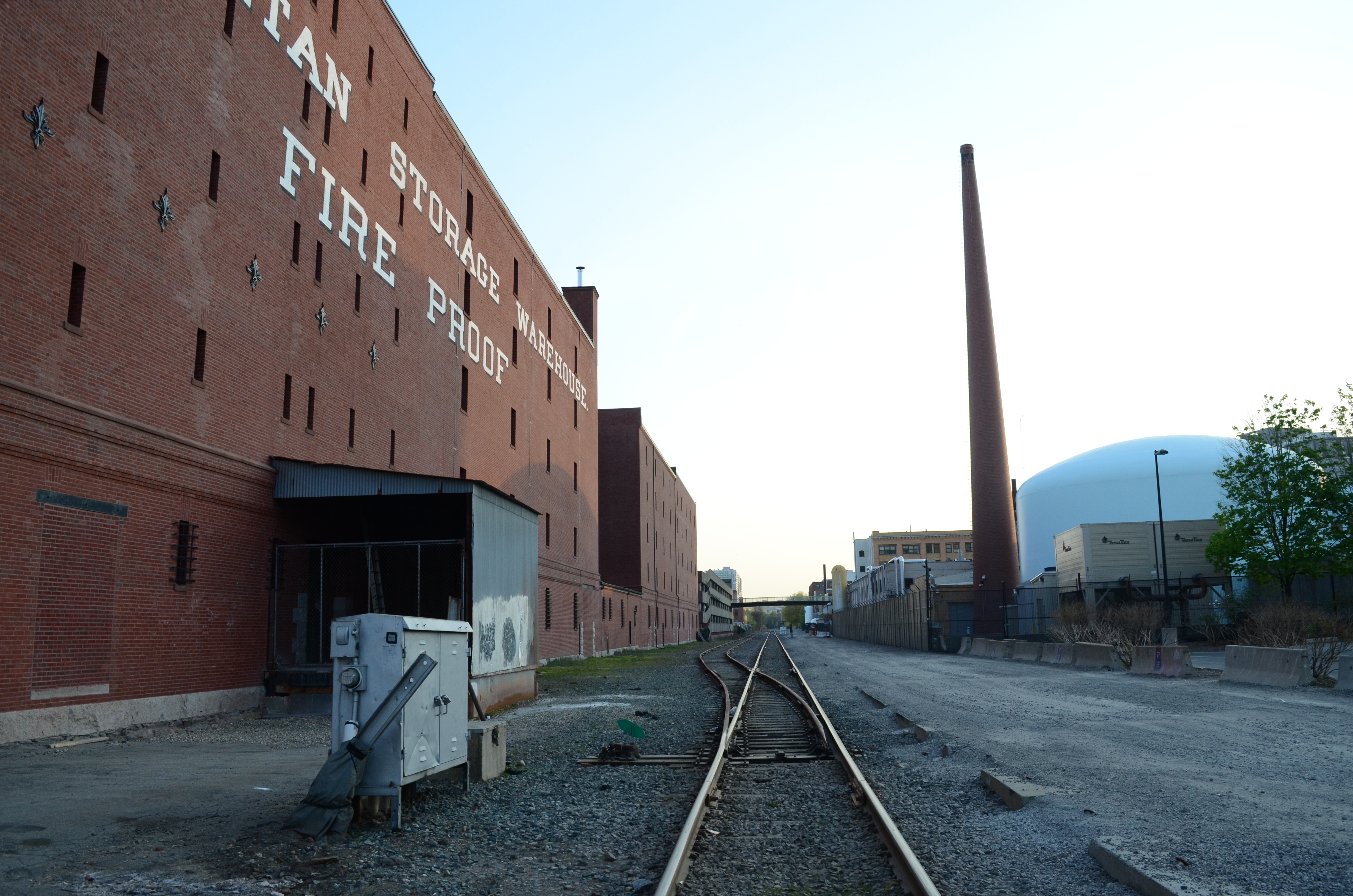 Figure 9: The Metropolitan Storage Warehouse still standing today, making it the largest and oldest selfstorage
facility in New England Cambridge, MA. [8]
Figure 9: The Metropolitan Storage Warehouse still standing today, making it the largest and oldest selfstorage
facility in New England Cambridge, MA. [8]
 Figure 10: Many of the Metropolitan Storage Warehouse loading docks on the railroad are now closed, as storage shipments don’t arrive by railroad anymore | Photo taken by Lina Kara’in, Cambridge, MA, 2015.
Another example is the Paper Goods Company on Albany Street, which was built in 1922 and most recently renovated in 1998. This building is currently occupied by the Sanofi Aventis US Company, a global biotech company (figure 11). One reason as to why this building wasn’t demolished and replaced by a newer home for the biotech company, might have been the easily adaptability of the factory layout with open plans. The space can be easily divided and repurposed according to the needs of the new inhabitants, saving the developers lots of money and time.
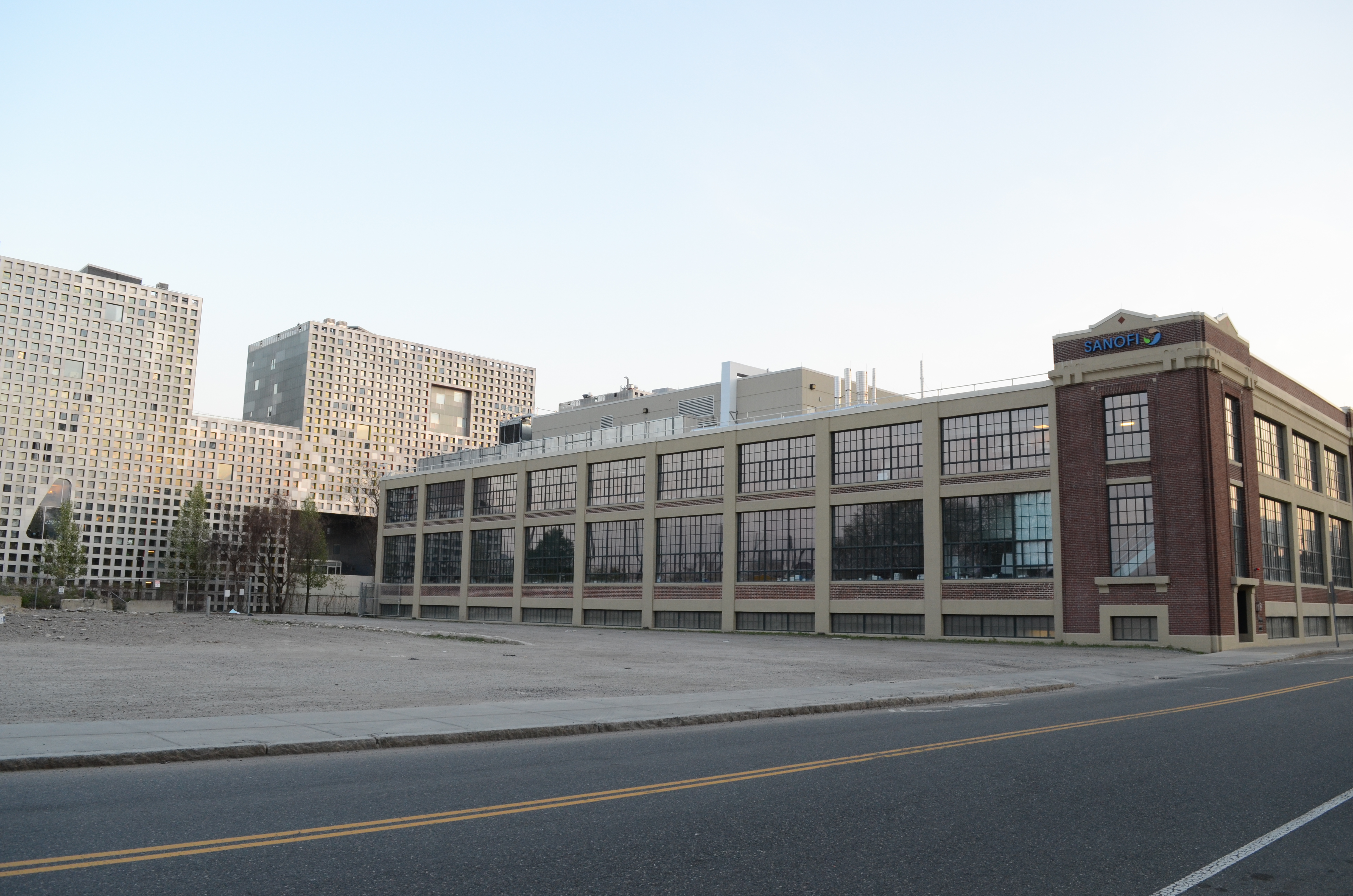 Figure 11: The Sanofi Aventis US Company currently occupies the Paper Goods Company on Albany Street, which was built in the 1922 and most recently renovated in 1998, Cambridge, MA. | Photo taken by Lina Kara’in, Cambridge, MA, 2015.
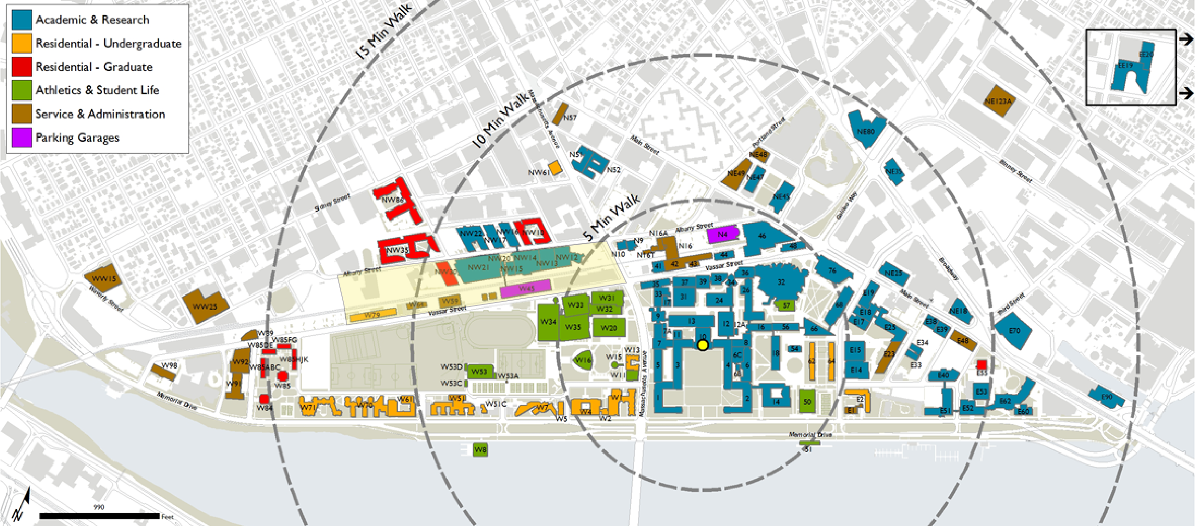 Figure 11: MIT campus map showing the site in red,Cambridge, Ma. [10]
By 1960’s, Massachusetts Institute of Technology (MIT) has acquired portion of my site as part of MIT campus expansion project for undergraduate housing. Many of the industrial buildings originally built on site were converted to offices or housing spaces for students, as many buildings have been bought by MIT after the factories and warehouses moved out to the suburban areas or went out of business. For example, the Heinz Storage Warehouse, once stored ketchup and mustard, is now known as building W59 and houses MIT Residential Life Programs, the Office of Campus Dining, and the Housing Office (figure 13). Another example is The Warehouse on Albany Street that has been changed into a graduate dorm. One reason as to why these buildings have been preserved might be due to the human need to preserve or reinserting the past, a notion that is touched on by Hayden saying that developers must “think about where resonant parts of the past exist that should be protected, or where reminders of lost pasts may be reinserted into the changing urban landscape”.[10]
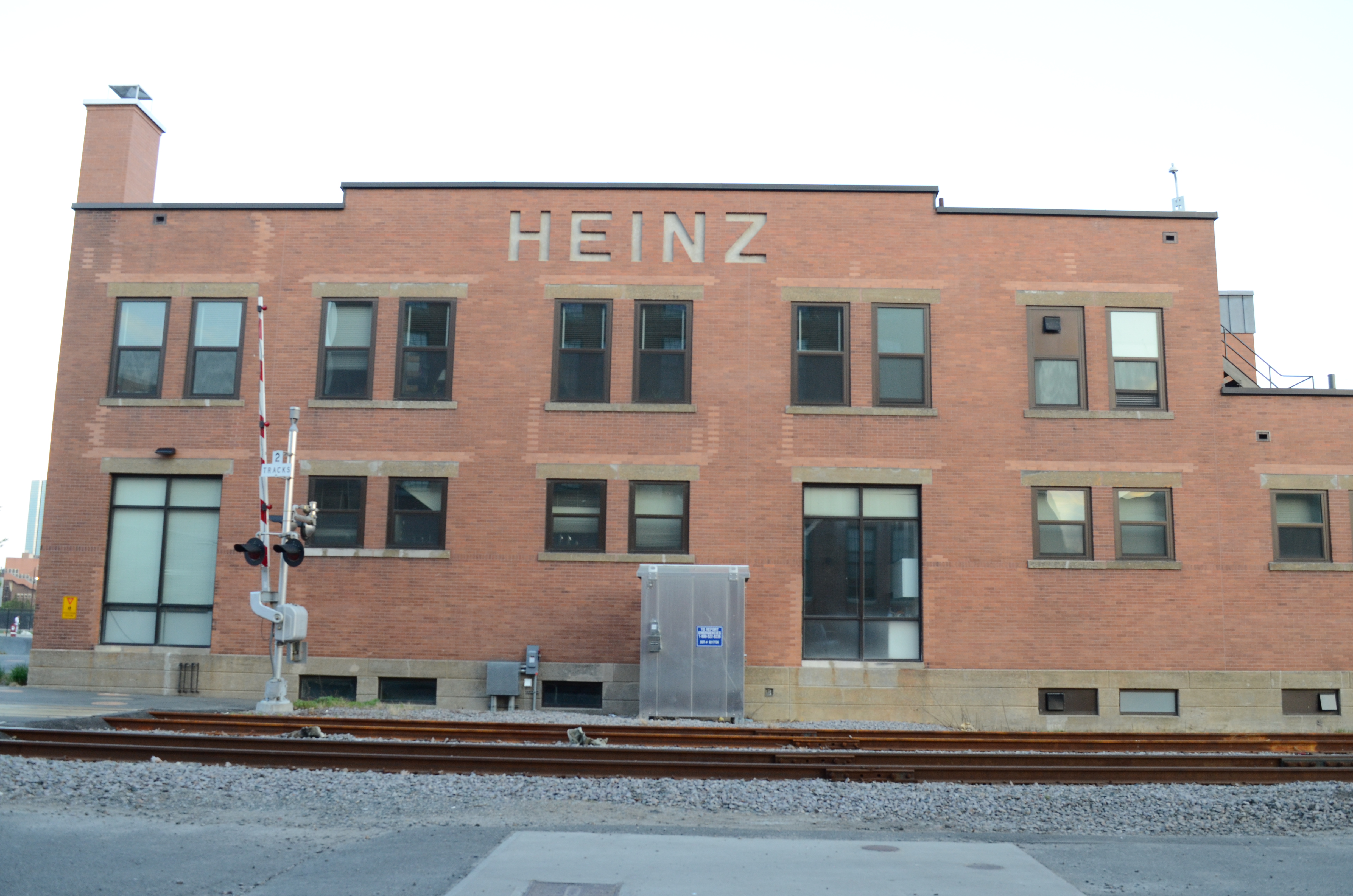 Figure 12: The former Heinz warehouse on Vassar Street is now known as W59 and houses Residential
Life Programs, the Office of Campus Dining, and the Housing Office.[11]
Figure 12: The former Heinz warehouse on Vassar Street is now known as W59 and houses Residential
Life Programs, the Office of Campus Dining, and the Housing Office.[11]
In addition converting factories and warehouses to offices and dorms, MIT also demolished few buildings and replaced them with research centers and laboratories. For instance, the Whiting Milk Company and the Ward Baking Company were all destroyed and replaced by the MIT Plasma Science & Fusion Center, Francis Bitter Magnet Lab and Nuclear Reactor Laboratory by 1970 (figure 14). Unlike the Paper Goods Company, these buildings might have been demolished because the were either in bad condition or they were not as easy to adapt and repurpose, as research centers and laboratories have very different safety and building codes than a milk or baking company in the early 20th century.In addition converting factories and warehouses to offices and dorms, MIT also demolished few buildings and replaced them with research centers and laboratories. For instance, the Whiting Milk Company and the Ward Baking Company were all destroyed and replaced by the MIT Plasma Science & Fusion Center, Francis Bitter Magnet Lab and Nuclear Reactor Laboratory by 1970 (figure 13).
Figure 13: By 1970, the Whiting Milk Co. and the Ward Baking C. were destroyed and replaced by MIT
Plasma Science & Fusion Center, Francis Bitter Magnet Lab and Nuclear Reactor Laboratory |1970
Sanborn Atlases of Cambridge.[12]
Another more recent example is Simmons Hall on Vassar Street. The dorm was built by Steven Holl in 2002 for MIT undergraduate students. The building is made out of reinforced concrete lined with aluminum panels with more than 3,000 small openings (figure 14). This modern style is in high contrast with the traditional redbrick buildings surrounding it, such as the Sanofi Aventis US Company (figure 15). This is an example of the contrast between the many different layers of time and styles on my site.
The arrival of the automobile brought a gradual change to my site as well. By
1988, few buildings on my site were demolished to make room for parking lots such as
the Plywood Warehouse on Vassar St or the Lamb & Ritche Metal Works Company on
Albany Street (figure 16). Jackson explains that the car, “even in its primitive form before
World War I, could do four times the work of a horse-drawn wagon which took up the
same street space”. Hence the addition of the car was a necessity worth tearing a few
warehouses to the ground.[13]
Now the traces of these buildings are left as vacant parking lots. This might be a
land-holding strategy by MIT. For example, the David H. Koch Childcare Center on
Vassar Street, which was built in 2013, was a vacant parking lot since 1988. Simmons
Hall, built in 2002, was also a parking lot since 1996 (figure 17).
In addition to tearing down few buildings and turning them to parking lots, a
portion of the railroad connecting Vassar Street and Albany Street was removed in 1996
(figure 17). Maybe Boston & Albany Railroad Company decided that the railroad was no
longer the most profitable use of the land and decided to turn it into parking lot as well.
The traces of the tracks cannot be seen today as the land has been covered with asphalt
and gravel.
By 1996, many factories and warehouses on my site were demolished after the
companies moved to the suburbs and were replaced by parking lots as the automobile age
came rushing in (figure 17). Looking at the site today, we notice that new buildings, such
as student dorms and childcare centers, are replacing these vacant parking lots. This
suggests that this might be a land-holding strategy by MIT as mentioned in previous
section.
Figure 15: This modern style of Simmons Hall is in high contrast with the traditional redbrick buildings surrounding it, such as the Sanofi Aventis US Company building, Cambridge, MA. | Photo taken by Lina Kara’in, Cambridge, MA, 2015.
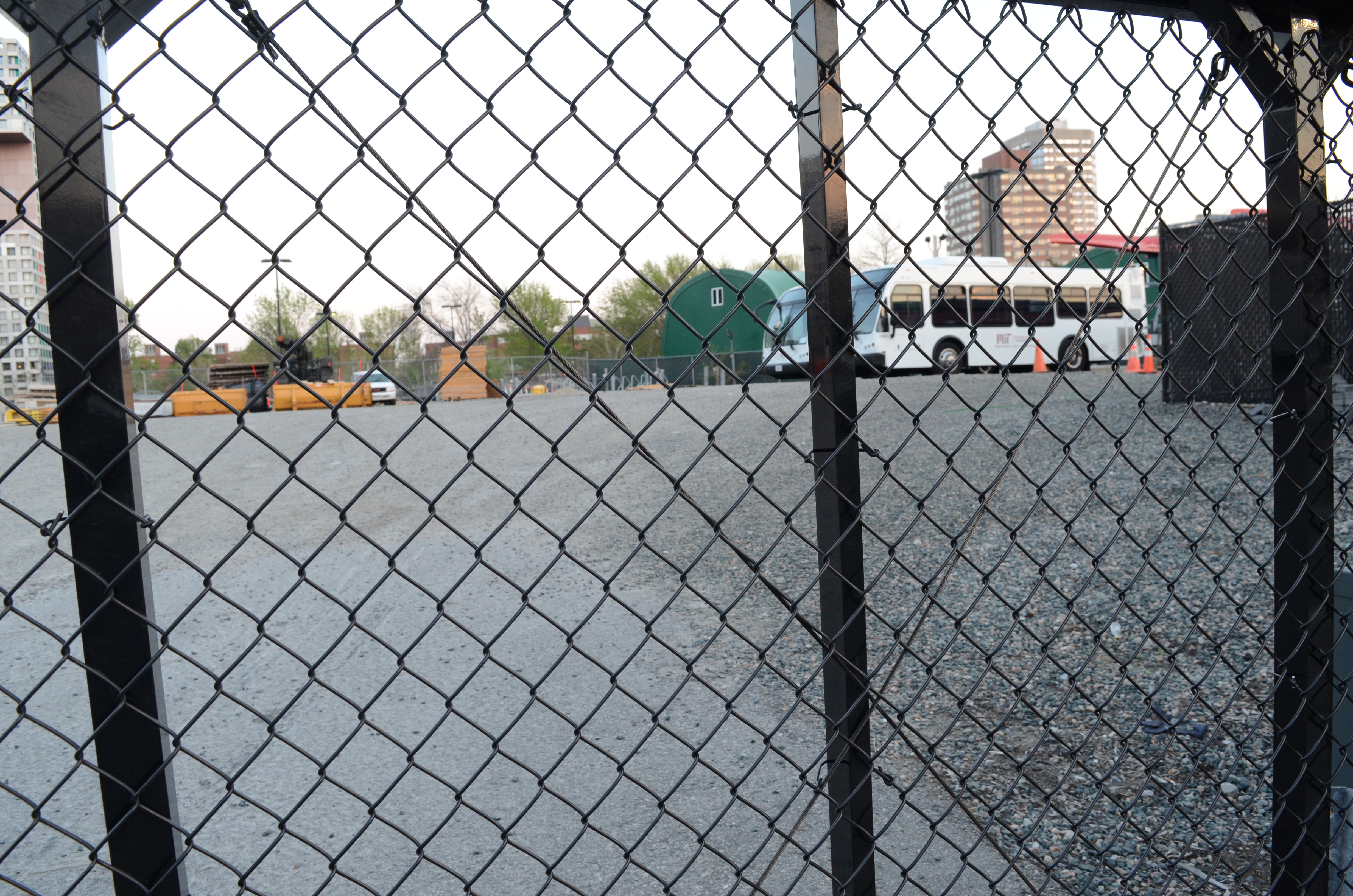 Figure 16: The Lamb & Ritche Metal Works Company was destroyed by 1988 and turned into this parking lot, mainly used by MIT shuttles and trucks, Cambridge, MA | Photo taken by Lina Kara’in, Cambridge, MA, 2015.
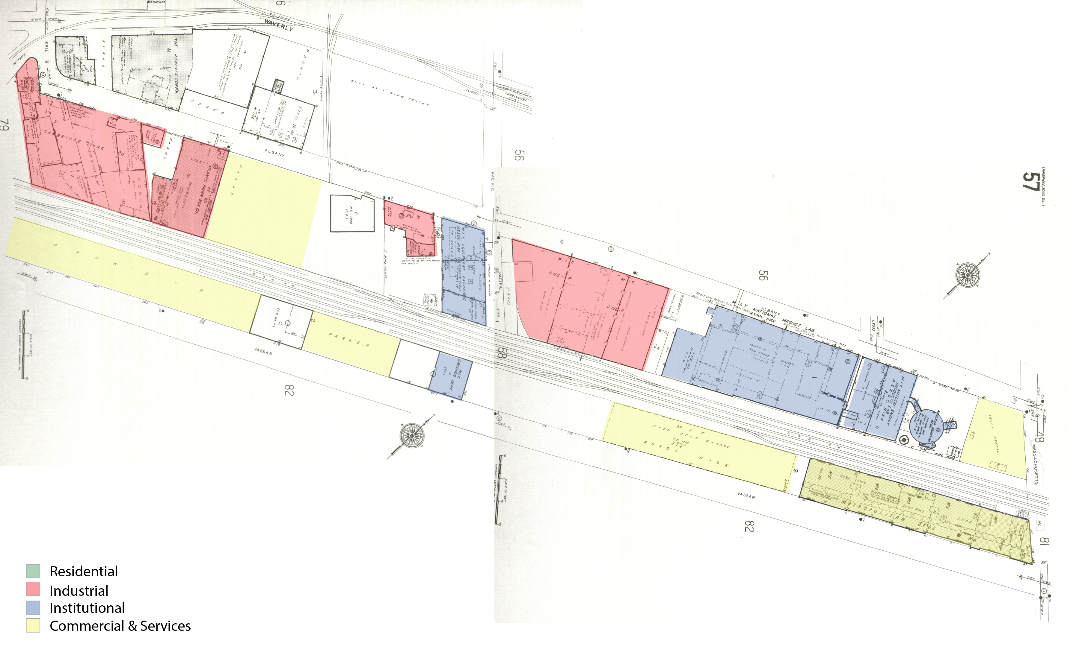 Figure 17: the David H. Koch Childcare Center and Simmons Hall were vacant parking lots on Vassar
Street, Cambridge, MA | 1996 Sanborn Atlases of Cambridge.[17]
Figure 17: the David H. Koch Childcare Center and Simmons Hall were vacant parking lots on Vassar
Street, Cambridge, MA | 1996 Sanborn Atlases of Cambridge.[17]
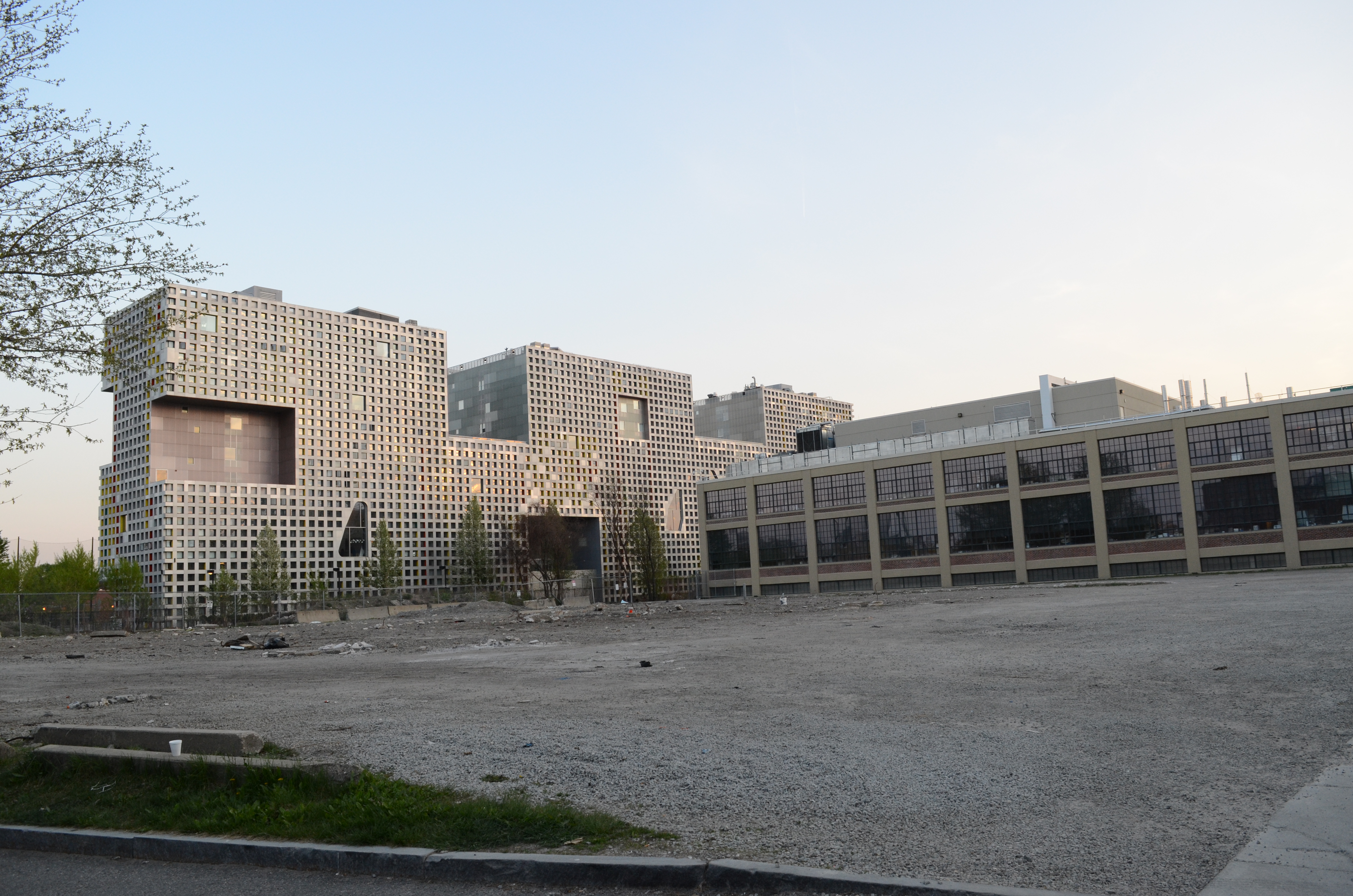 Figure 18: portion of the railroad connecting Vassar Street and Albany Street was removed in 1996 and turned it into parking lot as well. The traces of the tracks cannot be seen today as the land has been covered with asphalt and gravel Cambridge, MA | Photo taken by Lina Kara’in, Cambridge, MA, 2015.
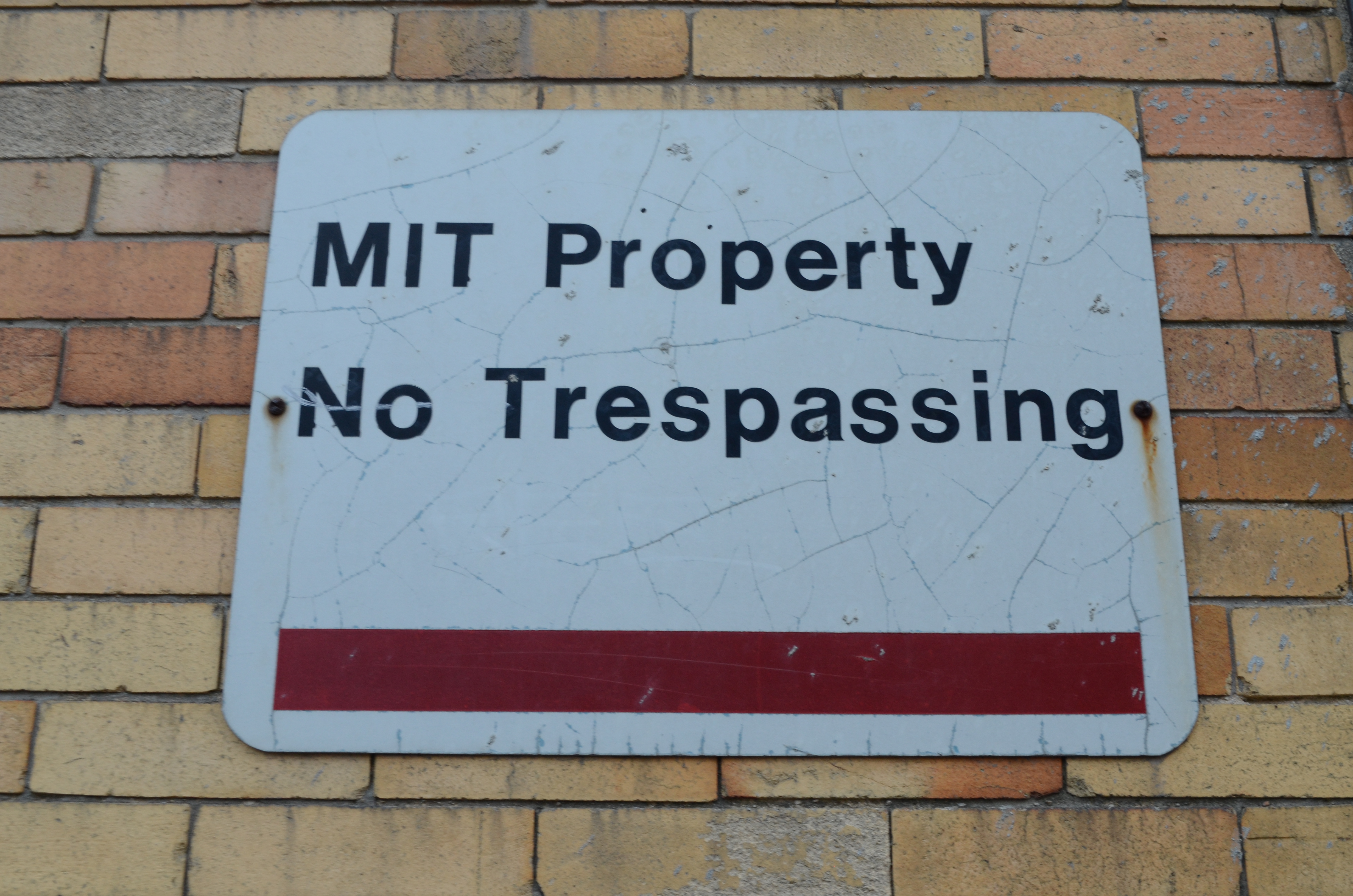 Figure 19: Image showing signage on MIT building, Cambridge, MA | Photo taken by Lina Kara’in, Cambridge, MA, 2015.
There are still many parking lots and vacant land on my site today waiting to be
developed. It is expected to continue observing such a trend as MIT campus is
continuously growing and changing, and there a constant need for student housing and
new laboratories.
Looking at MIT campus map today, we also notice that almost all of the buildings on site are MIT owned now, with the exception of the Metropolitan Storage Warehouse and the Sanofi Aventis Building. Since the 1960’s, MIT has been acquiring more and more buildings and vacant land on my site. If such trend continues, MIT will end up owning my entire site in few years.
MIT is currently conducting a feasibility study to explore the redevelopment of the Metropolitan Storage Warehouse. If the redevelopment is found to be feasible, the project will consist of residences, maker and collaborative spaces for undergraduate students and street-level retail space along Massachusetts Avenue. [16]
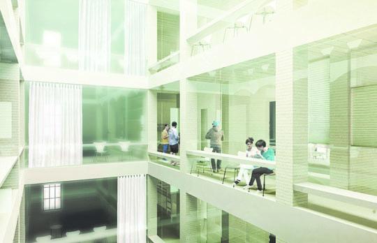 Figure 20: Rendering showing the new proposal for redeveloping the Metropolitan Storage Warehouse, consisting of residences, maker space, and collaborative space for undergraduate students.
In just over one century, from the mid 1800s to the late 1900s, my site has been drastically transformed due to forces of industrialization, a rising automobile age and institutional expansion. By tracing a site’s history through maps, atlases and photographs, and comparing its characteristics, one can get a glimpse into the changes that have occurred over time, such as changes in land use, density of settlements, ownership, and transportation. One can also find physical traces of these changes present in the current environment, such as old train tracks or factories and warehouses, and discover signs and trends that indicate future changes on site, like replacing vacant parking lots with institutional buildings, and to interpret their significance.
Bibliography: Books: 1. Hayden, Dolores. The Power of Place: Urban Landscapes as Public History. (MIT Press: Cambridge, MA. 1995), 15, 234. 2. Jackson, Kenneth T. Crabgrass Frontier: The Suburbanization of the United States (New York: Oxford University Press, 1985) 38, 183, 203. 3. Simha, O. Robert. MIT Campus Planning, 1960-2000: An Annotated Chronology. (MIT Press: Cambridge, MA. 2001), 135. Articles: 1. Nidhi Subbaraman, “The Evolution of Cambridge,” The Technology Review (2010), accessed April 10, 2015. http://www.technologyreview.com/article/422108/the-evolution-of-cambridge/ Websites: 1. MIT 2030: http://web.mit.edu/mit2030/framework.html 2. Sanborn Atlas: http://sanborn.umi.com/cgibin/auth.cgi?command=AccessOK&CCSI=254n 3. H.F Walling Map of Cambridge 1854: http://ids.lib.harvard.edu/ids/view/7933307?buttons=y 4. Bromley Maps: http://pds.lib.harvard.edu/pds/view/6153086