“Thus, many a city’s future can be previewed in what is happening today, in either the destruction or enhancement of these old breaks.” - from Close-Up: How to Read the American City by Grady Clay
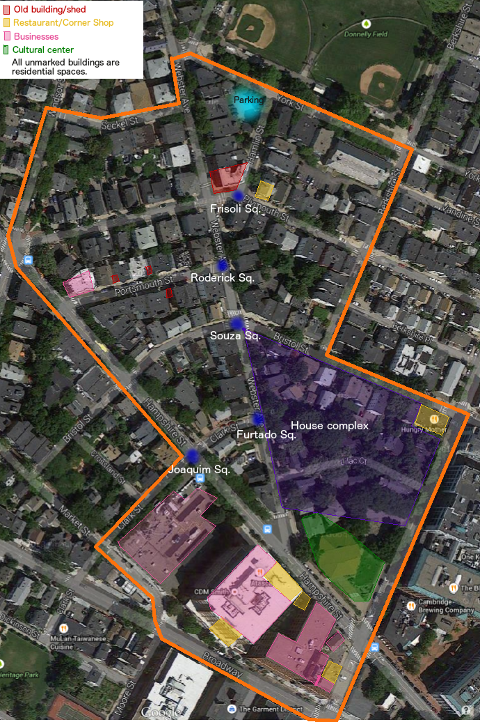 Figure 1: Map, from Google Satellite, with marked boundaries in orange, and the various uses of land marked in colours (described in the legend and on map)
One the most important learnings that can be extrapolated from Clay’s work is the consideration of the breaks in a city. How these come to be and what they involve is extremely important on the workings of the city as a whole. In choosing the site studied here, the Cambridge area was observed to find the most interesting “change in character”, in Clay’s words, in the grid system. The area chosen can be seen in the map, with its boundaries clearly marked (Fig.1), where the grid system evolves from being aligned with Donnelly Field to shifting diagonally and even curving for some streets to fit with the diagonal streets like Broadway, Hampshire, and Webster. This particular set of blocks was chosen using several methods: Google Maps served to notice the breaks in the pattern of streets; Google Maps Streeview was useful to identify the areas of possible interest and observe the region in a different weather; and visiting the site by foot was used to properly determine the boundaries and observe the different ages of the buildings present and uses of land as a whole. The focus of this investigation will be the history behind this juxtaposition of street building methods and periods of construction and development, while also looking at the residing communities and their influence on the neighborhood.
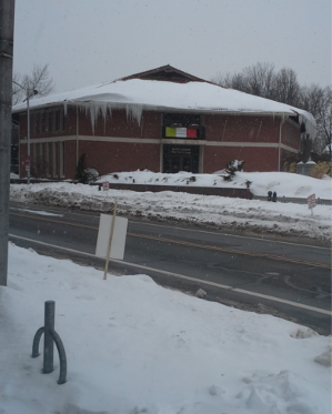 Figure 2: Dante Alighieri Italian Cultural Center
With the preliminary site visiting, severely limited by the inclement weather, several questions came to mind about the arrangement of the streets. Simply looking at the names of the streets present, there seems to be a historical significance that comes to mind with Broadway and Market Street. So were these streets indeed at the start of the development of Area IV, as the greater neighborhood is known? If so, when was the Donnelly Field put in place, and why is it at such an angle to the surrounding streets? Clay remarked in his work that the grid system usually aligns with a body of water or railway, and here the only set of parallel streets are in direct contact with the park. He also stated that: “The rightful place of nature in this scene [the city] is endlessly debated and remarkably subject to disruption by expanding urban energies.” Thus a timeline of the street developments surrounding the park needs to be established. Another element to this timeline should be the naming of the squares in the site, since these could have been established along with the streets, or later once the neighborhood was populated. Either way, it would show the influence of the residing communities, and maybe explain the presence of the Italian Cultural Center (Fig.2).
Several uses of land exist in this area in both in the residential and commercial uses. Using one of Grady’s tactics, a way to determine the different uses of the residential buildings was by counting the number of mailboxes, but other methods were also used like counting the number of doors with different numbers on them, and the buzzers in the entries. The first two indicated multi-family homes in a large part, and from the second one could safely assume apartments. As seen in Fig.3, snowtracks could also be considered as an indication of the lack of people circulating on foot in the weather, the residents not being able to keep up with the recent snowfalls, and the lack of a business on this particular street. Several questions must be answered when considering the age of the present buildings. For example, when studying the block surrounding Lilac Ct that seems to be a house complex: was it always a residential block, or was the original settlement torn down recently to build the current structures? When did these changes take place? For the other residences, were these buildings originally built for multi-family homes or apartments, or were they converted? There were also several older constructions that could be identified by the dates engraved on their fronts (Figs. 4 and 5), and another element to consider is who originally built it. Was the building built in 1902 originally meant to be a apartment complex or a hotel? Was the shed from 1924 meant to simply be a shed, or did it used to be a single car garage for example? There was also an unexpected number of these along Portsmouth St., so was there a common factor that led to these being constructed?
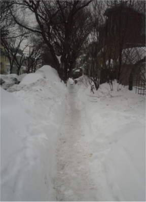 Figure 3: Sidewalk along park on Plymouth St.
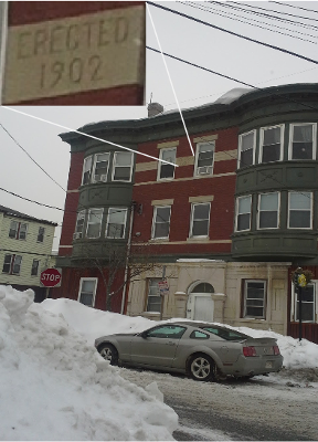 Figure 4: Building on Frisoli Sq. (inset on date)
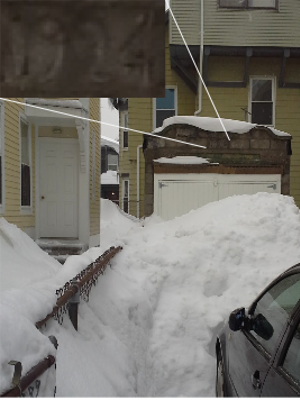 Figure 5: Shed along Portsmouth St. (inset on date)
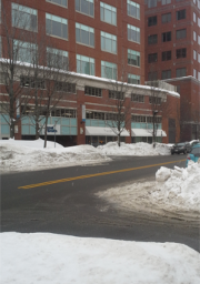 Figure 6: Tatte Bakery and CDM Smith entrance along first floor of Mitsubishi research building
 Finally, the presence of businesses in the area will also be considered. There are several types of businesses, ranging from small restaurants like Emma’s along Hampshire St. to upscale places like Hungry Mother on the corner of Cardinal Medeiros Av. and Bristol St and Tatte Bakery on Broadway (see Fig.6), but also research facilities (Mitsubishi Electric Research Laboratory), and business like CDM Smith. Not only are the presence of these businesses interesting, but where they are housed is also interesting. From visiting the site, there seems to be three types: independent buildings, built for the purpose of the business holding it; reconverted old homes, that retain their “family home” charm; and developed space in a newer building, using on the first floor.
All in all, this area will be considered as a greater example of the people that have resided in the area and the actions that they took that still affect it today. In the words of Clay: “Each [city] reflects the ideas, traditions, and energies available to its citizens in past centuries, as well as at this moment.”
Footnotes:
1 G. Clay, Close-Up: How to Read the American City, (The University of Chicago Press, Chicago and London, 1980), pp.16
2 All images were taken by student
3 Close-Up, pp.14
Bibiography: G. Clay, Close-Up: How to Read the American City, (The University of Chicago Press, Chicago and London, 1980)