 Copley Square: Natural Process
Our environment is a network of interconnected systems: air, wildlife, earth, and water. We are a part of the environment, a mere component within the system. The key to our prosperity and the environment’s is to keep a balance between the systems. No single element can become too dominant without skewing the others.
Thus, we must not act without heeding the other cogs in the mechanism that together create our ecosystem. We have imposed ourselves upon the natural world so that we may grow and prosper. We can feel the repercussions for not keeping a holistic view of our city during development. Originally we built cities to protect ourselves from the elements and to improve our lives, but only by working with nature and natural processes will we create a true haven through symbiosis.
Creating the Urban Landscape
The peninsula on which Boston is located was formed by seawater rising and covering all but the remains of hills created by glaciers 10,000 years ago.[1] The Native Americans inhabited the area until displaced by the colonists who arrived in 1630 as the Massachusetts Bay Company setting north of Boston. Shortly after, the settlers moved to the Boston peninsula to utilize the Charles River’s potable water. These early Bostonians set the development patterns that are still recognizable in downtown Boston.
It would have been near impossible for the colonists to have the foresight to plan for the city to accommodate the increase in population to today’s magnitude. For this reason over the past centuries the people of Boston have needed to adapt the natural environment to meet our needs beyond those of the early settlers. Later, we will get into how the manipulation of the environment can lead to unintentional consequences. The most notable expansion, in respect to my site, is the 1855 filling of Back Bay. The following maps show the growth of Boston after this land filling (See Figures 1 and 2).
 Figure 1: 1852 Map- features Mill Dam and railroad tracks in Back Bay [2] Figure 2: 1880 Map- features filling of Back Bay [3]
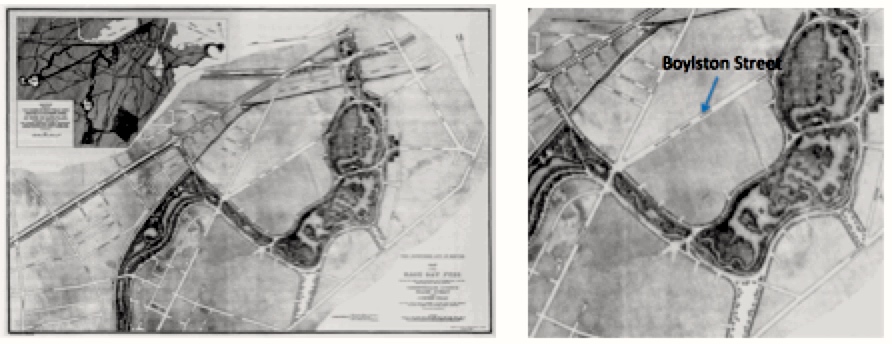 Figure 3: 1887 Map of Back Bay, to highlight Back Bay Fens Plans — note Boylston St has been created, but the land is still largely unused.[4]
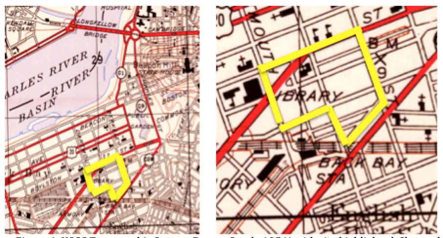 Figure 4: USGS Topographic Survey, Boston South, 1954 with site highlighted. Shows the gradual development of the area—Copley Square features the Trinity Church and plaza design and the railroad tracks have been laid in the location of I-90. [5]
Since all of Back Bay is created via filling, when investigating the earth elements on my site I must keep in mind that the foundation of the city is really filling from near by hills to fill the water basin. So throughout all of Back Bay earth and water are working together to physically support the area.
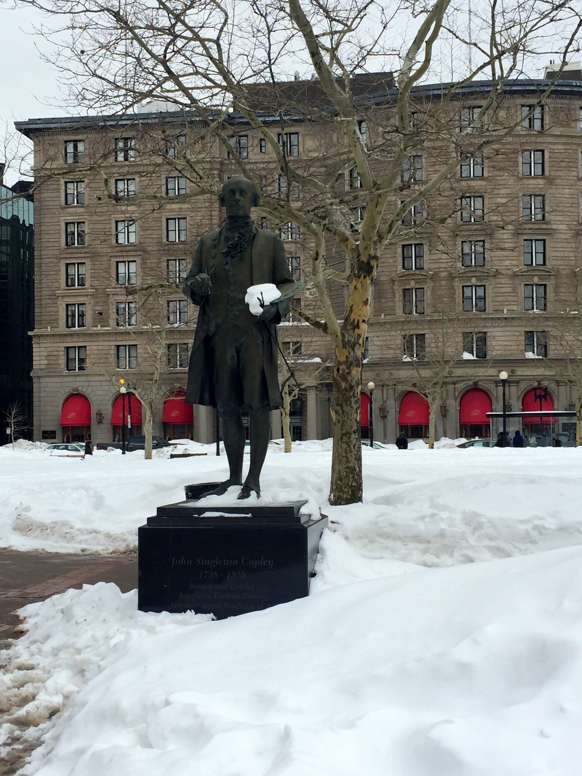
Another notable construction of the Back Bay landscape is the redevelopment of the city in the 1960s and 1970s. This era is referred to as the urban renewal era.5 The office-building boom is reflected in the construction of John Hancock Building. The Hancock Building was controversial, and has transformed the area’s topology from environmental and aesthetic viewpoints.
Air
The first natural component of my site I recognized is the air. Approaching Copley Square from MIT, I walk up Boylston Street and feel huge gusts of wind (See Figure 5, Node 1). The wind subsides as I enter the square. As I amble down Boylston Street I continue to feel gusts of wind especially while crossing intersections.
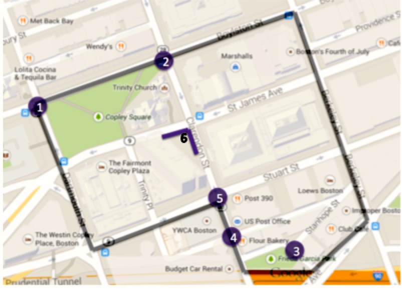 Figure 5: Depiction of windy nodes on map; Key: Purple nodes were notably windy/gusty areas; gray border is site boundaries; Source: Google Maps 2015. Observations of writer made March 2015.
Although on a whole the city is less windy than the country, due to the buildings blocking the majority of wind by forcing it to pass above the city, the microclimates created within the city feature gusts and lulls of wind. The causes of these observations can be explained by multiple phenomena expanded upon below.
The first-- long wide avenues with relatively low friction allow wind to swoop through unperturbed. The nodes along Dartmouth Street and Clarendon Street were particularly windy. Both of these streets become wider and accommodate larger traffic loads further south on the site. These areas contribute to windiness because there is nothing to impede the wind’s speed along the street’s long and wide stretches. Also contributing to the wind speed is the orientation of the streets relative to wind direction: wind accelerates along stretches parallel to its direction.
Secondly, whereas long avenues tolerate wind speed, frictional elements on the road, such as street trees, slow down the wind. I will explore the effects of street trees further in discussion of wildlife. It is important to recognize the intersystem dynamic at play here—the earth and water dependent trees contribute to wind effects.
Lastly, the windiest stretch on my site was at the corner of Clarendon Street and St. James Ave along the base of the Hancock Tower (see Figure 3 node 6). The tower although it overall contributes to the wind blowing over the city, on a microclimate level when wind hits the tower it is directed down towards the pedestrians walking below. When the Hancock tower opens onto Copley Square the wind speed dissipates possibly due to friction inducing trees in the square and along the street.
 Figure 6:Observations in southeast corner of site [6]
The air quality as a whole surrounding Copley does not have noticeable pollutants. It was not until I walked to the southeast corner of my site that I could feel noxious pollutants in the air. The area along Columbus Avenue has the most vehicular traffic and narrow sidewalks with skinny street trees, all of which contribute to the poor air quality. Columbus Avenue then opens up onto I-90 behind my site. The Frieda Garcia Park is located down a steep street that creates a triangle that is removed from Columbus Ave as well as I-90 (See Figure 6). Perhaps the difference of elevation level contributes to distancing the neighboring areas from I-90 and congested areas.
Wildlife
The most notable wildlife in this area is the street trees. Trees have the capability to counteract the negative effects of pollution from vehicular traffic—i.e. removing carbon monoxide particulates from the air. Unfortunately, the urban environment is inhospitable for these trees. It takes over forty years for a tree to mature, but the average lifespan of a city tree is only 10 years.
The influence of the street trees extends beyond aesthetics. As mentioned above it can mitigate the toxic pollutants in the air and can also counter strong winds. Since wind is invisible to the eye the only way to document it is through its signs and through observation using instrumentation.
The first intersection I reached that was significantly less windy was at Berkeley and Stuart Street. Looking down the street I immediately notice a corridor of trees along the side of the building. The sidewalk is double lined with trees, creating aisles within the walkway. This creates a shady microclimate lining the south side of the building and can provide pedestrians relief walking the streets in the summer. The double lined trees also protect the pedestrians by serving as friction element from the wind sweeping down the avenue. They also filter pollutants and litter as they are swept through the street by the wind. I was able to come to this conclusion because I observed the tree closest to the street and first in line, in respect to the wind, had plastic bags entrapped in its branches where as the rest of the trees did not. This is because the first tree is slowing the wind and in effect protecting the other trees from pollutants (See Figure 7). I continued to see this theme of double lined trees and individual trees with plastic ensnared in the branches throughout the site—specifically along Hancock Tower where the wind was more docile and in Copley square in front of Trinity church near Boylston Street.
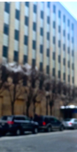 Figure 7: Double lined tree with garbage in the first but not th rest along Stuart Street
Another thing to note about the street trees is their health. The trees are confined to grow beneath the paved walkways and grates are placed on top of the plots to contain their growth (See figure 7a). It is clear in certain areas the growing conditions are inhospitable for the plants. For example, along Boylston Street nearing Clarendon Street the trees are struggling for survival: the tops of all these trees are wilting downwards and the roots force the iron grates to jut upwards out of the plane of the street. On a whole these trees in this area are short, stubby and dying. This highlights the point brought up in Spirn’s Granite Garden:
“City plants are a natural resource, but human function and fashion are often more influential than natural processes in determining the location and arrangement of plans” [5]
This fashionable conditioning of plants is seen in the images below (Figure 7). Plants aesthetics are appreciated and their environmental effects are beneficial, however they must exist in our cities on our terms—confined beneath the pavement or within designated beds. As seen in figure 7c the trees nutrients must be filtered down through the synthetic ground via grates instead of absorbed naturally through soil. Examples such as this show that we are mindful of the trees’ needs but we still try to manipulate its growth to meet our conditions.
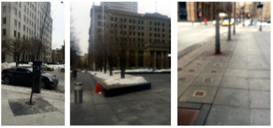 Figure 8: Manicured urban design for street growth a)tree along Boylston Street b) grate system to support trees c) raised bed of trees to provide uninterrupted (unpaved) soil for tree growth
The physical condition of the trees depends on having adequate soil, sunlight and water resources. The trees are also impacted by their local environmental conditions such as vehicular traffic and buildings. As seen in the image below (Figure 8), the trees within Copley Square plaza are not all growing in the same conditions. The tree on the left hand side is has grown upwards in a symmetric fashion. This could be because it has a large plot of natural land (unpaved) to grow in and access to lots of sunlight because of the openness of the square. Alternatively on the right hand side this tree is not as prosperous. Besides the fact that it is shorter (which could be due to unhealthiness or to time of planting), this tree’s branches are stunted and asymmetric in growth. Additionally this tree has a smaller patch of land in which to grow and is more directly in contact with the pollutants and traffic from Boylston Street. These observations hold beyond these two specific trees but rather for the entire row of planted trees in the square (yet another example of the double tree plantings).
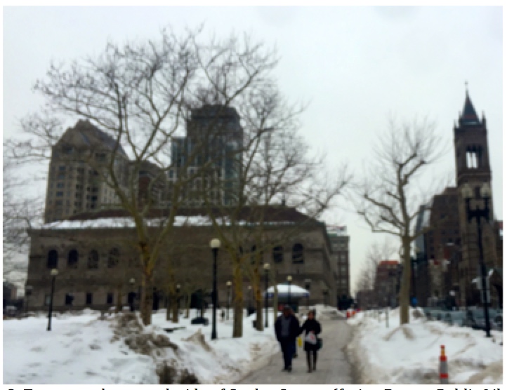 Figure 9: Tree growth on north side of Copley Square (facing Boston Public Library)
Besides vegetation the wildlife observed is essentially non-existent. I had only one encounter with birds—I heard a single bird at the corner of Stuart and Clarendon Street in the shrubbery along the old Hancock Tower. This corner was the most hospitable area on my site because it is low and wide bed of shrubbery removed from the traffic. The building shelters the corner from windy gusts and it is oriented towards the southwest so it has maximum solar gains. As seen in my picture below, while the rest of my site was blanketed in snow due to our heavy snowfall this winter, this corner was the only area naturally cleared area of snow.
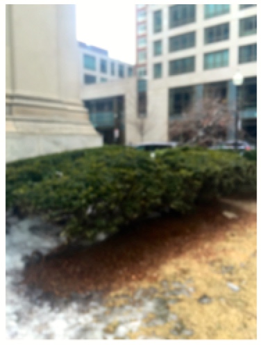 Figure 10: Southwest corner of John Hancock Building-- snow melt and bird sighting
Earth
Again, due to the heavy snowfall this year much of the site’s ground besides pavement is covered by snow. However, thanks to James Elkins chapter on “How to look at pavement” in How to Use Your Eyes, I have begun noticing much more in the paved environment around me.
Revisiting Copley Square after reading Elkins piece, what I used to perceive as a well-paved walking site I began see it as an undulating mess that clearly resists the natural environment below it. The cracks and stress in the pavement in the walkway along Boylston is most likely due to this forced development that did not keep the natural environment in mind. Especially now that the snow is melting the undulations have become more apparent. The ice patches in the Square appear to be randomly distributed because they are not only at the curb by the melting snow banks but also in the center of the shoveled plaza. The reason behind these random ice patches is due to the divots in the pavement where water rests and freezes.
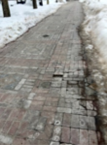 Figure 11: Undulation of brick walkway in Copley Square along Boylston Street
Besides undulation and ice patches the most notable observations in the pavement are the cracks on the street and sidewalks. The largest and most dense cracks occur at the heavily used intersections. Especially at corners when the road and sidewalk merge into ramps, cracks appear because of the frequent use and possibly the change in elevation weakens the paved structures.
The largest cracks in the asphalt roads are those leading into the drains in the middle of the road. The cracks could be seen as the residue left behind by the movement of water that traverses the same paths as the cracks. The water seeps into the pavement and this weakening causes the cracking. Or the subterranean infrastructure of the drain causes stress on the road, and this instability leads to cracking. Either due to structural weakness or water’s influence the cracks are a sign of the weakness of our manmade roads that we are inflicting upon the natural environment.
As Spirn notes “Cities are fragile creations balanced on the earth’s crust…” . We impose our structures and order onto the earth, but we must maintain balance with our synthetic topography. The pavement we lay absorbs more solar heat gains than traditional soil cover; this in turn contributes to the heat island effect, which makes our cities notably warmer than the surrounding countryside. As we are in the throws of Boston’s winter, it is hard to imagine wanting to reduce solar gains, but in the summer in this central business district with tall buildings and high volume traffic and pedestrian use the heat island effect can be atrocious. For this reasons tree coverage, and microclimates must be intentionally designed.
Conclusion
We have attempted to control nature by diverting water, filling land, razing hills in order to build and support our citizens. However, what we have failed to recognize is that each time any section of our ecosystem is damaged the rest will also be influenced. Aesthetically we have found the emulation of nature admirable, but as long as it conforms to our own terms. We develop manicured lawns and encaged street trees amongst our sprawling pavement. Although we have attempted to tame the elements, they always prevail. Our streets have buckled, our buildings shaken, our lawns flooded. Our dominance cannot match nature’s power.
Even when we design our urban dreams, we must keep in mind the necessary symbiosis of the ecosystem. Every element interacts and in combination can create unintended effects. As Spirn states in Granite Garden:
“Air pollution, discomfort and energy consumption are treated separately, when they are addressed at all, not as the interrelated whole they represent. Attempt to solve one problem often create several new ones.” [7]
It is important in future designs to remain more fully informed about all of the elements. The plans should incorporate flexibility because although we may be well intentioned, the combinations of air, earth, and water can be unexpected. If we can adjust our cities response to these dynamic elements we can live more cohesively with our environment. Currently buildings with adaptable shells that can morph based on wind loads or the needs for solar gains are being developed and built. This recognition and adaptation to out natural environment will generate a better union of nature within cities.
Citations
[1] Krieger, Alex, David A. Cobb, Amy Turner, adn David C. Bosse. "A Brief History of Boston". Mapping Boston. Cambridge, MA: MIT, 1999. Print.
[2] Krieger, Alex, David A. Cobb, Amy Turner, adn David C. Bosse. "Diagramming the Growth of Boston". Mapping Boston. Cambridge, MA: MIT, 1999. Print.
[3] Krieger.
[4] Krieger.
[5] USGS Topographic Survey, Boston South, 1954.
[6] Spirn, Anne Whiston. The Granite Garden: Urban Nature and Human Design. New York:Basic, 1984. Print.
[7] Spirn. Page 91.
[8] Spirn. Page 70.