In preparation for selecting my site, I explored two areas of interest – Central Square and Lechmere Station – briefly in person and then more thoroughly on Google Maps. Though the Lechmere Canal neighborhood offered more of the natural aspects I was looking for in its park and riverfront features, the social-cultural aspects of Central Square’s community raised questions that I was more eager to explore.
My initial walk-through of Central Square via Massachusetts Avenue and Bishop Allen Drive spanned from the western-most tip of campus to the T station. I observed odd contrasts in population and economy as the transition between MIT affiliated properties and an independently operated territory of the city occurred quite conspicuously. For example, when walking toward Central Square Station, prior to Brookline Street I saw evidence of businesses either thriving or in development in the well-maintained store-fronts and construction. Past Brookline, however, I began to see graffiti on properties that had gone out of business and been vacated (see figure 1). Brookline also marked a difference in demographic territories as the local homeless issue became more visible against the MIT students, science and tech professionals, and occasional families I had been walking amongst. I’m very curious to research the history of Central Square’s development in relation to MIT and Harvard to uncover the roots for the discrepancy in its cultural and economic priorities with its neighbors. My curiosity lies specifically in the founding of H-Mart and the Boston Area Rape Crisis Center – how the need for those services was recognized and how they became established and accepted into the existing community.
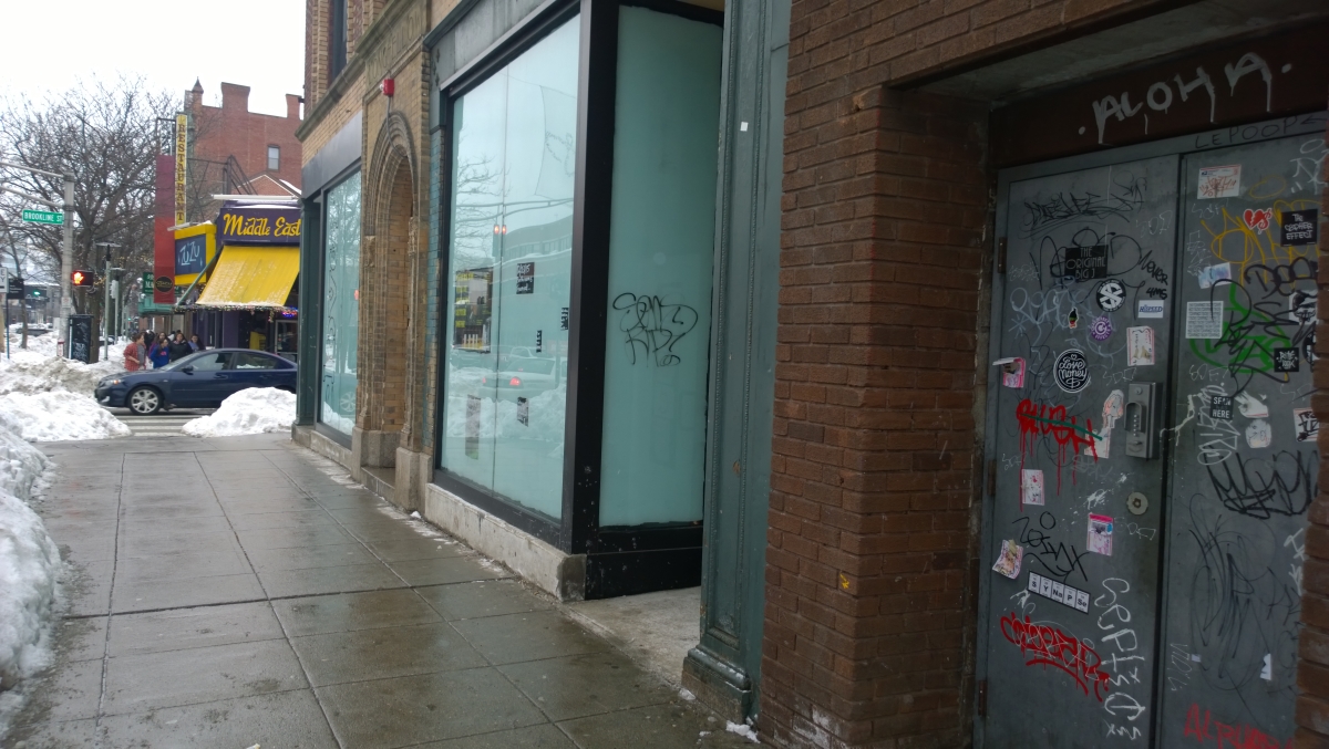 Figure 1 Brookline St as a marker of economic divide between thriving and abandoned businesses in Central Square [author’s own photo]
Just one block over, behind the major street, I was struck by how much more quiet and slow it seemed as busy car traffic and bustling streams of people coming to and from public transit (see figure 2) were replaced by families coming out of the several churches I passed by and an empty park covered in feet of snow. A satellite view of the area allowed me to see the total scope of what I had observed firsthand and I noticed the change in density of parking lots versus trees in areas between buildings as I moved further from the main road and deeper into the residential section. I wanted to have a balance between the anomalies I was observing in both the public and private spheres, so I shortened my final site boundaries to between Columbia and Essex Streets, and stretched it from Massachusetts Ave to Worcester St (see figure 3). I felt that having two blocks each of commercial and communal land use and residential and recreational land use would offer me a chance to study a more complex intersection within the community. What stands out to me in particular on the map is how Bishop Allen Drive marks what Grady Clay called a “breakpoint” in the orientation of the streets on either side that seems to correlate with the bend of the Charles River at Longfellow Bridge (42).
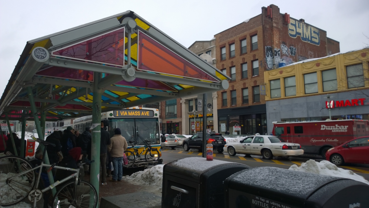 Figure 2 A significant traffic point at the highly frequented bus stop on the major road Massachuestts Avenue [author’s own photo]
An overall characteristic present in both the public and private sections of Central Square that I also plan to research is the fact that many blocks serve as a dedication to some previously important community leader, indicated by the various art pieces and plaques posted throughout the neighborhood. I’ve observed this community feature throughout the greater Cambridge area and it lends to the greater sense of history that I feel in the east coast versus my home in Bay Area California. When I see them, I wonder what services were provided to receive the recognition and honor, how often dedications are given, and if they still matter to populations that came after the fact. Along the same line of thought, since my final site boundary starts at Brookline St, which is where I have observed to be the definitive transition between MIT and the city, I am also curious to find out how MIT’s resettlement on the Cambridge side of the Charles River has affected Central Square, and whether its presence now is or is not a significant factor in the community’s present and future.
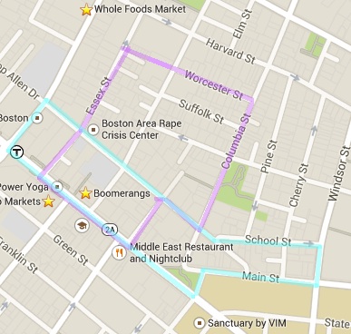 Figure 3 Initial (blue) versus final (purple) site boundaries [edit of Google Maps]
Works Cited
Clay, Grady. (1980). Close-Up: How to Read the American City. Chicago, IL: The University of Chicago Press.