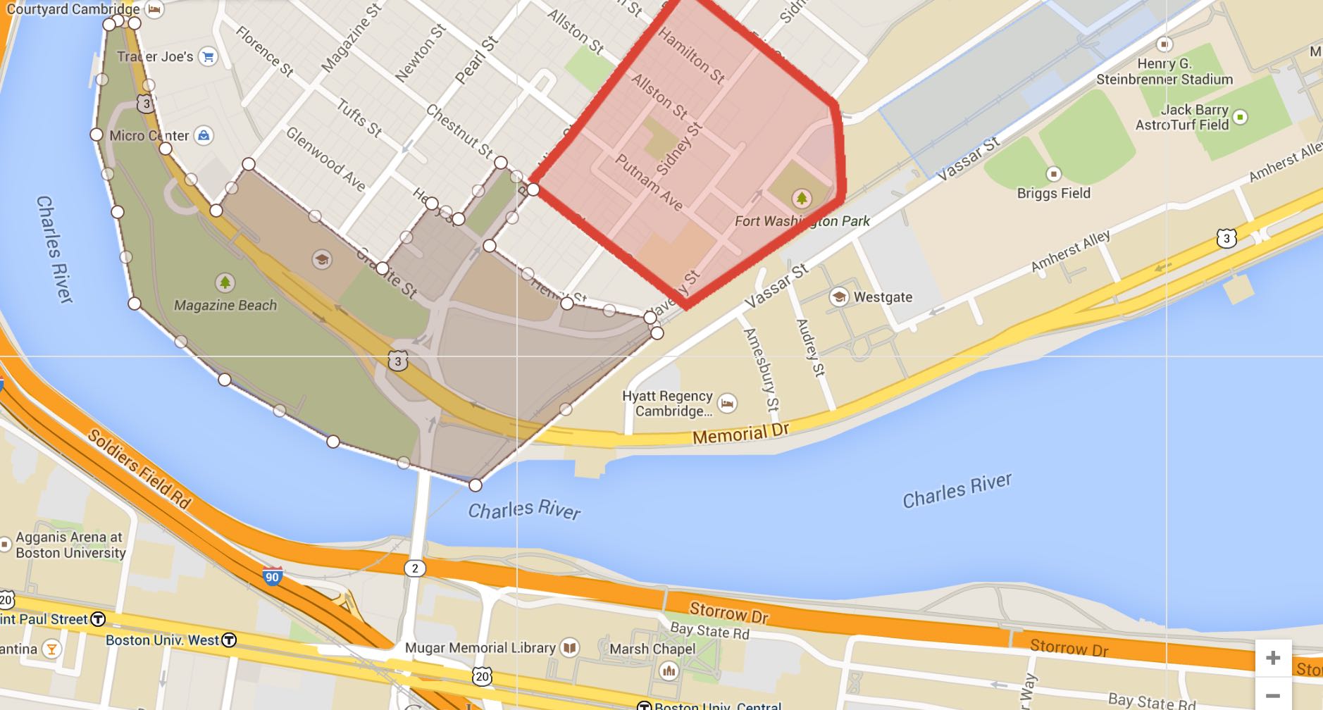
 Site denoted by brown region; from Google Maps https://www.google.com/maps/d/edit?mid=zYi5pgCV1g_k.kIBXphKoTDmA
Along the Charles River, between Pleasant Street and the railroad tracks that border MIT’s campus, runs Magazine Beach: a park with walking trails, a boat house, and Veterans Memorial Pool. Looking northeast into Cambridge from the park, you see a commercial area with a Shell and a Micro Center electronics store, and Morse Elementary school. Beyond, the area quickly becomes residential, giving way to the single-family homes of the Brookline neighborhood. Hastings Square park fits neatly into the grid.
But the centerpiece of the site is a busy section of Memorial Drive, part of Massachusetts Route 3, which connects Boston via Longfellow Bridge to the northern part of the state, merges with US Route 3, and continues into New Hampshire and beyond.
The section between MIT and Pleasant Street is particularly interesting because it epitomizes the relationships between Memorial Drive and the areas that border it: recreational (Magazine Park), commercial, residential, and institutional: it will be interesting to investigate the relationship between the busy road and the adjacent elementary school, as well as MIT.
Memorial Drive is prone to congestion, perhaps because it is an extension of a highway, but built like a surface street. For the same reason, it lacks bike lanes and bus routes, and has few marked pedestrian crossings. It does sport an elevated pedestrian bridge between the Morse Elementary School parking lot and Magazine Beach. There is also a crossing at the intersection of Memorial and Brookline, at the site of the Boston University Bridge. That intersection gets particularly snarled, partially because Memorial Drive temporarily splits into three: a section in each direction enters the intersection as surface streets, and one lane in each direction follows an overpass paved with brick that skips the messy junction. I am interested to discover how Memorial Drive was designed to accommodate and integrate with the areas and communities through which is runs.
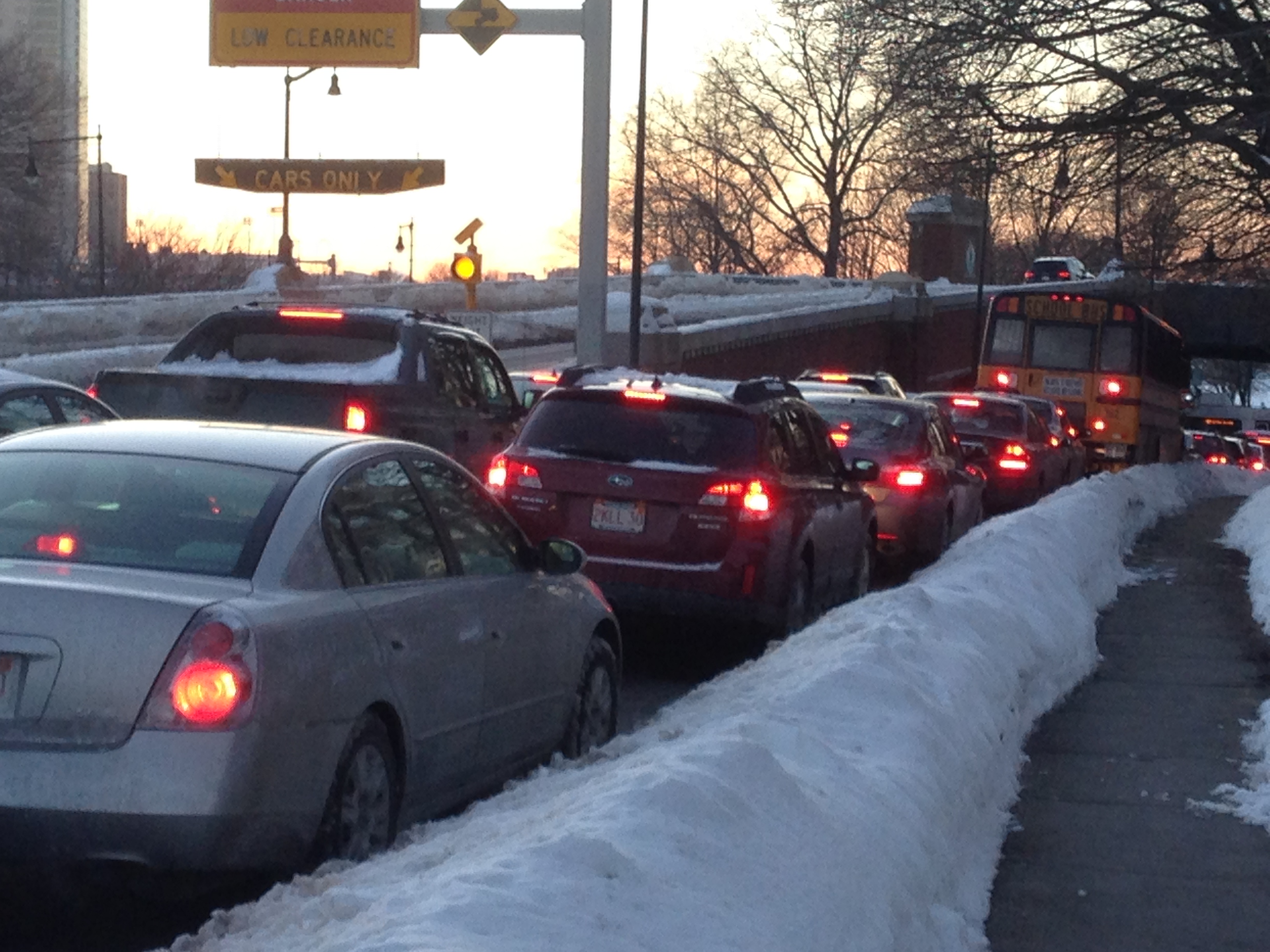 Rush hour traffic on Memorial Drive, looking West toward the intersection with Brookline Street and the Boston University Bridge
It is striking how quickly surroundings change as you leave Memorial Drive. Just a block northeast from the jammed intersection of Memorial and Brookline, difficult to navigate for everyone but especially those not driving cars, the area becomes quiet and residential. A bicycle wayfinding sign, one of a network put up a few years ago by the City of Cambridge, directs cyclists down Brookline as a route to Inman Square. People walk their dogs through Hastings Square, along the path that cuts diagonally across the park.
The stark contrast in pace between two areas so close together suggests a difference in the populations that use the two areas. Perhaps the people who flow through the site on Memorial Drive have little to do with the neighborhood, and people of the neighborhood mainly travel into Boston via that Boston University Bridge, and make little use of the thoroughfare. Who uses Memorial Drive, and for whom it was designed, is an interesting question that may help explain how the roadway interacts with the rest of the site.
Memorial Drive both connects MIT to the outside world as a thoroughfare, and helps buffer it from Boston proper. Most traffic uses Memorial Drive as opposed to other routes through MIT, making the campus feel less urban and more enclosed. In the words of Grady Clay, Memorial Drive is at once a “venturi” and “break”: it is a well-traveled route that facilitates the exchange of ideas and money, and it breaks a pattern, in this case one of academic land use.
More study will be necessary to uncover the relationships between the diverse land use areas surrounding Memorial Drive and the road itself. But hints lie in the way Memorial Drive separates itself from the area with overpasses and underpasses, and the stark difference between the roadside and the neighborhood adjacent. Large roads both adapt to a help form the areas that surround them, by acting as thoroughfares and as breaks.