Traces from the environmental history and development of Memorial Drive and Magazine Beach still impact the use of the site today. The area’s swampy beginnings and domination by the automobile are visible in the pavement, the street pattern, and the land use of the site. Though the area is modernized, its past has established trends of use, care, and disrepair that are likely to continue into the site’s future. These patterns are determined by how the population assigns value to the attributes of the area. Public attitude toward the flow of water and the flow of traffic have in large part shaped what the site is today.
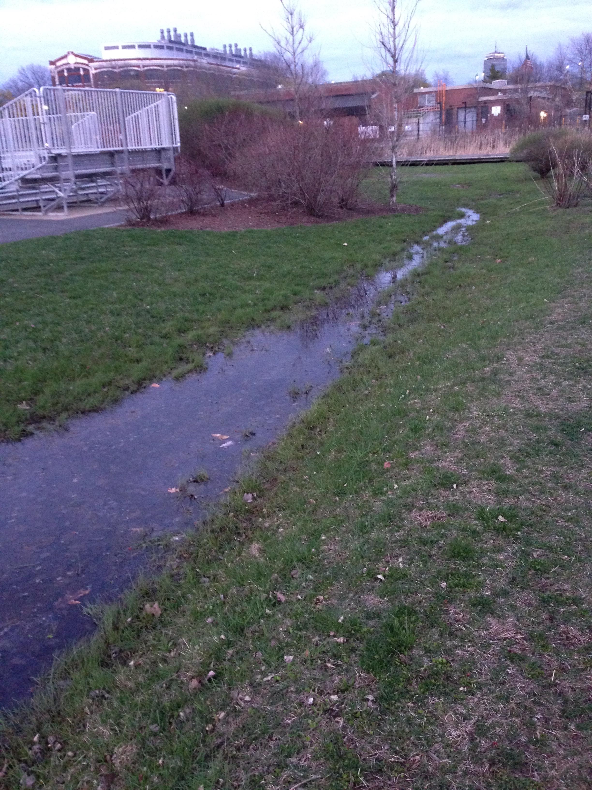 Figure 1: Pools of standing water are evidence of bad drainage and traces of Magazine Beach’s history as a marsh.
As late as 1894, streams flowed across what is now Memorial Drive and Magazine Beach. In The Language of Landscape, a similar scenario is described: urban development occurs on top of and without regard to waterways (Spirn, p. 10). In the case of Magazine Beach, the land’s former wetland state is apparent from evidence of bad drainage. Large pools of standing water occupy any low patch of ground (Figure 1). Pavement crumples and bulges between car tires and loose, wet foundations (Figure 2). These traces of the site’s former environment still impact its functionality: potholes damage cars; people using the park for recreation are bitten by mosquitoes inhabiting the stagnant pools. Traces of a disregard for waterways helped shape the site and are still evident today.
 Figure 2: Shoving of pavement near the Charles River suggests loose, wet foundations on a former swamp.
Dominant forms of transportation have had a large impact on the Magazine Beach site throughout its history. In particular, the rise of the automobile guided its development. Because there was little development near Magazine Beach before that rise, most infrastructure on the site is tailored toward the car. However, the railroad runs under Memorial Drive and across the Charles River near the Boston University bridge. The rail line is rusted, graffitied, and populated by geese— a state of repairs in contrast to that of the roads that surround it (Figure 3). The relative decay of the railroad yields clues about differing sense of public responsibility for different forms of transportation infrastructure. According to The Crabgrass Frontier, State and Federal governments funded roadways while leaving public transportation systems to private companies, which were not able to maintain the lines and keep themselves out of bankruptcy (Jackson, p. 163). Figure 4 shows a pothole that appears annually around a sewer manhole on Memorial Drive. Public agencies repair the road in this area every year, after the pavement warps over the winter months. This pattern of care is evidence for a continuing trend of annual repairs and associated allocation of public funds. In contrast, the railroad does not show such evidence of consistent care. Patterns of use and care suggest patterns in public attitude toward public versus private transportation systems.
 Figure 3: Railroad tracks are rusted and graffitied, evidence of limited care.
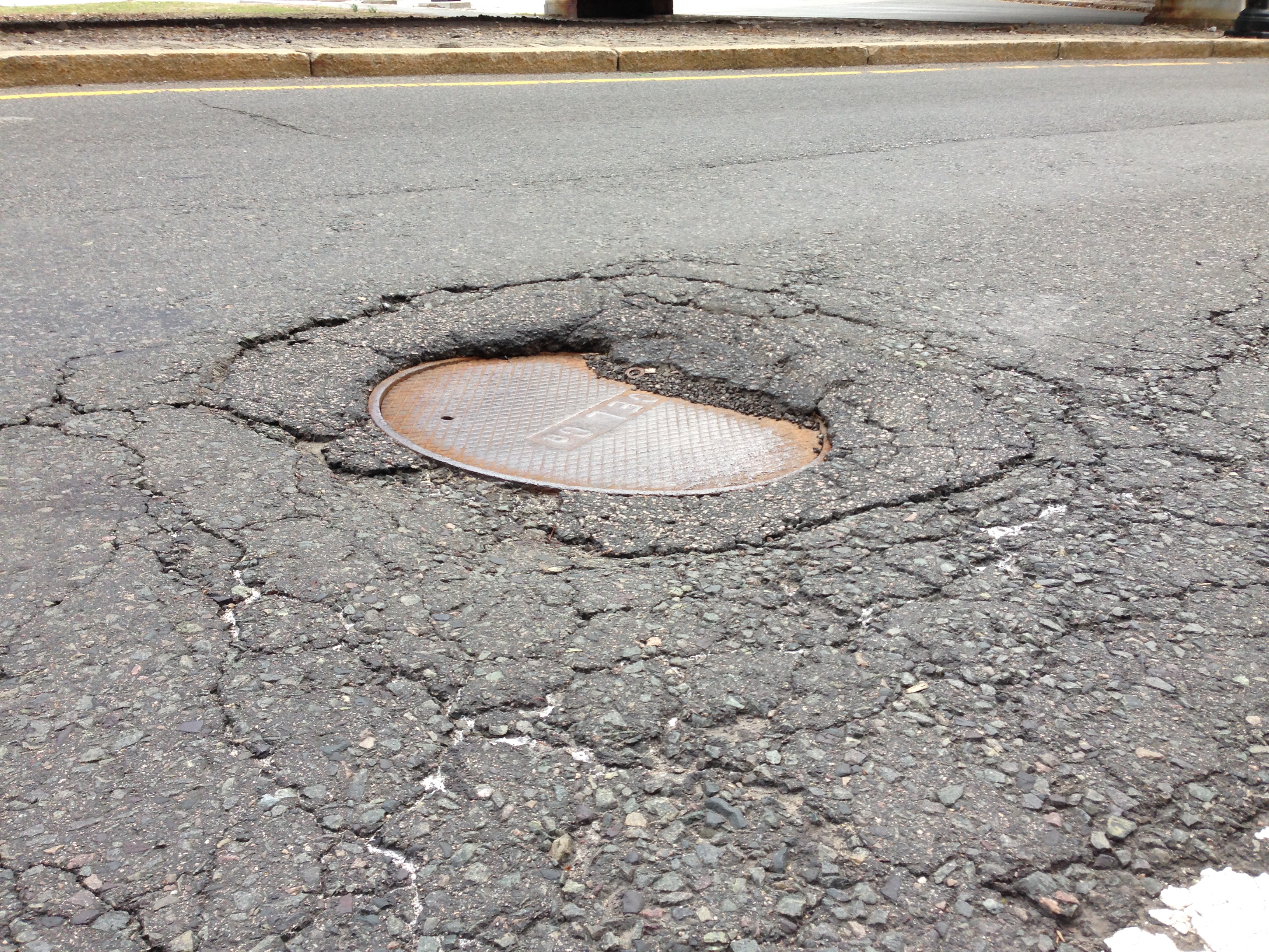 Figure 4: An annual pothole on Memorial Drive, which is repaired after every winter.
Artifacts from the expansion of automobile-based transportation systems dominate the area around Magazine Beach. Memorial Drive divides into surface streets and an overpass (Figure 5). This structure is an artifact of a push in the mid-twentieth century for expressways designed for the automobile and only the automobile (Jackson, p. 166). The overpass is made of brick and what appears to be copper (Figure 6), a material composition pointing to its mid-twentieth century origins. Memorial Drive was once Charles River Parkway, a thoroughfare designed for pleasure driving. Traces of this old purpose are found in Memorial Drive’s shape: the road follows the river instead of bridging it or cutting through Cambridge in a straight line. Memorial Drive was originally built to be scenic. Now, the sign pictured in Figure 7 is an artifact of the shift from an emphasis on pleasure driving to an emphasis on commuting. Traveling on highly-traffic Memorial Drive is no longer a pleasurable experience. Nor are cars considered a luxury anymore: instead, they are seen as necessary tools for getting around. The fact that Memorial Drive is now a highway that connects to the state highway system is evidence of a trend toward a more utilitarian view of the automobile.
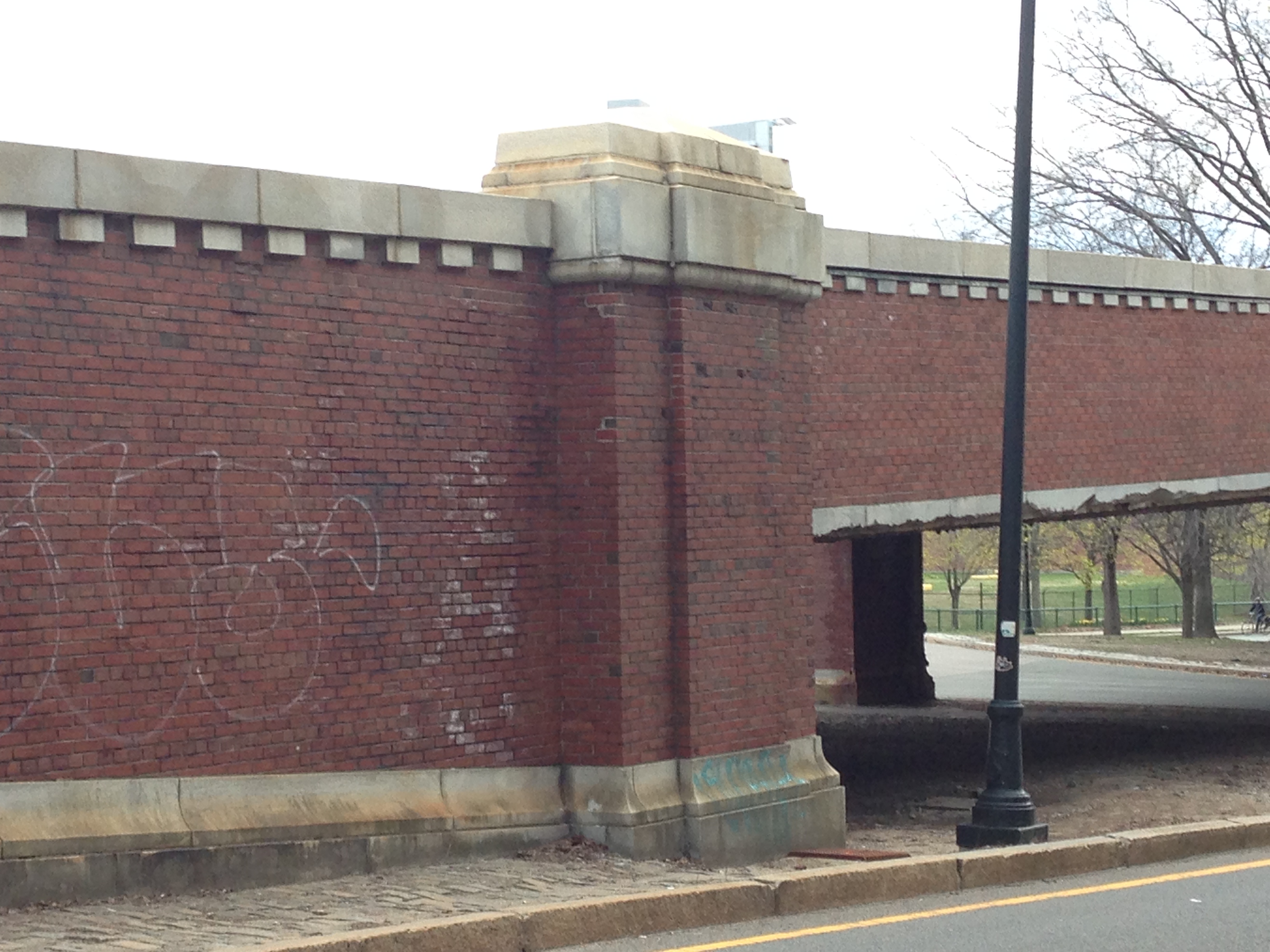 Figure 5: the Memorial Drive overpass cross the busy intersection with Brookline Street.
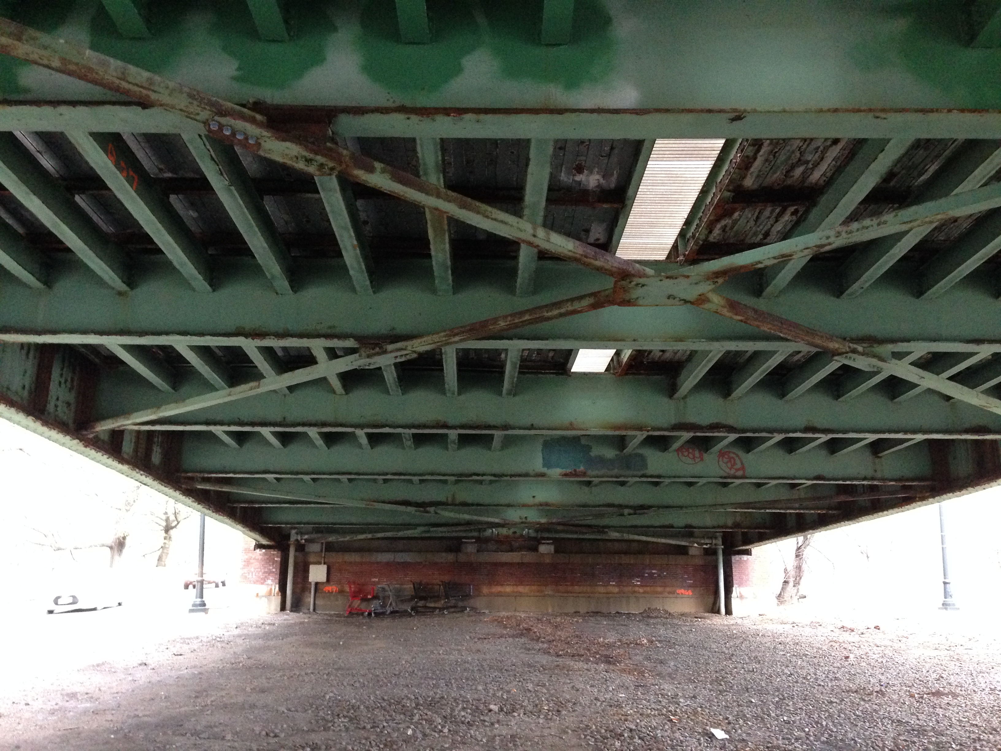 Figure 6: The underside of the overpass, which appears to be made of copper.
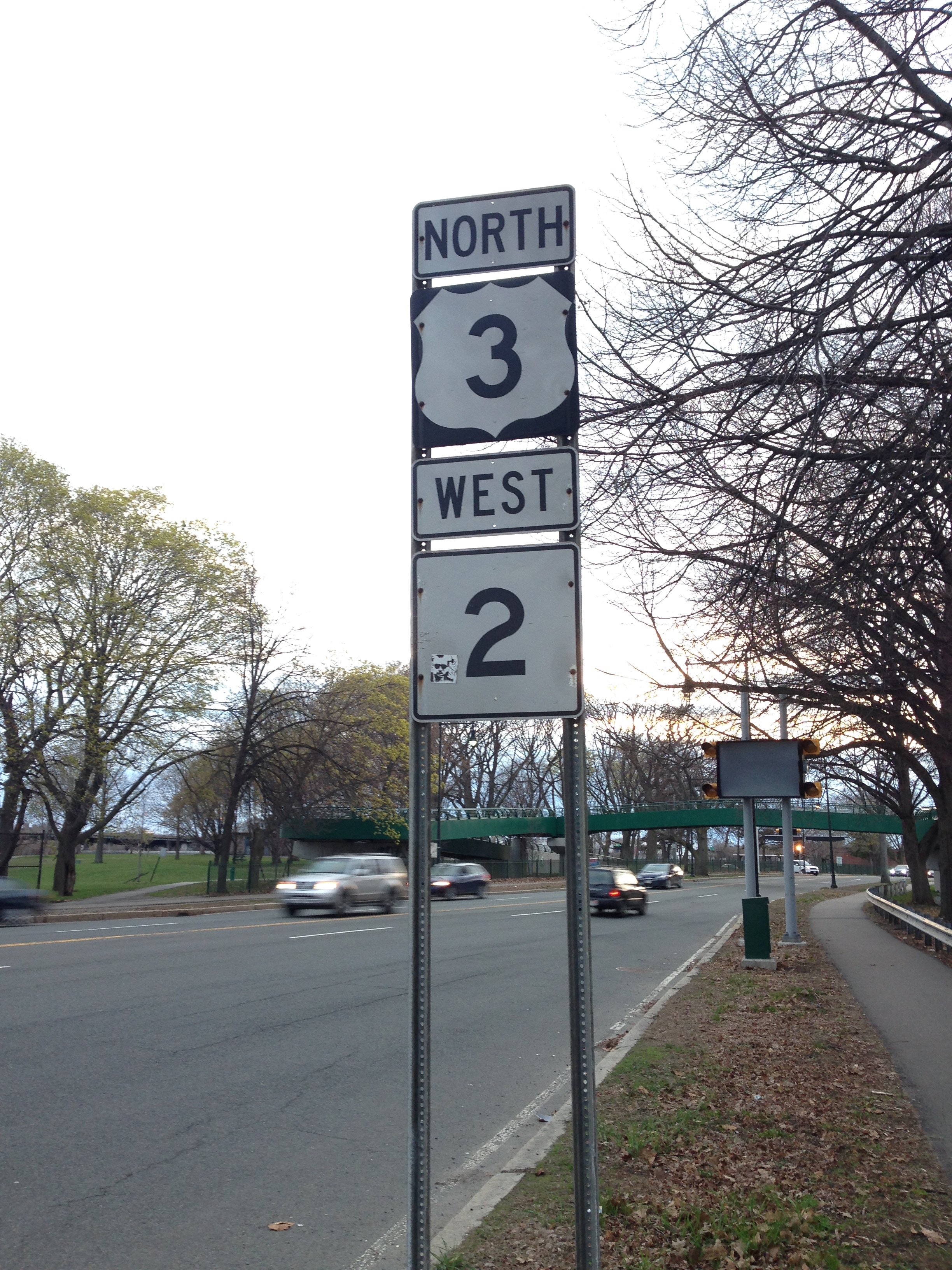 Figure 7: Memorial Drive is part of the state highway system; this sign is an artifact of the shift in emphasis from pleasure driving to utilitarian driving on Memorial Drive.
Another trace of this shift appears at the junction of Memorial Drive and Brookline Street. The intersection is a highly-trafficked roundabout, which may be a trace of overlapping parks and roadway jurisdictions. The shape is convoluted, confusing, and prone to congestion. When Memorial Drive was the Charles River Parkway, it was under the jurisdiction of the parks department and considered a space for recreation. But in the mid-twentieth century, Memorial Drive became part of the state highway system, which increased traffic flow on the roadway. The change may have also complicated which department was in charge of interfacing the new highway with surface streets, leading to the snarled intersection that exists today. Traces of the change in use of the thoroughfare impact the experience of people who use it today.
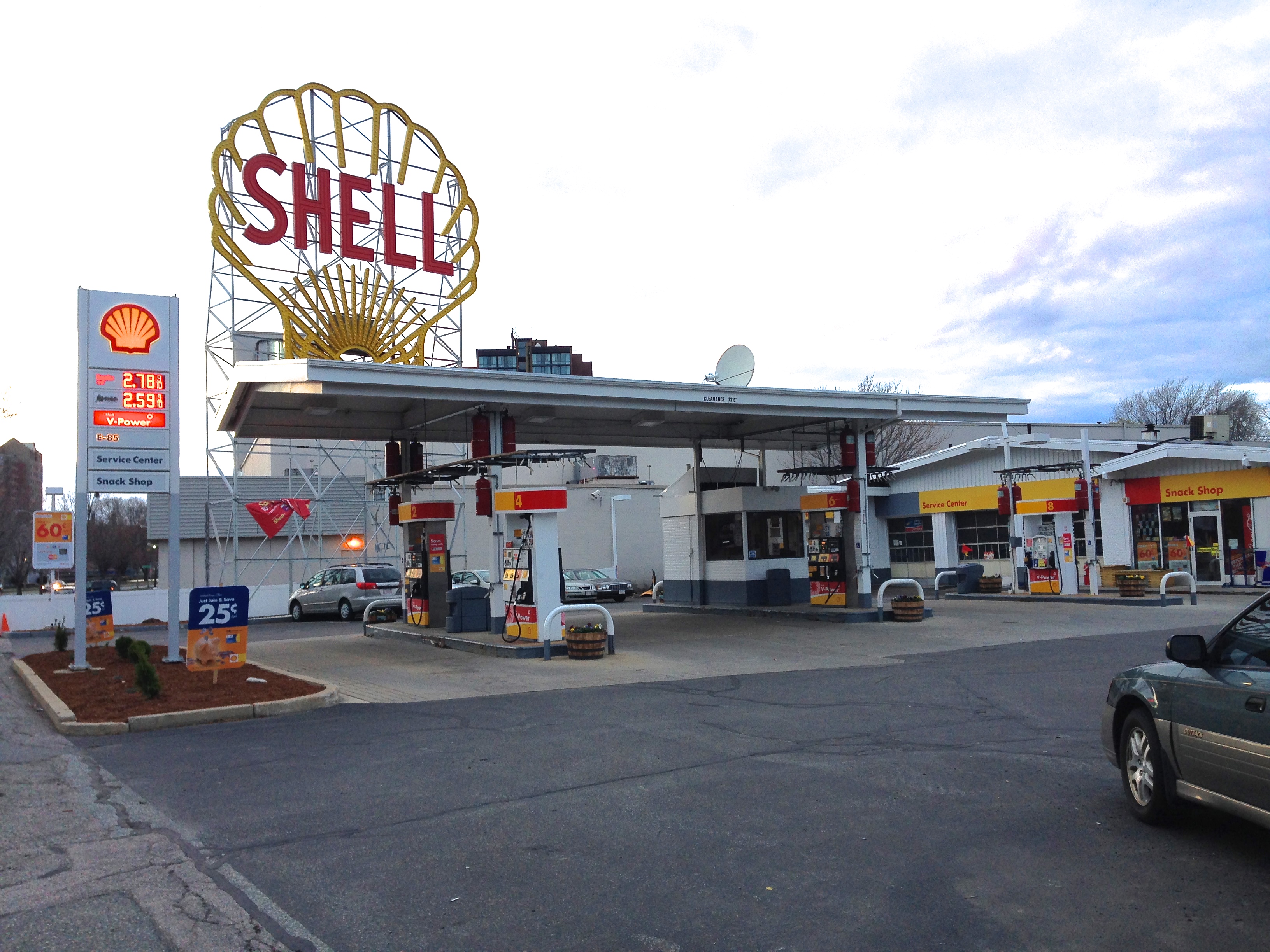 Figure 8: Fill station near the 1970s location of the first fill station on the site.
More tributes to the automobile’s dominance are still to be found around Magazine Beach. A large fill station (Figure 8) occupies a site near that of an historic fill station that appears in a 1970 map of the area. The site of that older fill station is now the Microcenter, an electronics retail establishment. A parking garage also used to stand where the sprawling Microcenter building is today. That structure was presumably torn down to make way for retail, but the land across Riverside Street has since become a large parking lot (Figure 9). Riverside Street itself is a trace of old intentions: it was never extended to reach the riverside. In fact, its designation as a street is probably a relic of an old use. Today Riverside Street does not connect to anything: it is simply a turn-off from Memorial Drive into the parking lot in front of the Microcenter. This may be evidence of a shift in attitude as cars became a means by which to access retail. Now people use the parking lot to access the Microcenter or the Trader Joe’s grocery on the other side, whereas the parking garage was likely built as storage space for the prized possession that was the automobile.
 Figure 9: Riverside Street was never extended to reach the riverside; nor is it really a street, but a turn-off from Memorial Drive into a parking lot.
Public opinion often determines use patterns and informs policy, both of which can shape a site. Magazine Beach and Memorial Drive have been shaped by a disregard for waterways and a changing view of the automobile: from a form of recreation to a necessity. Traces and artifacts of these trends are evident in the land features, the infrastructure, and the patterns of use and disrepair in the area. In the future, these patterns will likely continue, unless public opinion were to shift again— perhaps in favor of public transportation or environmental reclamation. It is hard to imagine, but perhaps a new technology could be as transformative to the site as the automobile was formative.
Works Cited
Spirn, Anne Whiston. The Language of Landscape. New Haven, Conn.: Yale UP, 1998. Print.
Jackson, Kenneth T. Crabgrass Frontier: The Suburbanization of the United States. New York: Oxford UP, 1985. Print.
Photos by author