|
Try to remember. I’ve grown so close to Boston that its walls and streets are thick with fiction. Sometimes it’s dangerous to develop an image of something, because it becomes hard to then see it for what it really is. One’s impression is developed from engagement with RECORDS: the stories of a setting, be they memories of firsthand experience, primary source material, gathered statistics, or assorted descriptions consolidated over time. While situated experience in a location is vital to building practical and tactical knowledge of SITE [the variable, manipulatable physical locality], one cannot discredit the power of rumor, mystery, and factoid in the creation of PLACE [imaginative character as a backdrop for daily life]. Here are my records, beginning as glimpses but hopefully becoming a network of memories and associated files. By sharing them, I hope to integrate a jumble of datasets into a coherent storyline onto which vivid projections of Savoy’s past and future may be built.
I first went to the South End on assignment. Cataloging a neighborhood, as an
architecture student and amateur psychogeographer. How can one begin to build
knowledge of something at the scale and complexity of a neighborhood? I was
resolved to understand its progressive organization, the structure behind its
form, the people comprising its culture. All of these things happened to me, I
just don't quite remember in what order.
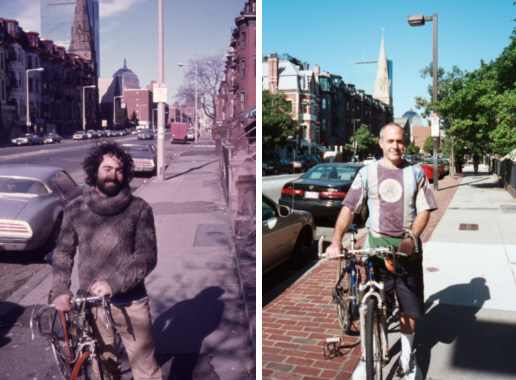
It was back when my bicycle seat wasn’t a hockey glove, I could lean back, way
back, and take in the street. Facades flicker by. On the back of a mittened
hand, thick rubber bands held a mid-resolution camera optimized for internet. A
green indicator light (which you'd see if it was dark out [which it wasn't yet])
was indicative of its connection to the portable computer secure in the pack on
my back. With it, I recorded the surface of my city surroundings. I traversed
the streets, sidewalks, and alleyways, pausing in alcoves on two wheels and a
whim. A peripheral GPS device tracked my experiential trajectory from objective
overhead. I took the footage and ran it through resolume, a digital VJ software
sometimes used in clubs, to condense and mirror it in integer-fold symmetries.
The result was an evolving kaleidoscope of bricks and paver, grass and garden
bed. Trees with sky behind, fleeting iron and ornament. The patterns were
amplified by self-juxtaposition, asymmetric perceptions made symmetric. I made
it, mixed it, saved it, remixed it. I watched it a few times and never really
showed it to anyone.
The T didn’t seem especially convenient, so the two of us grabbed the bus
outside of Bexley. Transit. Trans-what? Crossing the Charles brought us into
Boston. Crossing the Southwest-Corridor Park, a breath of fresh green & an
orange line station, ushered in that South End feeling. We offed ourselves at
Columbus, one of the neighborhood’s three major parallel thoroughfares (i.e.g.
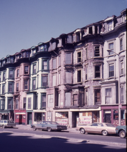
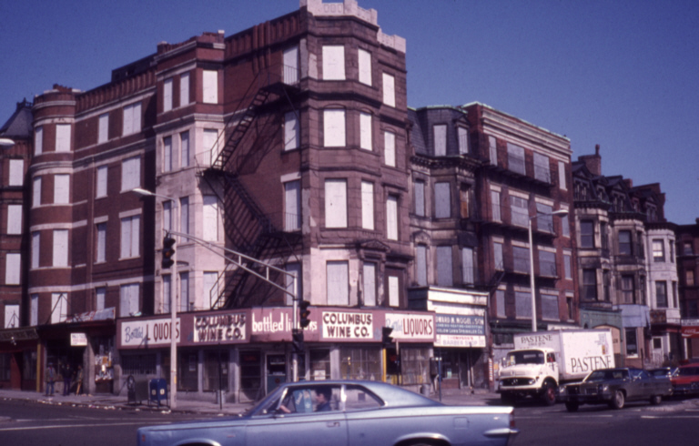
Tremont and Washington,) perpendicular to Mass Ave. The South End as a district
has remarkably sharp edges. The thin linear corridor park to the NW, Mass Ave
stringing along the SW, 90 separates it from what becomes Chinatown further NE,
and visually solid bar of institutions hides a mess-mass of infrastructure to
the SE.
Re: Laconia Lofts, 1200 Washington. From: the architect, direct. Described were
the subtleties of building in a historic district—to get the committee’s nod of
approval, the program / design should express some sensitivity to the specific
location’s former history of uses. I twitch, as I weigh how much to weigh this
notion in generating a truly feasible scheme. It would seem to beg for some sort
of hyper-local postmodern response, at least in a proposal’s social protocol. Is
this an under-your-breath hypothesis that there’s a dormant, unacknowledged
characteristic to a site that makes it already optimized for its previously
enacted uses? If that were the case, why would those old states have
disappeared? Suppositions of this sort seem dangerous because they border on an
invented determinism between geography & use, decreasing one’s ability to
recognize the roles chance, mutation, and mistake have played. When is it
appropriate to herald history to channel further coincidence versus deeming a
timeline fit to be tied off, and moving on with lessons learned? People do seem
to rely on history, however fabricated, as a conceptual firm ground in time.
Even my own ahistorical tendencies are tangled up with nostalgia and ritual, so
I shouldn’t throw stones so heavy that I can’t lift them Building in a place is the continuance of the storyline of a fixed location—a storypoint? How it relates to the past, to the larger arc of historical development, is often moot to designers with many other more pressing considerations in mind. Even the accumulated past’s ongoing realization as fleeting present is treated with little more than schematic and statistic consideration. If it sounds like I speak with disdain, I do not fully mean to, as I believe those methods to be absolutely effective at accomplishing the goal of building something. A touch of tabula rasa is useful to stretch and strengthen one’s design muscles, but I believe a cascade of clues and a wealth of unevaluated lessons may be lost in the process. History should not be a weight, it should be an exquisite corpse on which to operate. |
|
{video resource}
southwest corridor of mirrors {text resource}
Bill:
One foot, two foot, three foot.. {audio resource}
{cd-rom record} 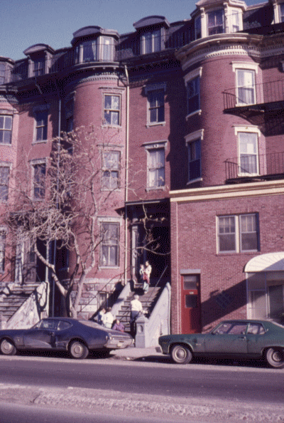
|