| Potential Watershed
|
|
|
|
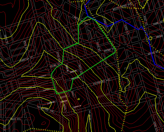
The watershed line was followed the topography, the contour lines. The above is the potential watershed (area in green line). The total area is arroud 1 million sq ft. The peak flow is around 60 cfs during 25 years storm.
The blue line is the watershed line of the old Mill Creek and the yellow dashed line is the ridge line. |