Questions GIS can answer
TABLES/MATRICES
-
COLUMNS = Fields, Headings, Categories
ROWS = Records, Instances, Events, Features
MS Excel Spreadsheets - the WaWa spreadsheet
An Access Database - the ATM database tables
An HTML Table
ArcView Tables - the Census table
Data Types
-
Numbers - Decimal and Integer
Strings - Characters, Alphanumeric text
Dates
Data Dictionary
|
Queries & Selection Sets |
 |
A Couple more VIEW buttons & tools
-
Attribute Table Button

Identify Tool
Find Feature

Query Builder

Defining Themes - Hiding Features
TABLE buttons & tools
-
The TABLE GUI
Find Record
Query Builder
Promote Selection

|
Select All Select None Switch Selection |

|
Identify Tool
Pointer Tool
FIELDS
-
Selecting Fields
|
Sort Ascending Sort Descending |

|
Statistics [no button]
Summarize

Joining Tables on a Common Field

TABLE Properties
-
Table Structure
Hiding and Renaming Fields
TABLE Editing
-
New Tables
Add Field
Add Record
CHARTS - require tables
-
Chart Button

Chart Gallery
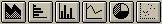
Chart Properties

Chart Symbols Tool
Erase Tool
Related Websites
-
Environmental Systems Research Institute(ESRI)
ESRI's What is GIS page
ESRI Virtual Campus
Environmental Systems Research Institute. Using ArcView GIS. ESRI(On Reserve)
Bruce Davis. GIS: A Visual Approach. OnWord Press.
Scott Hutchinson & Larry Daniel. Inside ArcView GIS 2nd Edition. OnWord Press.
ArcView Exercise Book. OnWord Press.
ASSIGNMENT
You may do this week's assignment in pairs if you wish. It should be turned in on a floppy disk labeled with your name(s). It is due at the beginning of class next Thursday.
CENSUS Data
- If necessary, copy the /ArcView_week2/ folder to your local session directory from the //Print_Server/Data/Classes/Larp601/ directory.
- Open the week7.apr Project
- In the CENSUS BLOCKGROUPS - UTM View, make the 1990Census theme active. Using the Edit > Copy menu item, copy the them. Using the Edit > Paste menu item, Paste the a copy of the theme into the Table of Contents. Do this twice more so that you have four themes. You do not now have 4 different shapefiles. Rather, you simply have four copies of the same file. However, you can now apply four different legends to them.
- Using the Legend Editor, create 4 maps of your choice (adjust the classification, legend type, colors, etc.) showing Unemployment, Owner-Occupied Housing, Population Density and Percent Below Poverty. For information on each of the fields in the Census shapefile, please refer to the Data Dictionary
- In the Project Window, select the File > Save As menu item and save the file in the session directory under a different name.
- Close the Project.
- Using the Windows Explorer, copy your Census *.apr file to a floppy disk. Use this floppy disk to turn in your homework.
- Read this portion of the assignment carefully before beginning. It may be necessary to gather some information before you sit down at the computer.
- Open the wk7_assign.apr in the /ArcView_week2/Assignment/ directory.
- This project is a subset of the West Philadelphia spatial database we have been working with for the last few weeks. It has a single View showing a few layers with which you are probably already familiar and a couple of new ones - Coffee Shops and Food Trucks. You can choose to work on either of these two themes. Begin by opening the Theme Attribute Table.
- You will notice a single Field called Shape. You are going to add several Fields to this. Select Table > Start Editing to make the Table editable. Notice what happens to the Field names at the top of the Table.
- Using the Edit > Add Field menu item, add new Fields to your Coffee Shop or Food Truck table using the following data dictionary:
Field Name Type Width Decimal Places Name Char String 24 0 Type Char String 12 0 Food_Item1 Char String 24 0 Food_Item2 Char String 24 0 Price1 Number 4 2 Price2 Number 4 2 Rating Number 3 0 Comments Char String 36 0
- Using the Edit Tool, fill in each of the records. For [Name] enter the name of the Truck or Coffee Shop that corresponds to that location. Note that you may need to first Select the record with the Pointer Tool in order to see where the record is located on the map. In the [Type] Field, enter the type of food truck or coffee shop. Is the truck a Chinese food truck, a Fruit food truck? Or is the coffee shop a Restaurant or a Cafe?For [Food_Item#], enter the name of a product sold at that truck/coffee shop. If you do not know, feel free to make this up. The same applies for [Price#]. Rating is for an overall rating of the quality of the truck/coffee shop on an arbitrary scale of 1 to 100.
- When each cell in the Table has been filled in, select Table > Stop Editing and answer YES to Save the Edits. Notice that the Field Names return to being italicized.
- You now have a populated Table that can be used for thematic mapping, charts or queries. In the View Window, double click on the FoodTruck or CoffeeShop legend to bring up the legend editor. At the top of the screen will be a pulldown menu showing 'Single Symbol'. Change this to 'Unique Value'. This will change the Legend Editor to a new box allowing you to select a Field upon which to symbolize. Select a Field and color scheme and press Apply to see what happens. Try ramping the colors, randomizing the colors, etc. Now change Unique Value to Graduated Color. Select a different field this time (Note that Graduated Color only works with Number Fields). A default of 5 categories will appear. You can adjust the number of categories by selecting the 'Classify' button. Finally, try changing the Graduated Color to Graduated Symbol and use the [Rating] as the Classification Field.
- Using your Food_Truck or CoffeeShop table, make a new Chart in the Project. Select the [Rating] field for the 'Groups' area of the Chart Properties dialog box. Select a Chart type. Try changing the Chart Type with different Fields. There are several types of Charts. If you need to see a number of examples and how each might apply in a given situation, please refer to the Using ArcView GIS manual, pp138-148 for some color examples.
- In the Project Window, choose File > Save As and save a copy of the project to your session folder.
- Close the Project.
- Using the Windows Explorer, Copy the project (*.apr) and coffee shop or food truck (*.dbf) table to your floppy disk. Label it with your name(s) and turn it in on Thursday. If you had any problems, questions or comments, type them in a word processing document and add this document to the floppy disk. Keep a copy of it on hand as it may be necessary for the assignment next week.
Creating a NEW Table
- Before beginning this portion of the assignment, you will need to find a list of Philadelphia addresses. Try to decide on a category around which to gather the addresses. The list of addresses might be Schools in Philadelphia, WaWa's in Philadelphia, Classmates, Laundromats In My Neighborhood, etc. There should be at least 10 addresses, even if the list is longer, don't use more than 25 addresses unless you really have a lot of time on your hands. (You only need the street address. You do not need the zip code, city, etc)
- In a New Project, use the Project Window to start a New Table document. Select a location for this Table in the Session directory of your computer and give it a name.
- Using Edit > Add Field, add a field called 'ADDRESSES'. Add a second field called 'NAME'.
- Using Edit > Add Record, add as many records as you have addresses in your list.
- Using the Edit tool, enter these addresses and the name of each in the table.
- Select the Table > Stop Editing menu item, say YES to save the edits.
- You have now created a new table file with two fields in it called [ADDRESSES] and [NAME]. This table should have 10-25 records, each consisting of a single address and the name of the place or person corresponding to the address.
- Do not turn in this Address Table. Please bring it to class next week. We will use it in class for a process called GeoCoding.
intro | readings | schedule | help | questions
last update: 12 Oct 1997