| SETTLEMENT mill creek | ||
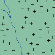 |
FORESTED LAND densely forested land inhabited by the Lenape Indian tribe |
+ |
 |
ESTATES large estates on elongated plats running perpendicular to waterways built by wealthy landowners as retreats from the city |
+ |
 |
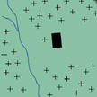
FARM LAND forest land abutting waterways and roadways cleared for agriculture |
+ |
 |
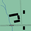
INDUSTRY textile and saw mills established along waterways with advent of Industrial Revolution; roadways, railways and bridges developed for overland transportation of people and goods; access to area by travelers marked by increase in hotel industry |
+ |
 |
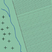
SETTLEMENT overcrowding of the city as well as health and environmental concerns draw people outward while transportation developments allow ease of access to city; beginning subdivision of large plats for development; landmarks created (cemetery, Fairmount Park) |
+ |
 |
DEVELOPMENT further development of West Philadelphia for residential use; increased subparcellation of land; infrastructure of roads and sewer lines laid out extending existing gridded development of city and early suburbs despite natural topography and waterway; industry moves out no longer dependent on location |
+ |
 |
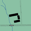
DENSIFICATION residential and commercial development and densification as support for city; concentration of educational and social institutions near Schuylkill River established |
+ |
 |
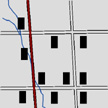
DESTRUCTION first of a series of cave-ins along sewer line which resulted in the displacement of local residents; depression; district redlined; federal funds for housing and projects made available; low income housing development |
- |
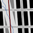 |
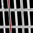
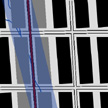
REEVALUATION original meandering waterway slowly redefining itself with a path of vacant and shifting land; rift in urban fabric caused by the destruction along with social and political developments to reshape the neighborhood |
- |
| CONCLUSION While early industry and agriculture positioned itself directly with regard to local waterways and topography, beginning settlement and development oriented itself with major roadways. The rigid geometric organization marked the spread of development from the city. To facilitate this development, the city harnessed the existing waterways into underground sewers along the lines of the grid. This move to dominate natural forces marked the beginning of densification and urbanization, but also pointed to the eventual failure of any development within its path. Social and political forces combined with natural and physical ones acted simultaneously to shape the nature of this place. |
||