|
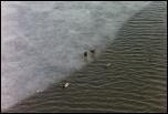
Cool ducks
|
Sm
Med
Lg
Full
|
|
Description :
|
Some ducks loiter along a chunk of ice floating in the Mystic River.
| |
Date :
|
28 Mar 2004
|
| |  |
| |
|
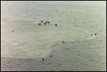
Ducks on ice
|
Sm
Med
Lg
Full
|
|
Description :
|
More ducks, more ice, same Mystic River.
| |
Date :
|
28 Mar 2004
|
| |  |
| |
|
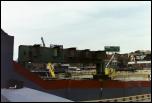
Support
|
Sm
Med
Lg
Full
|
|
Description :
|
A support from the former Central Artery, near Faneuil Hall.
| |
Date :
|
28 Mar 2004
|
| |  |
| |
|
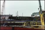
Looking north
|
Sm
Med
Lg
Full
|
|
Description :
|
From the path between Haymarket and the North End, looking to the north at the remains of the elevated Central Artery.
| |
Date :
|
28 Mar 2004
|
| |  |
| |
|
Fenced in
|
Sm
Med
Lg
Full
|
|
Description :
|
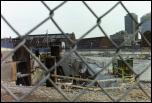
Looking to the south from the path between Haymarket and the North End. A tunnel bends off to the left towards Logan Airport.
| |
Date :
|
28 Mar 2004
|
| |  |
| |
|
Got email?
|
Sm
Med
Lg
Full
|
|
Description :
|
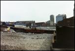
Demolishing the Information Superhighway.
| |
Date :
|
28 Mar 2004
|
| |  |
| |
|
Crane
|
Sm
Med
Lg
Full
|
|
Description :
|
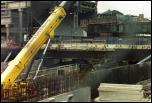
A crane works below surface level. The large building to the left is the large garage above Haymarket Station and Congress Street.
| |
Date :
|
28 Mar 2004
|
| |  |
| |
|
North End
|
Sm
Med
Lg
Full
|
|
Description :
|
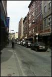
Looking off into the North End. The Big Dig is behind us.
| |
Date :
|
28 Mar 2004
|
| |  |
| |
|
Tunnels
|
Sm
Med
Lg
Full
|
|
Description :
|
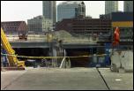
Some of the tunnels aren't finished yet, and are open to the surface.
| |
Date :
|
28 Mar 2004
|
| |  |
| |
|
Structure
|
Sm
Med
Lg
Full
|
|
Description :
|
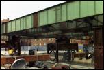
The demolition process seems to have generally begun with removing the surface of the highway. Here the steel structure remains, but sun comes through the top rather than hitting pavement.
| |
Date :
|
28 Mar 2004
|
| |  |
| |
|
Highway
|
Sm
Med
Lg
Full
|
|
Description :
|
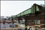
What remains of the Central Artery is being demolished sporadically. This block-long section of one side of the highway has no surface.
| |
Date :
|
28 Mar 2004
|
| |  |
| |
|
End of the road
|
Sm
Med
Lg
Full
|
|
Description :
|
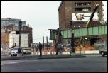
The elevated highway ends abruptly at Haymarket Square. Looking to the north, down North Washington Street.
| |
Date :
|
28 Mar 2004
|
| |  |
| |
|
Not quite yet
|
Sm
Med
Lg
Full
|
|
Description :
|
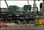
These on-ramps to the depressed Artery aren't quite open yet.
| |
Date :
|
28 Mar 2004
|
| |  |
| |
|
Sun
|
Sm
Med
Lg
Full
|
|
Description :
|
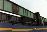
Sun can be seen between girders on the remains of the elevated structure.
| |
Date :
|
28 Mar 2004
|
| |  |
| |
|
Closed ramps
|
Sm
Med
Lg
Full
|
|
Description :
|
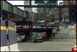
This is still visibly a construction zone. I'm not clear why there's traffic lights on an on-ramp.
| |
Date :
|
28 Mar 2004
|
| |  |
| |
|
Last off-ramp
|
Sm
Med
Lg
Full
|
|
Description :
|
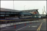
The last off-ramp from the elevated Central Artery, to Haymarket Square. This ramp was actually built in coordination with the T, which is still using it as a temporary incline for the Green Line to get to North Station.
| |
Date :
|
28 Mar 2004
|
| |  |
| |
|
Green Line
|
Sm
Med
Lg
Full
|
|
Description :
|
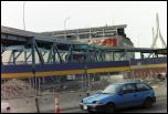
An MBTA Kinki-Sharyo LRV descends the incline.
| |
Date :
|
28 Mar 2004
|
| |  |
| |
|
Causeway St.
|
Sm
Med
Lg
Full
|
|
Description :
|
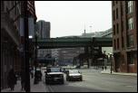
The elevated structure still stands over Causeway Street; the elevated Green Line can be seen behind it. Until 1975, the Orange Line also ran here, coming up a ramp parallel to the Green Line but turning right and ducking under the elevated highway.
| |
Date :
|
28 Mar 2004
|
| |  |
| |
|
Crossing the Charles
|
Sm
Med
Lg
Full
|
|
Description :
|
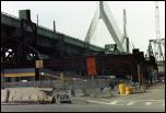
Both the old bridge over the Charles and the new Leonard Zakim bridge can be seen here.
| |
Date :
|
28 Mar 2004
|
| |  |
| |
|
Underneath
|
Sm
Med
Lg
Full
|
|
Description :
|
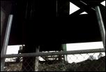
Looking up at the elevated highway heading towards downtown.
| |
Date :
|
28 Mar 2004
|
| |  |
| |
|
Unused highway
|
Sm
Med
Lg
Full
|
|
Description :
|
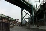
On the left, another block of elevated highway; above us, the ramp to Haymarket; to the right, the Green Line.
| |
Date :
|
28 Mar 2004
|
| |  |
| |
|
Storrow exit
|
Sm
Med
Lg
Full
|
|
Description :
|
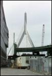
The curved green ramp used to be the entrance to 93 South from Leverett Circle and Storrow Drive. On the left, the Fleet Center and North Station.
| |
Date :
|
28 Mar 2004
|
| |  |
| |
|
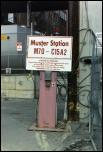
Muster Station
|
Sm
Med
Lg
Full
|
|
Description :
|
...for evacuation in emergencies?
| |
Date :
|
28 Mar 2004
|
| |  |
| |
|
"Demo"
|
Sm
Med
Lg
Full
|
|
Description :
|
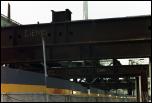
Girders are marked for demolition.
| |
Date :
|
28 Mar 2004
|
| |  |
| |
|
Curve ahead
|
Sm
Med
Lg
Full
|
|
Description :
|
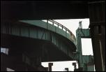
The Storrow on-ramp.
| |
Date :
|
28 Mar 2004
|
| |  |
| |
|
Bridges of Suffolk County
|
Sm
Med
Lg
Full
|
|
Description :
|
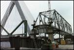
The old bridge over the Charles remains as just a frame. The southbound lanes ran on the bottom of the bridge; the northbound lanes ran on a middle level that has been removed.
| |
Date :
|
28 Mar 2004
|
| |  |
| |
|
Below the bridge
|
Sm
Med
Lg
Full
|
|
Description :
|
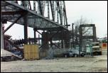
The support on the right used to be for a connection from 93 to US 1 and the Tobin Bridge, but has been unused since traffic was rerouted under Charlestown. The elevated structure continues away to the left.
| |
Date :
|
28 Mar 2004
|
| |  |
| |
|
Harbor shuttle
|
Sm
Med
Lg
Full
|
|
Description :
|
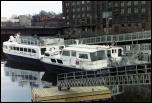
The MBTA runs shuttles across Boston Harbor. Here, two boats wait at Lovejoy Wharf near North Station.
| |
Date :
|
28 Mar 2004
|
| |  |
| |
|
Ground level
|
Sm
Med
Lg
Full
|
|
Description :
|
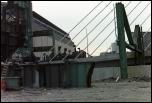
93 emerges from the ground to climb up on to the Zakim bridge. Bits of the old elevated still remain, including some large chunks of metal lying on the ground.
| |
Date :
|
28 Mar 2004
|
| |  |
| |
|
Old and new
|
Sm
Med
Lg
Full
|
|
Description :
|
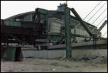
Some of the structure from the old elevated 93 remains adjacent to the new 93 as it emerges from the ground.
| |
Date :
|
28 Mar 2004
|
| |  |
| |
|
Empty bridge
|
Sm
Med
Lg
Full
|
|
Description :
|
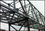
The old bridge over the Charles remains, but with only its superstructure.
| |
Date :
|
28 Mar 2004
|
| |  |
| |
|
Side of the bridge
|
Sm
Med
Lg
Full
|
|
Description :
|
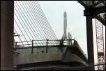
The Zakim bridge has an extra two lanes on the northbound side. These lanes aren't connected to entrances from downtown yet, though.
| |
Date :
|
28 Mar 2004
|
| |  |
| |
|
Wharves
|
Sm
Med
Lg
Full
|
|
Description :
|
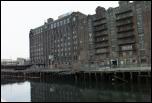
In between the Charlestown Bridge and Lovejoy Wharf, a waterfront building is built on top of decaying piers.
| |
Date :
|
28 Mar 2004
|
| |  |
| |
|
Commuter Rail
|
Sm
Med
Lg
Full
|
|
Description :
|
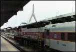
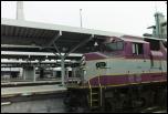
MBTA GP40MC 1137 waits to depart North Station.
| |
Date :
|
28 Mar 2004
|
| |  |
| |
|
Commuter Rail
|
Sm
Med
Lg
Full
|
|
Description :
|
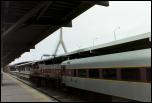
MBTA GP40MC 1137 waits to depart North Station.
| |
Date :
|
28 Mar 2004
|
| |  |
| |
|
Train, Bridge
|
Sm
Med
Lg
Full
|
|
Description :
|
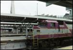
The Central Artery runs adjacent to North Station. As the train waits to leave, the Zakim Bridge can be seen in the background.
| |
Date :
|
28 Mar 2004
|
| |  |
| |
|
Bridge, Train
|
Sm
Med
Lg
Full
|
|
Description :
|
The Central Artery runs adjacent to North Station. As the train waits to leave, the Zakim Bridge can be seen in the background.
| |
Date :
|
28 Mar 2004
|
| |  |
| |
|
ACSES Box
|
Sm
Med
Lg
Full
|
|
Description :
|
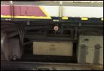
All of the MBTA's locomotives, apparently, are equipped with decoders to read Amtrak's cab signalling system used on the Southwest Corridor (MBTA Attleboro/Providence, Franklin, and Stoughton lines).
| |
Date :
|
28 Mar 2004
|
| |  |
| |
|
Looking back
|
Sm
Med
Lg
Full
|
|
Description :
|
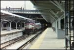
North Station is immediately beneath the Fleet Center. The commuter rail waits to leave, with the rearmost cars hiding beneath the building and the Leverett Circle Connector ramp.
| |
Date :
|
28 Mar 2004
|
| |  |
| |
|
Ready to go
|
Sm
Med
Lg
Full
|
|
Description :
|
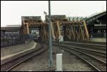
There are four tracks of drawbridge immediately north of North Station. The signal on the leftmost track indicates the the train is clear to cross the bridge.
| |
Date :
|
28 Mar 2004
|
| |  |
| |
|
Leaving
|
Sm
Med
Lg
Full
|
|
Description :
|
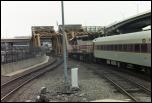
The commuter rail heads north across the Charles River.
| |
Date :
|
28 Mar 2004
|
| |  |
| |
|
"Exit Left"
|
Sm
Med
Lg
Full
|
|
Description :
|
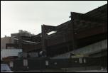
A sign on the abandoned Storrow Drive exit ramp from 93 directs demolition vehicle drivers to exit left for North Station.
| |
Date :
|
28 Mar 2004
|
| |  |
| |
|
28 North
|
Sm
Med
Lg
Full
|
|
Description :
|
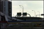
You can go either left or right for 28 North, apparently. (The sign on the left, for Storrow Drive, should be 28 South.)
| |
Date :
|
28 Mar 2004
|
| |  |
| |
|
Parking
|
Sm
Med
Lg
Full
|
| |  |
| |
|
Charles waterfront
|
Sm
Med
Lg
Full
|
|
Description :
|
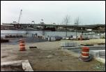
Part of the Big Dig project is building new parkland along the Charles River. Here work is going on near North Station. 93 and the Zakim Bridge are to the right; the Museum of Science is to the left.
| |
Date :
|
28 Mar 2004
|
| |  |
| |