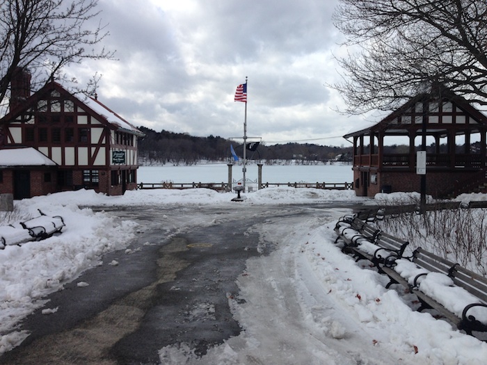
 Jamaica Pond Boathouse
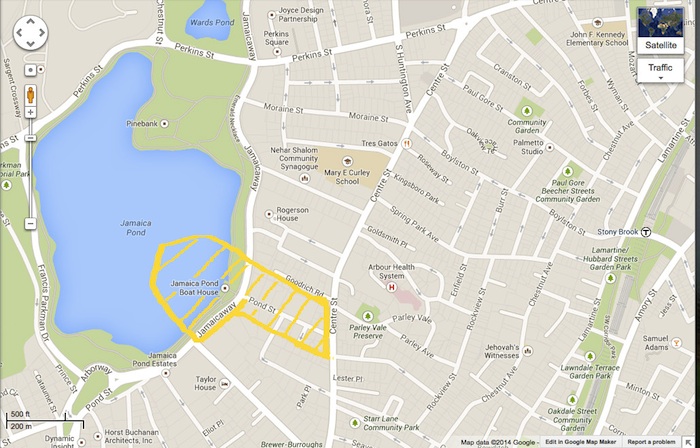
There is a length of Pond Street in Jamaica Plain, between the boathouse and Centre Street, four blocks from end to end, that links the land together. Eight blocks of area connect the shore, the central commercial street, and two vastly different places in the neighborhood’s past. I chose to focus on these eight blocks leading up to the edge of the water.
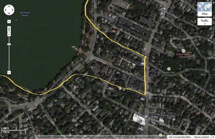
I consider the site to be the stretch bounded by Centre Street in the southeast and by Jamaica Pond to the northwest, of width one block from Pond Street on each side. Most of this land is residential. Colonial mansions, with fresh white walls and broad lawns, overlook the Pond. Next door, further from the water’s edge, a neat brick apartment complex faces classic Bostonian triple-deckers across the street, the kind with weathered paint, front porches, and old-fashioned facades. Single-family residential properties next to multi-family residential properties next to public housing, sandwiched between a public park and a commercial thoroughfare. A space is defined by its edges: I delineated the edges of the heterogeneous residential stretch and observed the area enclosed.
 Site selection is outlined and shaded in yellow (Google Maps.)
The site is compelling because of its diversity of use, because of the interaction of the natural landscape (the pond, particularly) and the built environment, and because of the history it reflects. The succession of buildings tells a story. Jamaica Plain was Boston’s first streetcar suburb. In the beginning, wealthy Bostonians kept country homes by the pond. Today, these are the outsize estates at the intersection of Pond Street and Jamaicaway. Later, when Jamaica Plain was considered a neighborhood in decline, or possibly in recovery, the M.M. Collins apartments appeared. Walking past the apartments for the first time, I was struck by the juxtaposition of wealth and modesty. The development was neat, pretty, and quiet, but the apartments were small. I wondered at first how that land (which would seem to be prime real estate, with its proximity to the pond and the mansions) had been available for a large-scale construction project at any time within the past century. Something about the uniformity of the apartments made me suspect that they had been built for a specific group of tenants. This turned out to be true. They are owned by the Boston Housing Authority, and rented to low-income, elderly, and disabled people. I am curious about them. I imagine there were plenty of newspaper articles written about the project at the time of its development.
 .The M.M. Collins apartments at 29 Pond Street.
 . Colonial mansions bordering Jamaica Pond.

I am curious about the pond and its origin, both as a feature of the natural landscape and as an artifact of planning. Jamaica Pond is part of the Emerald Necklace, the curvilinear park system designed by Frederick Law Olmstead to link Boston Common and the Public Garden to Franklin Park. That explains, superficially, why the park is here, but I want to know why the pond is here. Is it an isolated depression, or part of the floodplain of a river system? How has it been altered by urban development, and how has its presence shaped the development around it? I want to find out how this stretch of street came to be the way it is. I want to see how the parts interact: how Centre Street became a patchwork of dingy old shops and shiny new cafes, right up to the edge of the residential area and into Pond Street, how the residents of M.M. Collins feel about the people who live in mansions on the water, how the mansions on the water turned from country homes to houses in town. Jamaica Plain is a changing neighborhood, and probably always has been. In these blocks, I am starting to see a synecdoche. A small part of a neighborhood can begin to represent the whole.
Sources:
Jamaica Pond, Boston, MA. (17 Feb 2014). Google Maps. Google. Retrieved from
https://maps.google.com/.
Clay, Grady. Close-Up: How to Read the American City. The University of Chicago Press: Chicago, IL. 1980: pp. 11-16, 38-65.