|
by Li Lian Tan
INTRODUCTION Sunda Kelapa is the ancient port town that evolved into present day Jakarta. It represents the enduring importance of the sea to the city's vitality and economic well being. The area of Taman Fatahillah is a reminder of the heyday of Sunda Kelapa as the major trading port of the region when the city was under the control of the Dutch East India Trading Company (VOC). The area has been under rehabilitation and some of the historic buildings restored and reused since the early 1990s. CONTEXT Physical To the south of Sunda Kelapa is the site of the former Dutch settlement of Batavia, which was founded in the 17th century and existed until the Japanese occupation during World War II. This part of Jakarta still maintains the regular grid pattern laid out by the Dutch and several buildings from the colonial era remain in use as museums. The boundary of the city is not clearly evident, as agricultural land around it is haphazardly converted into housing. The morphology of the city does not reflect its history, since almost all of the new development has been preceded by total demolition of the old structures. It was only during the 1970s that conservation of historic buildings, including those of the city's colonial heritage, became a significant concern in city planning. However, the threat of demolition and redevelopment for the sake of monetary gain still exists today. In the mid-1960s, a piece of marshland between Sunda Kelapa and the new port was developed into a high-income recreation park called Taman Impian Jaya Ancol. To the west of Sunda Kelapa, housing was built in Pluit. Both projects involved filling in marshland. In the early 1980s, housing was built on reclaimed land, which was named Pantai Mutiara, next to the Pluit housing. Around the same time as the Pantai Mutiara development, Cengkareng International Airport was opened on the western end of the Jakarta seafront. This increased land values in the area between the airport and the Pluit housing and very soon after, a new central business district and housing project, Pantai Indah Kapuk was built. Furthermore, since 1992, Ancol has been in the process of expanding its facilities in phases. All these projects cater to the high-income strata of society and include amenities such as golf courses, marinas, entertainment, hotels, waterfront housing, high-end retail shops, theme parks and open spaces. At latitude 1o N of the Equator, Jakarta experiences little variation in temperature throughout the year. Temperatures range from about 30 35o C during the day to about 25 - 28o C at night. Pollution actually accounts for an increase in temperature by about 2 - 3o C. The rainy monsoon season begins in November and ends in March. Historical In 1522, the Portuguese signed an agreement with the king of Padjadjaran, which allowed them to build a trade fortress at Sunda Kelapa. However, in 1527, before they were able to build the fortress, the town was taken over by Fatahillah, military leader of Demak, an Islamic kingdom in Central Java. The town was then renamed Jayakarta, meaning glorious or perfect victory, and became a regency under the control of the Demak Kingdom. The Dutch set up a base in Banten in 1596, and were only allowed to trade in Jayakarta after 1611. They obtained a piece of land in the Chinese quarter on the east bank and immediately constructed warehouses that were later fortified. In 1619, the Dutch conquered Jayakarta, and the fort was enlarged and given the name Kasteel Batavia. A new city, named Batavia, was planned and built as an elongated grid with canals, consisting of four parts: the Kasteel, an eastern quarter, a western quarter and the Voorstad (the Chinese quarter), located outside the city wall. The placement of the Old Dutch buildings created a square in the middle where meetings could be held and people could gather to listen to speeches. From it developed the idea of the square as a place for conveying ideas to the local population. This square was renamed Taman Fatahillah after World War II. (Image - Taman Fatahillah Square) The three-kilometer long Molenvliet Canal was dug from the end of the Voorstad to the south, which directed the growth of the city along its edge. This led to the development of a new suburb on the other end of the canal in the 18th century known as Weltevreden. (Image 1 Map of Historical Sites in and around the former walled city of the VOC. Area formerly inside the walls of Batavia is gray.) (Image 2 Ground of Batavia) Given its accessibility and its greener and healthier environment away from the congestion of the old city, Weltevreden grew as a residential district and later became the new capital of the Dutch administration. Two squares were built, and are known today as Lapangan Banteng and Lapangan Merdeka or Lapangan Monas. Today, the latter is considered the city center of Jakarta. The increase in trading activities between Asia and Europe, coupled by the opening of the Suez Canal in 1868, led to the building of a bigger port 8 km east of Sunda Kelapa. Today, the new port is still the main port that handles national and international trade, with Sunda Kelapa serving only local trade and fishing industries. (Image 3 Growth of Batavia until 1938.) The name, Jakarta (shortened from Jayakarta), was first used in the early 20th century by Indonesian leaders who were calling for independence. When the Japanese invaded Batavia in 1942, they officially renamed the city Jakarta from Batavia in the hope of finding an ally in the Indonesian people. After the surrender of Japan in 1945, Indonesia declared its independence. Jakarta was established as the capital city of the Republic of Indonesia. This resulted in a huge jump in population from 680,000 before the war to 1,500,000 in 1949 and an accelerated expansion of the physical size of the city. Economic growth and prosperity continued through the 1970s and 1980s. Suburbs and neighboring satellite towns were subsumed into the city of Jakarta, which has ballooned to a population of 9 million by 1998. Image 4 Development of Jakarta THE PROJECT Building/Neighborhood Sunda Kelapa is still used as a port but only handles domestic water traffic and supports the fishing industry. Since the rest of Jakarta's seafront is taken up by high-end developments with limited access, Sunda Kelapa is the only portion of the seafront that is open to the public. (Image 5 Boats parked at Sunda Kelapa) Taman Fatahillah represents the Dutch colonial period in Jakarta's history. The area has evolved into a cultural center with major museums located around the square. Physical Description The Dutch Look-Out Tower was
built in 1839, and the coral-stone bastion on which it stands
dates from 1645. The bastion, known as the Culemborg, formed
part of the old city wall, and once guarded the city's entrance
from the sea. The actual gateway no longer exists but now forms
a busy street between a police station and the Museum Bahari.
(Image 7 - Former city gateway to the sea, outside Museum Bahari,
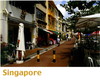
with the Look-Out Tower in the background.) Luar Batang means "outside the log," and is one of the sub-areas of Sunda Kelapa. The name refers to the log that was used to close the mouth of the river at night and which was also the site of the customs office. The mosque here, built in 1739, is considered a very sacred place as it houses the tomb of a famous preacher. Taman Fatahillah consists of a square flanked by an imposing two-story building completed in 1710, known as the Stadhuis, or City Hall. The City Hall served as the seat of administration for the town of Batavia, as a court dealing with matters of tax, debts, trade, and licenses, and also as a prison. The Stadhuis is now the Historical Museum of Jakarta. (Image 8 Taman Fatahillah Square) The nearby Wayang Museum is situated on the site of a former church. It was built as the Museum of Old Batavia in order to house the collection of stones, furniture, and pictures of the time of the Dutch colonization. This collection has been moved to the Historical Museum. There is also a baroque Portuguese church close by, locally known as Gereja Potugis or Gereja Sion. The church was built on 10,000 wooden piles. COMPARISONS The Sunda Kelapa and Taman Fatahillah buildings contain many elements of the local architecture, such as large overhangs and plentiful natural ventilation. However, these areas are also unique in their age and historic value. The buildings of the Dutch colonial era resemble the neo-classical buildings of Europe but have been adapted to the local climatic conditions. Singapore, a former British colony and Malacca, a former Portuguese colony, also have similar smatterings of European architecture in their cityscapes. CONSERVATION PROGRAM INTERVENTIONS 1 On the instigation of the Governor of Jakarta and a group of concerned citizens, a land-use and conservation plan was established. It included historic sites to be conserved, residential and home industry sites, recreational areas, commercial areas, maritime industry zones, and mixed-use areas. Among the four sub-areas, Pasar Ikan and its surroundings was considered the top priority as it contains many historic buildings and also has commercial potential. At the time that the master plan was drawn up, a private investor had already acquired some of the land, and was planning to develop it. (Image 10 Land-Use Plan) In the Pasar Ikan sub-area, the Indonesian National Heritage Trust proposed that redevelopment and conservation be based on the vision of reconstructing old Jayakarta. The new functions, commercial and recreational, would resemble the old functions in Jayakarta, such as were found in the "inner area" of Jayakarta (#11 in Image. 11 - Pasar Ikan), the market area (#20, #21) and the waterfront area (#27). In the site around the "inner area" of Jayakarta, a multi-purpose hall that resembles the dalem (palace) would house performances and festivals. The square would be an open space that could be used for outdoor performances and other cultural events. A mosque would also be part of the inner area and a number of buildings that resemble old houses for nobility would function as exhibition space and host workshops related to the history of the city. The market area is located outside the inner area and retains some of its traditional character as a fish market while accommodating the functions of a contemporary cultural center. (Image 12 Street in Pasar Ikan) The waterfront area would be used for water activities such as rowing and sailing and include restaurants while still resembling the old waterfront with traditional fishing boats. Furthermore, it was proposed that linkages with other historical districts be established, including the link to Taman Fatahillah where the major museums are located. Also, a link with Onrust Island, which had a role in Dutch colonial era history, would promote cultural and historical tourism. However, one of the concerns implicit in the desire to create these linkages is the issue of memory and the attitude that Indonesia takes towards its colonial heritage. Is it something to be glorified, should it be forgotten, or just viewed as a matter of fact? My research did not uncover any literature that considered this question, (Image 13) but given the fact that a number of Dutch colonial buildings are being restored indicating that their value (at least for tourism) is appreciated.
THE PLAYERS The government agency of the Indonesian National Heritage Trust. (however, not sure of its role beyond the initial planning stage.) The development of Jakarta has been haphazard with little central planning. The effectiveness of the implementation of the master plan is not apparent in the city. Most development is driven by profitability. Thus, the role of the government and NGOs is minimal and instead, conservation, carried out without supervision, is by private investors targeting tourist revenue.
Endnotes 1. All information in this section is based on a proposed conservation plan for Sunda Kelapa. The most recent information found dates back to 1993 and it is unclear as to the extent of the execution of the plan.
Bibliography Priatmodjo, Danang. "Urban Waterfront Development: Case Studies of Barcelona and Jakarta." M.Arch Thesis in Human Settlements, Katholieke Universiteit Leuven, Belgium, 1993. Heuken, Adolf. Historical Sites of Jakarta. Jakarta: Foundation Cipta Loka Caraka, 1982. Jayapal, Maya. Old Jakarta. Kuala Lumpur: Oxford University Press, 1993. Abeyasekere, Susan. Jakarta: A History. Singapore: Oxford University Press, 1987. Khan, Hasan-Uddin. "Some Recent Large-Scale Projects in Asia." Continuity and Change: Design Strategies for Large-Scale Urban Development. Cambridge: Aga Khan Program for Islamic Architecture, 1983. Khan, Hasan-Uddin. "Small Scale Restoration Projects in Indonesia, Singapore and Malaysia." Adaptive Reuse: Integrating Traditional Areas into the Modern Urban Fabric. Cambridge: Aga Khan Program for Islamic Architecture, 1983.
Illustration Credits Mamta: Priatmodjo, Danang. "Urban Waterfront Development: Case Studies of Barcelona and Jakarta." M.Arch Thesis in Human Settlements, Katholieke Universiteit Leuven, Belgium, 1993. |
|
 |
|
 1840
1840 1950
1950 1980
1980