Home
> Quick Look > Regional >
Sea Surface Temperature
Sea surface temperature (SST) data were obtained from GISST (Global Sea Ice and Sea Surface temperature). More information on the data sets can be found here.
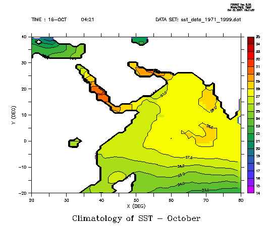
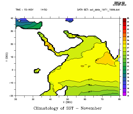
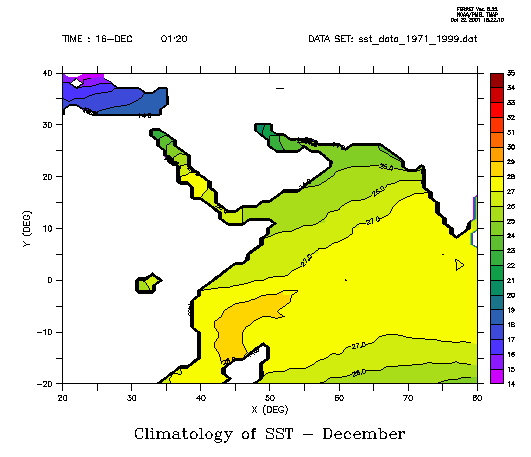
Climatology of SST and Upwelling
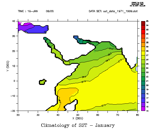
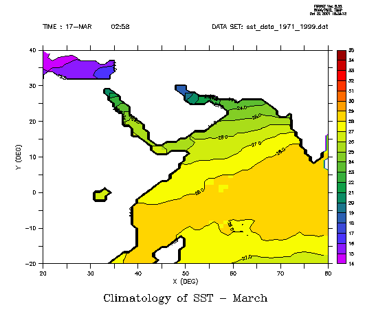
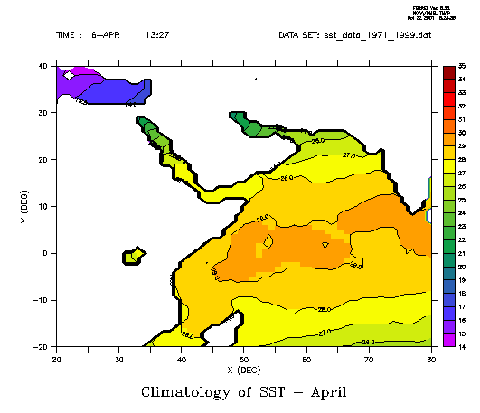
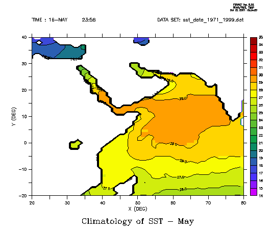
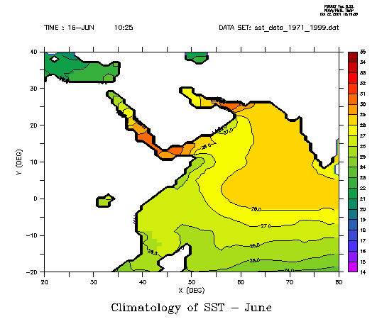
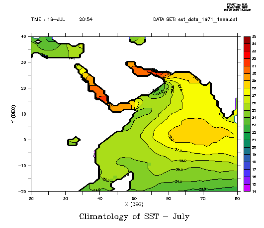
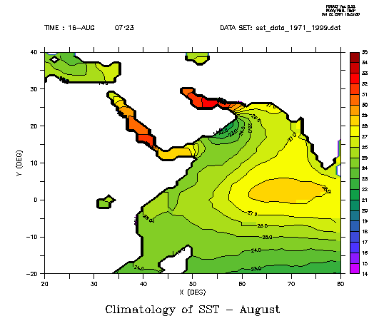
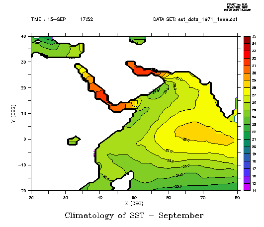
Plotted in figure 1a-l is the climatology of SST in the Arabian Sea. One
can clearly see how two cold spots appear in June:
one along the Coast of Somalia and another one along the coast of Oman.
These are the upwelling areas in the Arabian Sea which are due to the
monsoon winds. It reaches its highest point in August
weakens again in September. There are hypothesis
that the upwelling is responsible for the cloud formations over Dhofar.
However, it can be seen form the pictures that the upwelling zone along
the coast of Oman reaches usually until 55 degree East only and it is
thus located downstream of Dhofar. It seems therefore unlikely that the
cold upwelling waters are a direct source of the clouds in Dhofar. However
an indirect interaction for example deviation of winds is possible and
should be investigated in the future.
The process of upwelling is explained in more detail in the literature
review on the climate in Oman.
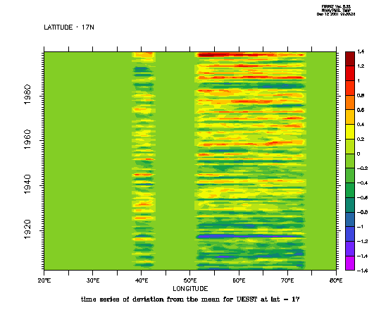
Changing SST
Figure 2a and 2b show the time-series
of SST over the last century. Clearly this dataset shows that SST have
been rising in the Arabian Sea during the last 100 years. A statistical
trend analysis for the SST in the region just offshore of Salalah showed
that SST in 1901-1930 was significantly lower than the SST from 1971-2000.