Quick Look
Overview
Climatology
Changing Climate?
Graphs:
Overview
We looked at 4 different climate stations. More information on the climate
stations and the datasets used can be found on the dataset
information page.
| Station | Annual rainfall | Summer rainfall | Time coverage | Missing values |
| Masira | 5.9 | 1.3 | 1987 to 1999 | 11 over 156 points |
| Salalah | 114 | 60 | 1943 to 1996 | 0 over 648 points |
| Quairoon Hairitti | 252 | 203 | 1985 to 1996 | 0 over 144 points |
| Thumrait | 37.6 | 11 | 1987 to 1999 | 9 over 156 points |
table 1: annual and summer precipitation in the selected climate stations – check here for exact information on the climate station’s location, properties and time coverage.
Climatolgogy
Looking at table 1 and comparing figures 1b and 2b
it can be seen that both stations Salalah and Qairoon Hairiti show a regular
shaped annual distribution of precipitation. The regularity of the curve
shows a annual periodicity in the climate – each year they are underlying
a returning climate cycle. Both stations receive a substantial amount
of their annual rainfall during the monsoon. This is especially true for
Quairoon which lies further up in the mountains. Not only receives Quairoon
twice the precipitation of Salalah, but also 80% of it during the Summer
alone (compared to 50% in Salalah). Salalah in turn receives nearly 50
percent of its precipitation from cyclonic storms outside the Kahreef
season and mainly in spring. These facts support two hypothesis: (1) as
assumed there is apparently more precipitation in the mountains than in
the coastal plain and (2) cyclones are less important in the mountains
(at least on the other side of the mountain crest) than in the plain and
the water input in the mountains comes mainly from the monsoon.
Masirah (figure 4b) and Thumrait (figure
3a) do not show a regular shaped precipitation curve, they receive
precipitation in a rather random fashion. Both do not show a peak during
any time of the year, which indicates that they depend mainly on cyclones
for rainfall and are not influenced by the monsoon. Thumrait is located
far behind the mountain crest in the desert where monsoon clouds cannot
reach. Masirah in turn receives the same airmasses as Salalah during the
monsoon season, however it does not have mountains so that the air is
not forced upwards and there is no cloud formation.
Changing climate?
Repeatedly concerns have been raised that the khareef rainfall in Dhofar
may have decreased during the last 30 years or so.
Figure 1d shows therefore the precipitation in Salalah
during in Summer (June July August - JJA) in mm/month. It can be seen
that the precipitation has been very high in some years (probably due
to single storm events), however there is no overall decreasing trend
recognizable from this graph. Interestingly, looking at the same graph
but for spring in figure 1c in can be seen that there
has been an increase in spring precipitation at least in the period 1943
to about 1985. In this period occurrence of precipitation in spring became
more frequent and also the magnitude of rainfall has increased. This may
hint on either stronger or more frequent cyclonic events or on an earlier
starting monsoon. To find out about this in detail daily records will
have to be consulted.
Also the summer rainfall in Quairoon does not show a trend within the period of record 1985 – 1996. However an increase of precipitation is apparent when looking at the precipitation data of fall (figure 2e), while at the same time the precipitation in spring (figure 2c) was rather low. The time series is too short to tell if this increase is a general trend or just due to interannual variability. It is interesting to note though that the precipitation period may have shifted away from spring and towards fall.
Salalah [17.02 N , 54.05
E] elevation 20 m
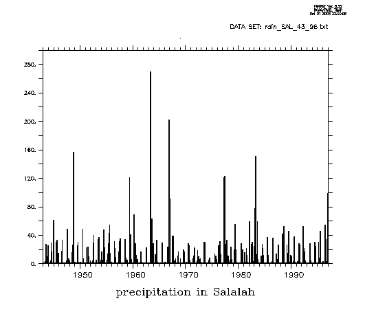
figure 1a: monthly averaged rainfall in Salalah – 1943 - 1996
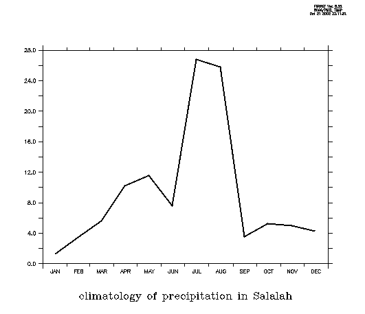
figure 1b: climatology of rainfall in Salalah – for years 1943-1996
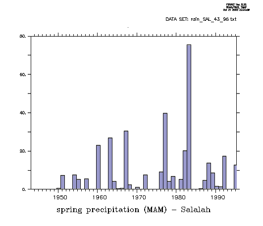
figure 1c: spring precipitation in Salalah in [mm/month]
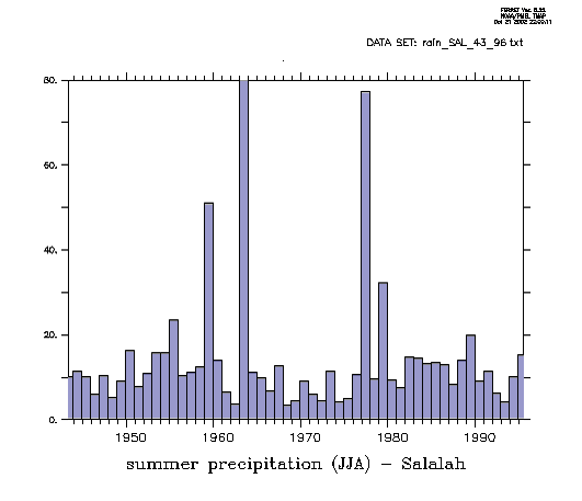
figure 1d: summer precipitation in Salalah in [mm/month]

figure 1e: fall precipitation in Salalah in [mm/month]

figure 1f: winter precipitation in Salalah in [mm/month]
Quairoon Hairitti [??]
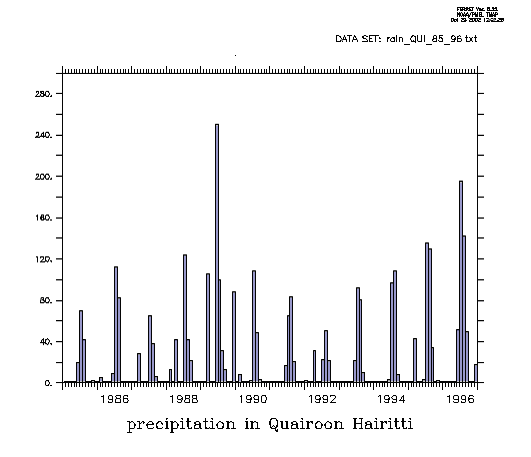
figure 2a: monthly averaged rainfall in Quairoon Hairitti – 1985-1996
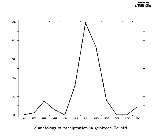
figure 2b: climatology of rainfall in Quairoon Hairitti – for years
1985-1996
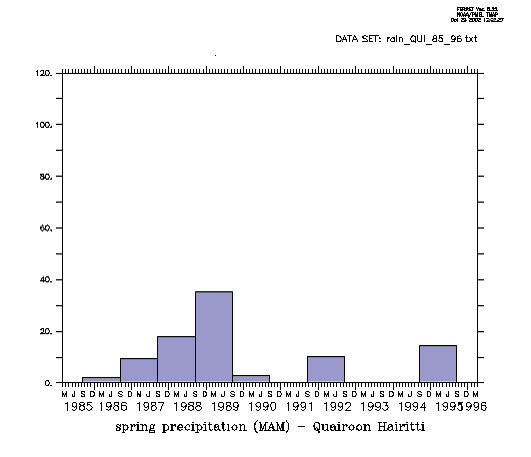
figure 2c: spring precipitation in Quairoon Hairiti in [mm/month]
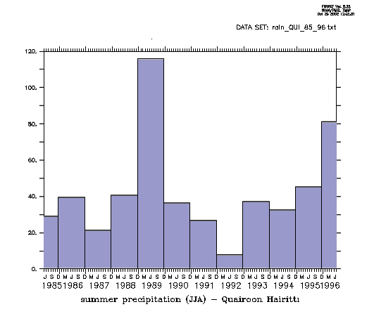
figure 2d: summer precipitation in Quairoon Hairiti in [mm/month]
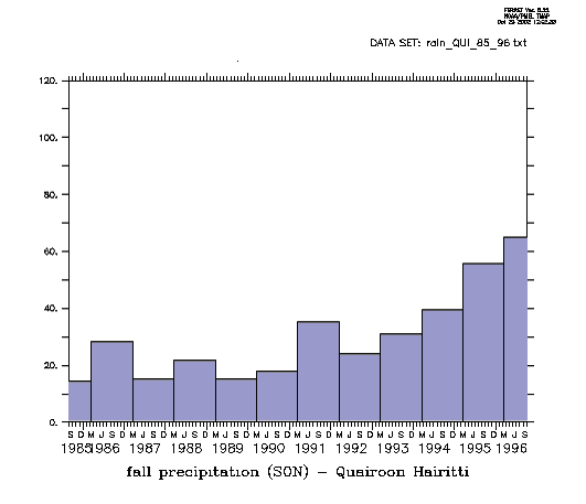
figure 2e: fall precipitation in Quairoon Hairiti in [mm/month]
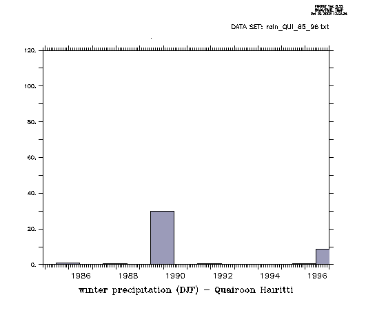
figure 2f: winter precipitation in Quairoon Hairiti in [mm/month]
Thumrait [17.40 N , 54.02
E] elevation 467m
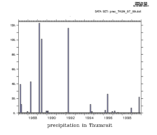
figure 3a: monthly averaged rainfall in Thumrait – 1987-1999
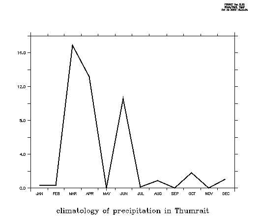
figure 3b: climatology of rainfall in Thumrait – for years 1987-1999

figure 3c: spring precipitation in Thumrait in [mm/month]
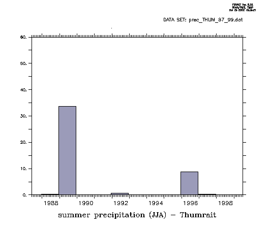
figure 3d: summer precipitation in Thumrait in [mm/month]

figure 3e: fall precipitation in Thumrait in [mm/month]

figure 3f: winter precipitation in Thumrait in [mm/month]
Masirah [20.40, 58.54]
elevation19 m
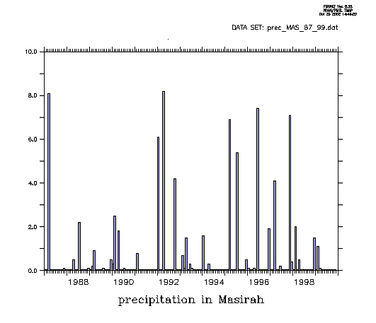
figure 4a: monthly averaged rainfall in Masirah – 1987-1999
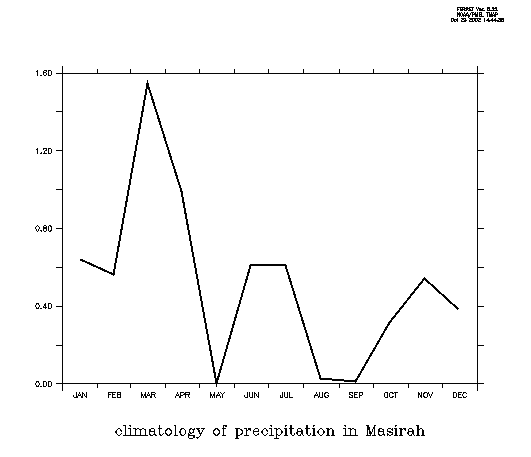
figure 4b: climatology of rainfall in Masirah – for years 1987-1999
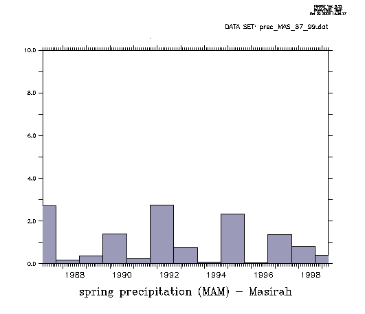
figure 4c: spring precipitation in Masirah in [mm/month]
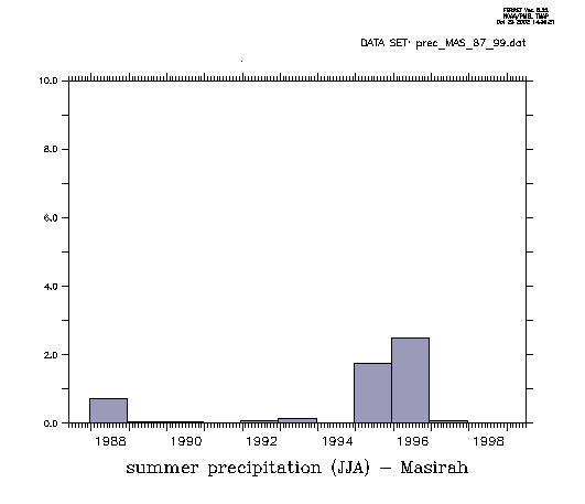
figure 4d: summer precipitation in Masirah in [mm/month]

figure 4e: fall precipitation in Masirah in [mm/month]
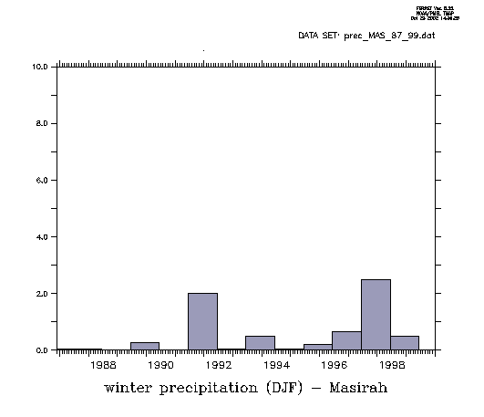
figure 4f: winter precipitation in Masirah in [mm/month]