Quick Look
The density of the vegetation cover is measured by an index that describes the “greenness” of the pixel. The index used here is called Normalized Vegetation Index (NDVI) and was extracted from satellite pictures. The product used is a monthly composite dataset. For more detailed information on the dataset check the section “dataset information”.
Two tiles were selected from the dataset to produce a time-series of NDVI. The tiles are located near Salalah (tile centered at [17.136N , 54.000E]) and near Thumrait (tile centered at [17.424N , 54.000E]). The area of the tiles is about 14x14km, thus they do not only cover one type of vegetation but a mixture. Especially the tile over Salalah covers both: desert and Dhofar forests.
Because NDVI is measured from space clouds pose a major problem during the monsoon season. Since the sky is covered the vegetation is almost invisible during the khareef.
As the climatology of the NDVI over Salalah shows the best look at the vegetation is possible in October when the clouds have disappeared. We therefore concentrate on October values when investigating the influence of climate factors on NDVI. Although this method may not give the best picture of the vegetation during monsoon itself, it still refers to the vegetation that was build up during the moist season.
It is interesting to note that NDVI from 1985 to 1997 was not decreasing, but rather increasing over the region of Salalah.
Extracted time series
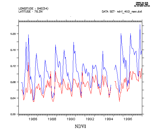
figure 1: timeseries of NDVI over a tile near Salalah (blue) and near
Thumrait (red)
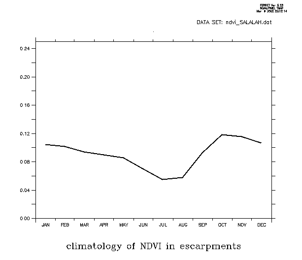
figure 2: climatology of NDVI over Salalah, calculated for the years 1985
to 1998
Climatology – regional plots
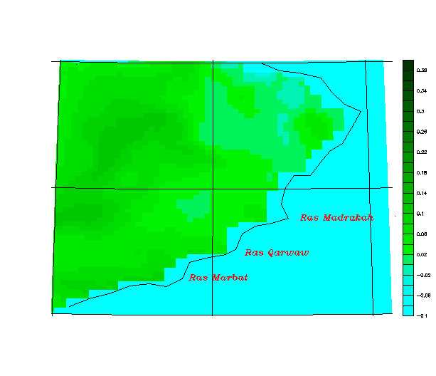
Figure 2a: climatology of NDVI in July, calculated for the years 1985
to 1998
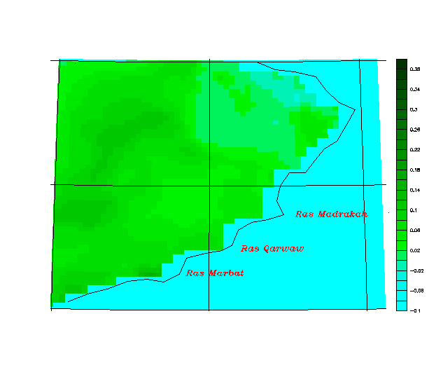
Figure 2b: climatology of NDVI in August, calculated for the years 1985
to 1998
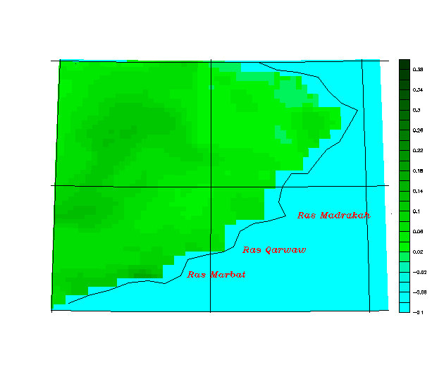
Figure 2c: climatology of NDVI in September, calculated for the years
1985 to 1998
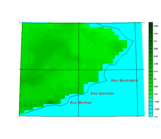
Figure 2d: climatology of NDVI in October, calculated for the years 1985
to 1998