(My main thought here is that if you've read this far, you're really bored, or are having an awfully slow day at work. Why would anyone care to see an aerial view of our neighborhood? Alternatively, why did I bother writing this, anyway...Darn good question.)
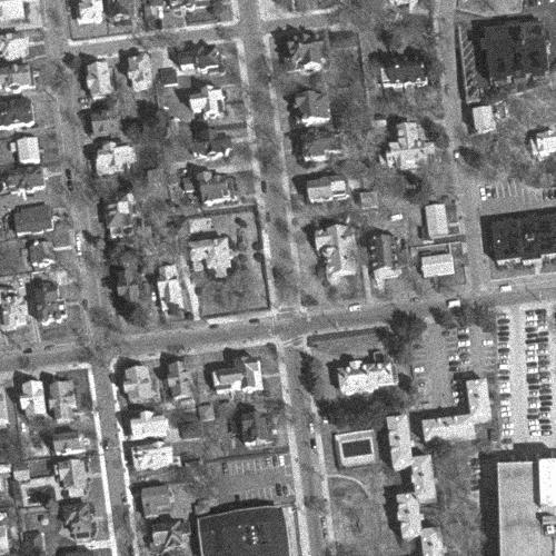
In this photo, the street our house is on (Dexter) runs up the center of the picture, more or less. Go up Dexter past the cross street (that's Maple) and our house is the third one on the left. Kinda nifty, eh?
This photo was downloaded from the MIT Digital Orthophoto Browser project. It's a clickable photo map of the whole Boston area. It's very cool, you should go play with it.
Navigational Assistance:
Anne's Other Random Stuff page is sort of "up" from here...
Date last modified: 31-Mar-1999
Copyright 1999 Anne R. LaVin
This page's URL: http://web.mit.edu/lavin/www/house-aerial.html