Traces and Trends
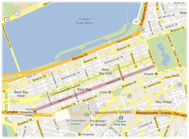 Location of Newbury Street within Boston. Source: Google. Google Maps (2013). Retrieved from http://maps.google.com.
In “The Power of Place: Urban Landscapes as Public History,” Hayden describes the complexity of the word “place.” Not only does it refer to a specific location, she says, but it also refers to the social, cultural attachments, and even the biological reactions induced by that location. [1] No description could better describe the kind of place Newbury Street is. Newbury Street is not just a site but also an experience, defined by its buildings as well as its charm. Its charm arises from the maintenance of its original 19th century brick houses in parallel with its movement forward in architectural and fashion trends. Walking down Newbury Street, one can appreciate the resourcefulness of stores, cafes, and institutions that cleverly repurposed old buildings for modern functions, creating an interesting juxtaposition. This dichotomy between history and modernity presents itself in various different aspects of Newbury Street, including its buildings and sidewalks, which define Newbury Street today and give insight into the developmental history of the neighborhood.
Artifacts from a Residential Neighborhood
Newbury Street was developed over the course of nearly forty years in the mid-19th century as part of the Back Bay expansion. This expansion was motivated by the increasing population and demand for housing. Thus, Newbury Street was originally designed as a residential neighborhood. Much of Newbury Street’s developmental history can still be derived from the details in the buildings.
A close look at the building’s details shows that houses within the same block are uniform with each other but each block has varying architectural detail. This pattern reflects the way that Newbury Street was constructed. Because the Back Bay was filled in one block at a time over four decades, from Boston Common to Massachusetts Avenue, the land was also leased to different building contractors one block at a time. Figure 1 compares buildings from two different blocks. As one can see, though the styles of the buildings are very similar, they each have signature features that set them apart, such as the spire atop the building on the right, and the smoother roofs of the buildings on the left.
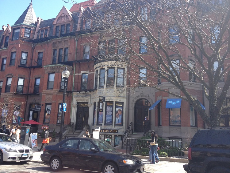
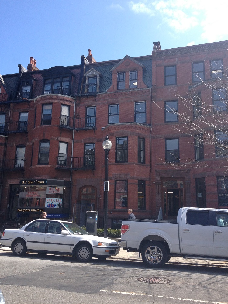 Figure 1
The Back Bay was also an incredibly wealthy area, and Newbury Street was no different. The buildings today still indicate the amount of wealth that was originally present. Each historic home reflects the ideals of a wealthy home in the mid-19th century: a spacious estate, four or five stories tall with lots of private rooms, an elegant brick façade, and a small yard in front (Figure 2). The smaller windows on the top floor also suggest that each home had servant quarters. And indeed, the 1897 Sanborn map of Newbury Street confirms that there was once a high demand for servant clothing, evidenced by two liveries that stood on opposite corners of the block closest to Massachusetts Avenue. The map also shows stables that offered horse and carriage rental services. [2]
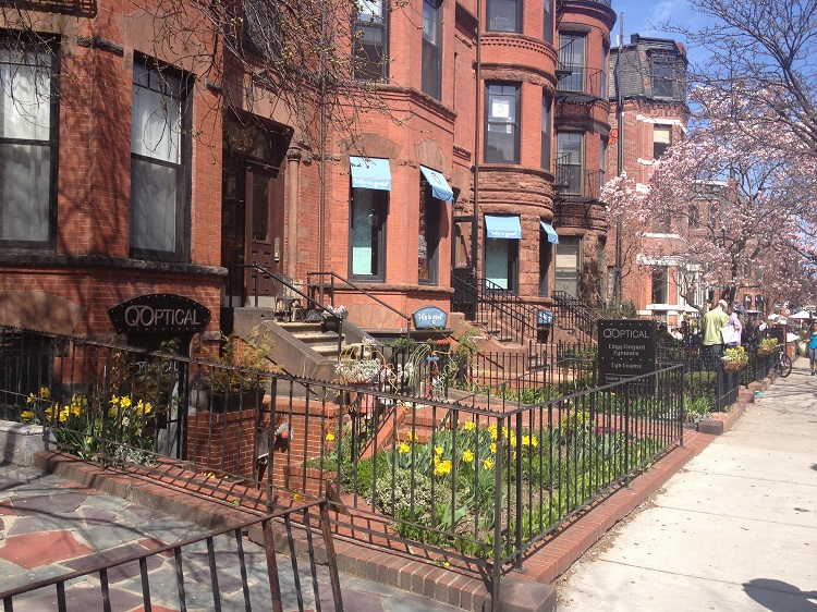 Figure 2
Today between Clarendon and Hereford Streets, the original brick buildings still stand but decorate by modern day store signs and store fronts. The facades of many buildings have undergone adjustments. For example, the windows on the first level have been enlarged to accommodate beautiful window displays, and the yards have been touched up with potted plants or converted into outdoor café seating areas (Figure 3). The interior of many buildings have also been completely renovated with different building layouts, more suitable for stores and restaurants, as well as new floors, paint jobs, and furniture. The juxtaposition of the historic structure with its modern purpose is by far the most prevalent example of this dichotomy and plays an important role in shaping the charming atmosphere of Newbury Street.
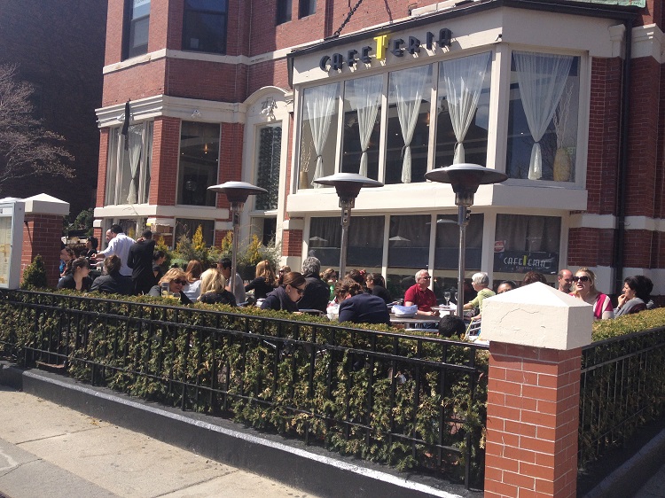 Figure 3
Traces of the Transportation Revolution
Not all of Newbury Street’s history can be read so obviously from the neighborhood today. Traces of Newbury Street’s historic forms of transportation provide a more subtle dichotomy with modern forms of transportation. Throughout the decades, the block of Newbury Street closest to Massachusetts Avenue has been a hub for transportation because it is right next to a main road. In the late 1800s, stables with carriages and horses for rent occupied the corner of Massachusetts Avenue and Newbury Street. [3] In the early 1900s, the huge rise in popularity of the automobile resulted in the appearance of five garages appeared, as well as several auto repair and sales shops. [4] In the mid-1900s, The Hynes Convention Center was also added with the addition of the subway. Each of these forms of transportation has left traces on Newbury Street.
The first form of transportation to come and go was the horse and carriage. Kenny and Clark Charles Gate Stable owned a building at least four residential houses wide and long, which can still be seen today. [5] The Urban Outfitters, Tavern, and Café which now share the space are set apart from other stores in the nearby vicinity with larger, more spacious architecture. Right across from the old stables is now the latest form of transportation to arrive, the subway and bus system. The Hynes Convention Center serves as the entry to the Green Line and the bus stop for several bus routes.
Perhaps most interesting, however, is the impact of the automobile, which altered sidewalks and buildings to accommodate its presence. The most significant traces present are in the buildings that used to be garages, or were intended to house automobiles in some other form. For example, in Figure 4, the building with heavy graffiti has outlines of garage doors that have since then been filled in and are no longer used. In the 1914 map, this building indeed shows up as a garage. Forever 21 is another example (Figure 5). The parking garage right next door is one of the original garages built in 1908, and Forever 21’s architecture mirrors that of the parking garage, suggesting that it too used to be an extension of the parking garage.
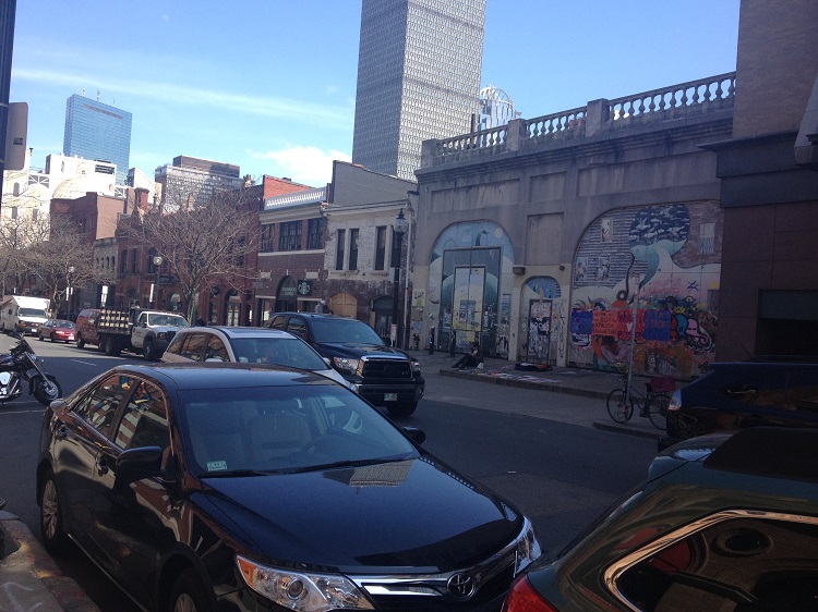 Figure 4
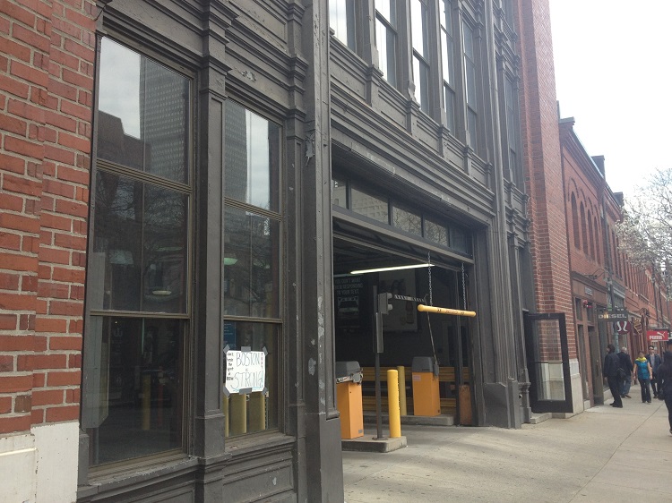 Figure 5
Along the sidewalks, the absence or presence of curbs also provide traces of the automobile. For example, in Figure 6A, the sidewalk in front of Patagonia slopes down to the street, suggesting an automobile-friendly design. This detail also draws attention to the shape of the front entrance to Patagonia, which is also shaped like a garage door that has since been repurposed. In Figure 6B as well, the color of the curb shifts, from an older and more worn out stone gray to a newer and smoother gray, which corresponds directly to the edge of Forever 21. This color shift suggests that the curb in front of Forever 21 is relatively newer compared to the rest of the curb, perhaps because it was added later than the other curb pieces. This speculation aligns with the original observation that Forever 21 most likely used to be a garage.
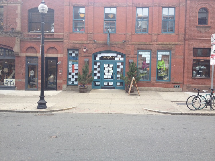 Figure 6A
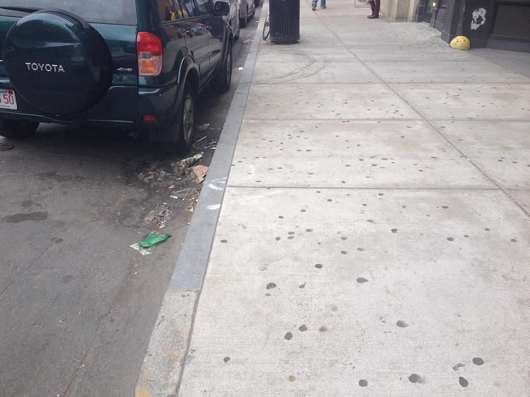 Figure 6B
Further along Newbury Street, around the center of the neighborhood is a newer and fairly large outdoor parking space. The photos in Figure 7 show the traces of the buildings that were taken down to accommodate the space. The wall along one side of the building is a chalky white color, outlining where the building had been attached. In addition, the fact that so many of the original parking garages have disappeared from the block adjacent Massachusetts Avenue while a larger parking space has been added to the middle of Newbury Street suggests an urban planning lesson. Because Newbury Street is such a long one way street that is mainly pedestrian, to cluster all the parking garages at the very end of the one way street is not very efficient in diffusing car traffic, nor is it very convenient for shoppers who must park their car but want to shop at the other end of the street. Therefore, the demand for parking by Massachusetts Avenue was not high enough to sustain the five different garages that cropped up within that block. However, the demand for parking at a central location in Newbury Street is pretty high, driven by convenience and diffusion of traffic. Thus, the two parking lots that have cropped up on either side of the street next to Dartmouth and Exeter Streets have been much more successful.
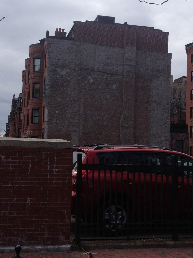
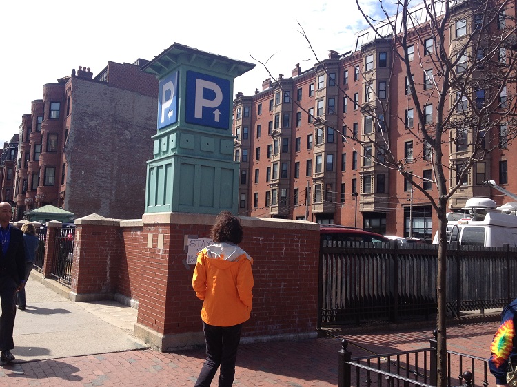 Figure 7
Layers through Time
The preservation of history alongside continuous modernization has created a very distinct layered affect across Newbury Street. These layers are present within individual buildings, as well as, across blocks. For example, any given store displays at least two visible layers. The original brick buildings constructed in the 19th century create the first and oldest layer, whereas the store details, such as signs, displays, and completely renovated storefronts, create a second layer. (Figure 8)
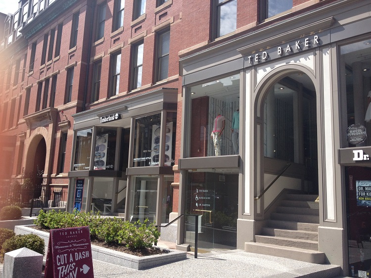 Figure 8
Several buildings even boast completely new annexations. This style of renovation is particularly popular in cafes, generally to accommodate more seating. Figure 9 shows an example of such a renovation. The original brick building used to house the First Spiritual Temple and in later years, the Exeter Street Theater. [6] Now part of it houses the Kingsley Montessori School, and the other part houses kitchen facilities and indoor seating for Joe’s American Bar and Grill. [7] The inner wall of the annexation is in fact the outer wall of the original building, with the same brick detailing, providing a unique display of each layer through time.
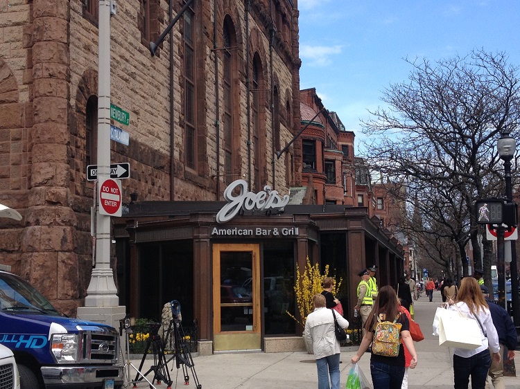
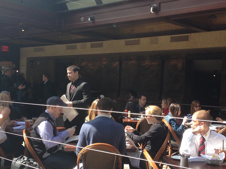 Figure 9
The neighborhood has also preserved several layers across the buildings within the three blocks next to Boston Common. Only a fraction of the original brick residences still stand because many have been replaced by larger and newer buildings. Figure 10A shows a typical example of this pattern along the section of Newbury Street that spans across Clarendon. The brick buildings visible in the frame are all original structures from the mid-1800s, whereas the large gray building in the foreground and white building in the background were built between 1914 and 1950. The gray building was probably built earlier in the 1920s, as a large store and replaced three residences. [8] Currently its first floor is still occupied by a store that has changed owners several times, and its top floors are taken by Sanford-Brown College. The Sanborn maps never detailed the commercial purpose of the original building, but one can infer that the top floors were probably used as office space or storage from the simple architecture and rows of windows. This architectural design is now very compatible with its current use as an institution.
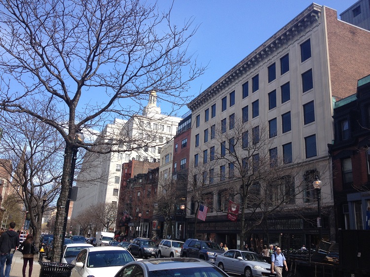 Figure 10A
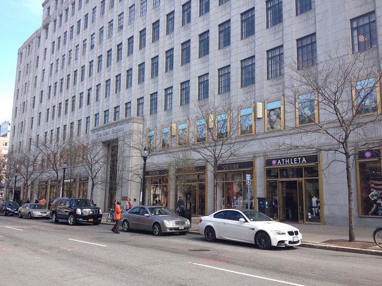 Figure 10B
The white building occupies the space where the MIT buildings used to stand. Built In 1940, it is used as a mall of sorts today, with large window displays and gilded rims (Figure 10B). But to the keen observer, the large presence of windows and the gilded dome on top suggests a different purpose in the past. Indeed, when it was first built, it was designed as the New England Mutual Life Insurance Company, and the windows still enumerate the number of offices the company housed. [9] The dome also signifies the stature of the original insurance company. Now these details are not quite compatible with its current purpose, but act as traces of its recent past.
In the block between Arlington and Berkley Streets, there has also been recent ongoing construction (Figure 11A). A view from Google Maps shows that buildings within this block were built significantly larger than the original residences (Figure 11B), but many of them still maintain brick facades. This pattern of construction not only suggests a trend in increasing building sizes to accommodate the growing need for more spacious facilities, but also a general trend in Boston’s efforts for historical preservation today. Building layouts are renovated to modern standards, but architectural styles are still chosen to look relatively old. It may be speculated that historical preservation is particularly encouraged for tourist purposes now that Newbury Street is considered a hotspot Boston attraction because many buildings built before the importance of tourism actually look newer than the buildings that are being constructed or renovated now. This also makes analyzing layers difficult when newer buildings look older than their predecessors.
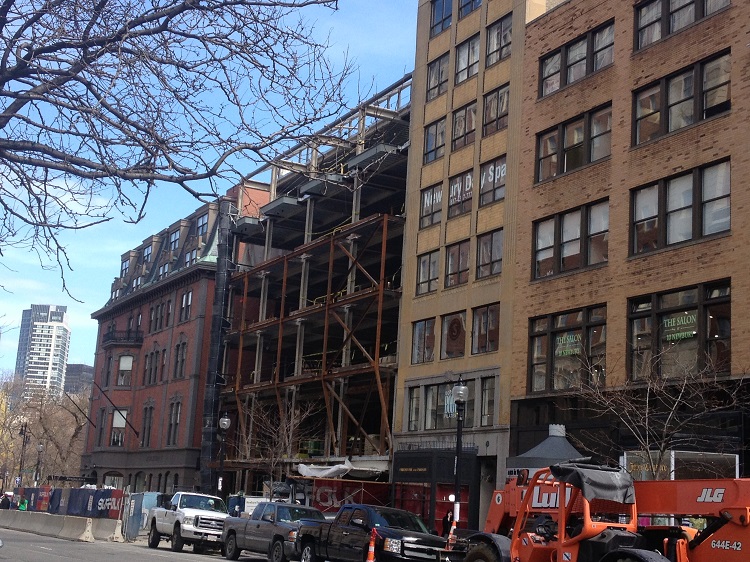 Figure 11A
 Figure 11B
Trends from the Past and for the Future
The layering of Newbury Street not only shows the dynamic past that Newbury Street has emerged from but also the direction that it is heading in the future. For one reason or another, the blocks near Boston Common are much more layered than the blocks near Massachusetts Avenue. And as seen in the maps over time, those blocks have always been more progressive in starting new trends that eventually spread down the street to Massachusetts Avenue. [11] One might speculate that this is because those blocks were built first, a few decades before those nearest the avenue. Therefore the community had had more time to establish itself and then adapt to the needs and demands of the time. It could also have been driven by factors such as the expiration of property leases and the change of ownership, which would have been offset from the other end of Newbury by at least forty years.
Regardless of the reason, it is pretty clear that the three blocks closest to Boston Common are the most layered, with different building styles and larger renovations than the blocks still a few decades behind. In these three blocks in particular, one can derive a significant amount of insight into Newbury’s past and future development. The layers from the past all speak to Newbury’s transition into a commercial hotspot. For example, the facades of brick homes were renovated to make eye catching storefronts, an academic institution was completely replaced by a banking institution to feed the economic growth of all the surrounding enterprises, and residences were completely replaced to provide more spacious commercial facilities. Since its origins as a residential neighborhood, commercial themes have driven the subsequent development of Newbury Street to modern day, leaving behind layers that represent time periods come and gone.
By comparing the newest layers present on those blocks to buildings along the rest of Newbury Street, it is also possible to see the emerging trends for the future. Window displays are getting larger, and annexations are becoming flashier, as seen from the side by side comparison in Figure 12. It is also apparent that stores are being taken over by larger brand names and expanding. For example, popular big brands that have become part of Newbury Street include Anthropologie, Guess, Victoria’s Secret, and H&M and they are beginning to encroach on local brands the Back Bay Framery, LIT on Newbury, and Back Bay Hair Designs. Finally, as mentioned before buildings are getting bigger and taller, with newer facilities but more historical features. From these details, it seems clear that Newbury Street will continue to develop as a large commercial venue, with a greater emphasis on big brand names and tourist-attracting designing.
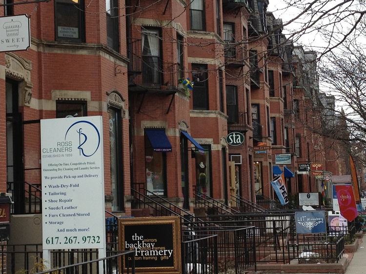
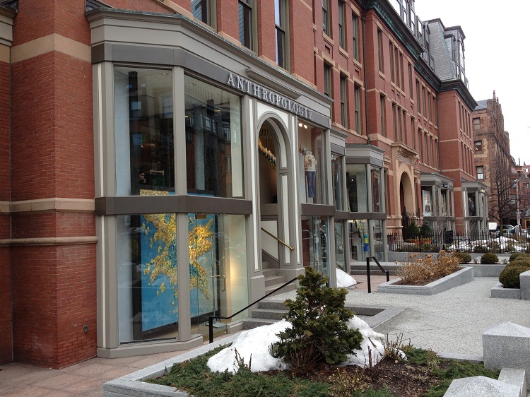 Figure 12
Today Newbury Street is defined by the dichotomy of its past and present. This dichotomy not only tells the story of its physical and economic development, but also the projections of its future. But there is also one last story to be learned from the juxtaposition of history and modernity. Newbury Street’s historical preservation has not always been driven by the same factor. Initially, the buildings were preserved in the transition from home to store out of convenience and later from lack of money. When the first stores emerged, they were largely family businesses, run from the home. Then during the Great Depression, it became much more economical to reuse the same buildings instead of rebuild new ones. When the sidewalks were left with traces of the automobile, it was out of neglect. Newbury Street’s advancement has almost always been driven by private development and the sidewalks are mainly public space. And today, history is being preserved with attentiveness, reflecting Boston’s pride for its history and the importance of tourism. Thus, Newbury Street’s layered preservation began as somewhat of an accident that has now become one of the most important aspects of the neighborhood’s charisma.
From its rich history to its dynamic present, Newbury Street has been shaped through the layers through time and the trends of the decades and will continue to provide a charming atmosphere, created by the modern bustle of a commercial hub in a classic, antique setting. Although it continues to change with the shifting demands of the future, these changes will always juxtapose artifacts and traces from the past and continue telling a unique story of growth, development, and transition.
References
[1] Delores Hayden. The Power of Place: Urban Landscapes as Public History. Cambridge, Massachusetts: The MIT Press, 1995, 20-21.
[2] Boston 1895-1900, 1897 [map]. 1897. Scale not given. “Digital Sanborn Maps 1867-1970.” ProQuest. http://sanborn.umi.com/ma/3693/dateid-000008.htm?CCSI=254n (12 March 2013).
[3] Boston 1895-1900, 1897 [map].
[4] Boston 1908-1938, 1914 [map]. 1914. Scale not given. “Digital Sanborn Maps 1867-1970.” ProQuest. http://sanborn.umi.com/ma/3693/dateid-000019.htm?CCSI=254n (12 March 2013).
[5] Boston 1895-1900, 1897 [map].
[6] Boston 1908-1938, 1914 [map]. Boston1929-1951, 1951 [map]. 1951. Scale not given. “Digital Sanborn Maps 1867-1970.” ProQuest, http://sanborn.umi.com/ma/3693/dateid-000035.htm?CCSI=254n (12 March 2013).
[7] “Newbury Street, Boston, MA.” Map. Google Maps. Google. 5 April 2013. Web. 5 April 2013.
[8] Boston 1929-1951, 1951 [map].
[9] Boston 1908-1938, 1914 [map].
[10] “Newbury Street, Boston, MA.” Map. Google Maps.
[11] Boston 1895-1900, 1897 [map]. Boston1908-1938, 1914 [map]. Boston1929-1951, 1951 [map].